
|
|
Mountain/Rock |
|---|---|
|
|
39.48313°N / 119.91012°W |
|
|
Washoe |
|
|
Hiking, Scrambling |
|
|
Spring, Winter |
|
|
6247 ft / 1904 m |
|
|
Overview
Point 6247 is a rocky point overlook at the top of a series of rocky cliffs just west of Reno, Nevada. It is generally not visible from Reno because it lies on the west side of the Hunter Creek blocked by a larger foothill rising east of the Hunter Creek. While the summit isn't considered that high for the Reno area, the great views, challenging climbing options, and general beauty of the area make this a compelling destination.
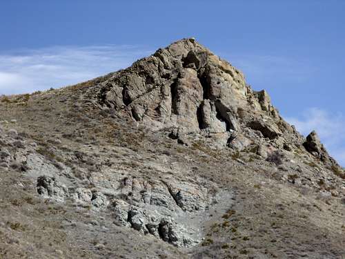
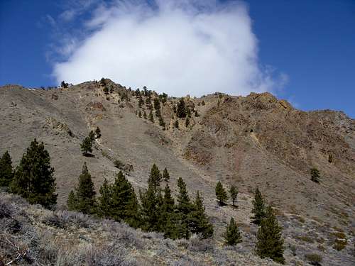 The summit is the rocky point at the left of the photo
There are three main routes to the top. The most challenging involves an 650' class 2 jaunt up a gully.
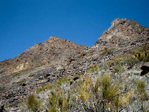 Rocky cliffs below the summit, as seen from the Hunter Creek Trail
Once a rustic trail well over a mile from paved roads, the Hunter Creek Trail is now part of an upgraded trail network, just outside of Reno's residential neighborhoods. It remains a place to get away from it all, without actually getting away from it all. It can be reached within 10 minutes from downtown, and leads to a variety of interesting hiking options; Point 6247 being one of them.
Point 6247 has a very limited prominence of only about 50 feet. The reason it merits a page, and not a nearby higher point, is because it is at the top of a rocky plateau. It is connected to the main ridge of the Mount Rose Wilderness, and it could possibly be considered a bump along the ridge to Mount Snowflower over 7 miles away!
Getting There
All three routes start from Woodchuck, a road off Plateau Road in Reno. Plateau Road is in the western part of town. From the western loop of McCarren Blvd south off I-80, take the north entrance to Caughlin Parkway. Head west for about 1 mile to Plateau Road. Turn right on Plateau and follow it for about 3/4 of a mile to Woodchuck. Take a left on Woodchuck, passing the entrance to the Steamboat Ditch trail, and follow the road as it goes uphill. The trailhead is about 1 mile from the entrance to Woodchuck.
The trailhead was recently constructed through the "Michael D. Thompson Trailhead Project". When I moved to Reno in 2007, the project was just underway, and the start of the Hunter Creek Trail was quite far - at least a 25 minute walk from the nearest parking area. Today, with the project completed, it is less than a 10 minute walk. The new trailhead is connected to the Steamboat Ditch Trail below, and a new series of trails have been laid down. The Hunter Creek trail is has been rebuilt.
From the parking area, descend to the jeep road straight until you reach a stream crossing after a couple hundred yards. After you cross the stream, you continue straight for another few hundred yards where the road ends.
At this point you have a couple options. Two of the routes involve the Hunter Creek Trail, which is directly in front of you. The second option requires you follow the jeep trail as is heads back up a hill. These routes will be described below.
Routes
There are essentially three routes up to the top, and only one legitimate route back down. This is because two of the routes are too steep and too dangerous to climb down.
ROUTE 1:
Route: Jeep Road route - out and back
Elevation Gain: ~1100 feet
Round Trip Hiking Distance: ~4 miles
Difficulty: Hike
This route requires that you avoid the Hunter Creek Trail, and instead follow the jeep road as it heads back up a hill behind you. Just before you get on the Hunter Creek Trail, the jeep road heads up the hill. Follow this road as it winds around the hill, and then heads back west below some telephone poles. The road curves around until it heads south, and eventually parallels the Hunter Creek Trail from above. Make sure to follow the road as it curves to the south. Although the road loses slight elevation early on, once it heads back up, make sure to follow it this way. The road eventually ends, and you follow a use trail up the ridge that fades in and out, but is generally easy to follow. After you reach the base of the ridge, you'll go straight up towards higher elevation, and continue up, using the trail where you can. The trail ends briefly at a series of rocks. Climb over the rocks, and follow the trail again up towards a false summit. Continue over a couple false summits until you reach the final summit. From the parking lot, the route to the top is about 2 miles and involves a class 1 hike.
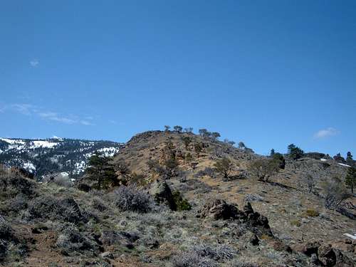 The final summit coming from the Jeep Road route
ROUTE 2:
Route: Hunter Creek Trail to North side rock face gully/return Jeep Road route
Elevation Gain: ~1200 feet
Round Trip Hiking Distance: ~3 1/4 miles
Difficulty: Class 2
If you want a challenging non-technical rock climb, this is the best route.
Start by taking the Hunter Creek Trail. It heads up and down through a canyon on the right side of the Hunter Creek. After about 3/4 of a mile on the Hunter Creek Trail, you will see the large rock face about 600 feet above you. There is an obvious gully to the right.
 The gully
From here, the ascent is pretty straightforward. It is very steep, but manageable. It takes about 20 minutes and 650' to reach the top of the gully. From there, continue up another 150' up the rocks to the summit.
Descending the gully is treacherous, and is not recommended. The rock is too loose. Return via Route 1 once you reach the summit of Point 6247.
ROUTE 3:
Route: Hunter Creek Trail to South side Open Meadow route/return Jeep Road route
Elevation Gain: ~1200 feet
Round Trip Hiking Distance: ~3 1/2 miles
Difficulty: Class 2
For this route, you still take the Hunter Creek trail. However, continue past the gully below the rock face route. Hike for another couple hundred yards until you find another gully. You will see the cave high above on your right. This time, the gully is far less treacherous and steep early on. Hike up the gully and then get to the left upon a steep meadow. This meadow involves a lot of loose dirt and rocks. For this reason, it is recommended that you hike this route when there is hard pack snow on the ground, for better traction.
I attempted this route in late April of 2007 only to encounter a rattlesnake sitting on one of the rocks in the gully. Upon seeing the snake, and figuring there were probably several more along the route, I turned back.
I took this route again in early April of 2008. The weather was much cooler, so no snakes were present. From the gully, it took about 25 minutes to reach the summit, mostly due to the challenge of finding the best route.
Descending the meadow is treacherous, and is not recommended. You should return via Route 1 once you reach the summit of Point 6247.
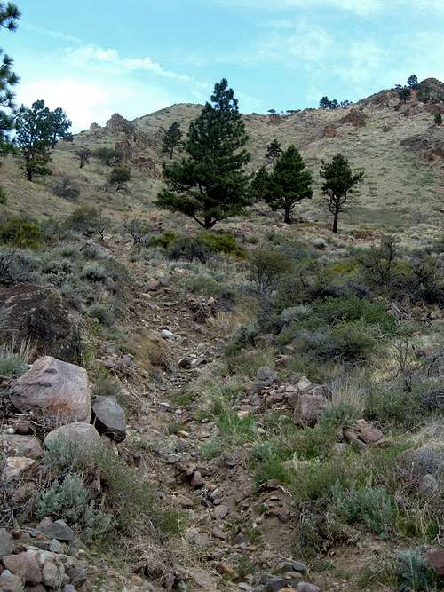 Gully for Route 3
When To Climb
While this area can be climbed all year, it is recommended to climb in moderate weather in late fall and early spring. As noted above, I ran dead straight into a rattlesnake in late-April, one of two snakes I saw that day (although the only rattlesnake). Bugs are pretty bad during the summer given the low elevation of the area. Wintertime in Reno varies from icy and cold to temperate. Avoid this area after early spring snowfall or rain, as it can get pretty muddy.
Overall, the best time to hike Route 1 is winter, early spring, and late fall.
The best time to hike Route 2 is early spring and late fall.
The best time to hike Route 3 is winter, preferably on snow.
Hunter Creek Trail
The Hunter Creek Trail is a rocky trail that follows a canyon. It can be accessed about 3 miles from West McCarren Blvd. Following the directions in the getting there section, you enter the trail a little over 1/2 mile from the parking area.
The trail used to go over sand and boulders along the way and was quite rustic. As of April 2012, it has been upgraded, with a new trail replacing the old one in many places and is now much wider. The trail passes a couple smaller climbing areas before reaching the large block of rocky cliffs that make up Point 6247. Beyond this area, the trail continues straight southbound and begins climbing up the canyon until you reach a waterfall about 3 1/2 miles up the trail. There is a sign next to the waterfall.
If you scramble up the trail to its highest point, you are about 600' below the summit ridge further south of Point 6247. From here, it is possible to find your way towards to Mount Rose. This trip would probably require two days. However, there are campsites up on the plateau.
Besides Point 6247 and the waterfall, there are plenty of other opportunities to sight-see throughout the canyon. A few of these are pictured below.
 Rock formation further up the trail
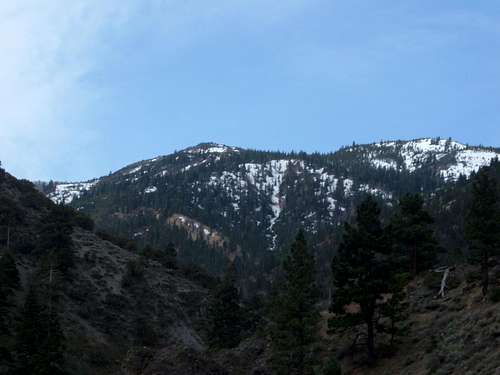 View further up the trail to the higher mountains
Red Tape
The trailhead is designed for hikers to enjoy the rustic beauty just outside of the community of Reno. It provides access to the Mount Rose Wilderness. There is no red tape.