Page Type Page Type: Mountain/Rock
Location Lat/Lon: 39.10050°N / 122.65806°W
Additional Information County: Lake
Activities Activities: Hiking
Seasons Season: Spring, Summer, Fall, Winter
Additional Information Elevation: 2838 ft / 865 m
Sign the Climber's Log

Overview

 
Over Long Valley from Wolf Creek Ridge
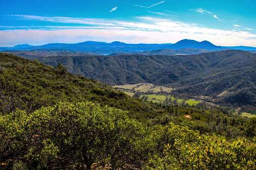
South from the ridge
Wolf Creek Ridge runs northwest for about 5 miles 5 miles north of Clearlake Oaks above the northeast side of Clear Lake. It is bordered by Long Valley to the southwest and Wolf Creek to the north east. The ridge is mostly covered with chaparral which is typical of mountain terrain in this area. There are a few old abandoned fire roads coming up the southwest slopes connecting to one main fire road that runs along the top.  
At first I was hesitant to put up a page on this hike because some sections of the road that run along the top are quite steep and covered in scree with a hard base. It was bad enough going up and worse coming down.
After I got back I reconsidered because the views in the pics I took made me feel it was worth the effort.
To the south is Mt. St. Helena, Cobb Mtn., Mt. Hannah and Mt. Konocti. To the north Rocky Ridge, to the east Cortina Ridge and Blue Ridge and below the beautiful green fields of fertile Long Valley.

The round trip effort to the high point is approximately 5 miles and 1,900' gain.

Getting There

 
Long Valley from Wolf Creek Ridge
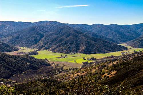
Long Valley from the ridge
 
Old orchard at the start of the route up Wolf Creek Ridge
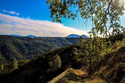
Old orchard along New Long Valley Road at start of hike
From Interstate 5 at Williams take Hwy. 20 35 miles to New Long Valley Road on the right.
From the junction of Hwy. 53 east of Clear Lake take Hwy. 20 2.7 miles to New Long Valley Road on the left.
Take New Long Valley road north as it curves to the northeast entering Long Valley 5.5 miles to an old orchard with just a few trees to the right at the base of Wolf Creek Ridge. Park on the side of the road. A steep old fire road commences up the ridge just past the orchard.

Route

 
Looking down the nasty scree section from the 2,820  high point on Wolf Ridge
Looking down the bad section from the 2,838' high point
 
The nasty scree section leading to the 2,820  high point ahead.
Lookin up the bad section to the 2,820' highpoint
The route starts (1,200') climbing steeply up the slope. It passes a merge with another road coming from the left at .4 mile. It continues another .3 mile going up to the right where it connects to the road along the top of the ridge (2,150'). The road climbs up and around progressively higher points with the option to go around some of the more direct steep sections. The last section to the 2,838' high point was the worst I encountered. About 200' vertical of loose scree rock on a hard base.
There were other roads coming up the ridge further along but they looked sketchy and incomplete on Google Earth.

Red Tape

 
Descending Wolf Ridge
Descending Wolf Creek Ridge
Except for an old no trespassing sign on one of the alternate connecting fire roads coming up the ridge there were no posted restrictions at all on the ridge.

When to Climb

 
Rocky Ridge from Wolf Creek Ridge
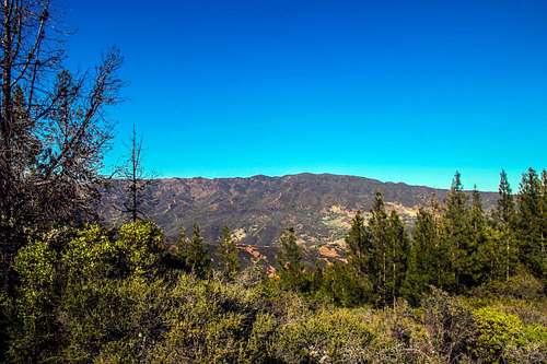
North to Rocky Ridge
Winter, spring and fall should be best. The ridge probably gets damn hot in summer with very little shade. It could have snow on top in winter.

Camping

 
Wolf Creek Ridge looking southeast
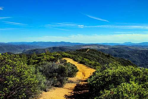
Looking southeast along the ridge
There is no camping in the immediate area. The nearest area would be Cache Creek Wilderness. The campground page is down as of 3-21-14. Some backpacking suggestions for that area can be found here.

Weather and 10 day forecast

 
Shrub and Mt. Konocti
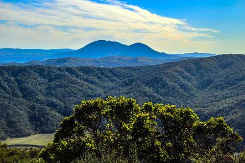
Mt. Konocti from the ridge
For Clearlake Oaks click here.