
-
 7698 Hits
-
 83.69% Score
-
 17 Votes
|
|
Mountain/Rock |
|---|---|
|
|
39.12999°N / 122.82442°W |
|
|
Lake |
|
|
Hiking |
|
|
Spring, Summer, Fall, Winter |
|
|
2979 ft / 908 m |
|
|
Overview
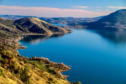
Clear Lake northwest shore from Hogback Ridge
Getting There
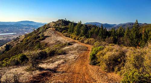
Hogback Ridge looking northwest
From the east: From the junction of Hwy. 53 and Hwy 20 on the east side of Clear Lake take Hwy. 20 16 miles to Bartlett Springs Road.
Take Bartlett Springs Road up about a quarter mile or wherever there is room to park along the side.
Route
Hogback Ridge road up from Bartlett Springs Rd.
About a half mile up Bartlett (a winding unpaved rd.) from Hwy 20 there is a locked gate to climb over to an old fire road that continues all the way to the top in about 1 1/2 miles. There is a first turn off before this gate that leads to a private residence with a no trespassing locked gate. After about .1 mile on the fire road you may want to cut straight up this steep hillside about .2 miles (400' el. gain) until it reaches a switchback on the route road to avoid the private residence.
At the top go around the old remains of a barbed wire fence and continue northwest to the 3 high points.
The 1st is 2,770', the 2nd is 2,979' and the 3rd is 2,881'.
At the top go around the old remains of a barbed wire fence and continue northwest to the 3 high points.
The 1st is 2,770', the 2nd is 2,979' and the 3rd is 2,881'.
It is about 5.5 miles and 2,000' gain round trip over all.
Alternative approaches: There are fire roads from Bush St. and one from Klein St. up on the southwest slope out of the high neighborhoods of Nice that involve only 3/4 mile and less than 1,000' gain one way up to the left of the northwest summit (2,881'). I did not check out access or parking from these starting points.
You could also approach from Hillcrest Drive starting at lake level (1,345') just past the town of Upper Lake near the northwest end of Hogback Ridge which involves a 10 mile elevation round trip and over 2,000 'gain to all the high points and back.
Red Tape
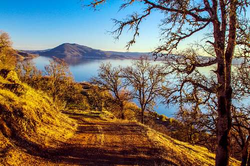
Descending Hogback Ridge looking northwest
When to Climb

Northwest from Hogback Ridge

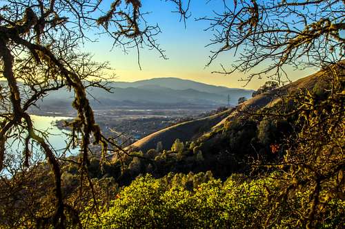
Hogback Ridge summit
Camping

Clear Lake from Hogback Ridge
Current weather and forecast

Oak on Hogback Ridge