

-
 59164 Hits
-
 94.97% Score
-
 60 Votes
|
|
Mountain/Rock |
|---|---|
|
|
46.37900°N / 9.95766°E |
|
|
Mountaineering, Trad Climbing, Ice Climbing, Mixed |
|
|
Spring, Summer |
|
|
12799 ft / 3901 m |
|
|
Overview
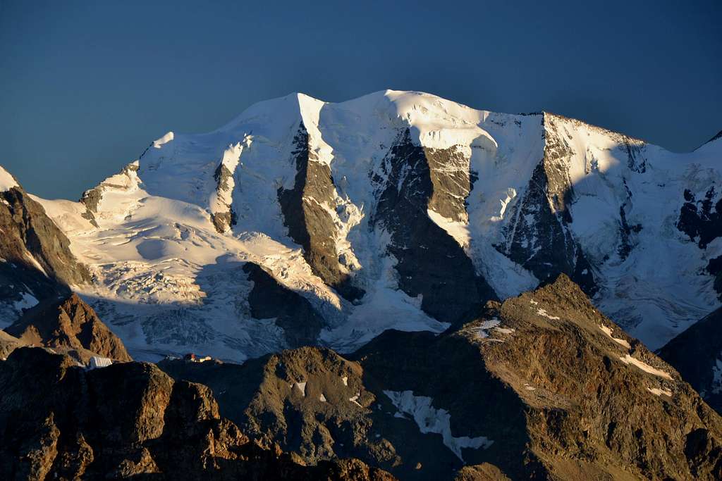
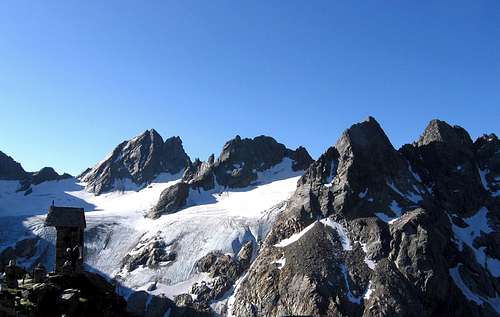
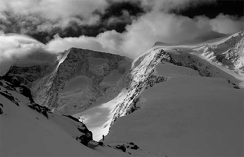
Piz Palü 3823 m, 3901 m, 3881 m
Piz Palü (Swiss toponym) or Piz Palù (Italian toponym), located between the Forcola Bellavista to the West and the Fuorcla Pers-Palù to the East, is one of the finest mountains not only in the Bernina massif, but in the whole Rhaetian Alps. This very important and famous mountain has 3 summits located on the main ice-covered watershed: the East summit 3882 m, the Central summit 3905 m (Muot dal Palü), the highest, and the West summit 3823m (Piz Spinas). It is located in the western Rhaetian Alps in the Swiss canton of Graubünden, but the West part of the summit ridge together with the highest summit is on the Swiss-Italian border.
Piz Palù has multiple possibilities for climbing, both on the Italian side and on the Swiss one. There are two Normal routes to climb Piz Palü, one on the Italian side and one on the Swiss side. They are not difficult routes, especially the Swiss Normal route starting from the Diavolezza refuge, which is located at an altitude of 3,000 m, but they cross crevassed glaciers and obviously require a full glacier equipment and a good knowledge of the high mountain rules. The normal access route from the Italian side is simpler but overcomes a greater difference in height. The departure takes place from Campomoro with the Rifugio Marinelli-Bombardieri as intermediate point.
The celebrated North face of Piz Palù is a powerful and extremely aesthetic wall, one of the most famous walls of the Central Alps and beyond, consisting of three spurs of rock and ice interspersed with mighty intermediate ice serac. The left spur is known as the Kuffner Spur and is the easiest and most popular of the three.
If, on the other hand, it is observed from the S, Piz Palù is a large ridge that rises slightly above the East Fellaria Glacier, definitely the least striking of the giants of the group.
Getting There
Road access
Italian side
Center of the region is the town of Sondrio 300m, which lies deep below Bernina group in Valtellina valley. Sondrio is most easily reached from Milano. From Milano head towards north or Monza and Lecco towns on the shore of the Como Lake and further to Sondrio (136km). Soon after the western entrance in the Sondrio there is junction (rotation) where signs point you towards left and Valmalenco valley. After 12.6km road reaches picturesque Chiesa in Valmalenco (960m) village which is center of the valley. Few hundred meters after the junction towards the center of Chiesa there is another junction towards right. Follow the signs towards Franscia. Road narrows and ascends above Val Lanterna in many sharp bends and tunnels, which were dig in pure granite, till you reach its end at Campo Moro.
Swiss side
St. Moritz, Pontresina, Cable car up to Diavolezza
Access to the huts
- To Rifugio Marinelli-Bombardieri from Campo Moro
At Campo Moro, after crossing the dam, continue at its feet to follow path n. 2 to Rifugio Marinelli Bombardieri via Rifugio Carate Brianza (3 hours, 900 m of altitude difference). After a steep slope between the trees, it goes down to precede a long flat stretch with a slight slope, where you will meet the path that goes up from the underlying Alpe Musella. The path from here to the Carate refuge is called of the "seven sighs"; in fact, you will pass 7 bumps in succession until you reach the Refuge Carate 2355 m. Continue to the Bocchetta delle Forbici 2660 m, from where you can see the peaks of the Bernina group: Piz Scerscen 3971 m, Piz Roseg 3920 m and Piz Bernina 4049 m. Following the trail signs we do a long traverse. After a curve to the right in a wide valley we start to see the Refuge Marinelli-Bombardieri high up on a rock spur. Along the path there are the yellow signs of the Alta Via. Following the stamps, continue in the valley crossing some small bridges and then begin to climb the rock spur on which the refuge is placed. Already in sight of the refuge, you come to a junction at 2740 m, which indicates in front of the Rifugio Bignami via Bocchette di Caspoggio. With a last stretch of climb you reach the refuge (3,30 hours from Campomoro).
- To Chamanna Diavolezza
Cable car up to Diavolezza. Alternatively by foot on an easy path starting from Bernina Suot 2046 m in about 2,30 h
Climbing history
East summit
First ascent: August 12, 1835 - the chamois hunter Gian Marchet Colani with Peter Flury, Oswald Heer, Johann Madutz, Meuli (uncertain)
Second known ascent: July 13, 1863 - Johann Colani, Count Wolf von Meternich and his daughter Isabella.
Third ascent: July 24, 1863 - Edward North Buxton, William FitzGerald Digby, Alexander Flury, William Edward Hall, Peter Jenny, J. Johnston, Montagu Woodmass, Johann Balthasar Walther.
Central summit
First ascent: 1866 - Kenelm Edward Digby, Peter Jenny and a porter
First winter ascents
West summit: February 1889 - Mrs. Elisabeth Le Blond-Main, E.W- Cooke, Martin Schocher and Christian Schnitzler
East summit: February 25, 1890 - W.H. Bulpett, J.H. Wainewright, Hans and Christian Grass
Central summit: February 20, 1891 - W.H. Bulpett, Mrs. Elisabeth Le Blond-Main, Martin Schocher and M. Weibel
Remarkable climbs
First crossing of the summit ridge: July 22, 1868 - Georg, Hans and Christian Grass, Albert Wachtler, Wallner.
WE traverse 1887 Septembre 1 - H. Bumiller, M. Schocher, Johann Grass, Christian Zippert Central spur 1899 July 31 J.T. Burton Alexander, Christian Zippert, Florian Grass W spur 1899 August 22 M. von Küffner, M. Schocher, A. Burgener E spur 1931 May 5: O. Feutl, W. Dobiasch Central Couloir 1939 August 2: P. Corti, Isacco Dell'Avo
Normal routes
Swiss Normal route from Diavolezza Hut
Difficulty: Alpine PD
Difference in level: 928 m. from Rifugio Diavolezza
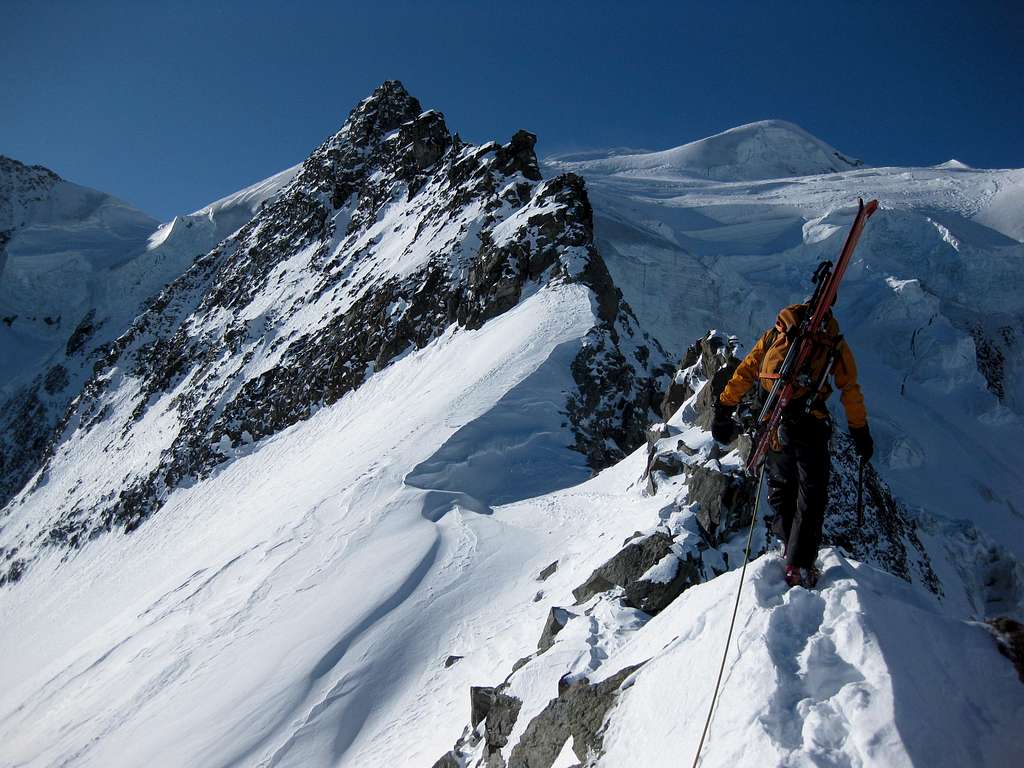
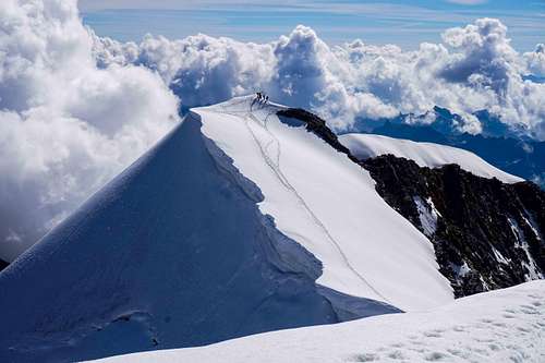
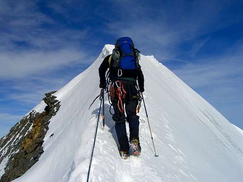
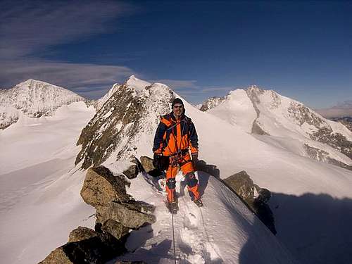
Glacier ascent, almost always marked by an obvious track, ending with an imposing ridge. It is possible to stop on the East summit 3882 m or continue to the Central summit, the highest and the main one 3901 m.
Report
From the Diavolezza hut take a path to the left heading towards Piz Trovat. The path goes around it to the left, and then descends on some easy rocky steps, thus setting foot on the Vadret Pers Glacier. You begin to climb the glacier on the flat, moving left towards the NW face of Pizzo Cambrena, until you reach a spectacular stretch, very crevassed and sometimes tricky, that must be overcome with due attention (some crevasses go around, others cross). After the crevassed section you enter the glacial basin between Pizzo Cambrena on the left and Eastern Pizzo Palù on the right.
The route overcomes a steep slope towards the Fuorcla Pers - Palù, without reaching the ice valley that leads to the NE ridge of the mountain. Reached the ridge, continue carefully along the airy wire reaching at first the foresummit, then the summit of Eastern Pizzo Palù. From this first summit descend along the snowy ridge to a small saddle and then always along the wire with a fairly airy stretch reach the Central summit of Pizzo Palù (culminating point).
Descent: follow the same uphill itinerary
Italian Normal route from Marinelli-Bombardieri Hut
Difficulty: Alpine F+
Difference in level: 1083 m. from Rifugio Marinelli-Bombardieri
The first section is easy and entirely on ice, with crevasses along the slope that precedes the Passo di Sasso Rosso. The final crest is wide at the beginning and on the top dome, with a sharp stretch in the short intermediate route.
From the rifugio Marinelli-Bombardieri follow the path that leads to the NE in the direction of the glacier. Going up between debris and rocks climb up reaching a scree basin under the Passo Marinelli Occidentale. Without reaching the pass, you must turn right and ignore the path to the Scerscen Glacier and the Marco e Rosa Refuge. Going up on debris or snow you reach the Passo Marinelli Orientale 3120 m. Rope up, head to the NE and start to cross all the Fellaria West Glacier, at a due distance from the southern buttresses of Pizzo Argent and Pizzo Zupò. A very crevassed slope leads to the wide saddle of the Passo di Sasso Rosso 3510 m. In case of need, 300 m to the S of the pass, on the rocks, there is the Bivacco Pansera 3546 m. From the saddle, turn to the N and cross the entire Fellaria Plateau, then climb in the direction of Forcola Bellavista 3693 m, between M. Bellavista and Piz Palù. Without reaching the saddle turns gradually to the right, aiming for the small snowy wall under the western summit of Pizzo Palù or Piz Spinas. This wall is located a bit to the right of the summit. After passing the bergschrund, climb the snowy wall and traversing to the right reach the summit ridge. Following it towards the E, you reach the large summit dome at the central top, the highest.
Descent: reversing the same route
West ridge from Marinelli-Bombardieri Hut
West ridge from Marinelli-Bombardieri Hut
Difficulty: Alpine F+
Difference in level: 1083 m. from Rifugio Marinelli-Bombardieri
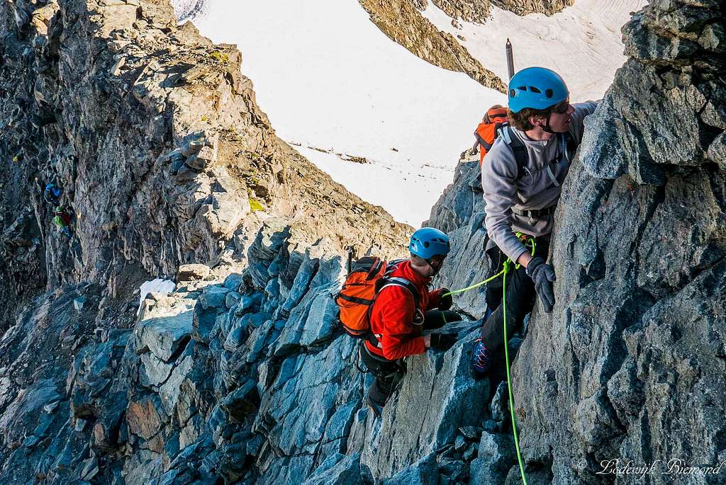
It is a pleasant climb that takes place mainly on a glacier, with some crevassed sections and a beautiful rocky ridge, which has II degree UIAA passages on solid rock and then mixed ground to the summit of Piz Palù Centrale.
Report
From the Marinelli Refuge, take the path that starts from the square to the left, with the signpost to the Marco e Rosa Refuge, passing under the Cresta del Rifugio, then rising on the debris and passing near a stream. Going up between debris and rocks, always on a marked path, you climb up reaching a detrital basin under the Passo Marinelli Occidentale. Before reaching the pass, you must turn right and ignore the path to the Scerscen Glacier and the Marco e Rosa Refuge. Going up on debris or snow you reach the Passo Marinelli Orientale 3120 m. Here it is better to rope up. Once set foot on the glacier (the Vedretta Occidentale di Fellaria), proceed on the flat to the right, passing under the SE spur of Pizzo Argent and then a slightly downhill stretch reaching a glacial basin under the slope that leads to the Passo Sasso Rosso visible towards left. Climb up the slope which is cut by numerous crevasses looking for the best passage, reaching the Passo del Sasso Rosso at 3510 m. From the pass turn left, on the almost flat glacier of the Fellaria Plateau with some crevasses in the direction of the clearly visible Forcola Bellavista 3688 m, a wide glacial saddle located between Pizzo Palù on the right and Monte Bellavista on the left, which can be reached easily. From the Forcola di Bellavista turn right, setting foot on the West ridge of Pizzo Palù, which must be climbed close to the wire. The ridge has some steps of solid rock with passages of maximum II+ UIAA, reaching the top of Pizzo Palù Occidentale m. 3825 or Piz Spinas. From here, continue along the edge of the ridge, climbing a last slope to reach the wide glacial cap that forms the top of Pizzo Palù Centrale m. 3905.
Descent: along the Normal route - Follow the West ridge for a while up to a flat stretch, where you follow the traces of the Normal route (see the previous chapter) that descends to the left the underlying short steep slope of snow or ice, known as the "paretina'' with a section inclined to 40°. When you reach the bottom of the slope, take care of the possible presence of a bergschrund. After the track turns right, rejoining the track followed uphill, just below the Forcola di Bellavista. From here, backwards, you follow the same uphill itinerary until you return to the Marinelli Refuge and from here descend to the Campo Moro dam.
Piz Palù East/West traverse
East/West traverse
Difficulty: Alpine PD+
Difference in level: 928 m. from Diavolezza
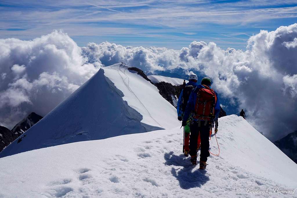
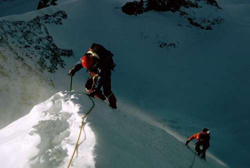
It is a advisable high mountain crossing that takes place mainly on a glacier, with some crevassed sections, then on a superbe snowy ridge connecting all the three summit of Piz Palù
From the Diavolezza hut head towards the SE upstream of a snowfield and near the last pylon of a ski lift take the path to Piz Trovat (white and blue stamps, arrows). At a crossroads, leave the marked path that head to the right and follow the track downstream that with some ups and downs bypasses the Piz Trovat and leads to the Fuorcla Trovat 3019 m. Take the Vadret Pers, skirt the NW face of Piz Cambrena at the foot and take the wide channel, gradually steeper and more crevassed, which leads to the E col of the Eastern summit of Piz Palù (between this and 3731 m). This stretch of glacier is quite crevassed and the best itinerary may vary from time to time. Generally, keep the left in the direction of the Fuorcla Pers-Palù 3457 m. Without reaching it, turn to the right and then reach the East col of the Eastern Palù with a wide turn to the left. From here go up the steep Eastern shoulder which then becomes a thin snow ridge and leads to the Eastern summit 3882 m. Go down towards the col between the East top from the Central one and go up towards it on a very sharp snowy crest, often fringed with cornices towards the North. Pay attention! Once you reach the top of the main peak 3901 m, descend the wide snowy slope that leads to the col between the main and the Western summit, also called Piz Spinas, in the W direction. Continue along the rocky ridge, surrounding the first gendarme on the left, up to the West summit 3823 m and then downhill towards the Fuorcla Bellavista 3688 m (I and II UIAA on rock, you may find also snow or ice).
Descent: From Fuorcla Bellavista, surround the Eastern base of the Bellavista up to a large hump that slopes down towards N. It is possible to continue traversing towards the W towards the Marco e Rosa refuge 3597 m to make the ascent of Piz Bernina the next day downclimbing or by using anchors for abseiling (5 abseils of which a pair of 20 meters: ropes of adequate length!)
Once you have touched the snowfield below the Fortress, continue towards the N and then, to return to Diavolezza, before reaching Isla Persa take towards the E to descend on Vadret Pers through a steep glacial channel immediately downstream of the rocks called Rifugi dals Chamuotschs, or better for snowfields and debris upstream of these rocks.
Cross the Vadret Pers from W to E aiming for the right side moraine of the glacier which you climb up along the trail and then continue along the path to Diavolezza (about 260 meters of ascent!)
Alternatively, it is possible to descend to Morteratsch (m. 1900) reaching Isla Persa and then take a path on the left towards the Vadret da Morteratsch and once set foot on the glacier, follow it easily to the end, arriving at the road that leads to the station and to the parking lot.
Other routes overview
- Piz Palü traverse West/East Difficulty: PD Time required: Marco e Rosa hut to basis then to summits and return = 6h-8h Start point: Marco e Rosa hut 2973m Top point: Central Piz Palü (3905m) Difference in height: hut to main summit: 350 m
- Piz Palü West (Piz Spinas) - North-West face Via Corti Difficulty: D (ice) Time required: hut to basis: 1:30h + basis to summit = 4h-5h Start point: Diavolezza hut (2973m) Top point: Piz Palü W (3823m) Difference in height: basis to summit: 620m
- Piz Palü West (Piz Spinas) - North Spur Via Zippert Difficulty: D- Time required: basis to summit = 4h-6h Start point: Diavolezza hut (2973m) Top point: Piz Palü W (3823m) Difference in height: basis to summit: 700m
- Piz Palü West (Piz Spinas) - NE face Via Gianni Comino Difficulty: TD (ice 60° to 70°) Time required: basis to summit = 4h-6h Start point: Diavolezza hut (2973m) Top point: Piz Palü W (3823m) Difference in height: basis to summit: 700m
- Piz Palü Central North Spur Via Bumiller Difficulty: D+/TD- Time required: basis to summit = 5h-7h Start point: Diavolezza hut (2973m) Top point: Piz Palü Central (3905m) Difference in height: basis to summit: 800m
- Piz Palü Central North couloir Difficulty: D and seracs (and very exposed to multiple risks) Time required: hut to basis: 1:30h-2h + basis to summit = 5h-6h Start point: Diavolezza hut (2973m) Top point: Piz Palü Central (3905m) Difference in height: basis to summit: 700m
- Piz Palü East North Spur Via Kuffner Difficulty: D- (IV+ UIAA on rock) Time required: 2h to basis and for basis to summit: 3h-5h Start point: Diavolezza hut (2973m) Top point: Piz Palü E (3882m) Difference in height: basis to summit: 500m
Red Tape
No fees no permits required
Huts
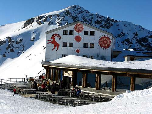
- Berghaus Diavolezza 2976 n
Guardian: Familie Lühr CH-7504 Pontresina
Size: 200 persons
Phone: +41 81 842 62 05 / Fax +41 81 842 61 58 (200 beds)
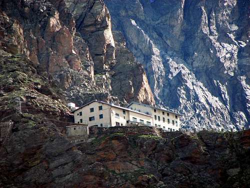
Rifugio Marinelli-Bombardieri 2818 m
Situation: High Scerscen Valley
Owner: CAI Sez.Valtellinese
Guardian: Giuseppe Della Rodolfa Guida Alpina UIAGM
Open: June-September
Size: 100 persons
Getting There: Campo Moro (Val Malenco) Path CAI n. 2
Hut's phone: +39.0342.511577 Hut's reservation phone: +39.347.5200146
Mail: rifugiomarinellibombardieri@gmail.com
Approach from Campo Moro
At Campo Moro, after crossing the dam, continue at its feet to follow path n. 2 to Rifugio Marinelli Bombardieri via Rifugio Carate Brianza (3 hours, 900 m of altitude difference). After a steep slope between the trees, it goes down to precede a long flat stretch with a slight slope, where you will meet the path that goes up from the underlying Alpe Musella. The path from here to the Carate refuge is called of the "seven sighs"; in fact, you will pass 7 bumps in succession until you reach the Refuge Carate 2355 m. Continue to the Bocchetta delle Forbici 2660 m, from where you can see the peaks of the Bernina group: Piz Scerscen 3971 m, Piz Roseg 3920 m and Piz Bernina 4049 m. Following the trail signs we do a long traverse. After a curve to the right in a wide valley we start to see the Refuge Marinelli-Bombardieri high up on a rock spur. Along the path there are the yellow signs of the Alta Via. Following the stamps, continue in the valley crossing some small bridges and then begin to climb the rock spur on which the refuge is placed. Already in sight of the refuge, you come to a junction at 2740 m, which indicates in front of the Rifugio Bignami via Bocchette di Caspoggio. With a last stretch of climb you reach the refuge (3,30 hours from Campomoro).
Rifugio Marco e Rosa 3609 m
Situation: South of Piz Bernina (normal route)
Owner: CAI Sez. Valtellinese Guardian: Giancarlo Lenatti Open: end of June till 20th of September Size: 48 beds (+winter 50) Getting there: From Coax Hut (4 hours: Sella Glacier - Sella Pass - Superior Scerscen Glacier), Boval Hut (4'30 hours: Morteratsch Glacier), Rifugio Marinelli-Bombardieri (3 hours: Marinelli Pass - Superior Scerscen Glacier) or, from Francia via Campo Moro: 1 hour, from Francia via Alpe Foppa: 2'30-3 hours.
Hut's phone: +39 (0)342-515370 Mobile (Hut's reservation phone): +39 (0)342515 370
Piz Palü summits


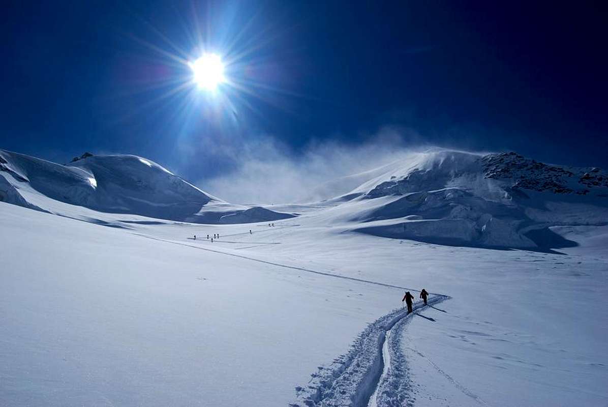
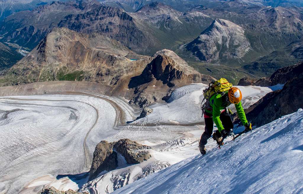
Pers Glacier
Born under Piz Palü north face this Glacier is the main affluent of Morteratsch Glacier.


Piz Palü south side


Piz Palü north side
 |
 |
 |
 |
 |
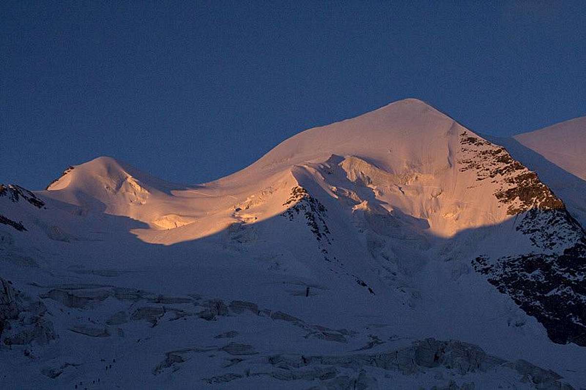
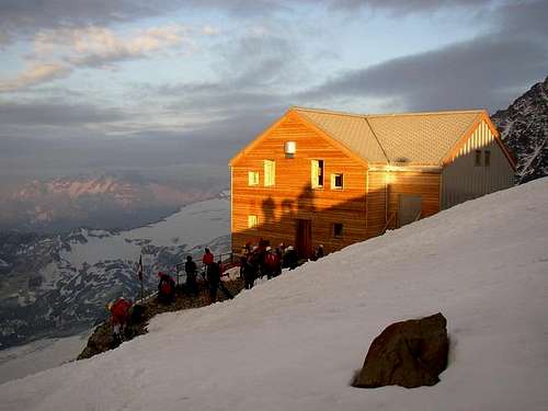
Sunrise on Piz Palü
 |
 |
 |
 |
 |
Piz Palü east side
 |
 |
 |
 |
When To Climb
Mountaineering: summer (June to September)
Ski-mountaineering: from April to June
Bernina express
A small wink to Bernina Express on Piz Palü page. This mountain train can be use to go to Morteratsch valley or to join Diavolezza cable car.
Meteo
Switzerland Forecast
Meteo Lombardia
Guidebooks and maps

"Bernina" - N. Canetta, G. Miotti - Collana Guide dei Monti d'Italia CAI-TCI 1996
"Bernina & Bregaglia Selected Climbs" - Lindsay Griffin ISBN: 0900523603 Alpine Club (http://www.alpine-club.org.uk/)
"Berninagruppe" Gebietsführer für Wanderer, Bergsteiger und Hochalpinisten - Walther Flaig ISBN: 3763324178 Bergverlag Rudolf Rother, München