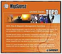
Mapsource Topo
| Page Type | Gear Review |
|---|---|
| Object Title | Mapsource Topo |
| Manufacturer | Garmin |
| Page By | Alan Ellis |
| Page Type | Oct 25, 2002 / Jan 20, 2007 |
| Object ID | 526 |
| Hits | 5803 |
| Vote |
Features include:
Trip and waypoint management functions*
Highways, roads, hiking trails, snowmobile trails, backwoods trails, elevation contours, point elevations, summits, some bathymetric contours, geographic names, churches, and schools
Shoreline detail for lakes, reservoirs, small bodies of water, waterways, rivers, and streams
Icons representing boat ramps, dams, marinas, campgrounds, public facilities, mile markers, first-aid stations, picnic, swimming, and ski areas, wrecks, fuel, and dangerous and restricted areas
Nautical navaids for the 50 states including radiobeacons, RACONs, and fog signals; river, harbor, and other lights; and daybeacons and lighted and unlighted buoys
Wrecks and obstructions—such as shipwrecks, submerged rocks, obstructions, and other hazards to nautical navigation
Images
Reviews
Viewing: 1-5 of 5 |
redsplashman23 - Mar 8, 2007 3:00 pm - Hasn't voted
Mapsource Review
I have a Garmin 60 CSx. This map program is very basic and simple to use. Just select the area you want and then transfer it to your GPS. It doesn't have the detail that Delorme or Memory-Map does, but it is descent.
BSPclimber - May 16, 2007 5:02 pm - Hasn't voted
Not bad
Just recently got this. Still learning what it can do, but so far it seems ok. Will have to play around with it more.
dobsonian - Jul 29, 2007 9:47 am - Voted 3/5
Necessary Evil
The tool gave me access to my GPS allowing for waypoint and track up/download as well as topo overlays. There is no capability to capture tracks and append them to the existing database using this software (there are other methods available) which would be great for new routes and off the beaten path trails. The accuracy of the maps seems to be about 100-150'. I was able to find some map sets on the internet for Israel and France that could be downloaded with a slight registry edit to the garmin gps via this software and these maps which had been recalibrated to actual user tracks were spot on vs what Garmin provided. Downside is that unless you edit the registry for the location of the CDs if you are keeping both east and west coast maps on your machines you need to swap back and forth between discs when uploading maps. If you want Europe of other areas of the world you kick in for another set of maps. There are certain formats that the tools supposedly reads for passing waypoints that it usually pukes on and I have to convert them with GPS Swiss Army Knife (GSAK). I only have serial access to my GPS so upload/download is a 15-20 minute process. Can't say I'm thrilled with the software but it works and is generally pretty accurate.
NCclimber - Apr 5, 2009 3:17 pm - Voted 3/5
OK, for the price
I got this software pretty cheap on sale, and I'm glad I did. Most of the waypoint data is off by a quarter mile in some cases, makes it for a confusing map on the GPS unless you turn them off. Plus the detail in contour is a little lacking, but it is supposed to be like a 1:100,000 quad, so no surprise there.
The nice thing about the software is that you can combine it with tracks and waypoints from Google Earth, and use the Mapsource contours and accurate tracks made from satellite data on the GPS for great route info on the trail.
The nice thing about the software is that you can combine it with tracks and waypoints from Google Earth, and use the Mapsource contours and accurate tracks made from satellite data on the GPS for great route info on the trail.
Viewing: 1-5 of 5 |


Alan Ellis - Oct 25, 2002 12:18 pm - Voted 4/5
Untitled Review