Back Roads Explorer
| Page Type | Gear Review |
|---|---|
| Object Title | Back Roads Explorer |
| Manufacturer | National Geographic |
| Page By | Alan Ellis |
| Page Type | Mar 3, 2004 / Jan 17, 2007 |
| Object ID | 1025 |
| Hits | 4083 |
| Vote |
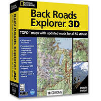
Features:
- TOPO! maps with road data for all 50 states on 17 CD-ROMs!
- Seamless USGS topographic maps of the entire United States
- Updated with current roads and streets
- 3D shaded relief
- Export maps to Palm or Pocket PC
- Load your GPS with personal routes and waypoints
- Customize and print photo-quality maps
Images
 |
Reviews
Viewing: 1-2 of 2 |

cwoods17 - Jan 20, 2007 12:05 am - Voted 5/5
Very useful
My mom hates Topo only because I'm always using it. It's really useful and extremely easy to use.
Downside: It doesn't zoom in very well, but if you need to look at something really close you can always just search it on Topozone.com.
In some spots they didn't use the USGS maps, they used other topo maps which don't show vegetation.
Downside: It doesn't zoom in very well, but if you need to look at something really close you can always just search it on Topozone.com.
In some spots they didn't use the USGS maps, they used other topo maps which don't show vegetation.
Viewing: 1-2 of 2 |
Alan Ellis - Mar 3, 2004 9:23 pm - Voted 4/5
Untitled ReviewDowns: Only 1/100 scale doesn't have the detail of the individual state CDs at 1/24, so it's really only suitable for general planning. Still....It's pretty good. What do you expect for only $59.00 (or $39.00)?