
-
 3222 Hits
-
 79.78% Score
-
 11 Votes
|
|
Mountain/Rock |
|---|---|
|
|
47.43845°N / 10.54626°E |
|
|
Hiking, Scrambling, Skiing |
|
|
Spring, Summer, Fall |
|
|
7461 ft / 2274 m |
|
|
Overview
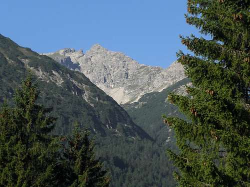
Lailachspitze as seen from Rauth trailhead
There are many Allgäu Alps summits which have – in my opinion – more interesting ascents from the southern / Lechtal valley side than from the Allgäu / northern side. This opinion may cause contradiction but after having summited quite a lot of those Lechtal – side Allgäu summits (some of them having already their SP page from my hand) I stick to this opinion. Maybe it’s the southern sunny side boy in me. Maybe it’s the fact that there are less people walking up those longer and more demanding slopes.
Leilachspitze or Lailachspitze is among those Allgäu south side peaks which have to be tackled best from the Lechtal side of this huge mountain range. Lailachspitze, is the highest summit of a small subgroup of Allgäu Alps, called Vilsalpseeberge, which mark the northeastern part of Allgäu Alps. The subgroup is named after Vilsalpsee, a beautiful alpine lake located in the middle of the subgroup. It can easily be reached by car coming from the village of Tannheim.
Lailachspitze is located in the southernmost part of the subgroup. To the east and south Lailachspitze drops down into Lechtal valley and Schwarzwasserbach valley, a small and lonely tributary valley to Lechtal.
To the north Lailachspitze is limitated by equally lonely Birkental. To the west the mountain ridge goes on to Krottenköpfe (also called Luchsköpfe or Luxköpfe) and to Lachenspitze, both summits belong to the Vilsalpsee mountains, too.
It is said, that the denomination Lailach or Leilach derives from a “bleeched blanket”. Strange thing to hear! The blanket – as to the locals – is a snow field near and shortly below the summit on the eastern side of the mountain, which was to be seen in former times even in summer. Nowadays the blanket vanishes in late spring but what is left is an interesting mountain with many “trails of silence”.
Another interesting feature are two huge cirques on the east and north side of the mountain. The eastern one is called Weißenbacher Notländer, the northern one Gappenfelder Notländer. Both host interesting trails and routes. Another strange denomination, as “Notländer” means a ground which you are in need for during trouble, also a ground, causing trouble. Up to now I did not find a satisfying explanation for this strange name.
Getting There
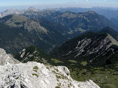
Summit view to Rauth
Main trailheads for Lailachspitze are:
You reach Weißenbach, Rauth and Tannheimer Tal by car
The next railway station is Reutte (see the schedule here).
Use the bus system from there to Weißenbach and Tannheim.
Routes Overview
Routes Overview:
Rauth Routes
Weißenbacher Notländer
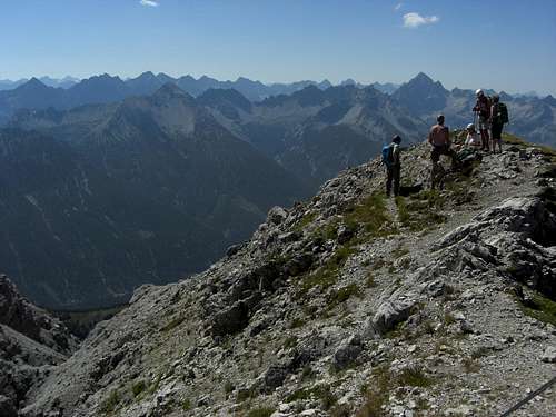
Follow the forest road from Rauth into Birkental, go straight on at a first road junction and take the left hand road on a second one. Near the end of that road take the trail, branching off to your left and follow the trail (number 426) until you reach Höflis hut. Beautiful trail; you have to cross Krottental creek valley, this steep and exposed section is secured with fixed iron ropes.
 Traversing Krottental creek Traversing Krottental creek |
 Birkental at Höflis hut Birkental at Höflis hut |
 Birkental Birkental |
At Höflis hut take the left hand trail (signposts), cross Weißenbach creek and ascend shortly to another forest road. Go left and the immediately right onto the trail branching off to the right. Go right again at a first trail junction and follow that beautiful trail into Weißenbacher Notländer cirque.
 Lailachspitze and Weißenbacher Notländer Lailachspitze and Weißenbacher Notländer |
 Weißenbacher Notländer trail Weißenbacher Notländer trail |
 Weißenbacher Notländer / Lailachspitze east face Weißenbacher Notländer / Lailachspitze east face |
Ascend the cirque until you meet the trail coming directly up from Weißenbach. Traverse to the west and ascend steeply a scree slope and then a rocky chute until you hit the north ridge of Lailachspitze near a secondary summit. This part is steep and the trail is not well maintained there.
Turn left and follow the north ridge up to the summit, the very last part at the summit block is easy rock scrambling.
 Lailachspitze east face Lailachspitze east face |
 Weißenbacher Notländer with trails Weißenbacher Notländer with trails |
 Lailachspitze north ridge Lailachspitze north ridge |
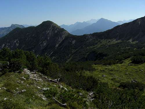
Birkental / Gappenfelder Notländer
Go to Höflis hut as described for Weißenbacher Notländer route above. At the hut go straight on and follow the trail into upper Birkental valley until it zigzags up to Gappenfelder Notländer (trail number 426). You meet Saalfelder Trail (number 421) at the col between Lachenspitze and Schochenspitze. Turn left on that trail and follow it to the south, at last ascending to Krottenkopfscharte.
 Gappenfelder Notländer Gappenfelder Notländer |
 Krottenköpfe above Gappenfelder Notländer Krottenköpfe above Gappenfelder Notländer |
 Krottenkopf col Krottenkopf col |
Turn left there again and follow the interesting trail on the south slopes of Krottenköpfe (Luchsköpfe) which can be summited easily (UIAA grade I scramble) from the highest point of that traverse.
Descend into the col between Krottenköpfe and Lailachspitze. Follow the ridge crest and traverse into a broad scree chute coming down from Lailachspitze summit block / west slope. Ascend the chute to its end, go left and ascend (good red marks) the summit block with some nice scrambling action.
 Krottenkopf traverse Krottenkopf traverse |
 Traverse between Lailachspitze and Krottenköpfe Traverse between Lailachspitze and Krottenköpfe |
 Summit block scramble Summit block scramble |
The Weißenbacher and Gappenfelder Notländer route can be combined to a great traverse of Lailachspitze. My favorite!
Vilsalpsee / Landsberger Hütte
From the parking area Vilsalpsee, east side of the lake ascent to Traunalp and Traunalpsee, Landsberger Hütte, col between Steinkarspitze and Lachenspitze, traverse to Krottenkopfscharte, south slope traverse of Krottenköpfe, west chute and summit block of Leilachspitze.
If you have an overnight stay at Landsberger Hütte several summits around this hut can be “bagged”: Rote Spitze, Steinkarspitze, Lachenspitze.
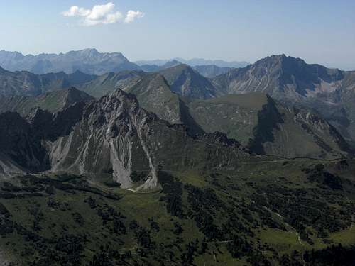 Summit view to Allgäu Alps Summit view to Allgäu Alps |
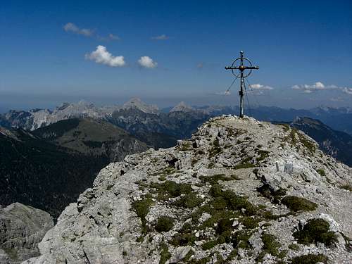 Lailachspitze summit Lailachspitze summit |
Weißenbach route
Try to park your car at the west end of Weißenbach. Take the forest road to Führenberghütte. Before you reach the hut take the trail up to the col between Lailachspitze and unnamed point 1914 m of the east ridge of Lailachspitze, dividing Lechtal valley from Birkental valley. Enter Weißenbacher Notländer cirque until you meet the trail coming up from Rauth. Go on as described above.
Red Tape & Accommodation
Lailachspitze summit view
Red Tape
The area around Vilsalpsee is a strictly protected conservation area.
There are information panels with all regulations and restrictions at the entraneces to the area. The western parts of Lailachspitze, the whole Gappenfelder Notländer and the upper Birkental valley belong to this protected area.
Bivouac and camping is prohibited within the protected area. Please stay on the trails and in the huts for your obernight stay.
The road to Vilsalpsee is closed for public trafic between 10 a.m. and 5 p.m. every day, otherwise open. During closing time there is a bus shuttle service from Tannheim to Vilsalpsee.
Accommodation
There are all kinds of accommodation at Lechtal / Weißenbach
Reutte
Tannheimer Tal
Mountain Huts
Landsberger Hütte
Gear & Mountain Condition
Lailachspitze is a late spring, summer and autumn hike. It is sometimes done with skies, too, but this seems to be rather unusual and there is not “official” ski route in the maps of the area. As for the winter/spring 2014 / 2015 there was one entry in the summit register.
Lailachspitze is a hiking summit which requires nevertheless some ability to walk in steep, unstable terrain and a bit of rock scrambling up to UIAA grade I in unstable rock. A helmet can be useful for the west ascent/descent from/to Krottenköpfe as rockfall can be possible in the upper parts, but is no must.

Current Weather of neighbouring Lachenspitze:
Map
 Weißenbacher Notländer below Lailachspitze
Alpenvereinskarte, number BY5:
Tannheimer Berge, Köllenspitze, Gaishorn,
scale 1 : 25.000, with UTM grid, trails and ski touring routes, edition 2012