
-
 5043 Hits
-
 82.33% Score
-
 15 Votes
|
|
Mountain/Rock |
|---|---|
|
|
46.51015°N / 10.04236°E |
|
|
Alta Valtellina/Engadina |
|
|
Hiking, Skiing |
|
|
Spring, Summer, Winter |
|
|
10184 ft / 3104 m |
|
|
Overview
The name Monte Cotschen 3104m (in switzerland called Munt Cotschen), has very ancient origin, and it’s taken from the romancio dialet “coccinus” that means “red”; due to the color of the brocken rocks on its SE flank.
It is part of the Livigno mountains, and placed on the boundary Italy/Switzerland. It appears as an outstanding pyramid with 3 sides. The north and west are swiss and they overhang the val Chamuera. Val Chamuera belong to the Engadin valley. The southeast side is italian and it is placed at the head of val Federia (Livigno).
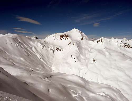
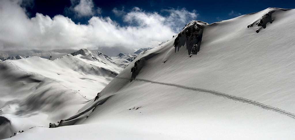
Monte Cotschen from Pizzo Cantone
Monte Cotschen is cleary visible from the ski area of Livigno, wherefrom the winter ski route starts. Differently the approach from the swiss side is rarely done.The val Chamuera that start from the village of Chamues-ch 1708m, is long 13 km, and it’s usually crossed only in summer when the transit by car is permitted. The slopes of the mountain are quite steep on every sides.
The hike ascent doesn’t require climb attitudes; instead the ski route on slopes with an average slant of 35°/40° is a good challenge despite not very long. (only from Italy).
Very nice view from the top towards the Bernina group. This mountain is one of storic destination of the telemark "Free heel festival" that Livigno hosts every april. www.livignofreeheel.it
Monte Cotschen
Getting There
The slopes of Monte Cotschen can be reached easily from different sides. Mostly from the italian Livigno Valley.From Switzerland:
From the Unter Engadin - from the village of Punt Chamues 1708m - Val Chamuera - Passo Federia 2901m
From Italy:
From Milano - Sondrio - Bormio - Livigno - Val Federia - Carosello 3000 ski area
By Bus:
From Switzerland: Line Zernez-Livigno Silvestribus
From Italy: Line Bormio-Livigno Bus Perego or APT Livigno
By Car:
From Switzerland: St.Moritz-Livigno Tunnel "Munt la Schera"
or Tirano/St.Moritz - Livigno - Passo della Forcola (open only in summer)
From Italy: Milano-Sondrio-Tirano-Bormio SP38 - Passo del Foscagno - Livigno SP301
Val Federia
Routes overview
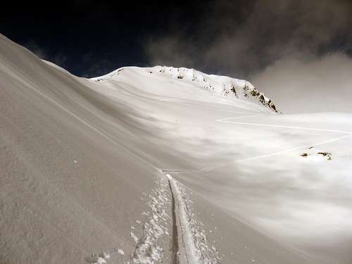
The summerand winter routes, passes across the south ridge. The ridge starts from thepasso di Federia 2901m that hosts a nice small lake, not visible inwinter. From Italy take the path 117that goes through the val Federia. From the swiss side only rarely stone pilesindicate the way to the pass from the val Chamuera.
Difficulty E for theapproach to the pass and EE for the ridge.
Ski route
In winter,from the “Federia” chairlift upstation, ski down on the western pist for 50/100meters, and go up to the passo Federia with a long travers at the foot of theMonte Campaccio.
Difficulty BS for the ascent and S3/S4 for the descent. The descentends at the foot of the Monte Cotschen; from here climb up for 100 meters to get again to the chairliftdown station.
Ski route
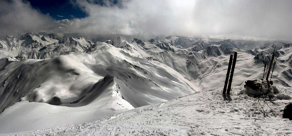
The summit and my skis
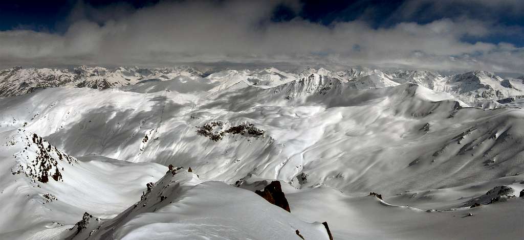
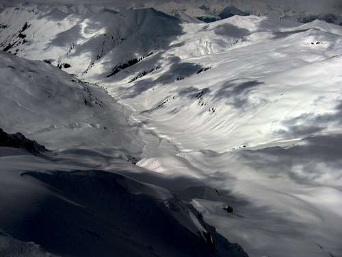
Val Federia from the summit.
Ski route
Classic ski route from Livigno:Ascent:
From the village of Livigno take the yellow bubble car that takes to the "Carosello 3000" (12 euros one way). From the top station, take the pist that leads to the bottom of Val Federia. Take the chairlift that get up back to the upper station. From here get into the pist n.27 and after 100 meters leave the pist into the slopes at the foot of Pizzo Cantone.
Once put the skins, follow with a long traverse the smooth slopes at the foot of Pizzo Cantone and Monte Campaccio pointing the easyest passage accros the border between Val Federia and the opposite Valle del Monte. When the border is reached, follow it loosing 80 meters until the Passo Federia 2901m.
From here the south ridge of Monte Cotschen is clearly visible. Takes the ridge, on the west side (your left). When the ridge ends to a rock cliff, turn right and with a very exposed traverse (warning!) get the base of the summit. From here reach again the south ridge and easily the top.
Descent:
From the ridge of the summit, go down on the opposite flank (north). Slant of 40°. The slope is very nice, with good snow. At the and of it, turn right on the east side of the mountain. The bottom of Val Federia is visible. Try to reach the base of it remaining more or less at the same altitude of the chailift downstation, visible on the opposite side of the valley (2300m). Here the slope are 30°/35° steep. Once on the bottom, climb up for 50/100m to get the station
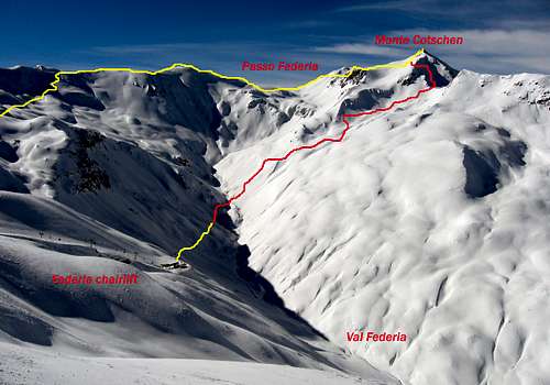
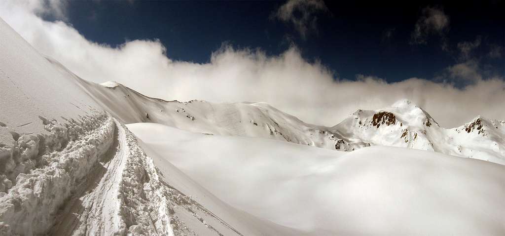
Monte Cotschen ski route. Yellow line is the ascent route. Red line is the descent route
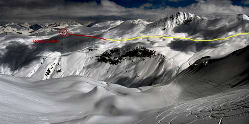
The circle shows the starting point. The ski route in yellow color