
-
 2871 Hits
-
 72.08% Score
-
 2 Votes
|
|
Route |
|---|---|
|
|
46.87000°N / 12.40000°E |
|
|
hard ski touring route |
|
|
A long day |
|
|
GAS = good alpine skier |
|
|
Approach
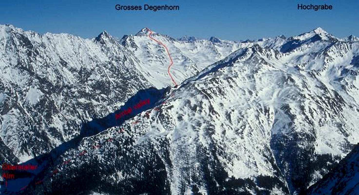
Getting there see main page.Starting point is the pasture of the Unterstaller Alm (1664 m) that is allowed to reach by private car. Whether this is possible on the snow covered little road is another question. In any case snow chains are necessary. In March 1994 we tried to drive up there and got stuck in too soft snow. So perhaps it is the better idea to leave the car before the road becomes steep. This is at the final farm at about 1500 m. From there climbing Degenhorn is a very long trip!
Route Description
Follow the road further on to Unterstaller Alm (1664 m) that is not inhabited in winter time.
The climb starts with the ascent along the valley to the very pittorsque little village of the Oberstaller Alm pasture (1883 m).

Follow the valley (behind Unterstaller Alm it is called "Arntal") further on up to app. 2100 m.

There starts the long SW slope of the Degenhorn that is a good terrain for skiing.


But first you have to gain another 800 m of elevation…
Time for ascent: 4-5 h, depending on the starting point
Essential Gear
ski touring gear with avalanche equipmentAvalanche Risk
I only have my own experiences: In March 1994 we had too warm conditions, so snow got too soft around noon and there was a great danger of wet avalanches at the lower slopes.Genarally a SW slope is a safe expositon concerning snow slabs. On the other hand you may not expect pure powder here. So the best option is to do the trip after a cold clear night in spring and try to be fast.