
-
 5238 Hits
-
 82.48% Score
-
 15 Votes
|
|
Mountain/Rock |
|---|---|
|
|
38.12034°N / 107.45758°W |
|
|
Hinsdale |
|
|
Hiking |
|
|
Spring, Summer, Fall, Winter |
|
|
13681 ft / 4170 m |
|
|
Overview
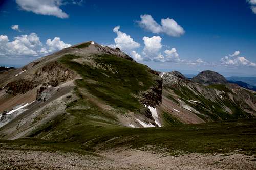
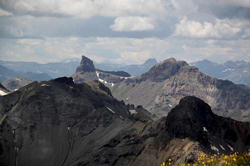
Unnamed 13681 and Sheep Mountain far right
UN 13,681 as seen from upper Little Cimarron drainage
Why unnamed? Colorado has so many 13ers (mountains above 13,000 feet - 3962 meters) that many remain unnamed.
Guide to Colorado Mountain with Robert Ormes (sort of a bible of Colorado Mountains) briefly mentions Peak 13681 twice in conjunction with Silver Mountain. First mention: "North and east of Uncompahgre are several peaks, many unnamed spread over a rolling tundra landscape. Silver Mountain (13,714') and Peak 13,681' are a couple of the more prominent, and can be reached from the same trail up Nellie Creek as Uncompahgre. Less than a mile pas the wilderness boundary, a trail to the right goes over a 12,400 pass into Big Blue Creek drainage. At 11,400 feet a trail heads northwest toward Silver's easy south ridge. To gain it, leave the trail at about 12,200' and hike directly west to a low point on the ridge and turn north. Peak 13,681' is another mile north from there across the tundra".
Second mention: When describing Sheep Mountain and Little Cimarron Trail. "It's a long way in here and you may want to make it a weekend by bagging both Silver Mountain and Peak 13,681. They can be reached by continuing south along Little Cimarron Trail, which eventually crosses Silver's east shoulder on the way to hooking up with other trails around Uncompahgre Peak."
Colorado Rank: 159
Parent Lineage: Silver Mountain
Class: 2
Wilderness: Uncompahgre
Nearby Mountains:
- Silver Mountain A 1.04 miles
- Unnamed 13060 D 1.12 miles
- Unnamed 13051 1.80 miles
- "Big Blue Peak" 1.81 miles
- Unnamed 13100 B 1.2.04 miles
- Sheep Mountain C 2.70 miles
- "El Punto" 3.11 miles
- Uncompahgre Peak 3.38 miles
Getting There
The Fall Creek Trail #231 begins at Fall Creek Trailhead - well signed located at the end of the Little Cimarron Road.
From Gunnison travel west on Highway 50 for approximately 26 miles to the intersection with County Road 864 = Little Cimarron Road (signed). Or from Montrose it is about 22 miles east on Highway 50 to the same intersection. Travel south on CR 864 - gravel, easily passable by 2 WD vehicles to the end of the road - large parking area, well marked = Fall Creek Trailhead. It is about 20 miles on the gravel road. (4 miles past East Cimarron Trailhead).
The Little Cimarron Trail # 229 begins at the Alpine-Little Cimarron Trailhead on Forest Service Road 864. This trailhead is located on the same road as above mentioned The Fall Creek Trail. It is just about 16 miles from the intersection with Highway 50.
Route
There are several options to get to the summit. I chose Fall Creek Trail because I wanted to explore this trail and also I was planning to summit Silver Mountain first. If one plans to summit on UN 13,681 - Little Cimarron Trail would be probably the best way to go.
Approach to the peak: I chose Fall Creek Trail as mentioned above, other optional trails would be Little Cimarron trail (I have hiked this trail when I was hiking Sheep Mountain C and Unnamed 13,100), Big Blue Creek Trail. I have not explored East Fork of Cimarron, but per map appears approachable.
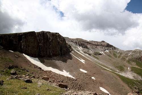
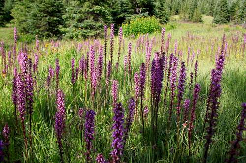
Fall Creek Trail: From the trailhead hike up on a nice and well marked trail, which leads initially into the forest, and then continues along a small stream and gently up through meadows. At about 2 miles you enter into a forested area and descend slightly down towards bigger Fall Creek drainage. Cross the creek (I had to take my shoes off since the water was high) and follow a trail along the creek in southern direction through open meadows, another creek crossing, through some marshes until you get below Silver Mountain. The first glimpses of the eastern ridge of Silver Mountain look impressive. At places the trail nearly disappeared in the grassy meadows, just to be found higher up. I continued up in southern direction along the eastern flanks of Silver Mountain and left the trail before it started to drop down into Big Blue Creek drainage. Unfortunately, there were no signs and I did miss the intersection for Little Cimarron Trail. However, I have found this trail on my way back without any difficulties.
I summited first Silver Mountain and then descended into the saddle with Unnamed 13,681 and walked up its gentle grassy south slopes to the summit. There was a cairn on the summit. I left a glass register there. The views are spectacular.
If coming from Little Cimarron Trail, continue on a trail up and near the end of the drainage (before the scree field starts to go steeply up along the eastern cliffs of Silver Mountain). Head for the saddle between UN 13,681 and Silver Mountain.
Return: I had to get back into a Fall Creek drainage, which meant climbing the scree field (the only scree on my hike) between Silver Mountain and Unnamed 13051. UN 13051 would be another and easy ranked 13er summit. I have not continued to its summit since it was hailing and I had a long way back to the car. (I did it as a day hike and logged around 15-16 miles).
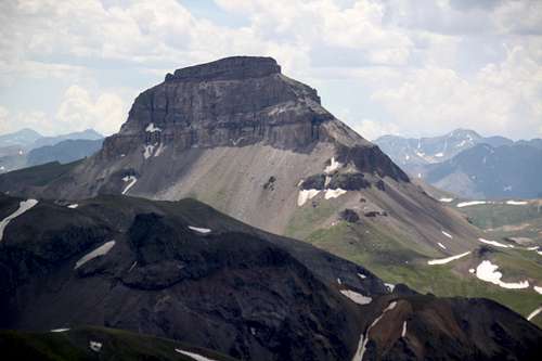
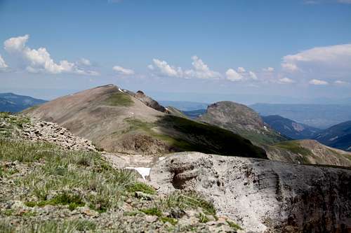 Unnamed 13681 and Sheep Mountain C as seen from Silver Mnt. | 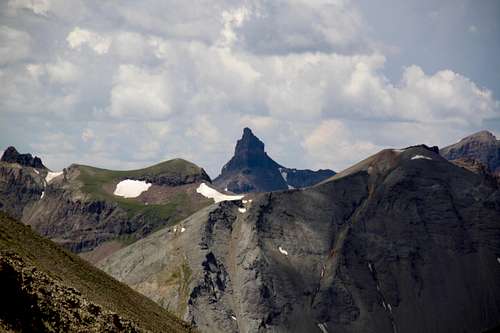 Coxcomb as seen from the Silver and UN 13681 saddle |
 Coxcomb and Redcliff from the summit | 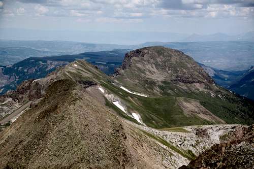 Sheep Mountain and UN 13100 B |
 Mighty Uncompahgre | 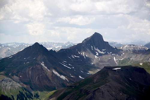 Wetterhorn and Matterhorn |
Red Tape
The Fall Creek trail is within Uncompahgre Wilderness and wilderness regulations apply here.
Uncompahgre Wilderness was designated in 1980. The name comes from a Ute Indian word with one of the translations being "dirty water". There are two fourteeners and at least twenty five 13,000 foot peaks.
Wilderness rules apply here: ALL VISITORS PROHIBITIONS:
1. Entering or being in the restricted area with more than 15 people per group, with a maximum combination of people and
stock not to exceed 25 per group.
2. Camping within one hundred (100) feet of any lake, stream, or National Forest System Trail.
3. Building, maintaining or using a fire, campfire, or wood-burning stove fire:
a) within one hundred (100) feet of any lake, stream or National Forest System Trail.
b) above treeline.
4. Storing equipment, personal property, or supplies for longer than seven (7) days.
5.Hitching, tethering, hobbling or otherwise confining a horse or other saddle or pack animal: 1) in violation of posted instructions, or 2) within 100 feet of all lakes, streams, and National Forest System Trails.
6. Possessing a dog which is not under control, or which is disturbing or damaging wildlife, people, or property.
Note: the term "under control" is defined as the dog being leashed, and/or under direct verbal control by the
dogs owner or handler at all times.
7. Shortcutting a switchback in a trail.
When to Climb
Best is June through October, early May will still have too much snow.
If traveling in winter, always check avalanche conditions and be prepared to spend the night out.
Camping
Wilderness backpacking camping is excellent with many many options, creek nearby and solitude.
You can sleep in the car at the Fall Creek trailhead - the parking is at the end of the road and parking lot is large and flat.
There are few primitive campsites along the road in the woods as you drive in, a few by the river right before you hit East Cimarron TH, and higher up in the forest between East Cimarron TH and Fall Creek TH.