On its way to join Green and subsequent to that, Colorado River, San Rafael River carves a canyon more than a thousand feet deep in central Utah to the east of the town of Castle Dale. Due to its resemblance to Grand Canyon (220 miles away on a straight line and probably more than a thousand river miles away), San Rafael River canyon has been referred to as “Little Grand Canyon”.
A dirt road starts just to the north of Castle Dale and takes you to a spot on the northern rim of the canyon known as “The Wedge”. From The Wedge, the road heads east and west along the rim for some distance providing you with great views of the canyon. I did a 9 mile long hike along the rim of the canyon in sub-freezing temperatures on a Monday in early March when I was lucky enough to be the only hiker.
Trip Report
Hike Length: 9.0 miles
Maximum Elevation: 6310 ft
Minimum Elevation: 5990 ft
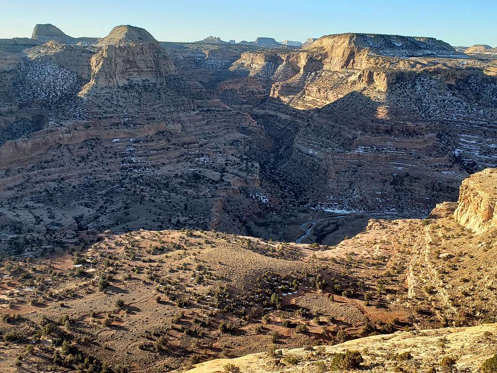
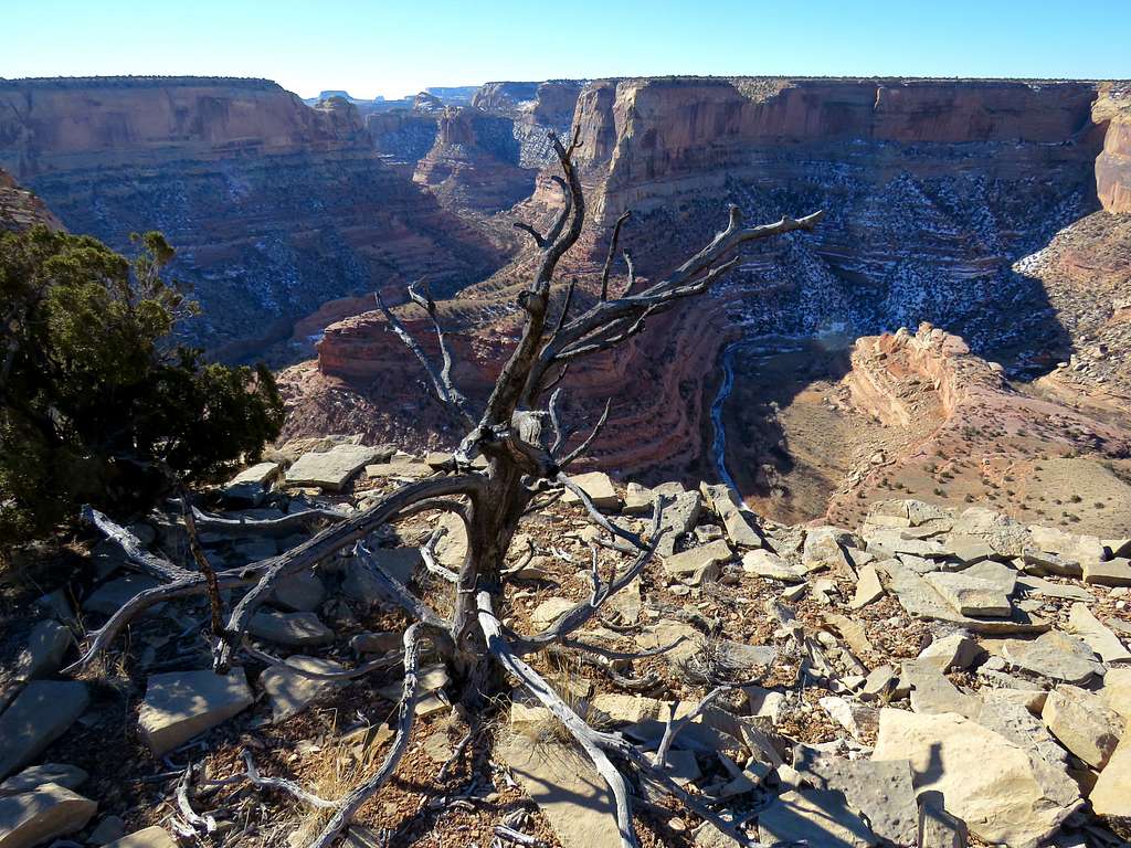
Left the motel in Ferron, Utah at 6:50 a.m. (sunrise around 7:00) when it was 16 degrees Fahrenheit. Drove the same path as yesterday (see the link above for the hike inside the canyon) except that I took the branch that went to The Wedge where I reached at 8:00 a.m. It was 19 degrees F and no one was there. I suddenly found myself on the north rim of an east-west running canyon 1100 ft deep. A small part of San Rafael River could be seen in the shade at the bottom of the canyon.
From The Wedge, Points 6493 ft and 6495 ft seen
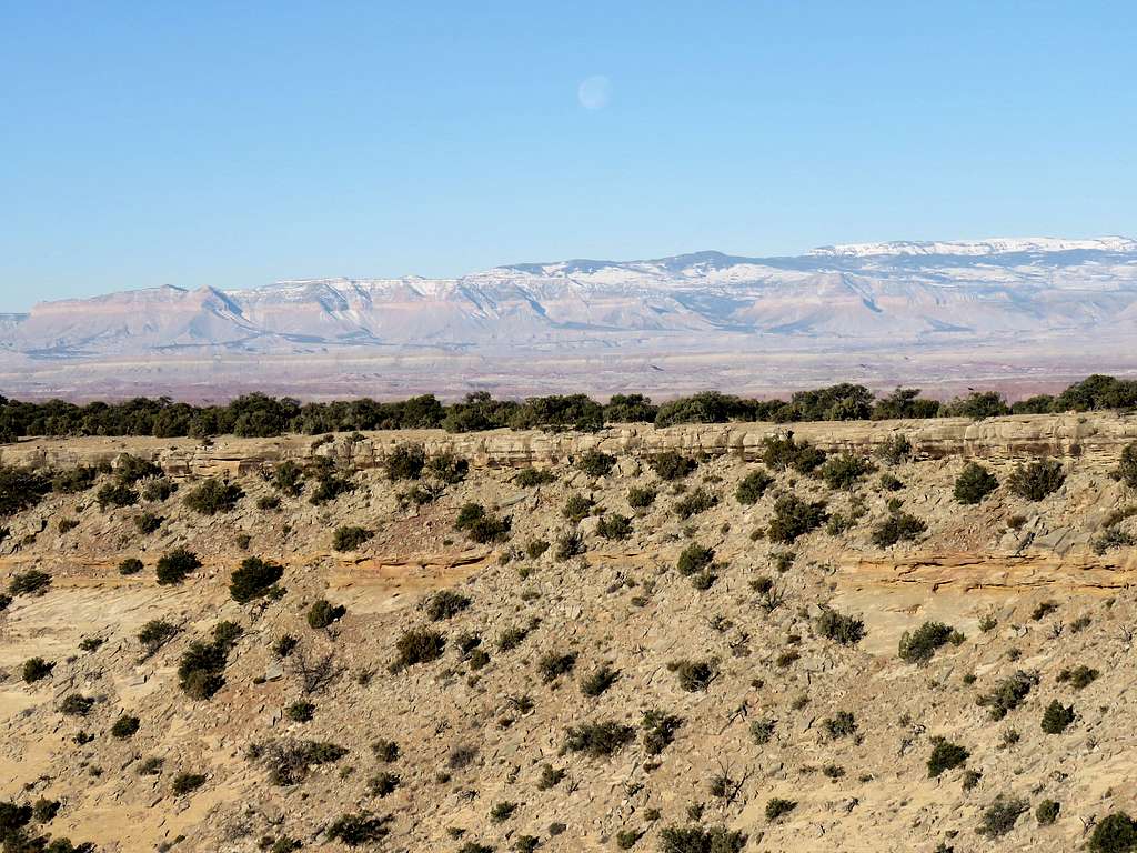
25 miles away to the west, the moon could be seen setting behind the snowy mountains to the west of Route 10.
Moon over the mountains 25 miles away
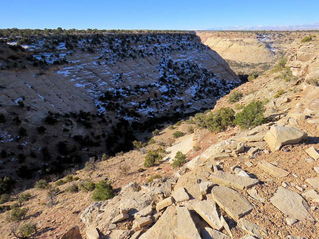
I headed west along the very edge of the drop off. The dirt road was near but I was lucky to have the whole place to myself. There was no wind so with proper clothing, it did not feel cold at all.
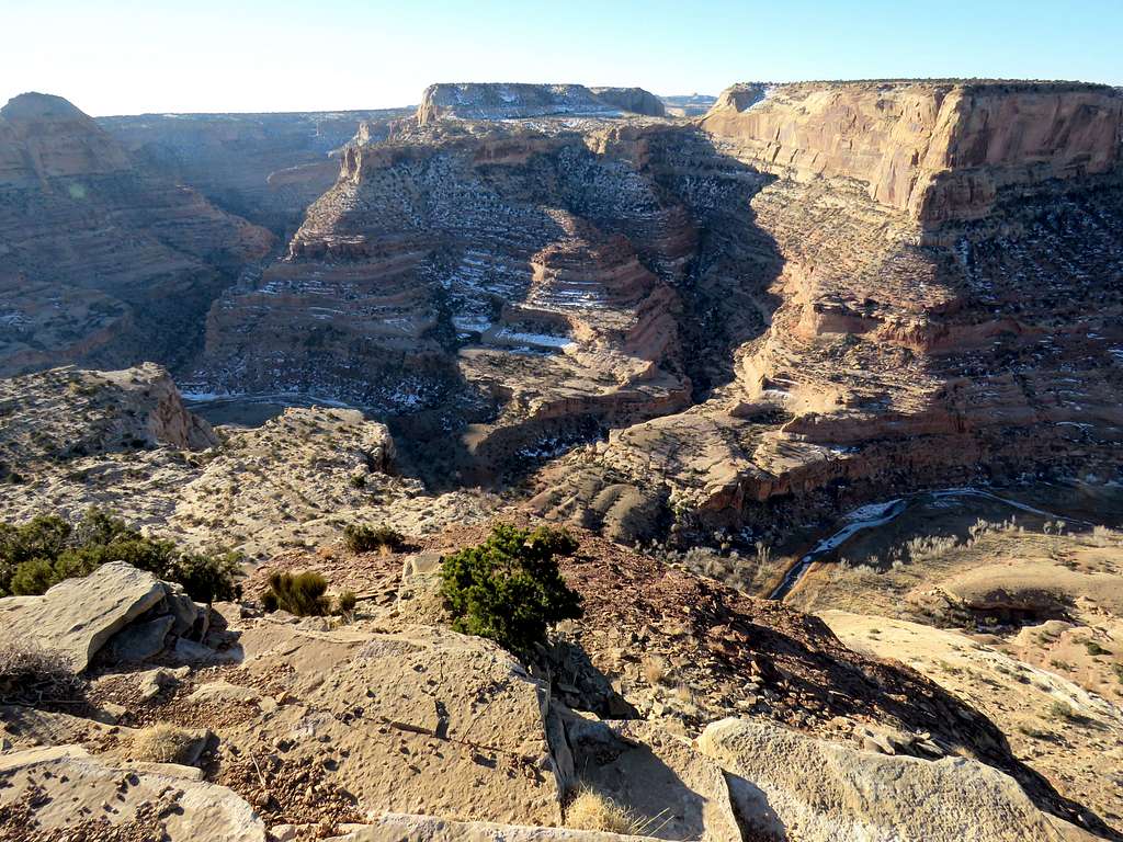
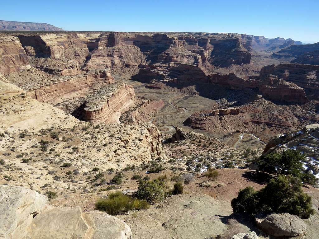
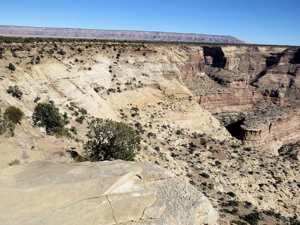
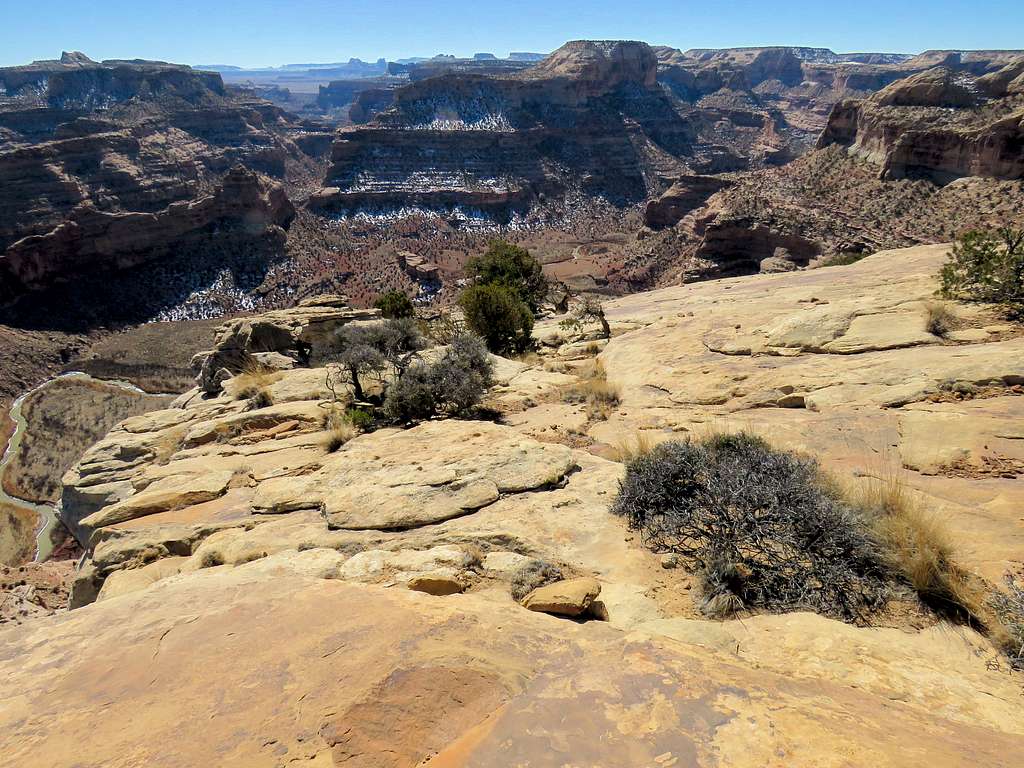
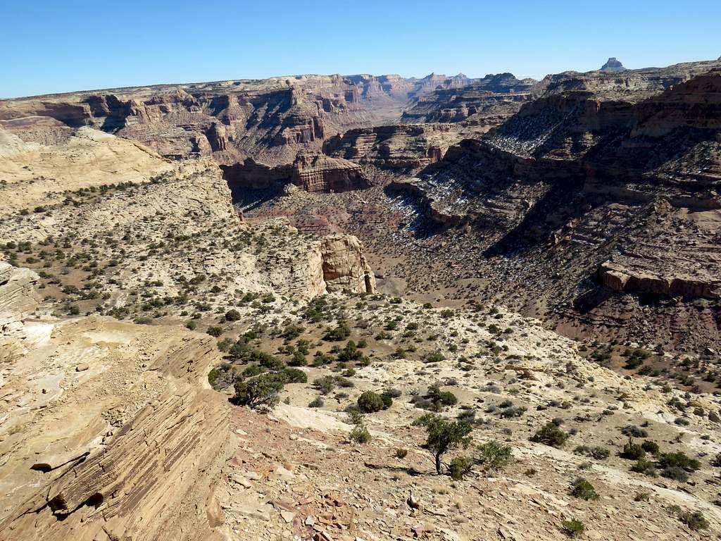
Canyon
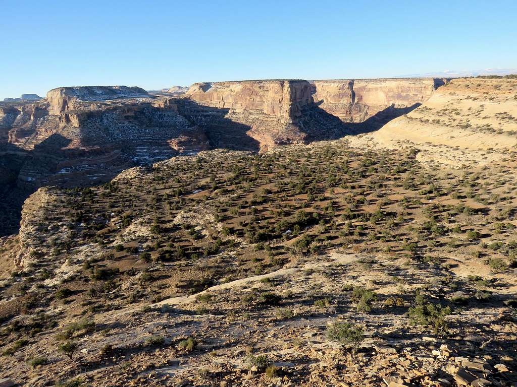
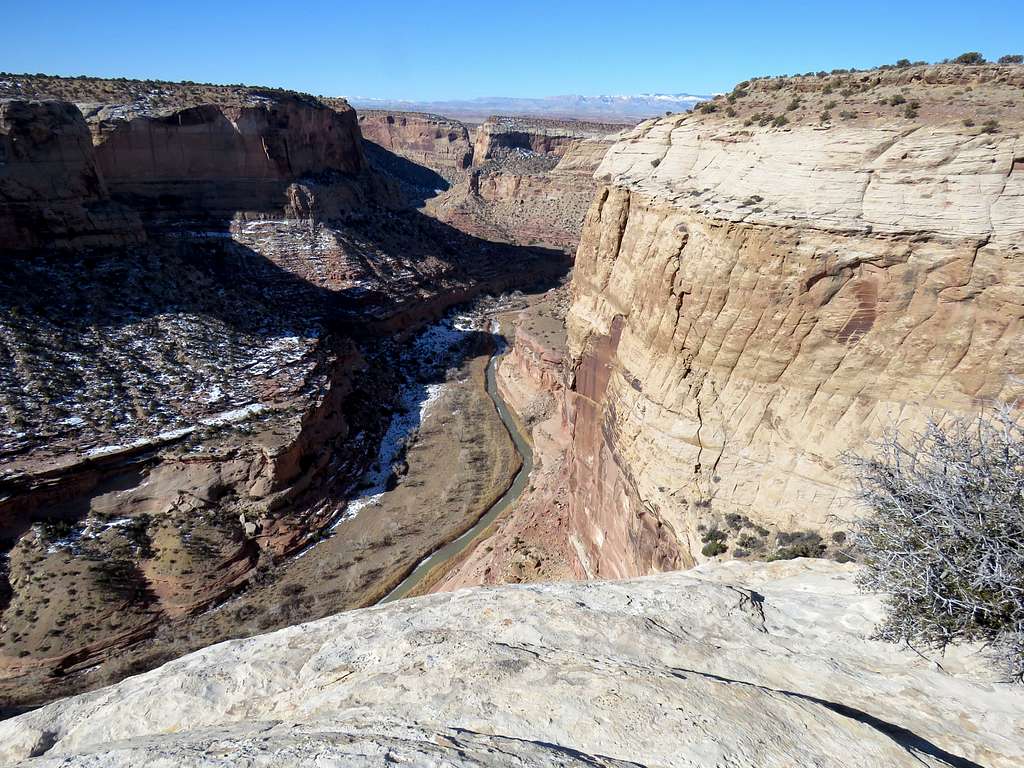
Very impressive views from the very beginning.
CanyonPoints 6493 ft and flat-top 6536 ftCanyon
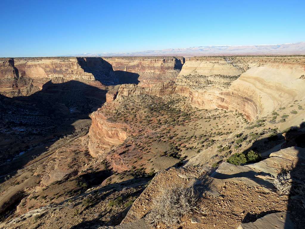
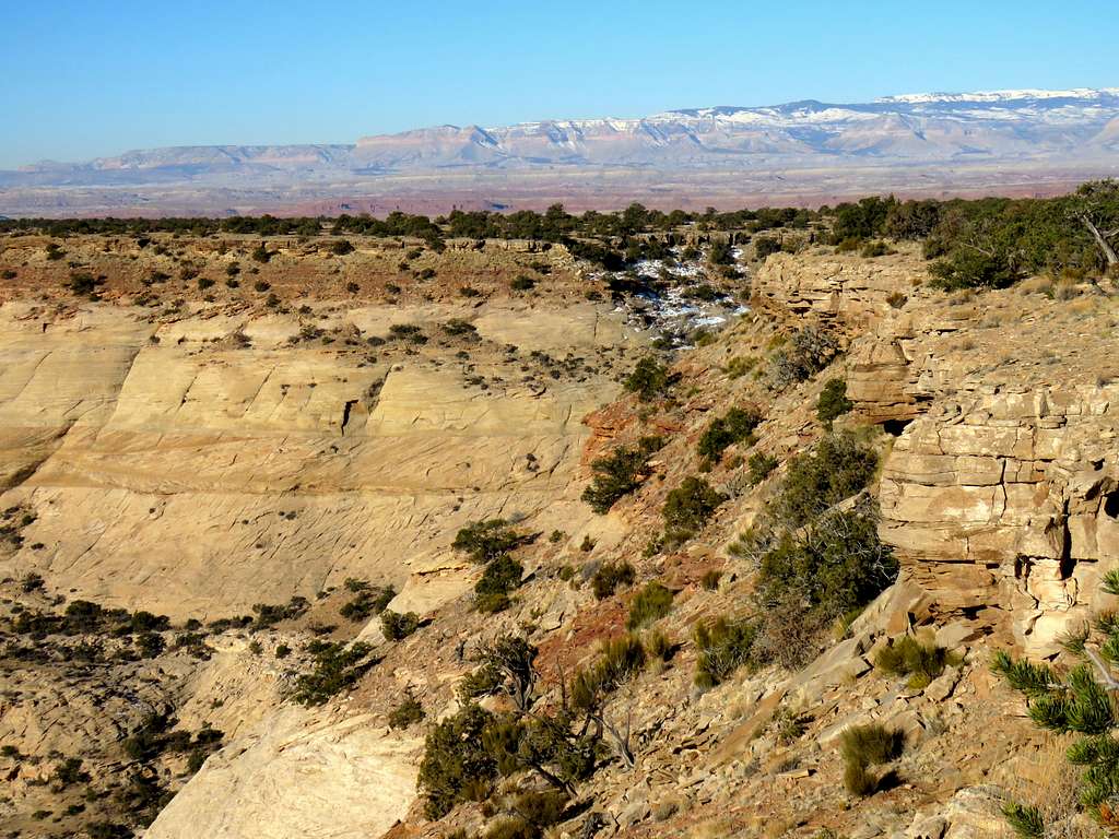
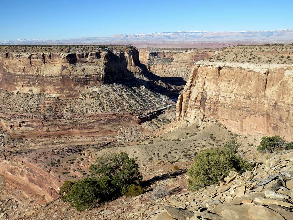
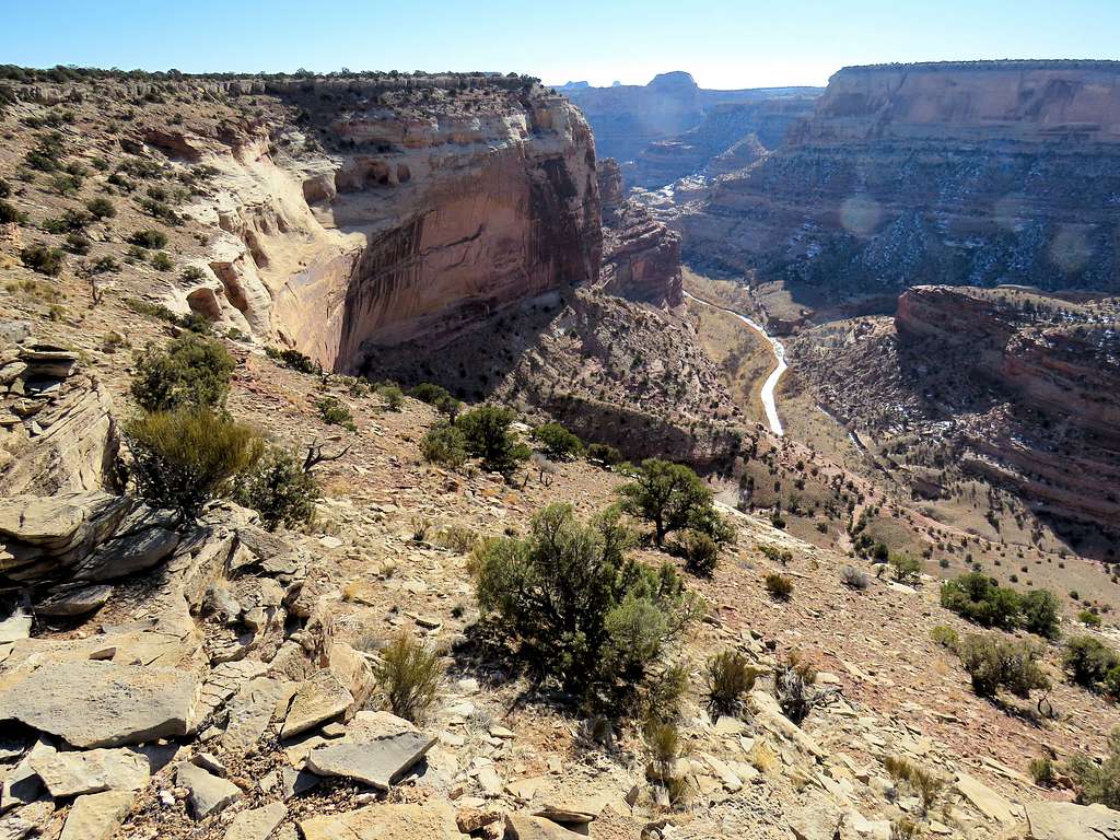
I was sticking to the very edge of the main canyon going away from the road walking onto a peninsula that stretched into a side canyon.
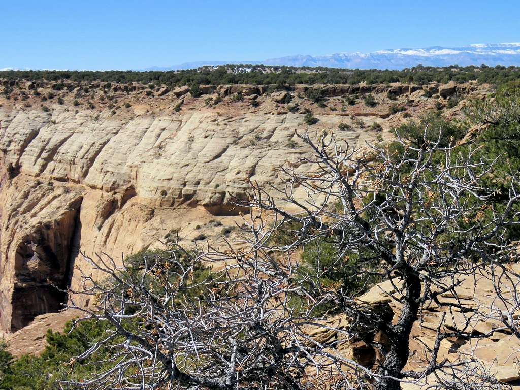
CanyonDistant Mountains to the west
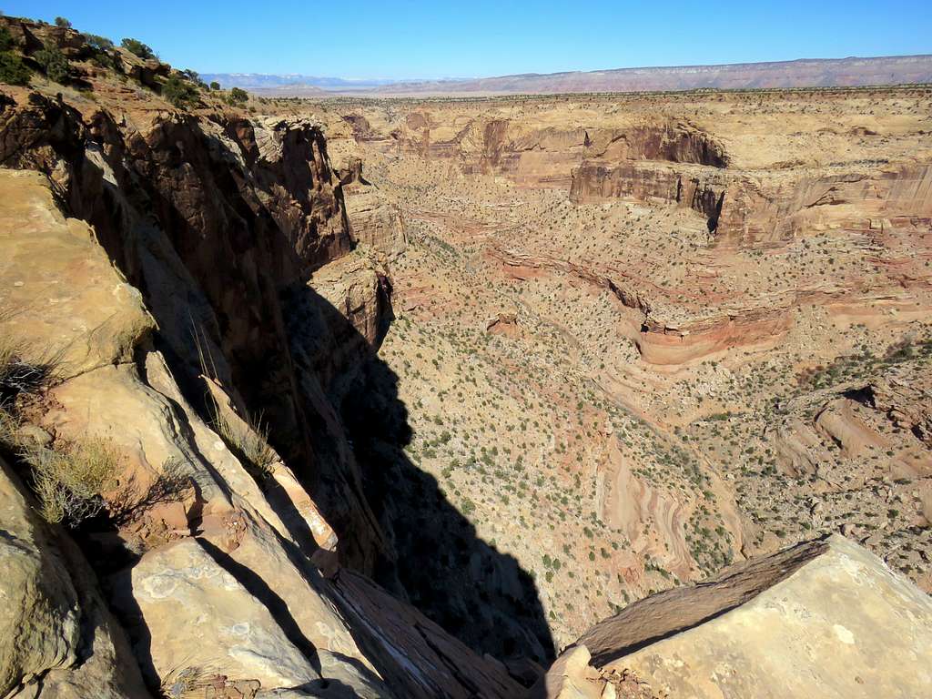
After 1.2 miles of hiking, I reached a side canyon that blocked my progress west along the edge of the main canyon. I had to go around the rim of the side canyon.
Side Canyon
At 2.7 miles of hiking, I was back on the edge of the main canyon (going around the side canyon had taken 1.5 miles).
CanyonCanyon
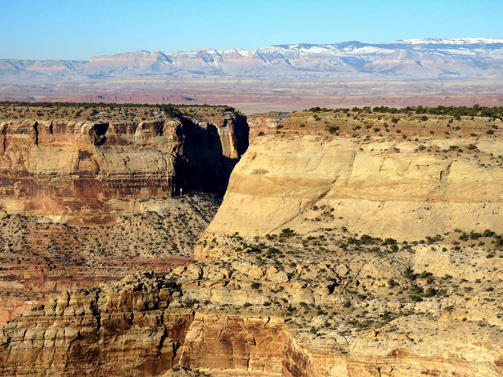
The junction of Virgin Spring Canyon with San Rafael River Canyon was well visible below.
Jct of Virgin Spring Canyon (L)
Continuing west.
Canyon
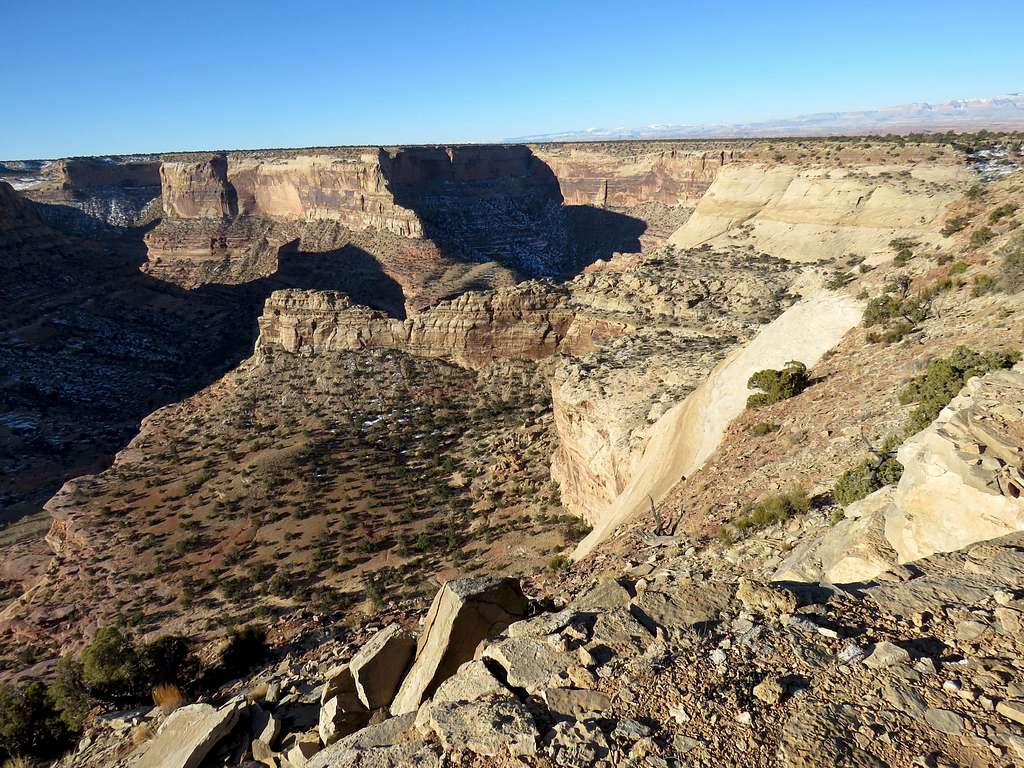
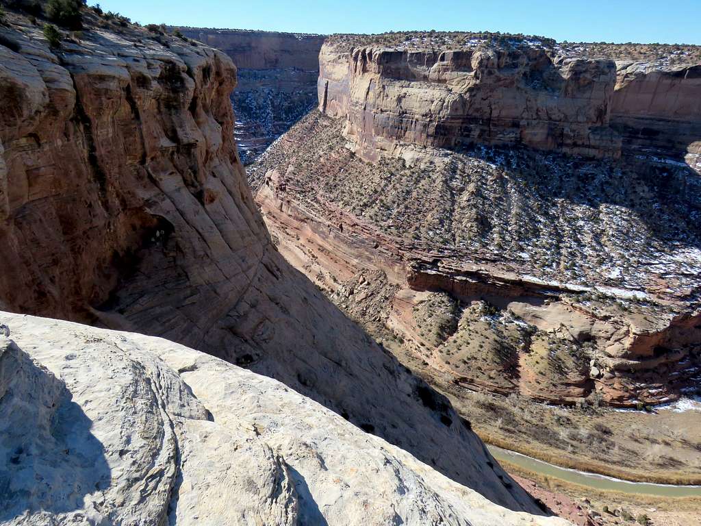
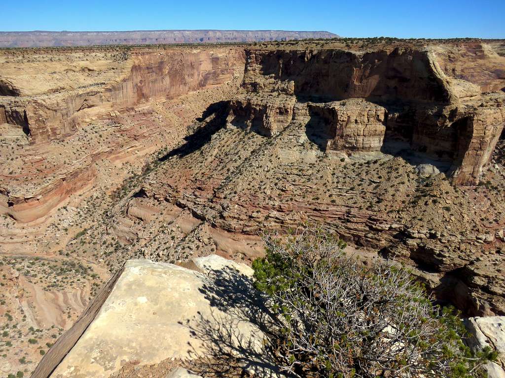
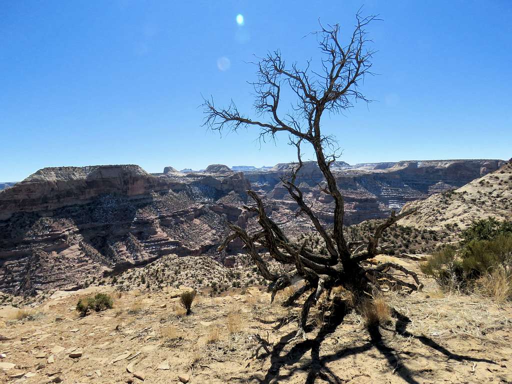
I then reached another side canyon (which would have taken another 1.5 miles to bypass). Views of the main canyon.
CanyonCanyonCanyonCanyon
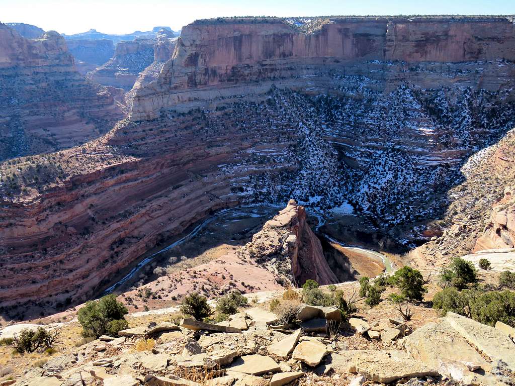
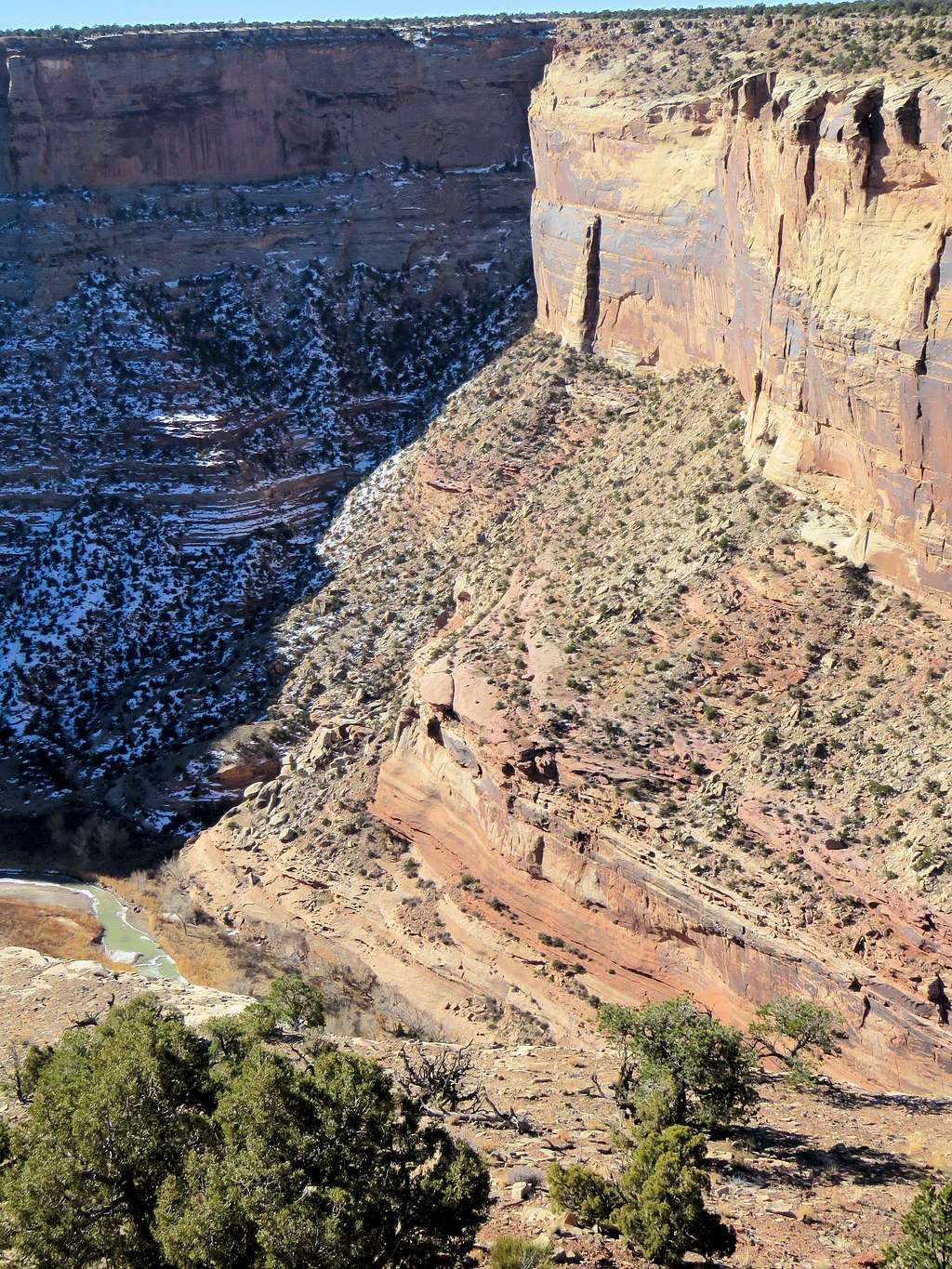
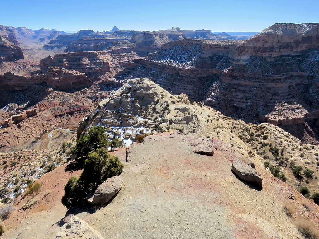
100 vertical feet below, found a rocky buttress that rose above the side canyon near the junction with the main canyon. Thought that would be a good spot to rest and get great views.
Rocky buttress in the side canyon
Found my way down to the top of the rocky Buttress where I reached at 10:05 a.m. and 3.52 miles of hiking. Sat there to have lunch and enjoy the views.
From the rocky buttressFrom the rocky buttress
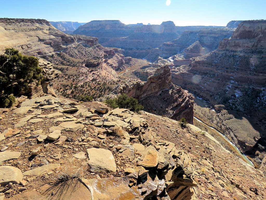
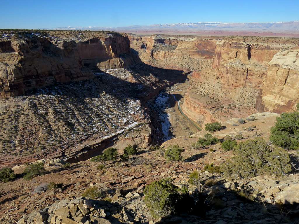
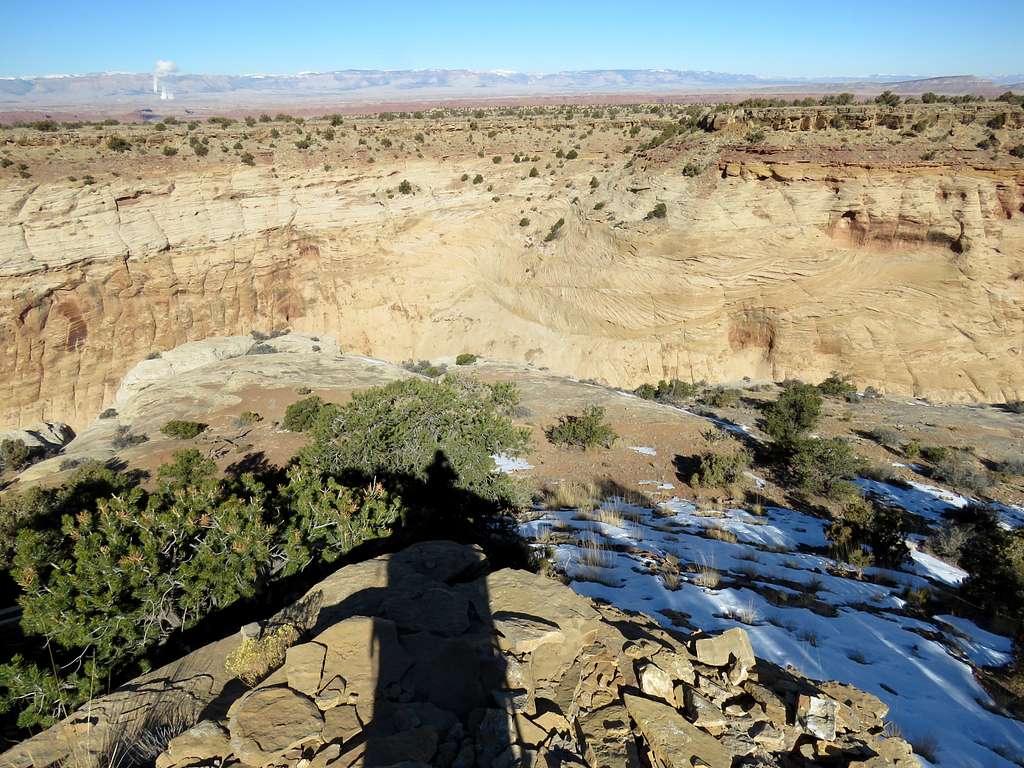
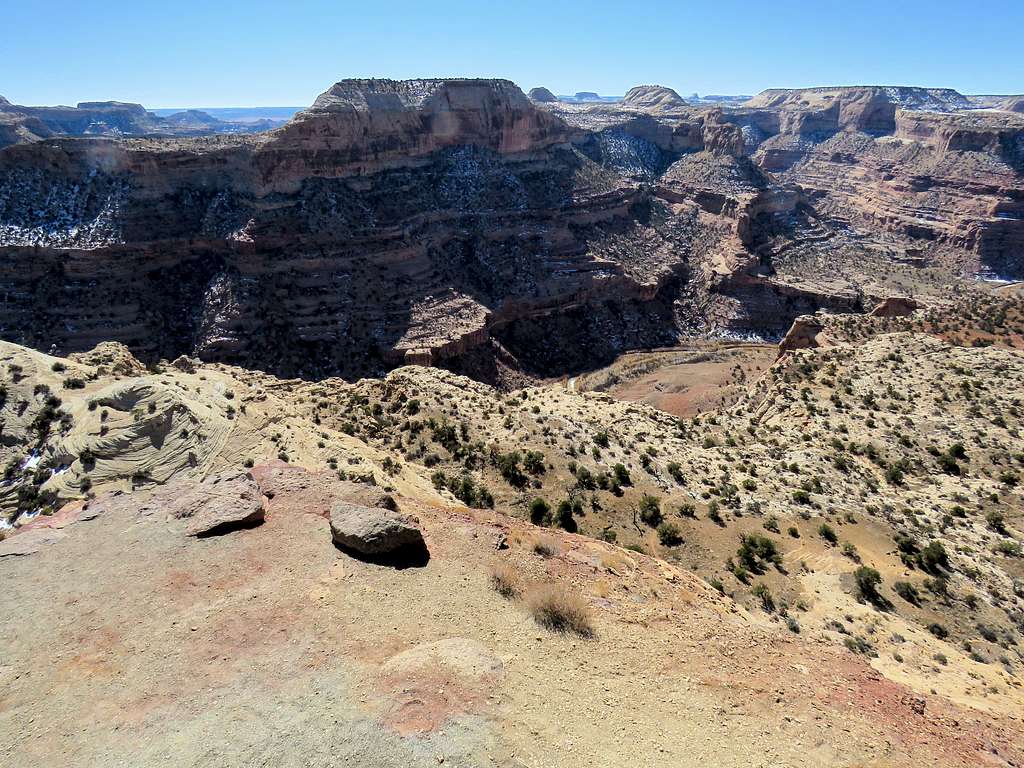
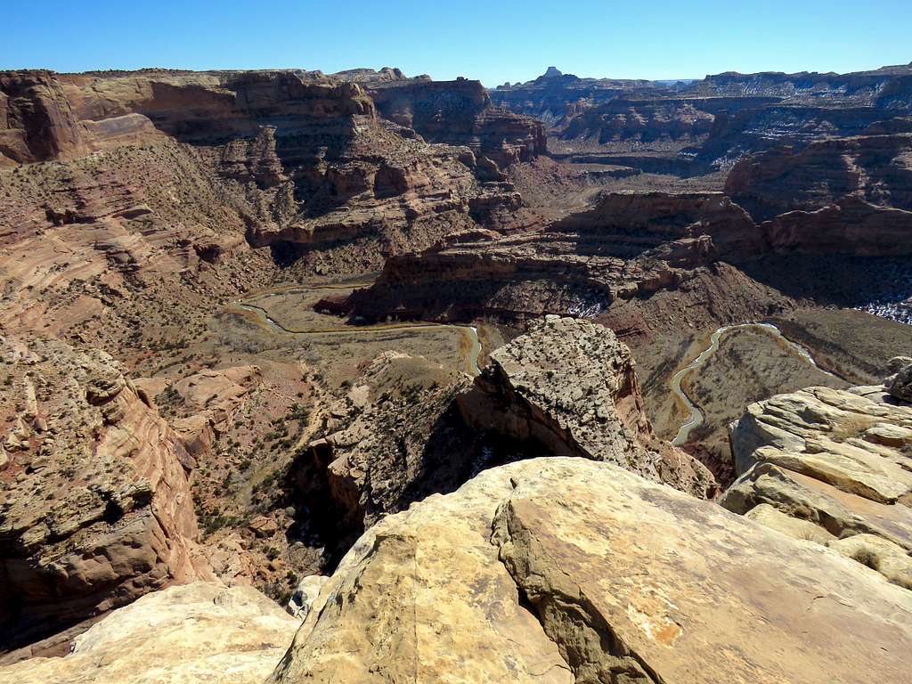
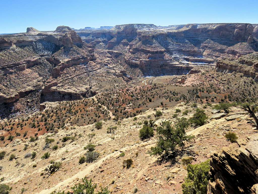
The plan was to go back to the starting point and then follow the rim east. Left at 10:20 and began to head east. Not going into the peninsulas and making other shortcuts made my hike short. Reached the starting point at 11:13 a.m. and 5.64 miles. A mountain biker was there with his dog and pickup truck. He was the only person I saw all day. Continued east to reach a place called Little Grand Canyon Overlook at 11:30 a.m. and 6.31 miles.
From Little Grand Canyon OverlookFrom Little Grand Canyon OverlookFrom Little Grand Canyon OverlookFrom Little Grand Canyon OverlookFrom Little Grand Canyon Overlook
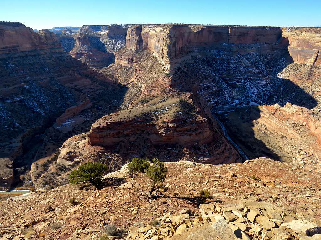
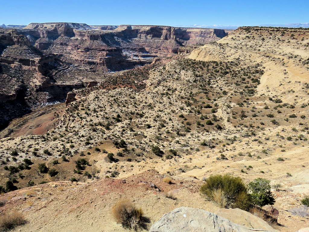
Went further east to reach the junction with a huge side canyon known as Good Water Canyon. Went down 100 vertical feet to reach the very top of the walls that dropped into Good Water canyon. It was 12:00 noon and I had hiked 7.4 miles.
Good Water CanyonGood Water Canyon
Where I had finished my hike the previous day at the bottom of the canyon on the banks of San Rafael River was well-visible.
The spot where I ended my hike the previous day at the bottom of the canyon is seenFlat-top Point 6475 ftCanyon
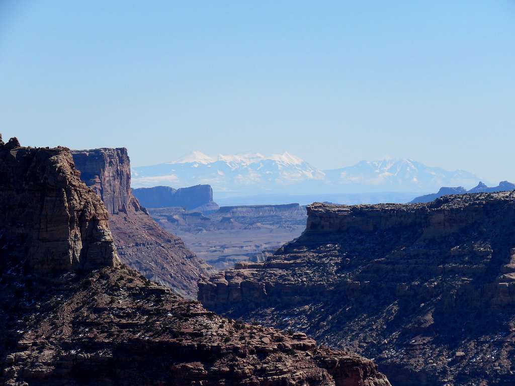
After a short rest, I began to walk back. Behind me, through the opening in the canyon, I could barely see snowy mountains in the distance which I recognized as the La Sal Mountains. With the camera on maximum zoom, I could actually identify the individual peaks. Later, I measured the distance to the La Sal Mountains as 93 miles on a straight line.
Zoomed view of La Sal Mountains 93 miles away
More views of the canyon on my way back to the starting point where I reached at 1:05 pm and 9.02 miles. Temperature had risen to 38 degrees F.
Parents refers to a larger category under which an object falls. For example, theAconcagua mountain page has the 'Aconcagua Group' and the 'Seven Summits' asparents and is a parent itself to many routes, photos, and Trip Reports.


Comments
Post a Comment