Pizzo Diei is an enormous heap of stones growing up, together with its twin Monte Cistella, on a secondary ridge starting from the Punta di Boccareccio.
There are only 2 reasons to climb this mountain :
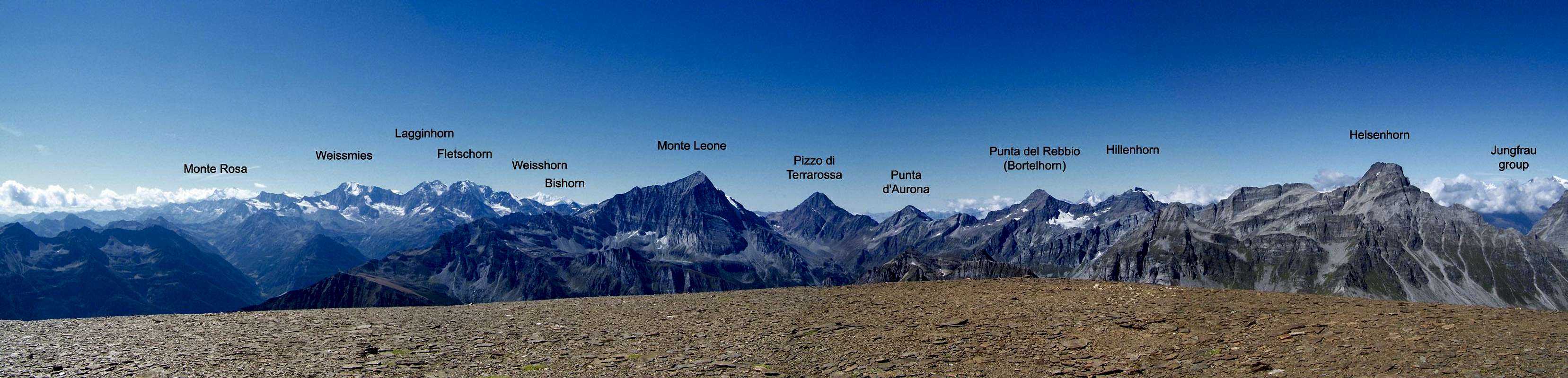
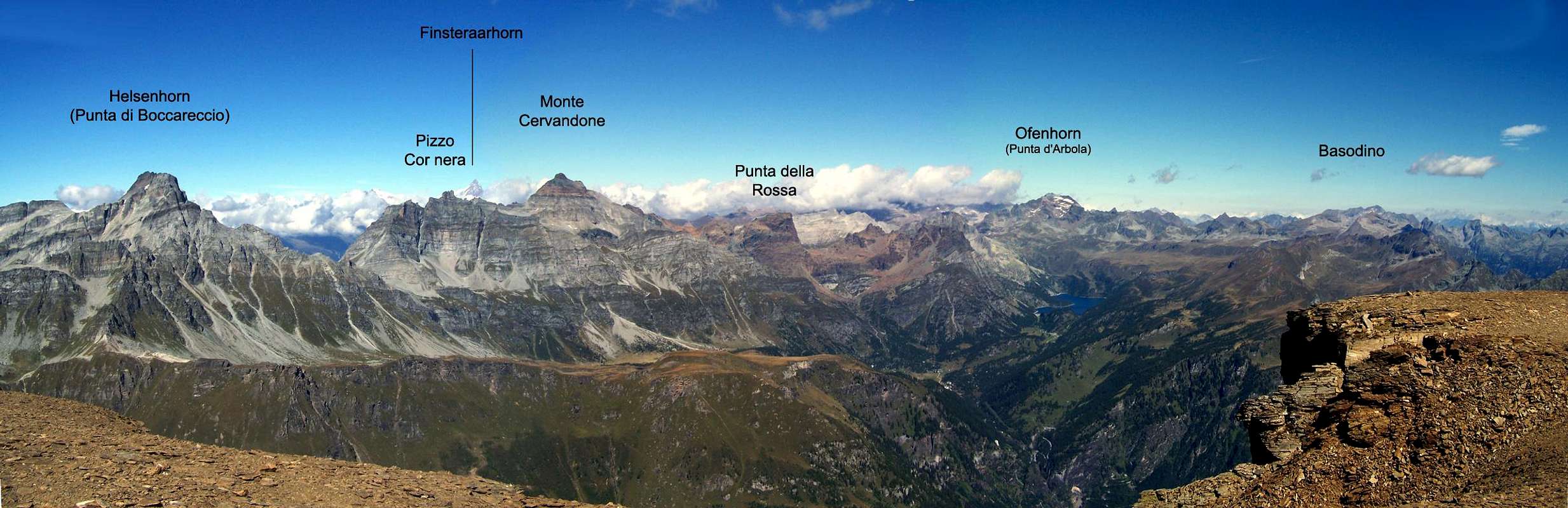
the 360° panorama from the summit (being out of the main ridge of the Alps)
in spring, with plentiful of good (and safe) snow, its a very fine and short ski mountaneering trip : ski tows allow to save a lot of difference in elevation and the higher part is really amusing (not easy)
Maybe fine in early summer, when the horrible stones are still covered by good snow.
Absolutely to be avoided in foggy days : if you loose the (low defined) path you can have to move in horrible channels, full of debris and ending over vertical walls of bad rock.
Getting There
The starting point is San Domenico, a small town above Varzo, on the Italian side of the highway to Simplon Pass.
Once in San Domenico 2 chairlifts allow to get fastly the Alpe Ciamporino (about 1950m) wherefrom, in early spring, using the skilifts you can fastly and without efforts, get the Passo di Ciamporino (2283m) or, above, the Pizzo del Dosso (2551m)
Route Description
Once at the Alpe Ciamporino you have to reach the Passo di Ciamporino and the Pizzo del Dosso, a dirt road and the ski tracks can give you the direction to follow, but ascending directly along the grass slopes or some not evident tracks (call them paths is a exxageration) it's really better and less tiring.
Once arrived near the summit of the Pizzo del Dosso, a small path (track) crosses (East) toward a channel of stones that (very tiring) lets you arrive to the first big debris band of the mountain.
Herefrom, following some tracks, some rare cairns and some (rare) signs you get the second rocky band that, along some short debris channels (danger of falling stones when someone is climbing above you) gives access to the second wide debris band.
A sequence of short channels leads to the summital (very wide) part , made of small tiles, and to the enormous summit.
Coming down is along the same route, easier to be found.
Parents refers to a larger category under which an object falls. For example, theAconcagua mountain page has the 'Aconcagua Group' and the 'Seven Summits' asparents and is a parent itself to many routes, photos, and Trip Reports.

 5729 Hits
 76.66% Score
 7 Votes