
|
|
Route |
|---|---|
|
|
33.01°S / 69.25°W |
|
|
Scramble + Easy Snow Climb |
|
|
A few days |
|
|
Walk-up / F |
|
|
Approach
A short description of the approach to the start of the climb. For more detailed information; check out the Getting There section for Pico Plata/Platita.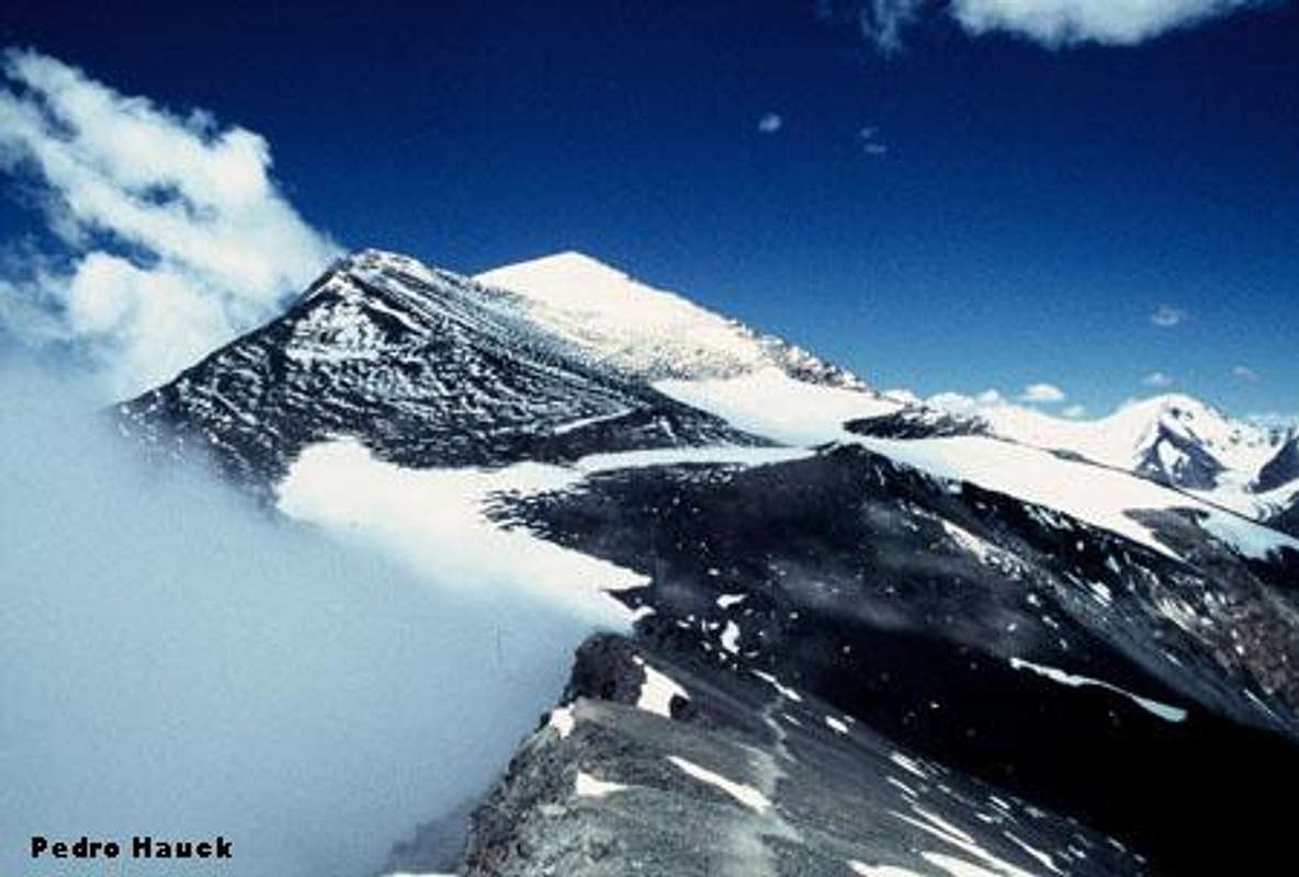
The two highest summits in Cordon del Plata. To the left Platita/Pico Plata and to the right Cerro Plata. On the photo, there are snow on the lower reaches of the route. You can see the portozuelo covered with snow. Traverse underneath the foot of Platita until you see Cerro Plata. Work your way up the large field of snow towards the NW ridge. Follow it to the summit.
Route Description
Start from camp Hollada. On your left you see Cerro Lomas Amarillos, of which you are at the foot of. Start to follow the paths along this mountain's reaches towards the ridge on your left. You should aim at the lowest point of this ridge. There are two alternative paths leading up the sometimes steep and tiring slope. Lots of loose scree. When at the ridge, you'll be very close to "The Golden "Rocks" a part of the ridge with very strong yellow colored rocks.The long ridge in front of you will take you to Portozuelo Vallecitos, which is the saddle in between the two main peaks in this part of Cordon del Plata. The path is always easy to find, even if it's switch-backing quite a lot.
At the Portozuelo (saddle) it's a smart move to take a GPS reading as the turnoff down the ridge can be very hard to find if the weather gets bad. This is the only place on the long ridge you can ascend/descend without any technical gear. On the other side of this ridge, there are some tent platforms with decent shelter for camping. No running water, but usually there's snow around.
The path to Cerro Plata circles around a small bowl-like depression on this wide part of the ridge. The well travelled path half-circles the foot of Platita, the little sister of Cerro Plata. Continue along it until you reach the NW ridge. If it's snow on the ground and you can't see the path, it's smart to always try to stay close to the ridge, as it's a guarantee it won't be very steep. If bare ground, you'll have no difficulties to see the path and follow its long, smooth switch backs.
When closer to the summit, the path is almost all the time on the actual ridge. There are a few passages where it's a little bit steep, but the walk to the summit is very straigth forward. Cerro Plata is said to be the easiest of all peaks over 6000m* and I tend to agree. There are a helicopter wreck just below the summit and three quite large crosses marks the wide summit. On a clear day you'll have excellent views of the whole Cordon del Plata and the Aconcagua Massif.
* New data indicates Cerro Plata's elevation is below 6000m.
Essential Gear
Sturdy boots, warm clothing, walking sticks, GPS, water, some snacks and if snowy; crampons. Remember, this is a peak close to 6000 meters and weahter changes can be extremely fast on this altitude. Better bring too much warm clothing, than too little.More information
The only book about the area is; “Mountains of light/Cord of the Silver” written by Alejandro Geras. It gives you all the information about the area and there are also sections about Aconcagua, high altitude medicine, nutrition and other alpinism-related topics. The maps and route-descriptions are good and there are plenty of photos of peaks which help you out a lot locating specific mountains without any prior local knowledge. There is one problem though; the translation. If you know Spanish, this version is for sure a better choice. The English version is sometimes ok and easy enough to understand, but some sections I didn’t understand at all. The below section is not to make fun of the author’s translation, just to let you know what I mean with bad translation. Then you can judge if the book is worth buying or not. This is one of the worst parts.From the gear list:
• Stock market of Vivac: A covers stock market it improves the heat insulation of stock-market to sleep and improves the conditions of a vivac.
The ISBN# is: 9874380454 (It does not work as a link in the book section. Probably only available in Argentina).
The altitudes given in the book, as well as on many maps of the area is highly exaggerated. On some of the higher peaks you have to substract over 300m. Cerro Plata's altitude is given at 6300m, but recent data says the peak is below 6000m.
A shop that sells the book is El Refugio. One of Mendoza's best outfitters, which also have lots of good gear, know-how, maps and books. English is spoken.
(Peatonal) Sarmiento 294 Mendoza. Tel: 423 5615
El_refugio@fullzero.com.ar
El Refugio's Website.
There are many more mountaineering shops on the streets Sarmiento, Las Heras and Suipacha in central Mendoza.
