
|
|
Route |
|---|---|
|
|
37.30310°N / 112.9324°W |
|
|
Canyoneering |
|
|
Spring, Summer, Fall |
|
|
Most of a day |
|
|
Class 4 |
|
|
Overview
I have been told that Mystery Canyon was historically named because the bottom is blocked by a falls and the middle section too, so before canyoneers or climbers descended the canyon, it was a "mystery" as to what was in the canyon. This is a beautiful canyon, but in my opinion over developed with climbing anchors, many of them fairly new.Even though many of the technical challenges have been tamed down, don’t get the wrong idea that this canyon is for the inexperienced. It would be foolhardy for anyone to try and descend Mystery Canyon without the proper skills. There have already been several parties rescued from the canyon-don’t be another one.
This canyon is highly recommended for those that have the proper skills needed, but whom are not ready for challenging canyons elsewhere in Zion or on the Colorado Plateau. At a minimum every member of the group should be well versed in rope skills used by rock climbers and especially in rappelling.
Mystery canyon had its first descent several decades ago. At least one place, rebar is pounded into a hole for an anchor attesting to the creativity or frugality of early canyoneers. The canyon now sees many parties in the May through October season.
Even with all the permanent anchors and development in the canyon, it is still a beautiful route. Highlights include a short but interesting narrows, high walls, greenery, and the last section with several waterfalls and pools. The last section is the best part of the canyon.
Mystery Falls at the end of the canyon.
Getting There
Hurray for the shuttle bus system. This makes access very easy.Weeping Rock Trailhead
Because you must ride the shuttle bus system in the only season that is practical to descend Mystery Canyon, detailed directions are not needed.
From the Springdale or the Zion Visitor Center (or any other shuttle stop in Zion Canyon), simply take the shuttle bus to Weeping Rock. The hike to the head of the canyon begins here.
Temple of Sinawava
You will exit at the Temple of Sinawava Trailhead. This is the easiest trailhead to find in the world because it is at the end of the line for the shuttle bus. You can’t go wrong.
The rap into Mystery Springs in Mystery Canyon.
Route Description
From the Weeping Rock Trailhead, ascend the Observation Point Trail. Stay on the route to Observation Point, ignoring a short branch to the left and Weeping Rock (which is still worth a nice side trip) and a trail to the right to Hidden Canyon.Bear left at Hidden Canyon Junction and follow the trail as it climbs up into Echo Canyon. Follow Echo Canyon (which is worth another side trip) for a while until the trail climbs out of Echo Canyon and follows a bench left and above the Echo Narrows.
You will turn left at a junction with the Echo Canyon trail and climb the trail up to through the cliffs of Observation Point. You will have now gained over 2100 feet in 2.7 miles from the floor of Zion Canyon and the views are fantastic. Once at the rim there is a junction with the East Mesa Trail. It is recommended you take a short side trip to the left and to Observation Point which is 0.3 miles away. Return to the junction and follow the East Mesa Trail.
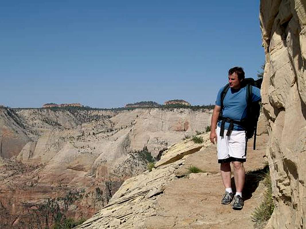
This was taken right below Observation Point on the route to Mystery Canyon.
Make sure to follow the map carefully from this point on as several parties end up in the wrong canyon. Follow the map carefully and to the head of Mystery Canyon. You will know you are at the right place by following the map and after cresting a hill (wait until you go over a small hill and are heading a bit down) and reach an unmarked trail heading off to the left. This trail takes you to the head of Mystery Canyon.
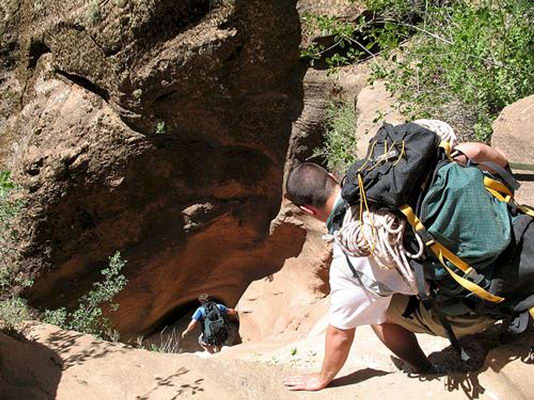
From the head of the canyon, a trail drops very steeply to the floor. After a short distance you will be in what is known as the Death Gully. Make sure to stay in the watercourse as to not cause erosion. Be careful here as there are many ankle twisting loose slopes.
After the Death Gully ends, the walking gets better. There are several downclimbs (handline or belay when necessary) and some may want to rappel at a place or two. Make sure to stay in the watercourse instead of taking social trails around the drops as this is a popular canyon and is in a fragile environment.
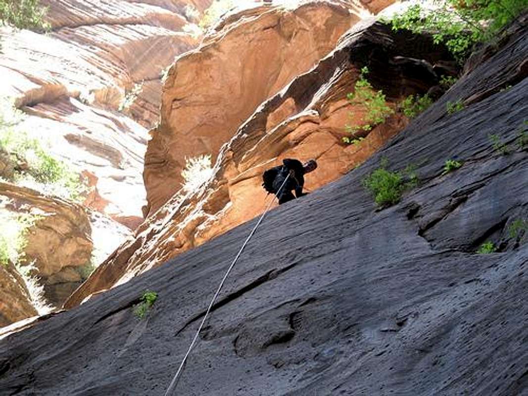
Soon you will reach the slot section. This is where the canyon makes a sharp “elbow” and switches directions. There are three to six rappels in the slot section; depending on how many are downclimbed and how many are simply rappelled. One of them has an old rebar anchor, but there are many (way too many) fresh bolts to use in the slot. The longest rap in the slot section is 45-50 feet. There can be water in the slot section at times, but it was bone dry on our visit.
Below the slot the canyon is very deep, but wide and hot for much of the year. There are a bunch of squirrels and wildlife in the forest in the area. They must be some amazing climbers. After a short ramble, you will be at a huge empty lakebed. In the 1970’s, a huge rockslide blocked the entire canyon and there was a lake here. Now the lake drains underground and through the natural dam, so it seldom holds much water.
There is a trail over the right side (looking down canyon) of the 100 foot high dam that climbs right over the dam. Continue to follow the canyon. After not too long, there is a downclimb (handline) or rappel over some slaps.
The downclimb (or rappel) over the slabs.
After the downclimb, the canyon is fairly easy until you reach the top of the drop above Mystery Springs. The best part of the canyon is from here on down.
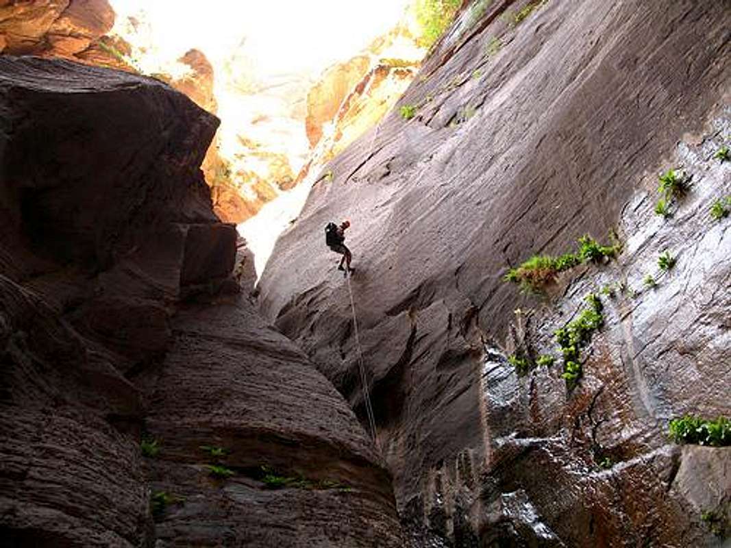
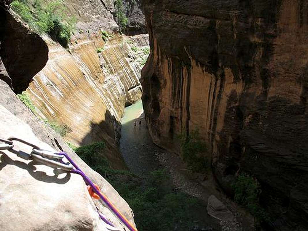
The rap into Mystery Springs is the crux of the route. The rap is on a ledge left and it is an easy but exposed traverse to get there. There is often a fixed line here, but if not, set up a belay and zip line. Make sure to have a daisy chain or sling handy to tie into the anchor before the rap.
The rappel is just over 100 feet. Make sure to get over the boulder and do the entire rap in one shot. At the bottom, you will land in a pool anywhere from waist deep to a swimmer. Make sure everything is dry bagged before starting the rappel.
Mystery Springs rappel.
The next section of the canyon is very pretty. There are a few obstacles to climb over and sometimes a pool to swim. There were no swims in May 2007.
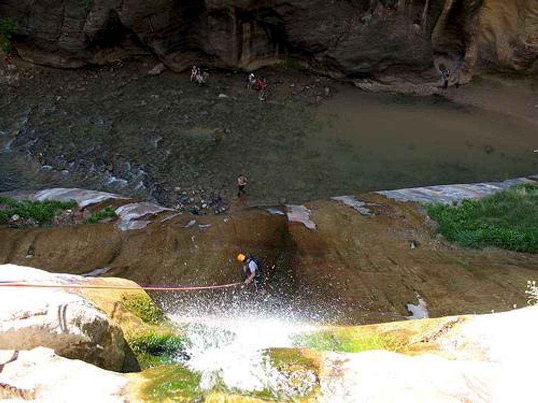
All too soon you will be at the top of Mystery Falls where the canyon drops right into the Zion Narrows. The rappel is over 100 feet and is a wet and slippery ride. More than likely, dozens of tourist will be waiting with their cameras like vultures, so don’t slip and look like a fool here.
Last pitch in Mystery Canyon. The Zion Narrows is below. The rock is wet and slippery, so you have to be careful not to slip and embarrass yourself in front of all the gawking tourist and their cameras and camcoders. Try to look cool.
After reaching the Narrows, walk down the canyon for 0.5 miles until you reach the paved trail to the left. This trail is followed for 1.0 miles to the Temple of Sinawava Trailhead and shuttle bus.
Most parties take anywhere from 6-10 hours for the route.