
|
|
Mountain/Rock |
|---|---|
|
|
42.18083°N / 23.59138°E |
|
|
Hiking, Mountaineering, Scrambling |
|
|
Spring, Summer, Fall, Winter |
|
|
9521 ft / 2902 m |
|
|
Overview
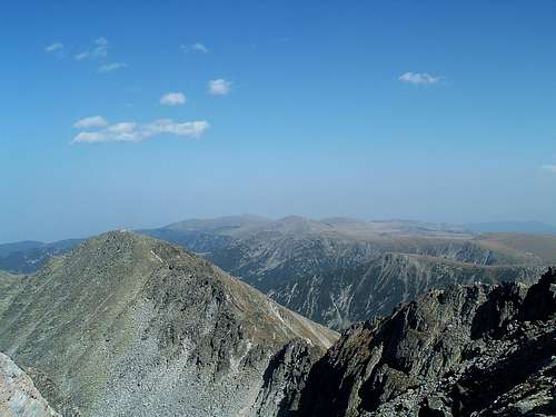
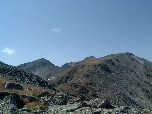
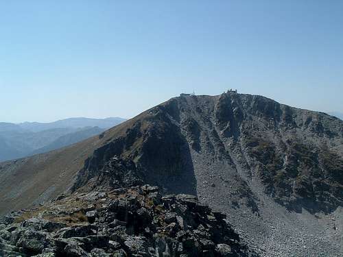
| Malka Musala (Maлкa Mусала) (2902 m) is the second highest peak of Rila and fourth highest of Bulgaria. It is also one of 6 summits of the Balkan Peninsula that are higher than 2900 m. It is relatively rarely visited though and perhaps its name, Little Musala, explains why. The less important sidekick of the highest Balkan mountain, although only in a stone’s throw distance, is off the beaten track and more difficult to reach. While numerous hikers visit Musala (2925 m) every sunny summer day via the well-maintained trail, not many of them venture to climb the rocky ridge that connects it with its slightly smaller neighbour. Malka Musala is situated in Musala’s north-eastern ridge, between the highest Balkan mountain itself and Ireček (2852 m). To see Malka Musala you have to go higher up the slopes of one of its neighbours, as its view from the north is completely obscured by Ireček. In the years 1950-90 Malka Musala was renamed to Georgi Dimitrov after the Bulgarian Communist Party leader but after the collapse of Communism the right name of the mountain was returned. Musala was called Stalin in 1949-62. I would be surprised if the peaks had been named the other way round... |
  |
Getting There
The most common starting point to the Musala group is Borovec, a mountain resort in the northern part of Rila. For advice how to get to Borovec, see the ‘Getting There’ section of the Rila main page by vvujisic.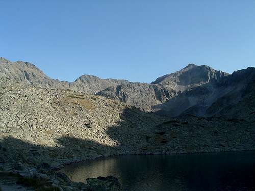 |
Routes overview
Malka Musala is usually climbed as a part of Musala horseshoe, so it can be reached by ridges from the west (from Musala) or from the north (from Ireček). A more detailed description of the Musala horseshoe route can be found here. From Ireček it is an easy scramble (less than I UIAA), while from Musala the difficulty can vary depending on whether you choose the easiest way bypassing the obstacles (less than I UIAA) or try to follow the ridge proper wherever possible (places up to II-III UIAA). Even on the ‘hardcore’ variant some ridge sections have to be bypassed anyway. Both Musala and Ireček are best climbed from Musala hut.To reach Musala hut, walk the dirt/gravel road from Borovec (4-5 h to the hut, see the route description by toc) or shortcut your way by taking the cable car from Borovec to Jastrebec and walking (30-45 min.) down the dirt road to the hut.
 |
Musala hut - Ireček - Malka Musala
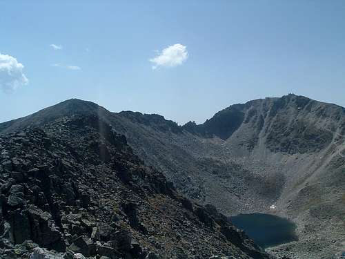
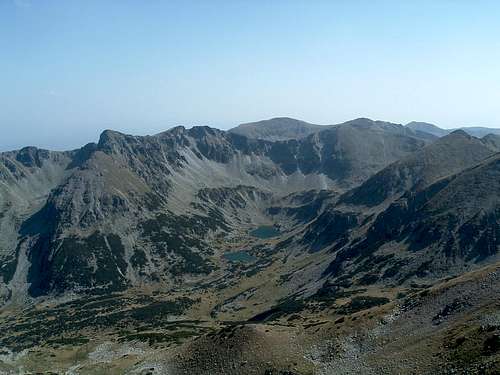
For hiking to Ireček from Musala hut, there are two possibilities. (1) You can follow the green-marked trail towards north-east which leads to a saddle, dividing the unimportant small peak of Groba (The Grave) from the last outpost of the Musala northern spur, Deno (2790m). Here abandon the marked trail and head out for the broad summit of Deno - an easy walk with some steeper sections. When looking south from the top of Deno, Ireček and Malka Musala dominate the horizon. Walk down to a high meadowy col (2650-2700m) with a rock formation called Sfinksa (Sphinx) (about 1.5 h). (2) Alternatively you can reach the col with Sfinksa by an unmarked path directly from the Musala hut (about 1 h).
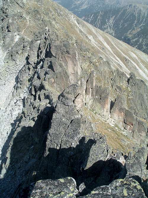
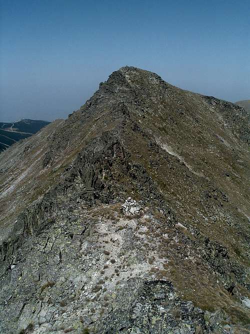
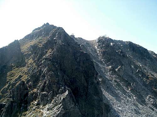
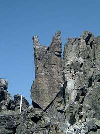
From Sfinksa walk up the slope towards south-west to the first summit of Ireček with a cairn (20 min.). Walk along the summit crest of Ireček (several bumps of similar height) and get ready for a bit of scrambling. Down to the col, bypass the rocks easily to your left or (more difficult) scramble down the crest of the ridge. Then scramble the easy rocks up to the summit of Malka Musala (20-30 min. from Ireček). Overall difficulty I UIAA or easier, depending on the chosen route.
|
|
Musala hut - Musala - Malka Musala
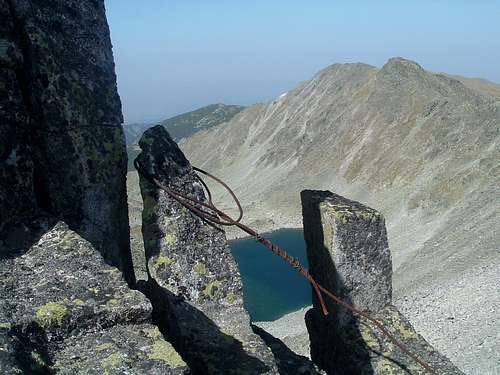
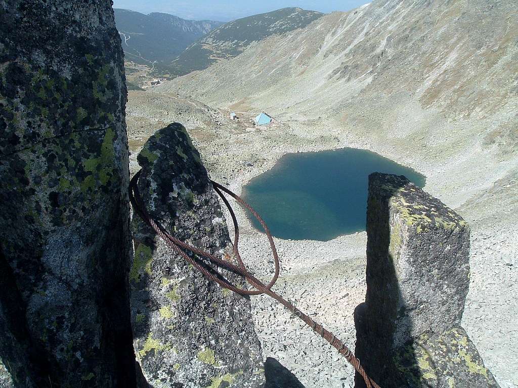
For the normal route from Musala hut to Musala see the route description by toc. From the summit, descend the ridge to the east, traversing its right hand (southern) side on an obscure path (easy scramble) until you reach the lowest point between Musala and Malka Musala. For the more skilled and adventurous scramblers: you can also follow the ridge proper wherever you can (up to II UIAA, possible places of III UIAA, depending on the chosen route, some rusty old cables as ‘protection’). From the lowest point go up the obvious passage (‘chimney’) in the rock wall (easy scramble, ‘secured’ with another knackered steel cable) and walk further up to the characteristic devil-shaped rock. Then either use the obscure path parallel to the ridge on its right (sometimes an easy scramble), or follow the ridge proper (I-II UIAA) to the summit of Malka Musala (30-40 min. from Musala).
I have come across the name ‘Iljuv’s path’ for this ridge scramble, to honour the meteorologist from the observatory on Musala summit who prepared this path and probably fixed the steel cables (that are now of no use). The spelling of his name is uncertain (Iliev?).
For a more personal account of this route, see the trip report.
|
|


|
|
|
Other options
Malka Musala can be also probably ascended directly from the south or east, turning right from the green-marked trail that goes from Marica hut. I have not tried that, although from the Malka Musala summit it looks like an ordinary hike/scramble, steep but without any big rock difficulties. Alternatively, the trail soon reaches the southern ridge of Musala, from where there is only a short walk to the summit of Musala.
Marica hut can be reached in about 4-4.5 h from Borovec via a yellow-marked trail.
 between Malka Musala and Musala |
Accommodation
Mountain huts/chalets:Musala hut (Hiža Musala/Xижа Mусала) - 68 places, food and drinks for sale, tap water outside but not always available. A new larger hut is being built beside the old one.
Marica hut (Hiža Marica/Xижа Mapица) - 49 places, food and drinks for sale, water available.
Shelters:
Ledenoto Ezero/Everest shelter - 30 places, drinks for sale, water outside - flowing from the lake.
Meteorological observatory at the Musala summit - no beds, only 2 mattresses, practically only for emergency accommodation, problems with water, sometimes drinks may be available to buy.
See the list of Rila chalets and shelters for more details. Thanks to vvujisic for the link.
According to the information here, camping next to the mountain huts is possible for a symbolic fee.
 |
Weather, when to climb & essential gear
Weather forecast from the observatory at the summit of Musala. Thanks to vvujisic for the link.For more info on Rila climate see the ‘Mountain Conditions’ section at the Rila main page.
For the hiking routes to the summits in Musala group you need good hiking boots, standard hiking clothes and equipment, including a compass and/or GPS in case of fog. The peaks on the Musala ridge are connected by high cols, so you will not lose much elevation when making your way from one summit to the other, but the whole route is long and without a good path, so it can be exhausting for one, especially in a hot summer. There is no water on the ridge. Sometimes drinks can be bought at te facilities at the Musala summit (but don't take it for granted). The scrambling sections do not require any special gear.
The routes described above can be hiked/climbed all year round, weather permitting. In winter conditions you'll need crampons, ice axe and full winter gear.
Red Tape
No permits or fees required. Follow the usual rules of behaviour in national parks. Leave the mountains in an even better, cleaner state than you found it - take all the litter with you.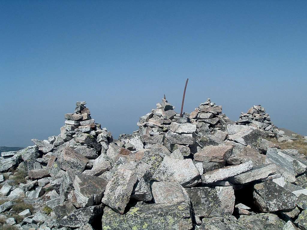 |
Maps
Pилa, Kартография EOOД, 2006(Rila, Kartografija EOOD)
1:55000
Not very detailed but overall a good and reliable map, with names in both Cyrillic and Latin alphabet. It can be bought in many bookshops in Bulgarian cities and towns.
Below is a scan of a fragment of its Cyryllic-only version, showing the Musala group (bottom left quarter) and Borovec (top).
 |
yatsek - Nov 9, 2008 1:48 pm - Voted 10/10
Plaques All OverWhen I was on Malka Musala (1977), it was still called Dimitrov Peak, and the very summit of the mountain (see the pic named "City of Cairns" on this page) was covered with a dozen of stone/metal plaques in memory to Bulgaria's first communist leader. (Unfortunately, I've lost the photo)