
|
|
Route |
|---|---|
|
|
44.16000°N / 71.7°W |
|
|
Hiking, Scrambling |
|
|
Summer, Fall |
|
|
Most of a day |
|
|
Walkup |
|
|
Class 3 |
|
|
Approach
This is a less popular and more-strenuous non-technical climb of Cannon Mountain. Start from the Lafayette Campground in Franconia Notch south of Cannon. There is a well-marked exit from I-93 and a large trailhead.
Route Description
Follow the well-trodden and maintained Lonesome Lake trail west up moderate slopes. After 0.4 miles, the slope gets steeper and the trail bifurcates. The right branch is the Hi-Cannon Trail. The left branch leads to Lonesome Lake. The more scenic route goes to Lonesome Lake and then takes the Dodge Cutoff back north to rejoin the Hi-Cannon Trail at mile 0.8. The direct route saves about half a mile over the scenic route.
Now the fun starts! The Hi-Cannon trail switchbacks a few times on rock ridge, ascends an excitingly exposed ladder (crux) and traverses left under a rocky overhang. The trail here is steep and rocky and entirely fun!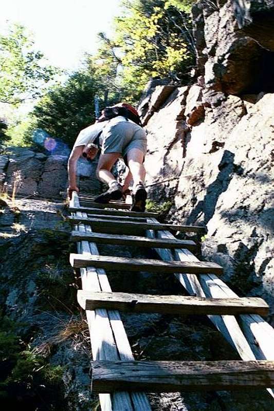
From the top of the ladder, the trail continues upward fairly steeply through patchy evergreens with a couple of small ledges on the left (south) side. The view from the ledges is spectacular down into the bowl of Lonesome Lake. Before long, the trail joins the Kinsman Ridge Trail on the long southwestern arm of Cannon Mountain. The summit is an easy 0.4 miles to the right. 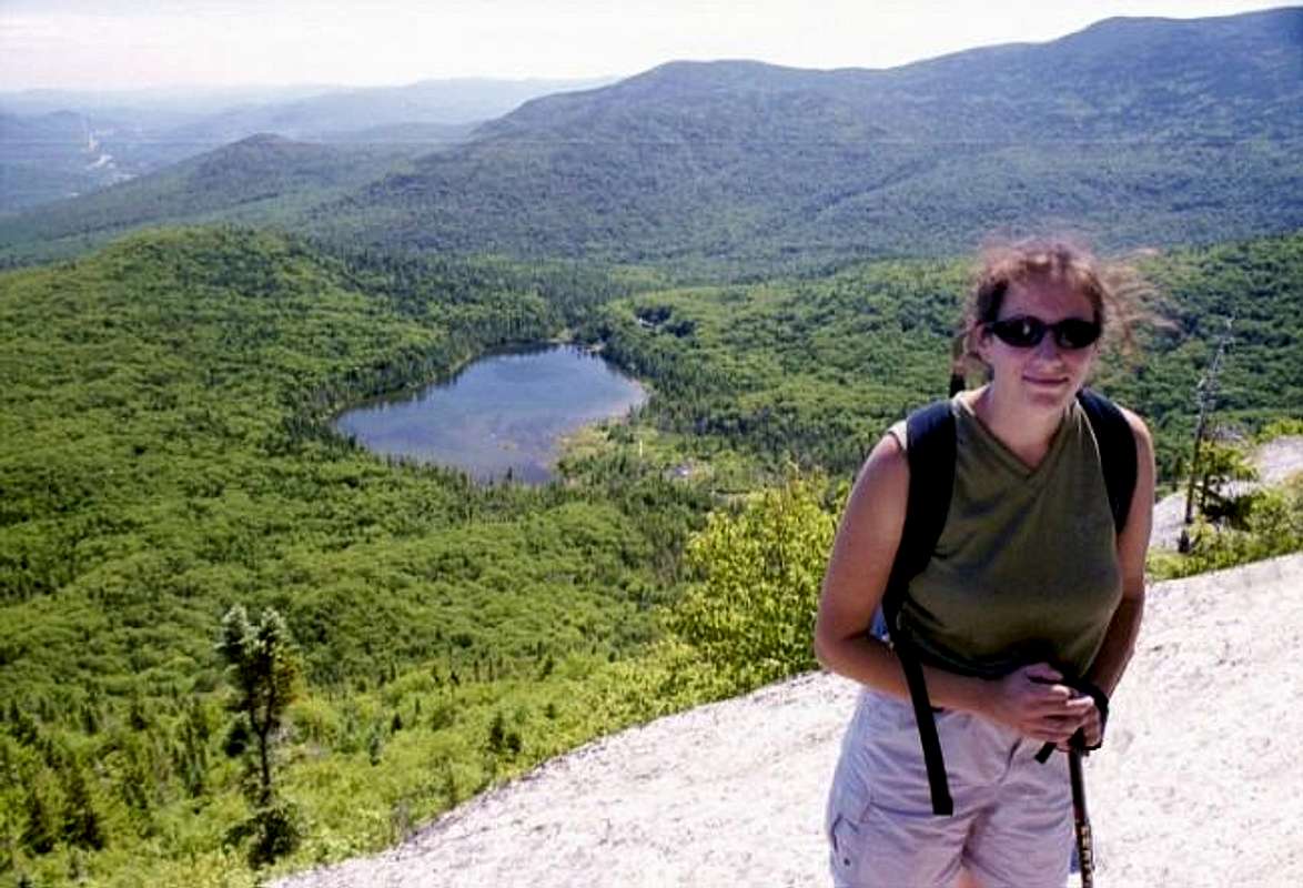
Total distance to the summit is 2.6 miles one way. Elevation gain is a stiff 2600 feet.
Essential Gear
Sturdy shoes are a must. Bring bug spray, sunscreen, lunch, an extra layer of clothing, and a camera.