Loma Alta southeast ridge

Page Type Page Type: Route
Location Lat/Lon: 38.02484°N / 122.61184°W
Additional Information Route Type: Hiking
Seasons Season: Spring, Summer, Fall, Winter
Additional Information Time Required: Less than two hours
Additional Information Grade: I
Sign the Climber's Log

Overview

 
Mt. Tam from Loma Alta
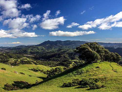
Mt. Tamalpais from Loma Alta southeast ridge shoulder
Loma Alta (1,591") is a huge hill centrally located in Marin County. It is an easy walk up from north or south. The top is often windswept and the views are quite expansive. To the north is an outstanding view of Big Rock Ridge, to the south a similar view of Mt. Tamalpais, to the west all the hills of west Marin and to the east a fine view of San Pablo Bay with Mt. Diablo on the horizon. San Francisco rises to the southeast beyond Sausalito.
The southeast ridge takes a fireroad from a neighborhood trailhead out of Fairfax that breaks off up a steeper use trail that continues to the summit with views southeast expanding along the way.

Getting There

 
Big Rock Ridge from Loma Alta
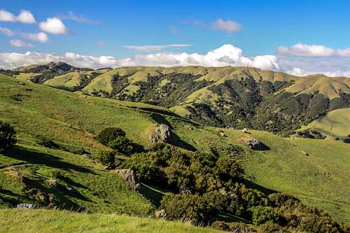
Big Rock Ridge from southeast ridge shoulder
From Hwy. 101 take the Sr Francis Drake Blvd. exit west 3.75 miles to "the hub" (the obvious big intersection) in San Anselmo. Continue to the left on Sir Francis Drake another 2.5 miles through Fairfax to Oak Manor Drive. Turn right and drive .6 mile staying to the left all the way to the top. Park on the left below the trailhead.

Route Description

 
Loma Alta southeast ridge
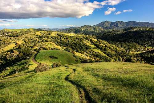
Start of the southeast ridge use trail
The route starts to the left from the Oak Manor fireroad trailhead at 550' el. It continues up over a small hill and down to some large watertanks. Go around to the right of the tanks and on up the Smith  Ridge  fireroad a few switchbacks to the obvious use trail going right up the ridge at 3/4 mile from the trail-head. Follow the use trail on up. It reaches a shoulder at 1,450' where it meets up with a trail. Here are rock outcrops and picturesque tree gardens. Views open to Big Rock Ridge to the north. You can take the trail at this point or the use trail continues on up the open slope to the left to the fireroad going to the right a short distance from the top.
The hike is just under 4 miles round trip with approximately 1,500' gain.

Essential Gear

 
Loma Alta southeast ridge shoulder
 
Use trail below Loma Alta
Loma Alta from the southeast
The top of Loma Alta is often windy and it can be hot in summer. A windbreaker, raincoat and or sunscreen are essential depending on the weather.

Current weather and 5 day forecast

 
Loma Alta panorama of north Bay area
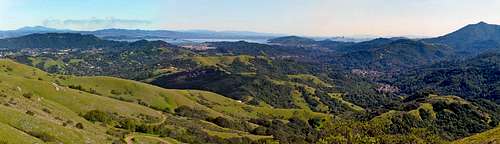
Panorama from Loma Alta with southeast ridge coming up on the left
Click here for the weather forecast for Fairfax.

Parents 

Parents

Parents refers to a larger category under which an object falls. For example, theAconcagua mountain page has the 'Aconcagua Group' and the 'Seven Summits' asparents and is a parent itself to many routes, photos, and Trip Reports.

Loma AltaRoutes