-
 15615 Hits
-
 86.73% Score
-
 23 Votes
|
|
Mountain/Rock |
|---|---|
|
|
46.56650°N / 11.97530°E |
|
|
Hiking, Trad Climbing, Sport Climbing, Aid Climbing, Via Ferrata, Skiing |
|
|
Spring, Summer |
|
|
9301 ft / 2835 m |
|
|
Overview
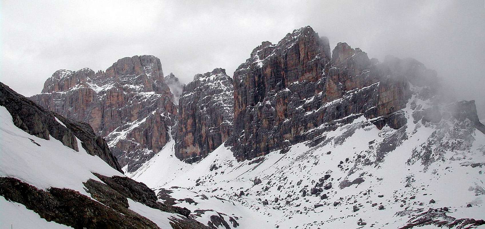
Immediately North of Passo del Falzarego, over the first wide rocky bulwark (Piccolo Lagazuoi - cable car station on the summit)there is a highland made by the high parts of 2 important and long valleys.
In the middle of this plateau a rocky structure looking like a ship bow is the starting point of a long range oriented S-N :
the Lagazuoi Grande
The Lagazuoi Grande contains 3 main summits (and some minor towers) Lagazuoi sud (2835 m) Lagazuoi di mezzo (2750 m) Lagazuoi nord (2804 m) Its typical structure is made of vertical yellow, red and black walls divided by some big horizontal ledges Just below these walls some easy paths allow a fast access to the climbing zone. I've spent here some funny afternoons climbing on wonderful rock with classic difficulties (never extreme). The summits can be reached almost by everyone that has a minimum rock climbing experience, normal routes are very easy (not more difficult than Sass di Stria) and lead to fantastic panorama points. I can suggest them as a very fine way to spend a "different" day, even (or expecially) if the weather is not so fine ... on these summits weather is not a critical problem ... and I can remember also a very fine and suggestive hike, with my family (the day of the total eclipse - aug 1999) making the counterclockwise "circumnavigation" of the Lagazuoi Grande,  .. .. .. .. This hike starts from Forcella Travenanzes, follows a fine well marked path till the Forcella Grande, comes down on the west side using a steep path (passing near the Bivacco Dall'Oglio) getting the base of the west walls and, along a track (higher than the normal marked path) passing through war ruins and big stones comes back to the Piccolo Lagazuoi or, better, to Forcella Travenanzes, wherefrom you can go on, eastward, along the slopes toward the Tofane till you meet the path leading to Castelletto or to "Magistrato delle Acque" (on the road Cortina-Falzarego) This hike could require less than 3 hours (till Forcella Travenanzes) ... but the environment is so fine that if you spend there less than 6 hours maybe you haven't understood much about mountain ...
Getting There & Starting PointsLagazuoi belongs to the Fanes GroupBest way (shortest and fastest) to access the Group is starting from Passo del Falzarego that can be reached quickly in 3 different ways : from north : Bolzano along the Val Badia road from south : Belluno - Cortina or Belluno - Alleghe all rock routes and hikes in this subgroup can be easily done in one day starting from Cortina or Corvara  private - restaurant - arrive here by the cable car starting from Falzarego Pass don't buy the a/r ticket ! coming down is fast and in a spectacular environment, especially if you follow the galleria degli alpini (a tunnel digged into the rock - lamp very useful !!) in the middle of the Plan de Lagaccio - along the route from Lagazuoi to Armentarola stopping here to eat is "a must" ! 9 beds - in the west side of Forcella Grande (the northern limit of Lagazuoi range) useful for hikers that want to cross the whole range along the ferratas
Routes Overview - Lagazuoi S Routes Overview - Lagazuoi N
When To Climblate spring till autumn beginningwinter and early spring for skiiiiiiiiing (wooooonderful !!) Red Tapeno fees, no permits neededjust remember you walk and climb in a zone where the "big war" has made a lot of deads ... |