
|
|
Route |
|---|---|
|
|
49.15000°N / 20.08330°E |
|
|
Mountaineering, Ice Climbing, Mixed |
|
|
Spring, Winter |
|
|
Half a day |
|
|
UIAA II/III |
|
|
5.3 (YDS) |
|
|
Overview
Krčmárov žľab - 800 m long couloir leading to Lavínová lávka (2544 m) in the massif of Gerlachovský štít (2655 m). One of the classic routes in High Tatras. Average inclination of this couloir is 45°; the last section - 60°. Climbing difficulty depends on snow conditions in the couloir, but it's in general II-III UIAA. The most difficult part is a rock band in 1/3 of this couloir, which can be covered by ice in early season. Very serious risk of rock-falls and avalanches. From Lavínová lávka (Avalanche pass) you can follow the ridge to Gerlachovský štít via Kotlový štít (2601 m), Gerlachovský zub, and Gerlachovská veža (2642 m) to the summit of Gerlachovský štít (2655 m), or you can traverse these slopes following the normal route from Velický žľab.First ascent: L. Darmstaedter, A. Otto, Tyrolean mountain guide H. Stabeler, 22.7.1899
First winter ascent: P. Habel, L. Noak, K. Scholtz, J. Franz sr. (guide), J. Hunsdorfer jr. (guide), 5.3.1902
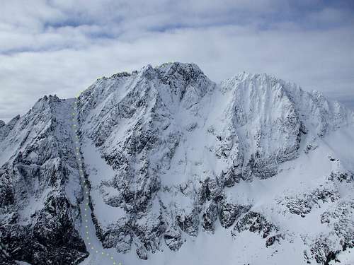
Krčmárov žľab Couloir - 800 m, 45º-60º, leading to Lavínová lávka (Avalanche Pass, 2545 m). From left to right: Čertova veža (Devil's Tower, 2565 m) - Lavínová lávka (2545 m) - Kotlový štít (2601 m) - Gerlachovský zub - Gerlachovská veža (2642 m) - Gerlachovský štít (2655 m) - Zadný Gerlach (2630 m).
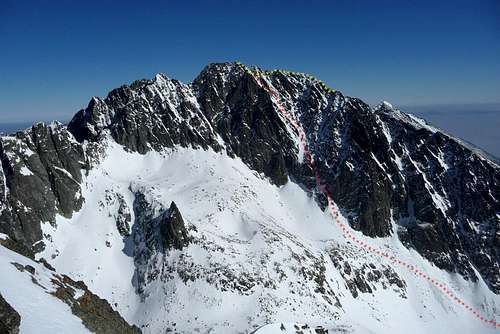
Gerlachovský štít - west face. Yellow dots - line of ascent from Lavínová lávka via Kotlový štít; red dots - descent via Batizovský žľab couloir.
Getting There
Starting point: Tatranská Polianka (1005 m), from there you can follow 6,5 km long road leading to Sliezsky dom (1670 m), or you can follow the green marked trail (2 h). From Sliezsky dom take the route leading to Poľský hrebeň (2200 m) until you reach Dlhé pleso tarn. From there you have to scramble to the top of the scree cone marking the beginning of Krčmárov žľab. The best descent is via Batizovský žľab to Batizovské pleso (1884 m), and from there you can easily return to Sliezsky dom (1 h 30 min).
Velické pleso (1670 m) in the morning.
Batizovské pleso (1884 m)
Route Description
One of the classic routes in High Tatras, preferred in winter conditions, due to a serious risk of rock-falls. From the bottom of Kvetnica (part of Velická dolina above Sliezsky dom) to Lavínová lávka - 2-3 h; from Lavínová lávka, partly following the ridge to the summit of Gerlachovský štít - 2 h. Descent via Batizovský žľab to Batizovská dolina Valley - 2 h.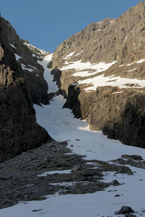
Krčmárov žľab from the scree cone at its beginning. You can clearly see a rock band, which is the most difficult part of this route.
Date of ascent: 1.5.2013
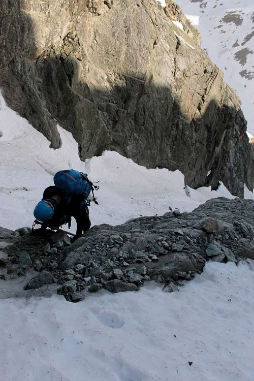
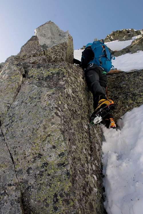
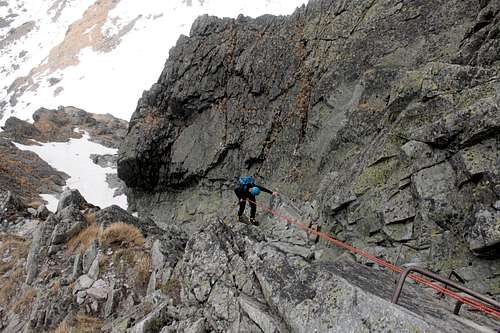
Starting point: top of the scree cone in Kvetnica. From there we followed the left side of the couloir until we reached the rock band in 1/3 of its length. In the late season it's wholly covered by snow, so there are no climbing problems (you can find small bergschrunds there); in the early season there are mixed climbing conditions or dry rock. In such a case the usual route of ascent runs through the center of this band (you can find a few pitons and slings for abseiling there).
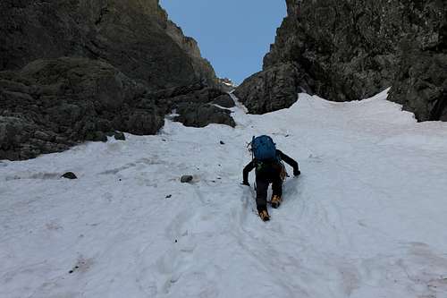
Already on the rock band, where we encountered small bergschrund.
On the rock band
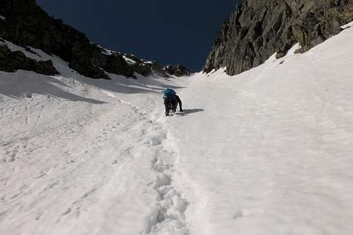
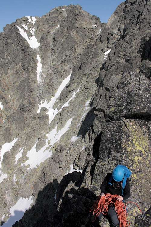
Once we were above this band, we continued on the left side of the couloir directly to Lavínová lávka (2545 m), but in the last section we moved to the crumbling rocks to the left of the couloir, because the snow directly in the sunlit couloir was knee-deep. Beware of cornices on the ridge!!
Here you can decide whether you want to follow the ridge: Štrbina pod Kotlovým štítom (2550 m) - Kotlový štít (2601 m) - Štrbina za Kotlovým štítom - Gerlachovský zub - Gerlachovská veža (2642 m) - Batizovská priehyba - Gerlachovský štít (2655 m) (easy scrambling, II UIAA, rope necessary) or to traverse the slopes from Štrbina pod Kotlovým štítom (2550 m) directly to Batizovský žľab (standard route for guided tourists from Velický žľab). We choose the first option, but we got only to Gerlachovský zub, and then we decided to abseil down and to find the standard route, as it seems to us that further advance along the ridge would be time-consuming (abseils necessary; belaying recommended).
Gerlachovský štít from the ridge connecting Kotlový štít with Gerlachovská veža
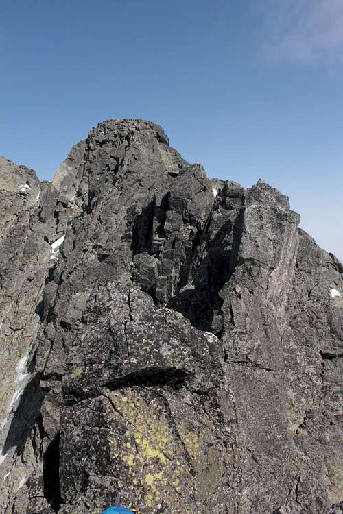
Ridge leading to Gerlachovská veža (2642 m)
After abseiling 30 m, we had to cross several gullies and ribs, until we reached small pass, from which we easily descended into Batizovský žľab. We followed this couloir almost back to the ridge and in 15 minutes we were celebrating on the summit of Gerlachovský štít (2655 m).
Descent route was easy to find - all we had to do was to follow Batizovský žľab to Batizovská dolina (two abseils in Batizovská próba).
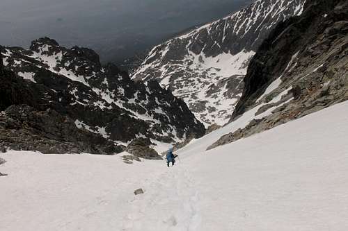
On our way down in Batizovský žľab couloir
Abseiling in Batizovská próba