Until recently, I hadn’t thought much about the peaks on the Bullion Divide because they weren’t as well-known and didn’t seem as impressive as some of the other peaks in the Wasatch. Due to a lack of research on my part, I assumed that the Bullion Divide was mostly a boring ridge walk over really mellow summits. We’d already done Sugarloaf Peak and Mount Baldy above Albion Basin, two of the five ranked 11ers on this route which seemed to corroborate this theory, so on this day we chose to take the Snowbird tram up to Hidden Peak to skip ahead to the section of the route we hadn’t done yet (check out my
Devils Castle / Sugarloaf Peak trip report to find out more about the Albion Basin portion of the Bullion Divide). The plan was to go over American Fork Twin Peaks, Red Baldy, and White Baldy, descending down the White Pine trail, since we had both already been up Red Pine before and were interested in seeing a new area.
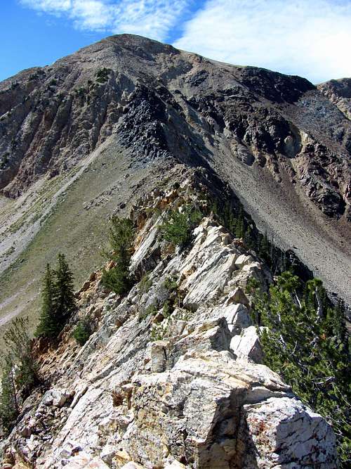
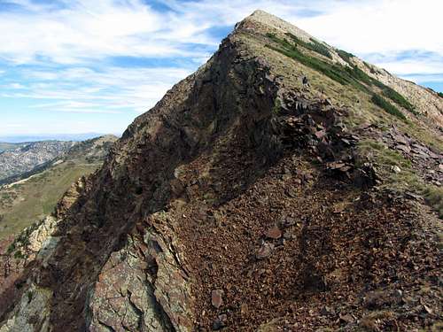
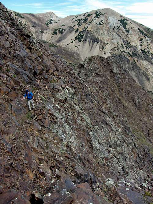
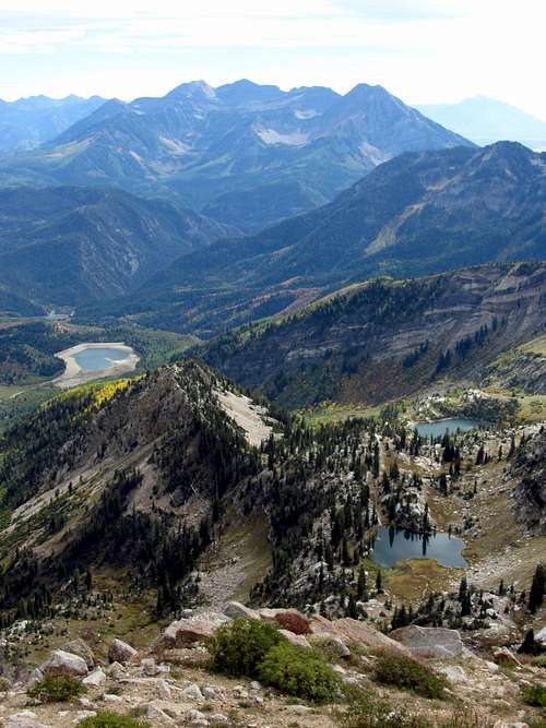
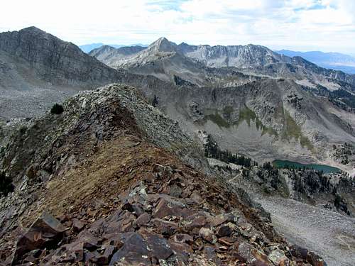
![Close-up of Alpine Ridge]()
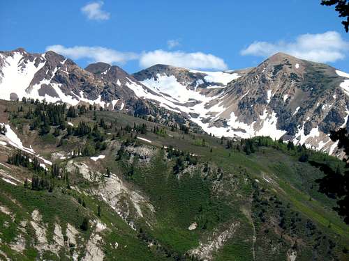
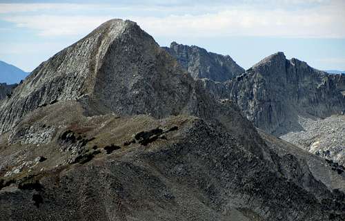
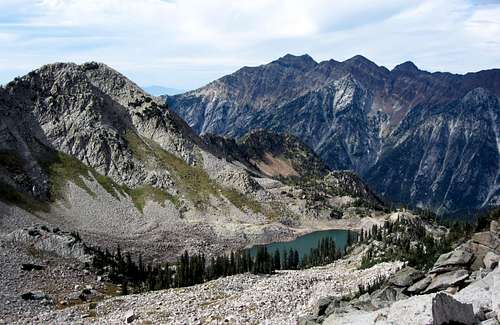
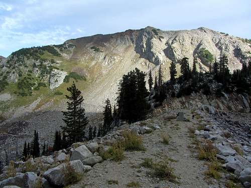
Looking north from Box Elder Peak to some of the peaks on the Bullion Divide (left to right: Red Baldy, Red Top Mountain, & American Fork Twin Peaks)
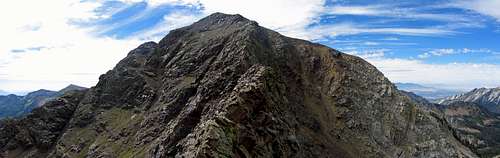
Once we got up there, I was kicking myself for my false assumptions and for waiting so long to try this route. It ended up being one of the most scenic hikes I’ve done in the Wasatch with lots of rugged terrain above tree line, with some of the most enjoyable and sustained sections of scrambling I’ve encountered.
Scrambling Heaven
The forecast showed a big drop in temperatures soon, so David and I both found a way to skip out on work the day before the first big fall storm was supposed to hit the Wasatch. This proved to be perfect timing since the very next day there was significant snowfall throughout the entire area as low as 8,000 feet, leaving snow on all of the Bullion Divide peaks from that point on in the season.
![Pfeifferhorn from Snowbird Tram]()
Pfeifferhorn seen from the Snowbird aerial tram
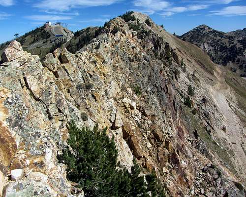
![AF Twin West Summit]() AF Twin Peaks west summit
AF Twin Peaks west summit![Cottonwood Ridge from Hidden Peak]() Cottonwood Ridge from Hidden Peak
Cottonwood Ridge from Hidden Peak
We met at the White Pine / Red Pine Trailhead parking lot at 10:30 am. I left my car there and rode up to the Snowbird parking lot with David, where we bought our tickets early to ensure that we’d catch the first tram up at 11 am. The nice thing about taking the tram up was that we could sleep in and start late, and since it was late enough in the year and we’d be above tree line almost the entire time, we wouldn’t have to worry about hot afternoon temperatures. I didn’t anticipate needing much water today so I only put two liters in my camelback, and gulped down plenty of water at the fountain near the tram boarding area instead.
![AF Twins NE Ridge Start]() The first part of American Fork Twin Peaks northeast ridge started out mellow ...
The first part of American Fork Twin Peaks northeast ridge started out mellow ...![AF Twins NE Ridge Crux]() ... but soon turned into a knife edge
... but soon turned into a knife edge
Some technical difficulties resulted in the first tram not leaving the station until about 11:40, so we didn’t actually start hiking until almost noon. Riding the tram on the way up, our views of American Fork Twin Peaks, the highest peaks in Salt Lake County, became more impressive. We could see the pointy Pfeifferhorn off to the west, but most of our route along the Bullion Divide would be hidden until we got to the top of the Twins.
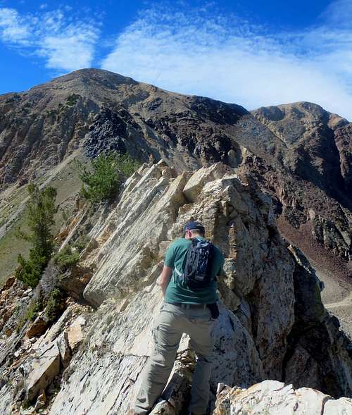
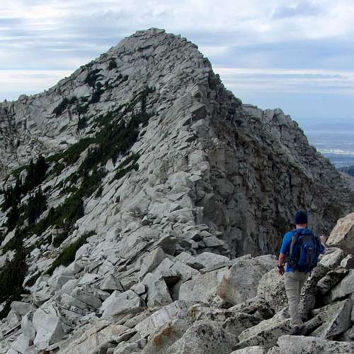
![AF Twins Knife Edge]() Making our way across ...
Making our way across ...![Steep NE Ridge]() ... the steep northeast ridge
... the steep northeast ridge
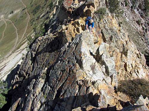
![Narrow NE Ridge]() The rock was solid ...
The rock was solid ...![Brandon on AF Twins NE Ridge]() ... and a blast to scramble on
... and a blast to scramble on
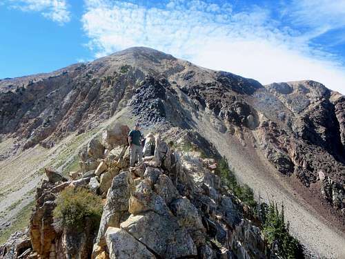
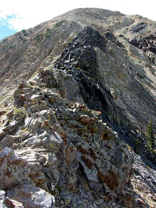
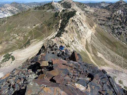
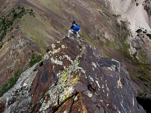
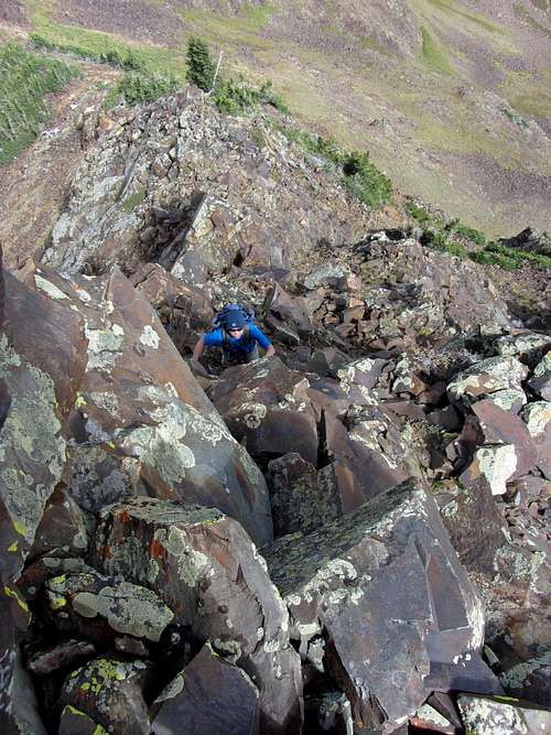
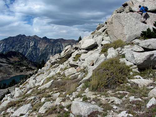
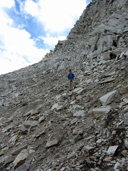
We set off at a brisk pace down a dirt road from the top of the lift area, and then went straight up onto the northeast ridge via a steep little trail. We skirted some trees along the ridge trail, and soon came to the start of some fun scrambling. The route was easy at the start, without really gaining any elevation, but some fun, exposed scrambling quickly demanded our attention. The crux of the route up American Fork Twin Peaks was probably near the lowest elevation of the ridge, where we encountered a little knife edge (with maybe one itsy, bitsy class 4 move).
![Steep black rock]() The route steepened at this section of darker rock ...
The route steepened at this section of darker rock ...![Near top of NE Ridge]() ... and soon we were looking back down on the northeast ridge
... and soon we were looking back down on the northeast ridge
![Up the black rock ridge]() Ascending black rock ridge
Ascending black rock ridge
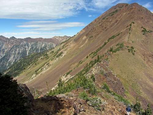
Soon after the knife edge we came to a stretch of black rock. At this section the route finally starts gaining elevation in earnest, but the scrambling is actually easier despite being much steeper. After the black rock scrambling we crossed some loose scree and found ourselves on a steep trail leading to the top. As we crested the top of the lower east summit, we were rewarded with some nice views of Mount Timpanogos to the south, as well as the imposing northeast face of White Baldy to the southwest, which was our final summit goal of the day.
![Red Baldy / White Baldy Preview]() A preview of more difficult scrambling to come on Red Baldy ...
A preview of more difficult scrambling to come on Red Baldy ...![White Baldy from AF East Twin]() ... and White Baldy
... and White Baldy
![West twin from east twin]() Making our way west ...
Making our way west ...![AF Twins summit cairn]() ... to the highest summit in Salt Lake County
... to the highest summit in Salt Lake County
The wind really picked up as we walked towards the higher west summit, which prompted me to tighten my lucky Utah Jazz hat on my head to make sure it didn’t blow away, but as long as I kept moving, the cold air actually felt nice. From this mellow portion of the Bullion Divide we had nice views of the central Wasatch peaks in every direction.
![Mount Superior over Snowbird]() Monte Cristo towering over Snowbird to the north
Monte Cristo towering over Snowbird to the northOnce on top of the west twin, the remainder of our route across Red Top, Red Baldy, and White Baldy became clearer.
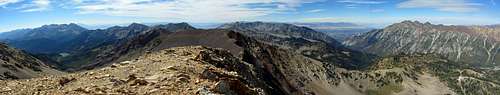
![AF Twins summit pano]() American Fork Twin Peaks summit panorama (click pic for detailed view)
American Fork Twin Peaks summit panorama (click pic for detailed view)![Ridge between AF Twins & Red Top]() Ridge to Red Top Mountain
Ridge to Red Top Mountain
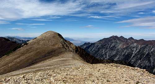
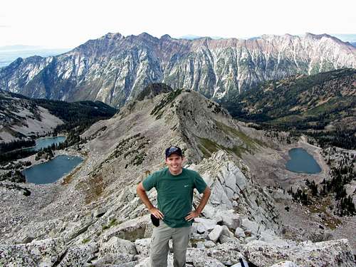
Even though Red Top isn’t very prominent in relation to the other nearby peaks, it’s right along the Bullion Divide between American Fork Twin Peaks and Red Baldy and is really easy to tag, so we walked along the top of it for some more nice views.
![AF West Twin]() Descending American Fork Twin Peaks ...
Descending American Fork Twin Peaks ...![Ridge Walk to Red Top]() ... on our way to Red Top Mountain
... on our way to Red Top Mountain
![Pfeifferhorn from Red Top]() Pfeifferhorn
Pfeifferhorn![Triple Traverse peaks behind Red Top]() Triple Traverse Peaks
Triple Traverse Peaks
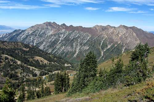
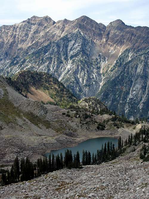
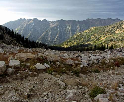
Red Top gave us a good vantage point over what would end up being our descent route down White Pine Canyon. We could see the other main drainages dropping from the Alpine Ridge down to the north, and everywhere we looked were awesome views of the peaks surrounding Little Cottonwood Canyon.
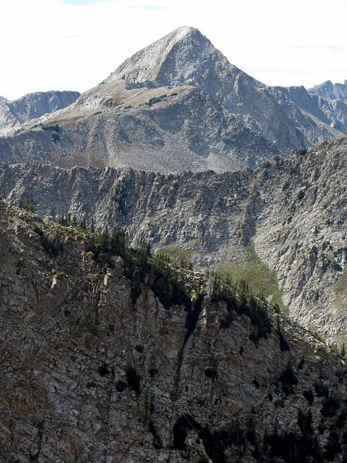
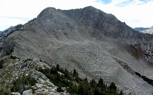
![Our White Baldy route]() From Red Top Mountain, a view of the most time-consuming section of our route up and down White Baldy
From Red Top Mountain, a view of the most time-consuming section of our route up and down White Baldy![Alpine Ridge drainages]() Alpine Ridge drainages leading down to Little Cottonwood Canyon
Alpine Ridge drainages leading down to Little Cottonwood Canyon
The terrain descending from Red Top was a little steep and required careful foot placement in a few places, but going down the boulders didn’t require any scrambling.
![Red Top Mountain]() Making our way down ...
Making our way down ...![Saddle below Red Top]() ... Red Top Mountain
... Red Top Mountain
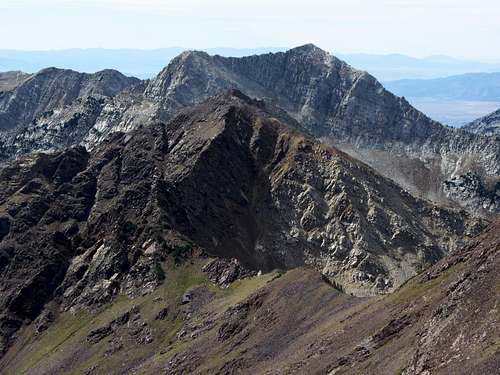
As we got down towards the next saddle, Red Baldy started looking more and more impressive.
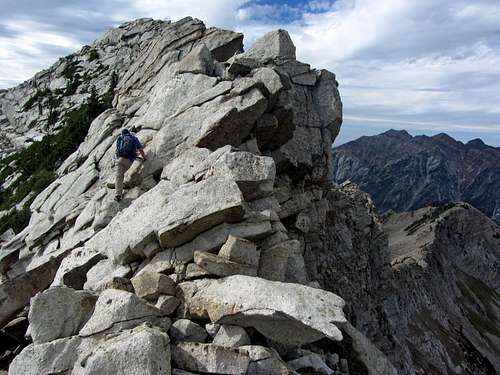
![Red Baldy northeast buttress]() Looking up at the northeast buttress ...
Looking up at the northeast buttress ...![Red Baldy]() ... of Red Baldy
... of Red Baldy
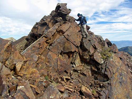
![David on top Red Baldy buttress]() David on top of buttress
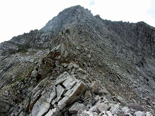
David on top of buttressI already knew about the scrambling on American Fork Twin Peaks’ northeast ridge and had heard that White Baldy had some sustained scrambling as well, but Red Baldy was something of an unknown for me. The scrambling up the steep northeast buttress and northeast ridge was a pleasant surprise, and proved to be probably the most fun part of the day.
![Red Top buttress scrambling]() Scrambling up the northeast buttress of Red Baldy ...
Scrambling up the northeast buttress of Red Baldy ...![Fun Red Baldy Scrambling]() ... was lots of fun
... was lots of fun
We dropped down to the left (eastern) side of the saddle before regaining elevation to scramble to the top of the northeast buttress. From here the view of Red Baldy was especially nice, with the ridge before us looking quite intimidating.
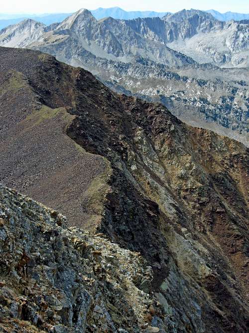
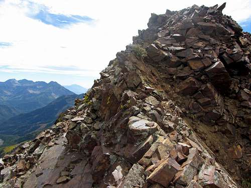
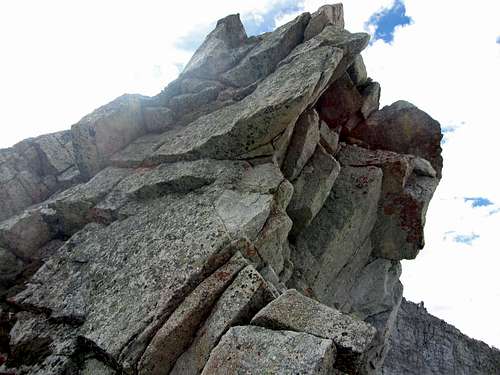
![Red Baldy northeast ridge]() The impressive northeast ridge of Red Baldy (click pic for detailed view)
The impressive northeast ridge of Red Baldy (click pic for detailed view)
After assessing our options, we chose to bypass the exposed class 4 section directly on the ridge itself by traversing across a couple small couloirs on the eastern (class 3) side of the ridge instead. The red rock was nice and solid for the most part, but after going straight up one steep part and accidentally dislodging a small rock and sending it down towards David, I decided to instead make a few large zig-zag switchbacks to ensure that he wasn’t in a line directly below me, minimizing the chances of any rockfall mishaps.
![Red Baldy route]() We took the highlighted path to the top of Red Baldy ...
We took the highlighted path to the top of Red Baldy ...![Below Red Baldy NE Ridge]() ... traversing a little below the northeast ridge
... traversing a little below the northeast ridge
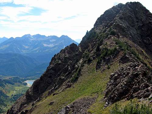
From the top of Red Baldy we admired the views of the more rugged sections of the Alpine Ridge to the west, with our eyes constantly being drawn toward Pfeifferhorn’s distinctive profile.
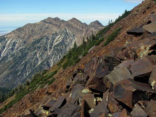
![Alpine Ridge peaks]() Alpine Ridge peaks to the west: Pfeifferhorn, Lone Peak, and Thunder Mountain
Alpine Ridge peaks to the west: Pfeifferhorn, Lone Peak, and Thunder Mountain![Thunder Mountain]() Thunder Mountain
Thunder Mountain![Monte Crist from Red Baldy]() Monte Cristo
Monte Cristo
The peak views from up here were quite nice. Below us to the south were impressive views toward Mount Timpanogos, and we could now see Silver Glance Lake, Silver Lake, Silver Flat Reservoir, and Tibble Fork Reservoir all lined up below us. Despite the fact that the backwards summer this year (hot early and then wet later, which is the opposite of what usually happens) was generally resulting in less vibrant fall colors, we were able to spot a few patches of yellow and red down American Fork Canyon.
![Timpanogos over lakes]() Mount Timpanogos behind Tibble Fork Reservoir, Silver Flat Reservoir, Silver Lake, and Silver Glance Lake
Mount Timpanogos behind Tibble Fork Reservoir, Silver Flat Reservoir, Silver Lake, and Silver Glance Lake![Red Baldy false summit]() A short section of scrambling ...
A short section of scrambling ...![Red Baldy false summit downclimb]() ... near the shorter west summit of Red Baldy
... near the shorter west summit of Red Baldy
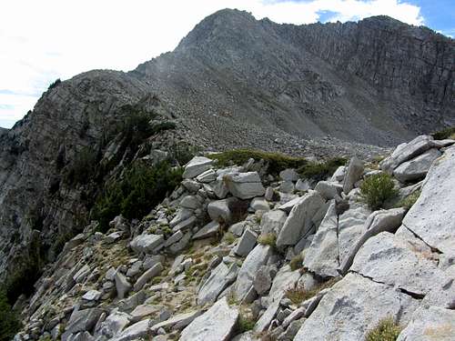
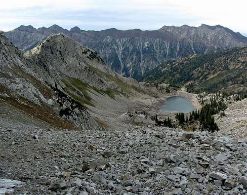
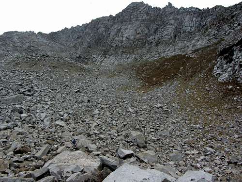
Down below us to the west we could see White Pine Lake, with what looked to be a dirt road (seemed too wide to be the hiking trail we should take) east of the lake. We couldn’t make out where we thought the hiking trail to the lake should have been (unknown to us at the time, there is no hiking trail leading to the north end of the lake), but we were sure it must have been there between some trees. I’ll comment later on how this caused a minor hiccup on our way down at the end of the day. Up until this point we had been cruising (made it over American Fork Twin Peaks, Red Top, and Red Baldy in just over two hours), but I underestimated how much more sustained the scrambling would get around White Baldy and how much more time-consuming it would be. It would end up taking us another two hours to get to the top of White Baldy, two hours from there back down to White Pine Lake, and still two more hours from the lake back to the White Pine Trailhead parking lot.
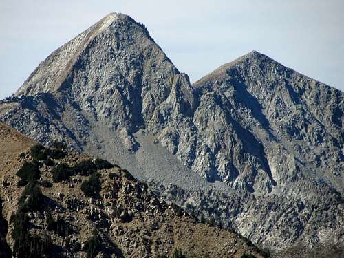
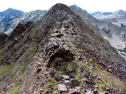
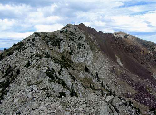
![Red Baldy southwest summit]() Ridge leading to lower summit of Red Baldy, with Box Elder Peak, White Baldy, and Pfeifferhorn in the background
Ridge leading to lower summit of Red Baldy, with Box Elder Peak, White Baldy, and Pfeifferhorn in the background![Red to White]() Where the rock abruptly changed from red ...
Where the rock abruptly changed from red ...![White to Red]() ... to white
... to white
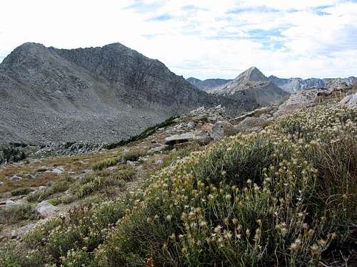
The ridge walk/scramble across to the lower summit of Red Baldy was short and sweet, and descending from there we could now see the abrupt transition from red rock to white rock (I’ll have to ask Liz about the geology behind that). The vegetation suddenly changed at this point as well, with more light-colored tundra and the last traces of some wildflowers along this part of the ridge.
![Shriveled Bullion Divide wildflowers]() Some dried up wildflowers ...
Some dried up wildflowers ...![White Baldy]() ... on the ridge leading down to White Baldy
... on the ridge leading down to White Baldy
The white granite boulders started getting bigger as we made our way down to the saddle between Red Baldy and White Baldy, and we now had to deal with pesky shrubs and trees in between the boulders.
![Red Baldy southwest ridge obstacles]() Navigating the terrain ...
Navigating the terrain ...![Red Baldy / White Baldy saddle]() ... near the Red Baldy / White Baldy saddle
... near the Red Baldy / White Baldy saddle
The views were nice though, so every now and then we’d stop to admire our surroundings.
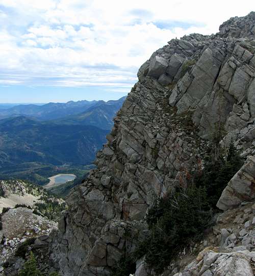
![White Pine ridge dropoff]() Looking south toward White Baldy eastern cliffs
Looking south toward White Baldy eastern cliffs![White Pine Lake below Cottonwood Ridge]() Looking north toward White Pine Lake and Cottonwood Ridge
Looking north toward White Pine Lake and Cottonwood Ridge
![Thunder Mountain over White Pine]() Scenic White Pine
Scenic White Pine
I rolled the same ankle I’d sprained earlier in the summer yet again in a clumpy patch of tall grass as I was meandering between boulders and also bashed my knee into a rock as well, which prompted me to pay more attention to where I was stepping. When faced with an obstacle, we usually opted for the right (west) side of the ridge, but upon reaching the bottom of the saddle and looking behind us we remarked that it may have been easier to have gone down the left (east) side of the ridge instead.
![White Baldy east ridge]() First part of White Baldy east ridge
First part of White Baldy east ridge![White Baldy east ridge obstacle]() White Baldy east ridge obstacle
White Baldy east ridge obstacle
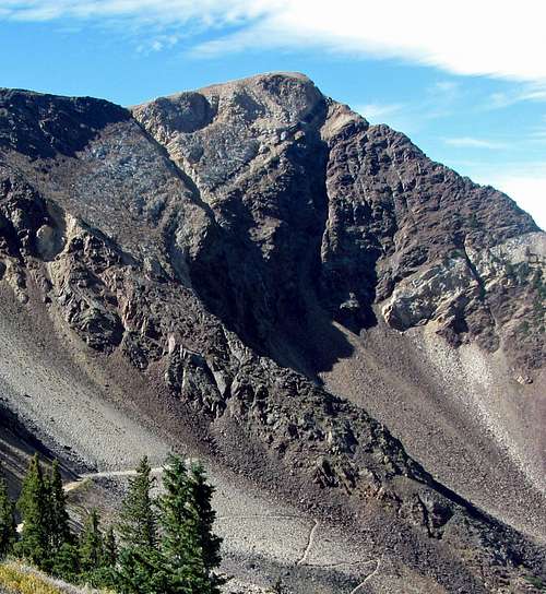
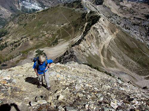
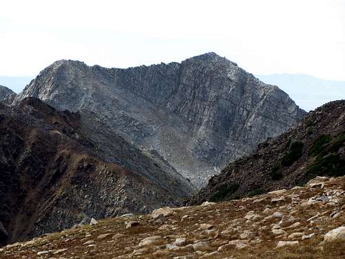
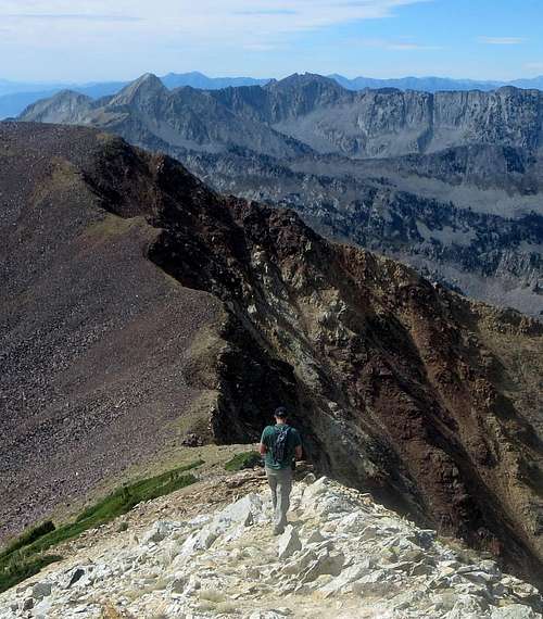
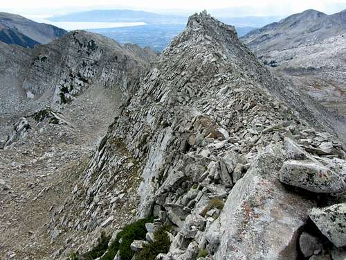
Looking up towards the false east summit of White Baldy, the east ridge looked pretty ferocious, so we followed the advice given on the SP route page and stayed on the right (north) side on our way up to the false summit, passing below some big pointy rock formations. There weren’t really any tricky parts, but all of the scrambling was starting to make me tired. Our pace slowed at this point, but we finally made it to the false summit, at which point we could now see our final objective.
![White Baldy ridge scramble]() Looking down on the east ridge of White Baldy
Looking down on the east ridge of White BaldyThe last section of scrambling from the lower east summit to the main summit of White Baldy was the most difficult of the entire day. I’d read a report of someone who descended down on the south side of this ridge a couple hundred feet, climbed up to the west ridge and then followed that back up to the summit, but since we were running a little late due to the late tram ride up and wanted to get back to the trailhead before it got dark (shorter days meant the sun was now setting closer to 7 pm), we decided to go straight across the ridge instead, and then depending on how it went we’d either come back the same way or take the longer previously mentioned way back to the east summit.
![White Baldy east ridge finale]() David near the top of White Baldy (our final summit) ...
David near the top of White Baldy (our final summit) ...![White Baldy crux]() ... which presented the most difficult scrambling of the day
... which presented the most difficult scrambling of the day
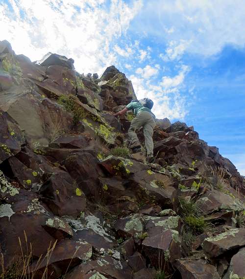
The beginning part of this section was easy enough, but as the granite slabs got bigger and steeper it became more difficult to know the best way to go. We stayed a few yards down on the left (south) side of the ridge at one of the trickier sections (which dropped down towards some more of those pesky trees which somehow seemed to be growing straight out of the granite), but were able to stay close to the top of the ridge most of the time. There was one short class 4 part where I had to lunge and pull myself up and over a large slab of granite, but fortunately I still had enough upper arm strength to do it. The granite, despite looking smooth and slick from a distance, was actually quite rough and grippy, which was good for traction but a little rough on the hands. Feeling a little ragged after our harder-than-anticipated scramble, I finally stumbled onto the summit.
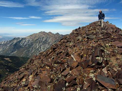
![White Baldy summit pic]() Brandon on the summit of White Baldy
Brandon on the summit of White BaldyFrom the top, you get a nice view of Cottonwood Ridge to the north, with the north ridge of White Baldy dividing the Red Pine Lakes on the left and White Pine Lake on the right. The lower west summit also looked quite impressive from up here. This was definitely one of the more challenging Wasatch peaks I’d summited, but due to time constraints we didn’t bother filling out the register in the summit mailbox.
Descent from White Baldy
I’d heard that the west ridge leading down to Red Pine was a little easier for descending, but since we still wanted to check out White Pine Lake, we decided that we’d go back down that way instead. Since retracing our path along the last part of the east ridge appeared difficult on the descent, we instead chose to start down the west ridge and then cut underneath the main summit to the south, losing some elevation but hopefully getting back to the east summit via a longer, albeit easier way. Sean, a friend from work whom I’d often talk with about various Wasatch hikes and climbs who has since moved to Seattle, saw a bear below this exact same spot when he climbed White Baldy back in June of ‘07. I’ve never seen a bear in the Wasatch and likely never will, but it was cool knowing that one had been spotted here (it may have been the same one that was killed a week later for dragging a kid out of his tent in American Fork Canyon, though).
![White Baldy west summit]() White Baldy west summit
White Baldy west summit![Traverse to White Baldy east summit]() Looking east at a different route we'd take to get back to the east summit
Looking east at a different route we'd take to get back to the east summit
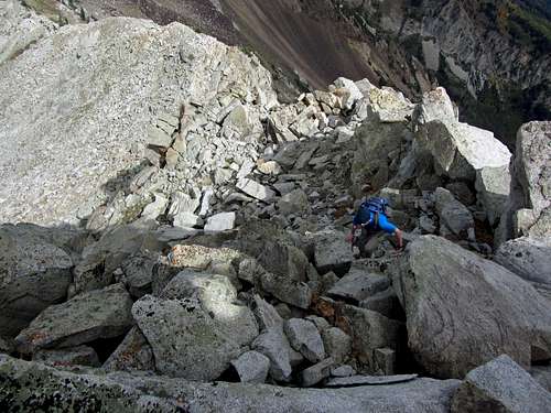
We started our loop south of the summit of White Baldy, and ran into another short class 4 section as we descended down from the west ridge. I went first down a steep little chimney and then directed David over to it, since it seemed like the easiest way down.
![White Baldy west ridge downclimb]() David climbing down from the upper part of White Baldy's west ridge
David climbing down from the upper part of White Baldy's west ridgeFrom above it looked like we’d have a clear path on dirt and be able to avoid those nasty patches of trees if we descended low enough, but a couple times I started along a line only to find an impassible nest of trees, forcing me to change directions a few times. David descended a little lower and seemed to find a better alternative, so to avoid going back up towards the west ridge again, I went straight through some bushes/trees in an attempt to meet up with him. I got a little scraped up, and at one point had to do a little mini-rappel while holding onto the branches of one of those trees to descend a steep granite slab (I tested my weight on it beforehand, but wouldn’t recommend this). A couple hundred feet below the east ridge we finally started regaining the elevation we had lost and made it back up near the east summit.
![There & Back Again]() The way we took to get back to the east summit (left) took forty minutes, which was longer than we anticipated
The way we took to get back to the east summit (left) took forty minutes, which was longer than we anticipated
Looking down on the east ridge and comparing it to the more direct north-facing slopes leading down to White Pine Lake, we chose to descend the loose northeast slopes of White Baldy instead of going back down the steep east ridge.
![White Baldy north ridge]() The northeast face (left) and north ridge of White Baldy ...
The northeast face (left) and north ridge of White Baldy ...![White Baldy boulderfield]() ... below which we would go though an arduous field of loose boulders
... below which we would go though an arduous field of loose boulders
![White Baldy loose northeast face]() Starting down a loose scree slope ...
Starting down a loose scree slope ...![White Baldy northeast face]() ... into a long, tedious boulderfield
... into a long, tedious boulderfieldThere was a lot of loose scree and talus, but we were able to carefully make our way back down. Since the slope was at an angle, we had to scree-ski leaning to the left (west) in order to keep our balance, which after a while made me feel like I was going to be stuck walking lopsided the rest of the way down. The loose rocks became bigger on the way down, and soon we were hopping through a seemingly never-ending boulder field. After what seemed like a long time, we finally made it down to stable ground, where my leg muscles thanked me. We made it to a wide trail along the eastern side of White Pine Lake, which I assumed would lead us all the way back to my car.
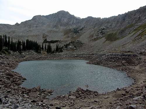
![White Baldy behind White Pine Lake]() White Baldy behind White Pine Lake
White Baldy behind White Pine Lake
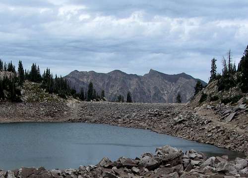
![Cottonwood Ridge bethind White Pine Lake]() Monte Cristo / Mount Superior behind White Pine Lake
Monte Cristo / Mount Superior behind White Pine Lake
Before we could get into a trail-walking groove, what we thought was the path abruptly ended at the northern end of the lake. To the east we could see what looked like the dirt road we’d seen from up on Red Baldy, so after some deliberation we figured that must be where we needed to go (the map I printed from Pellucidwombat showed a trail leading right up to the northeast corner of the lake, but later I found that this trail does not exist). When seeing that we’d need to bushwhack through more boulders to get there, David instead opted to go to the south side of the lake to meet up with what he figured was the start of that trail higher up. I was more in the mood to just take the shortest path through the boulders though, so we split and agreed to meet on the trail to the east a few minutes later.
![Red Baldy from lakeshore]() Looking east toward Red Baldy from the northern shore of White Pine Lake. The trail we wanted to reach is at the bottom left.
Looking east toward Red Baldy from the northern shore of White Pine Lake. The trail we wanted to reach is at the bottom left.
I went down some monotonous terrain to the northeast of the lake to get down to some more boulder fields, and in about fifteen minutes made it onto the trail/road. Looking back up at where the trail lead, it looked like David would have to regain quite a bit of elevation to meet up with that part of the trail, as it did not lead to the southeast corner of the lake like he thought it would. I kept my eyes on the trail above me to the south, looking for any sign of him, but half an hour after splitting up I still didn’t see him, so I started calling out to him, hoping he’d hear me. I heard a reply, but due to the constant wind (which had now blown in clouds for the impending storm) I couldn’t tell where it was coming from. I walked back up the trail to a more elevated and visible section and then stayed put, hoping eventually he’d find his way to me. I wasn’t totally sure yet if I was on the right trail, but was pretty sure it would at least lead us somewhere down to the bottom of White Pine Canyon.
![White Pine trail]() Finally on the trail that would lead us down to the White Pine Trailhead
Finally on the trail that would lead us down to the White Pine Trailhead
After a few more minutes I spotted David coming down from the lake near the same spot where I had been. Upon reaching me, he explained that once he figured how much farther away the upper part of the trail was from White Pine Lake, he decided to come back down to where we had split up. There he met two other hikers who said they’d seen me back on the trail from a distance, so David then made his way back to where I was. I shouldn’t have split up from him, but there was no harm done since we were close to the trail and no longer scrambling across difficult terrain. Just a word of warning to those going up White Pine Canyon though: there is no trail leading to the lake, which seems to be standard procedure almost everywhere else in the Wasatch. We hiked quickly down the wide trail/road, which in fact did turn out to be the right way to get down, and made it back to the trailhead just as it was getting dark. It was light enough that we didn’t need to bust out the flashlights, though.
![Sunset on Red Top]() Sunset on Red Top Mountain, on the last snow-free day to do the Bullion Divide
Sunset on Red Top Mountain, on the last snow-free day to do the Bullion Divide
I drove David back to his car at the Snowbird Tram parking lot and we talked about how it was nice to end our hiking season on a high note, and that the Bullion Divide was an awesome way to go out (it snowed a lot up in the mountains the very next day). The route had probably the most sustained scrambling that either of us had done in a single day, with awesome views of the Alpine Ridge throughout. Although we missed out on scenic Albion Basin by taking the tram up, I’d highly recommend doing what we did and forking out the $17 if you’re short on time and want to cut straight to the fun scrambling. I felt the scrambling became a little more difficult with each peak (AF Twins, Red Baldy, and then White Baldy), but besides a very short class 4 section on each peak it was class 3 and under the entire way (maybe with better route-finding we could have kept it at class 3 the entire time, but where’s the fun in that?), and being above tree line for such an extended period of time made it feel like we were hiking 14ers in Colorado. White Baldy also turned out to be a much more challenging and rewarding peak than I had anticipated. This was hopefully the first of many multi-peak ridge scrambles I’d like to do (next summer we might try the more difficult Beatout and Triple Traverse routes), and definitely ranks up there as one of my favorite days in the mountains.
Bullion Divide Stats
DISTANCE: 8 miles one way
HIDDEN PEAK TRAM STATION: 10,992 feet
AMERICAN FORK TWIN PEAKS ELEVATION: 11,489 feet
RED TOP MOUNTAIN ELEVATION: 11,378 feet
RED BALDY ELEVATION: 11,171 feet
WHITE BALDY ELEVATION: 11,321 feet
WHITE PINE TRAILHEAD: 7,660 feet
ELEVATION GAIN / LOSS: 2,400 feet / 5,600 feet
DIFFICULTY: Class 3+
TIME: 8 hours
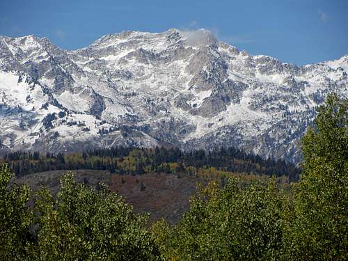
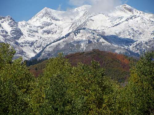
![First snow on White Baldy]() A few days later I admired the fresh snow covering White Baldy, ...
A few days later I admired the fresh snow covering White Baldy, ...![First snow on AF Twins]() ... Red Top Mountain, and American Fork Twin Peaks from the Alpine Loop Scenic Byway
... Red Top Mountain, and American Fork Twin Peaks from the Alpine Loop Scenic Byway


Comments
Post a Comment