
|
|
Mountain/Rock |
|---|---|
|
|
44.59543°N / 107.38399°W |
|
|
Sheridan |
|
|
Hiking, Scrambling |
|
|
Spring, Summer, Fall |
|
|
10828 ft / 3300 m |
|
|
Overview
Dome Peak sits along the long ridge reaching northwest from the core of the central Bighorns and Cloud Peak wilderness. It is one of two peaks towering over Woodchuck Pass providing panoramic views of the range and forest. Some sort of telecommunications tower sits atop the summit.
Getting There
From the maintained gravel Big Good Road #26 turn south onto Forest Service Road 226 which ascends toward Woodchuck Pass. This pass separates Bruce Mountain (west) from Dome Peak (east). After driving for 1.9 miles along FSR 226 park alongside the road. This road requires a high clearance vehicle and is not recommended if wet.
There is another more direct approach to the summit by parking after 1.4 miles. Howevere this route goes through a more forested valley.

Route
After parking I ascended toward the southeast avoiding the more forested and boulder sections. After gaining the first ridge I was able to follow decent elk trails east almost all the way to the summit. Near the summit the trails disappear and some boulder hopping is required. Total roundtrip distance was 5 miles.
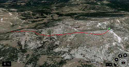
Google Earth image showing the approximate route. Great views and wildlife watching.
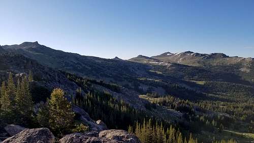
Summit of Dome Peak on the left. Sheridan County High Point is visible in the left of the photo.
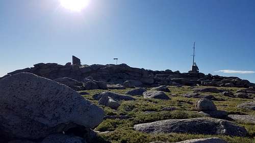
Summit of Dome Peak with telecommunications towers
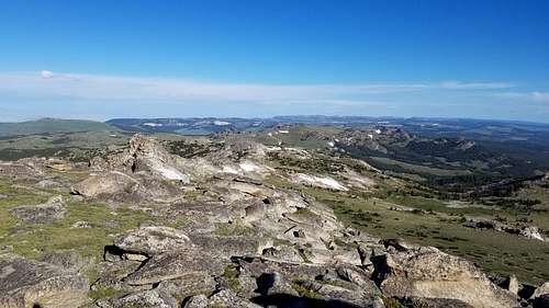
Looking west from Dome Peak summit toward Bruce Mountain
Red Tape
None
When to Climb
Spring, Summer & Fall
Camping
Free primative camping is widely available. There are multiple campsites available along FSR 226
External Links