
|
|
Mountain/Rock |
|---|---|
|
|
46.46185°N / 10.51930°E |
|
|
Lombardia |
|
|
Mountaineering, Skiing |
|
|
Spring, Summer |
|
|
11306 ft / 3446 m |
|
|
Overview
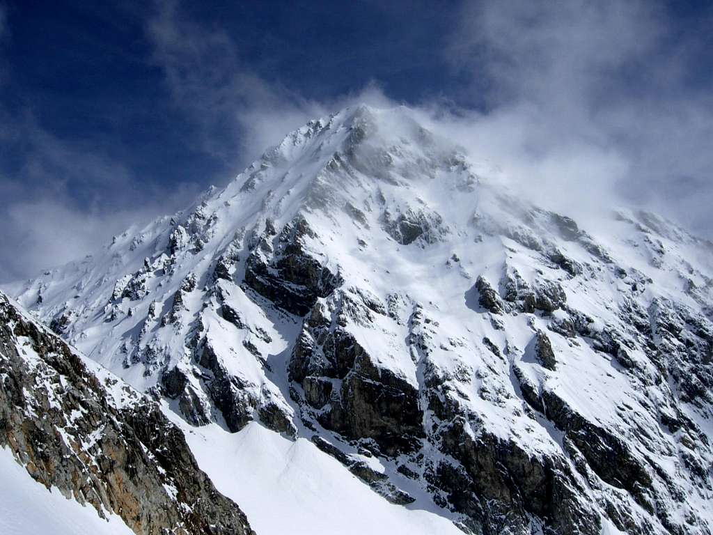
Cima delle Pale Rosse m. 3446
Cima delle Pale Rosse is a minor summit located South-West to the omonymous col in a glacial setting of extraordinary beauty, just in front of the South face of the majestic Gran Zebrù - Königsspitze and at the head of the Vedretta di Cedèc, also named Vedretta del Gran Zebrù. The mountain belongs to the Ortles-Cevedale Group and it's formed by two peaks, Punta Nord 3446 m, the highest, and Punta Sud 3401 m, at a distance of about 350 meters apart.

The name "Pale Rosse" comes from the many reddish towers with enlarged shapes that constitute the peak, especially along the Eastern ridge of Punta Sud. To climb the mountain directly from Rifugio Forni involves a long vertical drop, but it’s possible to stay overnight at Rifugio Pizzini, from where the vertical gain is about 700 meters.


In this page it's related the Normal Route to the Southern summit, an ascent that can be carried out in spring as a ski-mountaineering route or in early summer as a training ascent for most demanding climbs.
Getting There
Road access
The starting point to climb is the village of Santa Caterina Valfurva m. 1734, situated 12,5 km. to Bormio, an important destination which can be approached from Milan following Valtellina or from Alto-Adige through the Stelvio pass. From Santa Caterina a steep road leads to the Rifugio Albergo dei Forni, parking lot (8 km. from S. Caterina Valfurva).
- From Autobrennero exit Bolzano and follow the road to Merano, then enter the Venosta Valley and follow it to the fork in Spondigna. Turn to left, following the road to Passo Stelvio (2758 meters, open only in the summer period). From here descent to Bormio (3 hours and half from Bozen, Stelvio pass requires 44 bends to go up and 15 to go down).
- From Milano follow the state road "Valsassina" n. 36 to Lecco and then to Colico, here take the "Valtellina" road to Morbegno, Sondrio, Tirano and then to Bormio.
Approach to Rifugio Pizzini


From the Refuge Hotel Forni 2178 m follow the unsurfaced road which after a few bends enters the Val Cedec. A simple itinerary along the hillside leads to the Capanna Pizzini shelter in about 1 and a half hour.
Route
Cima Sud delle Pale Rosse from East
Difficulty: Alpine PD-
Starting point: Rifugio Pizzini-Frattola m. 2700
Exposure: South, then East

Route description - From the shelter take the path towards NNW and amongst moraine-debris reach the start of the western branch of the Cedèc Glacier. Here it's necessary to rope-up, because the glacier has some crevasses, insidious especially early in the season. Take the glacier in the middle and climb up along easy moderate slopes to the gap called Colle delle Pale Rosse, located between the South summit on the left and the North summit on the right.


From the saddle move to the bottom of the slope giving access to the ridge of snow and rocks and overcome the slope to reach the ridge, rising leftward to the summit. Follow briefly the ridge, opposing some loose rocks, getting to the summit.
Descent: reversing the same route
Red Tape
Cima delle Pale Rosse and the whole Ortles-Cevedale Group are situated inside Parco Nazionale dello Stelvio, one of the hystorical national parks in Italy, belonging to the provinces of Trento, Bolzano and Sondrio. Free camping is not allowed and fires are strictly forbidden. The whole fauna and flora are protected.
When to Climb
Mountaineering: usually the best period goes from June to the middle of September.
Ski-Mountaineering: from March to May
Hut


- Rifugio Pizzini-Frattola m. 2700
The Refuge Pizzini-Frattola is located in the large basin at the head of Val Cedèc in a majestic amphitheater, closed by Gran Zebrù to the North and Cevedale to the East. Owned by Club Alpino Italiano Sez. Milano, it was built in 1887 and destroyed during the First World War.
Meteo forecast
Bibliography
“Ortles Cevedale – Parco nazionale dello Stelvio” by Gino Buscaini – Collana Guide dei Monti d'Italia CAI-TCI (Club Alpino Italiano-Touring Club Italiano)
Map “Ortles-Cevedale” foglio 72 - Kompass 1:50.000