
-
 3850 Hits
-
 86.37% Score
-
 22 Votes
|
|
Route |
|---|---|
|
|
46.80162°N / 11.04401°E |
|
|
Mountaineering, Ice Climbing |
|
|
Summer |
|
|
Half a day |
|
|
PD |
|
|
Overview
Cima delle Anime/Hinterer Seelenkogel East Ridge-NE slopes crossing
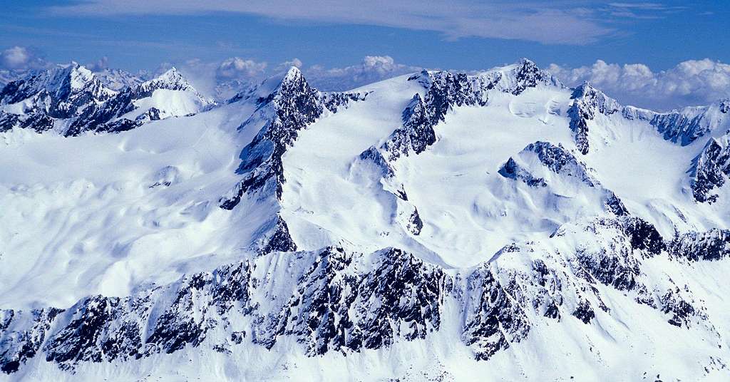
Cima delle Anime/Hinterer Seelenkogel 3472 m is a mountain of the Eastern Rhaetian Alps, subsector Ötztal Alps, and it is located along the border between Italy and Austria, while the route described is entirely situated on the italian side of the peak. Cima delle Anime - meaning Mount of Souls - is the italian name of Hinterer Seelenkogel and it doesn't coincide with the original Tyrolean place name. The south-eastern part of the Ötztal Alps is home to the three Seelenkogels. Extending roughly from north-west to south-east these are the Vorderer, Mittlerer and Hinterer Seelenkogel, meaning front, middle and back, respectively. The first two lie in Austria, the Hinterer lies on the border with Italy.
The Normal route to the summit along the East ridge is an easy, fun and popular climb. An interesting alternative to the standard route is the East Ridge - NE slopes Crossing, which can be climbed in both directions (up Northern slopes and down the East ridge. You can climb it starting from Plan (Pfelders) of Moso in Passiria in a long day, overcoming a difference in level beyond 1800 meters. Anyhow it's advisable staying overnight at Refuge Plan m. 2980 (Zwickauer Hütte).
|

|
Getting There
From Brennero Motorway, exit Bolzano South and follow the road to Merano and then to Val Passiria/Passeiertal, reaching San Leonardo/St. Leonhard and Moso in Passiria; take now the Plan Valley (Pfelderer Tal) to the very nice little settlement of Plan/Pfelders m 1620. Parking in Plan.
Plan/Pfelders
Public transport
Take the train to Merano. From Merano railway station directly by bus to Plan- Pfelders (Line 240).
From Plan/Pfelder m. 1620 to Refuge Plan (Zwickauer Hutte) m. 2980
From Plan/Pfelders (hotels) the itinerary always follows the path 6a. Climb the steep grassy slopes and debris, touching Malga Schneid (Schneidalm - m. 2.159).
From the pasture we continue with steep serpentines up to the rocky buttress of Oberer Schneid (m. 2.371) and from here, along the back of a steep ridge, we arrive to Refuge Plan (Zwickauer Hütte - 2979 m, 4 hours), possible dinner and overnight.
Route Description
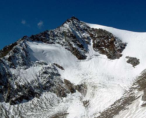
Cima delle Anime NE Face
Cima delle Anime (Hinterer Seelenkogel) East ridge - Northern slope traverse
Difficulty: PD (Alpine) - I grade (rocky section), 47° the snow section
Difference in level: 1850 m climbing directly from Plan, 500 m. from the shelter
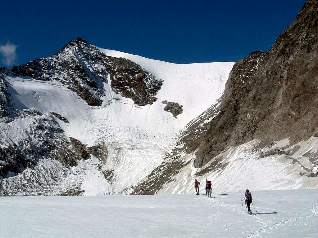
A pleasant climb up the East Ridge standard route, a lot of fun on the final wrinkly rocks! East Ridge is very popular, because it doesn't cross any glacier, but choising the complete ring is more fulfilling; in that case be aware that it involves downclimbing along the icy Northern slopes and crossing a glacier, even if small. Ice-gear is needed.
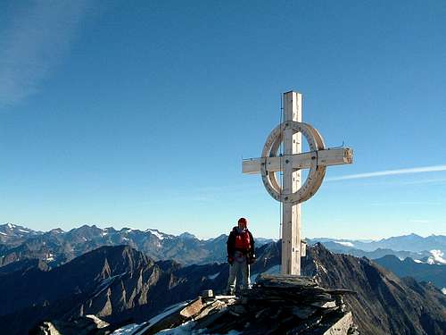
From Refuge Plan take the red marked trail to a fork just beyond the shelter itself. Always following cairns and red marks, start to climb the East ridge up on easy rocks, steps and large blocks, overcoming some passages equipped with fixed steel cables, always without particular difficulty. The climb leads to the foresummit, then to the wooden summit cross on the top (about 1.30 hours from the shelter).The view from the top is 360° wide over all the major peaks of the Val Venosta and also the Dolomites. The descent along the North-East slopes to the Vedretta di Plan/Planferner (Plan Glacier) is a steep but short ice-downclimb (45°), advisable only with good snow and ice condition, otherwise it's better to downclimb on the same ascent route. From the summit head to left (West) and follow for few meters the large easy ridge and soon leave it, turning right to descent along the North-East slope, at first gentle-angled, than steeper, reaching the Vedretta di Plan/Planferner. After crossing the glacier, a track descents to the shelter.

|

|

|
Essential Gear
Rope, axe, crampons, slings, glacier gear
Red tape
No fees, no permits required.
When to climb
Late Spring and Summer are the good season to climb.
Where to stay
Rifugio Plan - Zwickauer Hütte 2980 m.
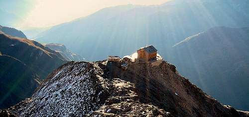
Refuge Plan at sunrise seen from Cima delle Anime Normal route
The hut stands on a rocky outcrop, the White Node, at the edge of Plan Glacier in a dominant position over the Valle di Plan. It was originally built by the section of Zwickau DOAV back in 1899, was destroyed by an explosion in 1967 and has recently been rebuilt. It has 28 beds and 44 bunks in the dormitory. Belongs to CAI Merano and it's open from early July to late September. Shelter phone, fax: 0039-0473-646002 Guardian Phone: 0039-347-5164308

|

|
")
|
Bibliography
"Escursioni alle cime del Sud Tirolo" - Hanspaul Menara
Map Tabacco Nr. 039 Val Passiria 1:25 000
Meteo forecast
METEO PROVINCIA BOLZANO ALTO-ADIGE