Overview
The Picture postcard view from Pico de las Nieves across Caldera de Tejeda
The route from the road saddle
Degollada de Cruz Grande onto the high plateau
Llanos de Pardana and on to the highest summits of
Gran Canaria is one of the grand hiking trails on the island. It connects a
camino real, which meanders among the big climbing walls of
Gran Canaria with a well trodden hiking path, which again passes by
El Campanario and
Pico de las Nieves. Further onward a short hike along an asphalt road takes you to
Roque Redondo while a last section touches
Caidero de Urian. Thus you can stand on top (or close to the tops) of Gran Canaria's highest summits all in one dayhike. The camino real in particular is breathtaking in its setting and is a good example of what engineers were capable of several hundred years ago. It follows a cobblestoned ramp up the huge west faces of
Las Candelillas, one of Gran Canaria'S main climbing destinations.
The route roughly follows the curving south faces of
Riscos de Tirajana, the massive walls which close in the topmost part of
Caldera de Tirajana, one of the two large erosion craters of
Gran Canaria. In several places along the route, notably on the summits, you have amazing views of different parts of the island. The section between
Roque Redondo and
Pico de las Nieves can be very crowded, thanks to the access road, which almost touches both mountaintops. On the remainder of the route you only meet a few fellow hikers, mostly near the trailhead at
Cruz Grande and at
Degollada de los Hornos close to Gran Canaria's landmark, Roque Nublo.
Getting There
Los Caideros, Punton de la Aqujereada
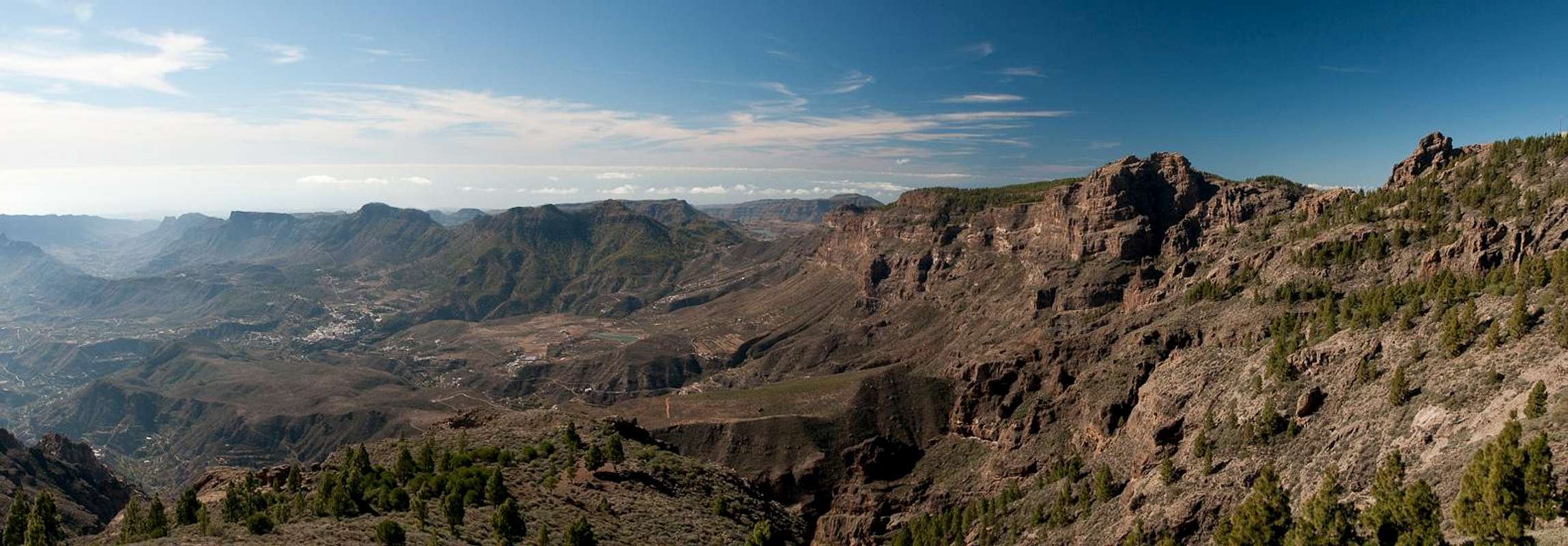
Cruz Grande or rather
Degollada de Cruz Grande didn't get its name because of a big cross near the saddle. Rather the cross meant here is an intersection of several important old paths or
camino reales (king's highways) which connected the mountain villages with the coasts in former times.
Cruz Grande was one of the most important crossings since it served the whole east and south of the island.
- From the south
- From Maspalomas take GC60 through Fataga and San Bartolome to the saddle
- From the north
- From Telde take GC131 which turns into GC130, direction Pico de la Nieve. The road will hit GC150 right at Gran Canaria's highpoint.
- For stay on GC150 for a few metres, then turn onto GC600 to Ayacata.
- Turn left onto GC60, direction San Bartolome until you reach the saddle (signs "Cruz Grande").
Route Description
Riscos and Caldera de Tejeda from between Caidero de Urian and Roque Redondo |
General:
- Start altitude: 1260m
- Summit altitude: 1951m
- Prevailing exposure: S
- Type: Hike
nbsp; - Protection: None
Effort: 1000m
Power: 2 - Long and strenuous (especially when returning the same way)
Psyche: 1 - No exposure (3 - exposed if you climb the summits of El Campanario)
Difficulty: 1 - Hike (2 - on El Campanario)
Orientation: 1 - Marked
Today, Degollada de Cruz Grande is less an intersection of camino reales than a road saddle, the highest point of which is marked by a gate of two basalt rocks. Our camino real starts on the eastern side of the saddle and looks like the access road to a house right above the saddle. Head up to the house and you'll soon pass two crosses. Stay in front of the house but pass it to the east where the real camino starts. It is cobblestoned with roughly cut rocks and heads in switchbacks to a ridge above the house (and saddle). Here you get a first view of the impressive climbing walls of Las Candelillas, Riscos del Laurel and Los Canadores.
The camino turns right and heads for Las Candelillas, making use of a ledge at the base of the faces. It follows the ledge to a corner in the wall, where the first fun starts. Ramps have been built from basalt cobblestones and now negotiate a noth in the otherwise vertical faces. The camino makes use of natural ledges but again and again follows one of these ramps. On a rather large balcony a water reservoir has been built (now in ruins) and here the camino makes its last efforts to reach the plateau of Llanos de Pargana. The name plateau is not quite correct as the Llanos are well structured, rather similar to the karst plateaus in the Dolomites or Julian Alps. From here you can easily reach the first summit, Los Caideros, which stands right above Degollada de Cruz Grande. It is rarely visited, however.
On Llanos de Pargana the trail splits in two: the left branch (only marked by cairns) follows the northern end of the plateau with good views into Caldera de Tejeda. The right (and also official) one is marked and leads across the llanos and through a forest of Canary Pines. It gets close to Punton de la Aqujereada, the second of the summits near the route, which, however is almost never climbed. The routes combine in Degollada de los Hornos, where the camino descends in a wide loop towards Roque Nublo.
Llanos de Pagana
Instead, turn right onto a sparsely marked path and follow the tracks up a slope through the forest. After several hundred metres the path gets more distinct and starts to rise towards the next saddle, Degollada de los Gatos. The saddle is hidden in the forest and marks the best spot to start the climb to El Campanario, Gran Canaria's second highest mountain. Follow the overgrown path and make the best sense of the huge number of cairns, which mark ambiguous paths. All, however, evenntually lead to a balcony to the west and right beneath the summit structures of El Campanario. Pass the summit to the north, heading for a saddle. From here descend a few metres, than head up steeply to the right and decide on the summit rock to climb (there are three of almost equal height).
| | Pico de las Nieves |
Return the same way to Degollada de los Gatos, the turn right, descending into the upper Valle de Tirajana, a steep gully which drops into the crater beneath. There is a huge tower to the right, close to the lowest spot, pass it, then head up the opposite slope. You'll leave the canopy of Canary Pines and cross a steep slope towards the parking lot and mirador of Pico de las Nieves. Don't be disappointed by the crowds and the souvenir booth up there. Rather enjoy the perfect views of Tenerife hovering above Roque Nublo and Altavista de Gran Canaria.
Above the Roch Window
Most hikers turn back here but you can head on to the next two summits of Riscos de Tirajana. The easiest route is to follow the road around the ugly radar installation on top of Pico de las Nieves until you reach an intersection. To the right is one of the Pozzos de las Nieves, two big holes in the ground, where snow and ice were colected and kept in former times. Alternatively you can reach this spot by a shortcut. From the parking lot ignore the no trespassing signs and scramble up along the fence of the radar installation until you reach the ridge which leads outward towards an impressive tower across a big rock window. From here you can already see the Pozzo but you have to use your own judgment for the best path to get there (most likely stll staying close to the fence).
Beautiful Roque Redondo
From the Pozzo return to the road intersection. Here turn right onto the road to Roque Redondo. There are lots of TV and radio antennas there among which the road winds. As an alternative there is a dirt road to the right of the road which cuts short some of the switchbacks but rejoins the road after several hundred metres. Still follow the road towards its end. Here a path heads out to a fire lookout, from which you have a wonderful view across Riiscos de Tirajana and the route you hiked to here.
[img:775633:aligncenter:small:Beautiful Roque Redondo]
For Caidero de Urian return to the road, from which a dirt road heads down onto Mesa de las Vachas another high plateau. The dirt road passes Caidero de Urian to its left. For the summit bushwhack towards the top. However, views will be obstructed by the flora on the summit.
Return the way you came. Alternatively there is a dirt road down into Caldera de Tirajana. Signs, however, told us that part of the road is now on private property and has been closed. I'm not able to confirm this.
There are now two trails, the official one Essential Gear
Hiking gear is sufficient but don't forget the water (though you might be able to buy something on Pico de la Nieve). Also, bring warm clothes - in case the trade wind clouds start to cover the Cumbre Central, fierce winds can spring up in no time at all.