
Comments
No comments posted yet.
|
|
Trip Report |
|---|---|
|
|
2.20693°S / 134.36391°W |
|
|
Jun 24, 2015 |
|
|
Hiking |
|
|
Summer |
I decided to hike these two peaks out of necessity. I had planned a week of high altitude hiking in Eastern Sierra and I had to acclimatise somehow. As I live at nearly sea level, my previous years' experience tought me not to take altitude change lightly. The prospect of hiking the highest peak in Nevada and a peak in California, as a day hike, made for an easy decision.
I also did not intend to write a trip report, but noticing that the most recent info regarding this hike was at least a year old, I decided to be helpful and give some up to date details about the hike. This hike uses the Queen Mine Rd to get to the trail head.
Getting to the trailhead
I left Bishop at 4:00AM and at the North of town I got on Highway 6. I took Highway 6 North, passed the town of Benton and entered Nevada. (For the record, Google maps was very accurate with the directions, with one negligible shortcoming.) I counted 10 miles from Benton to the Queen Mine Rd. The Queen Mine Rd is not clearly marked, so using Google maps and a few landmarks described by other hikers, was very helpful in providing me the confidence that I am not getting on the wrong road and wasting time. The pictures below are the landmarks one needs to find the Queen Mine Rd: the INYO National Forest sign, driving East on HWY 6, comes half a mile before the road. The abandoned water tank is literarily across the street from where Queen Mine Rd begins. I took these pictures after I came down from the mountain. At 5 AM it was still dark, but the landmarks are easily identifiable. The road is not marked and there are no signs to direct one to the trail head. Many other roads intersect or split from Queen Mine Rd, but following the road uphill is the obvious way to go.
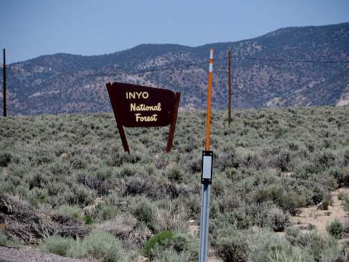 Sign driving East on HWY 6, 0.5 mile to Queen Mine Rd | 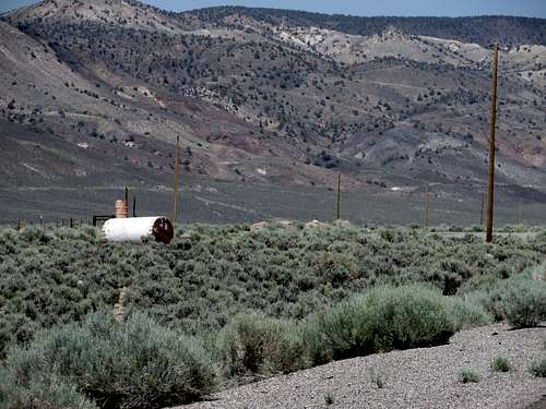 Water Tank, across the HWY 6 from Queen Mine Rd | 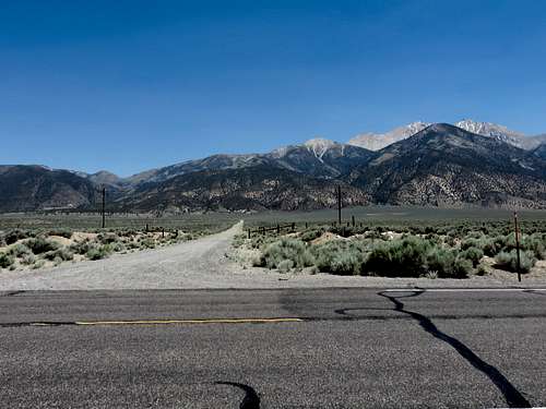 Queen Mine Rd |
In Google maps I searched for Boundary Peak and the direction took me within 1/4 mile from the trail head. The drive up Queen Mine Rd is OK. The dirt road is in good condition and drivable in any kind of car. However, the last couple of miles have a few obstacles that a regular car will most likely remain suspended above the deep holes in the road. I'd recommend driving a high clearance car just for saving the trouble of an extra 2 mile hike, each way, especially after coming down from that long, tiring hike. The Google maps directions brought me about 1/4 miles short of the trail head. Pretty good directions, I'd say. The trail head is obvious and the trail likewise. However, there is no sign to tell hikers where they are or what they are about to hike. There is no box and/or registry at the trail head. The entire hike is 100% in the Sun, so if there was a totally clear, sunny day, the discomfort was maximum. There is no water anywhere on the mountain; all the water needed has to be carried. Of course, some water bottles can be stashed away at certain points along the trail for not carrying it all the way to the summit and back, just to drink it 5 minutes before getting back to the car.
The Hike
I found the hike OK, with the only technical part on the last ascent on to Montgomery Peak. The hike up to Boundary Peak was not very interesting, with the ascent from the saddle to the summit a total pain due to the scree. Boundary mountain is basically a huge pile of scree. Once the scree gave way to rocks, close to the summit, the trail gets hard to follow, disappearing from under ones feet. However, the summit is in sight the whole time. It took me from 5:30 to 9:10 of casual hiking to get to the summit of Boundary.
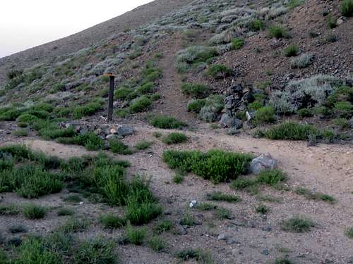 Boundary trail head | 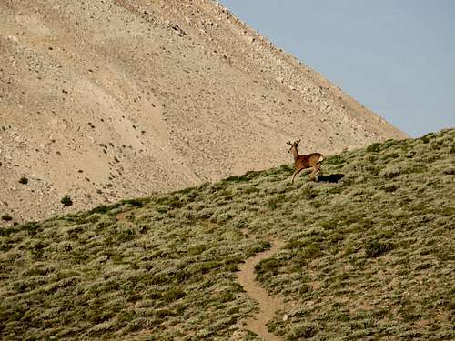 Boundary trail | 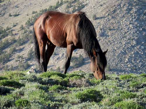 Wild horse on Boundary trail |
From there I traversed to Montgomery in 1 hour and 10 minutes. Montgomery is more made of rocks than scree, so the final climb to the summit was the only fun part of the day. The traverse itself is OK, with the fun of discovering that there is a line of rocks clearly marking the state line between Nevada and California. Going back from Montgomery, I did not hike back up to Boundary anymore, but rather bypassed it on the East side. That was a pain in itself since the scree made the crossing back very difficult.
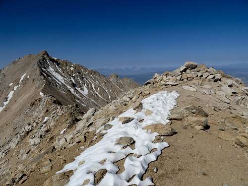 Boundary Peak and Montgomery Peak | 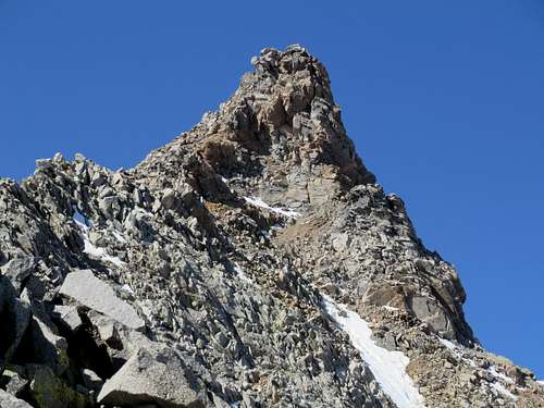 Montgomery Peak |
With the torching Sun on my back and not much to enjoy while down from the mountain, the last few miles to the car were just walking and taking pictures of flowers. I was back to the car at 2:00 PM.
As glad as I was to bag these two peaks, I would not consider hiking up there again. There are plenty of other peaks which offer better views and more interesting hiking. But in the end I got what I came for: acclimatization.
What I liked about the hike was that, for the very first time in my life, I saw a wild horse. The horse must have been used to hikers, since he did not care much for me. However, I saw plenty of deer, which was very scared of me. On the other hand, there was not one single person on the mountain. I did not see anybody, any car, any tents or any indication that hikers were on the mountain in the previous days.