
-
 1269 Hits
-
 79.78% Score
-
 11 Votes
|
|
Route |
|---|---|
|
|
45.87356°N / 7.32172°E |
|
|
Hiking |
|
|
Summer, Fall |
|
|
E |
|
|
Overview
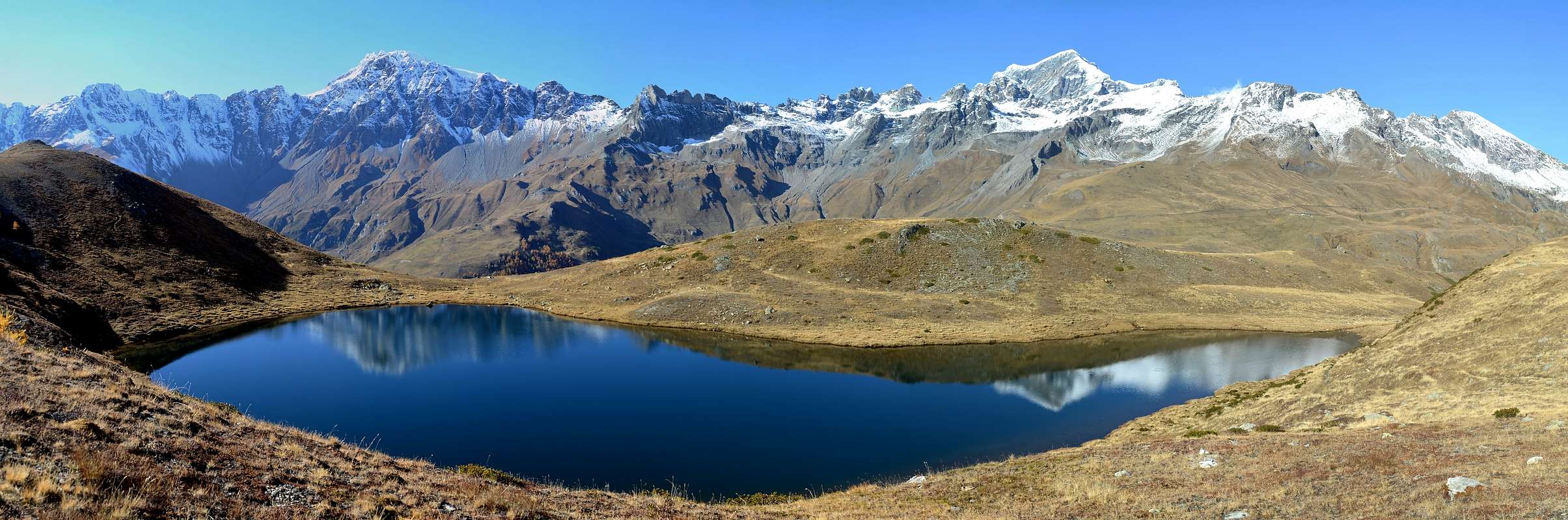 |
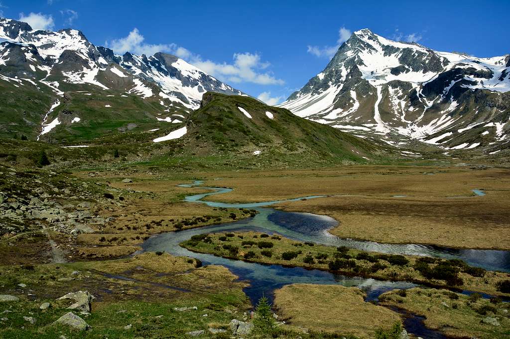
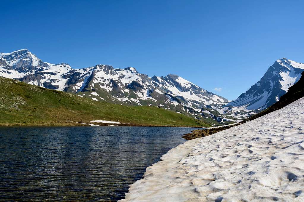
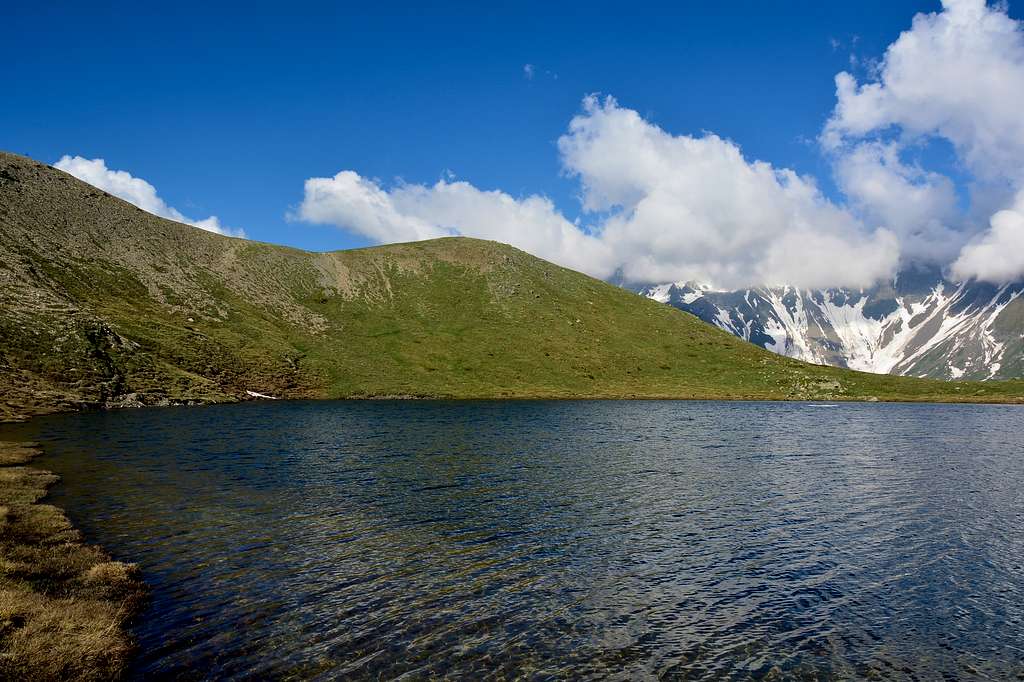
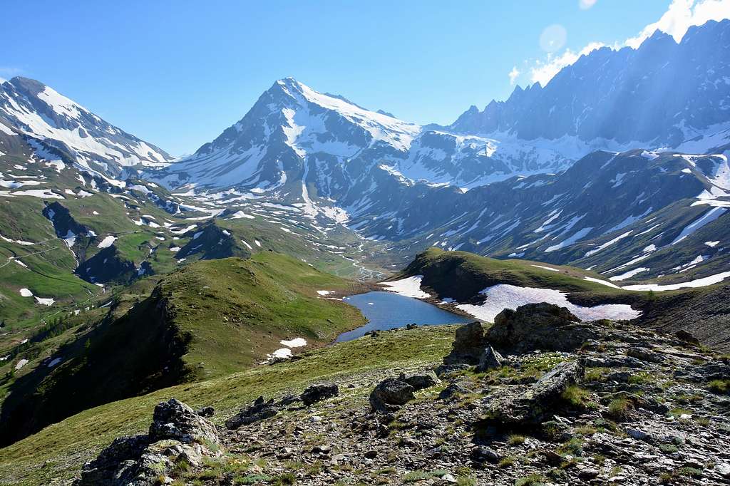
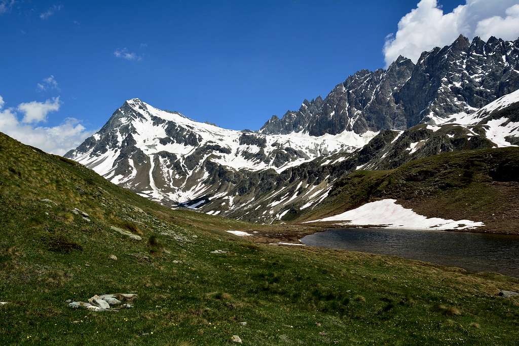
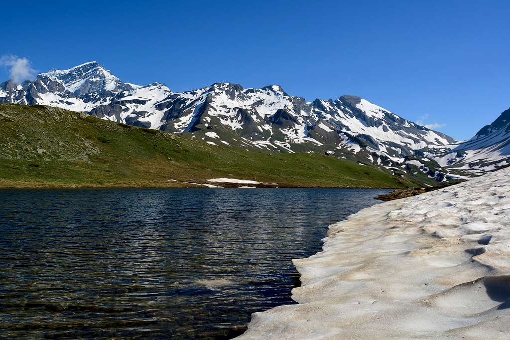
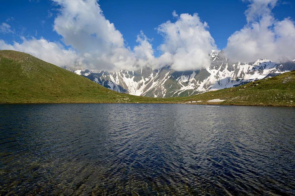
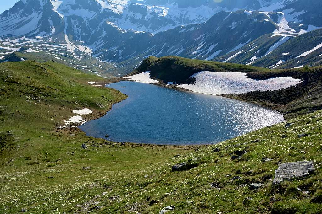
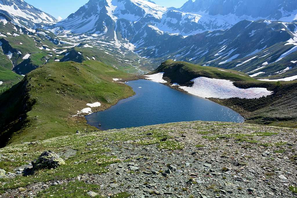
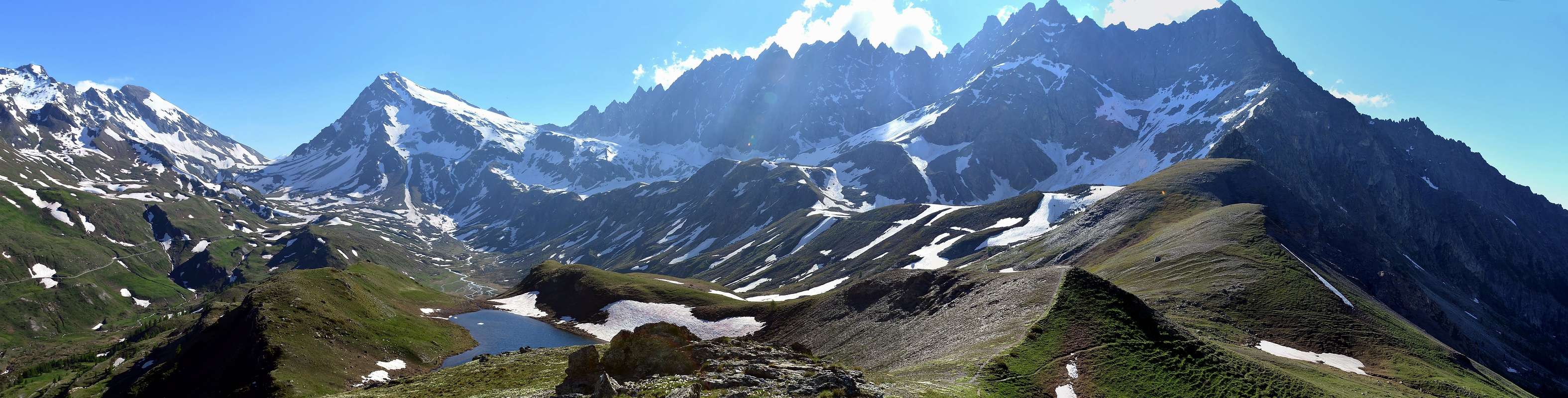
The Lake Cornet (2.334m) is located at the foot of Monte Berio (3.077m) and Mont Cornet (2.388m) from which it is possible to admire to the south the entire Valley of Ollomont and the Central Valley and the marvelous Conca d By a north. Excellent views also towards West North West where you can admire the whole Mont Velan group from Crou de Bleintse to Mont Avril and from Grand Combin to Mont Gele and the Morion Group.
Il lago Cornet (2.334 m) è posto ai piedi del Monte Berio (3.077 m) e del Mont Cornet (2.388 m) da cui è possibile ammirare a Sud l’intera Valle di Ollomont e la Valle Centrale e la meravigliosa conca d By a nord. Ottimo il panorama a anche verso Ovest Nord Ovest dove si può ammirare tutto il gruppo del Mont Velan dalla Crou de Bleintse al Mont Avril e dal Grand Combin al Mont Gele e il Gruppo del Morion.
 |
Getting There
BY CAR:
- From TORINO, MILANO, etc: Motorway A5. Exit at Aosta East
- From FRANCE: through the Mont Blanc Tunnel to Entrèves/Courmayeur. By Little Saint Bernard Pass, closed since November until half May to La Thuile Valley - Pré Saint Didier - AOSTA Municipalities. It is not necessary to take Motorway A5: you can drive on SS.26, in the direction of AOSTA - IVREA - TURIN.Add Getting There text here.
 |
 |
 |
 |
 |
 |
Specific Road
From Aosta East exit of the motorway, follow along the SS.27 for the Gran San Bernardo Tunnel. After about ten Km turn to the right (Northeast) towards Valpelline (964m), creoss it and turn to the left to get Ollomont (1.335m) and the small built area of Glacier (1.549m), where you must start walking.
Dall'uscita del Casello Autostradale di Aosta Est, proseguire sulla SS.27 in direzione del tunnel del Gran San Bernardo al confine con la Svizzera; dopo circa un decina di chilometri svoltare sulla destra (Nordest) verso il Paese di Valpelline (964 m). Dopo averlo superato svoltare sulla sinistra (Nord) e raggiungere il Paese di Ollomont (1.335 m); proseguire sino alla Frazione di Glacier o Glassier (1.549 m), dove inizia l'itinerario a piedi.
 |
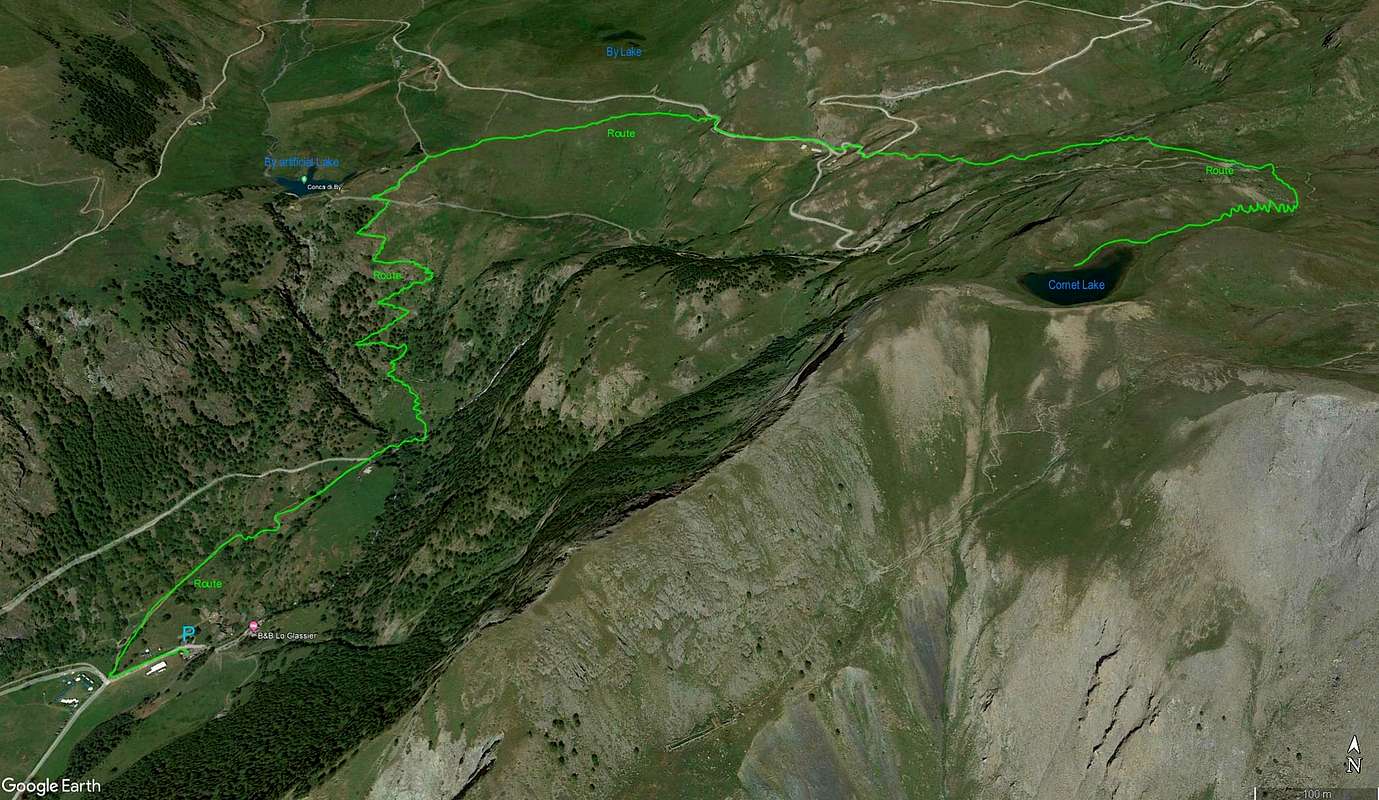
Route
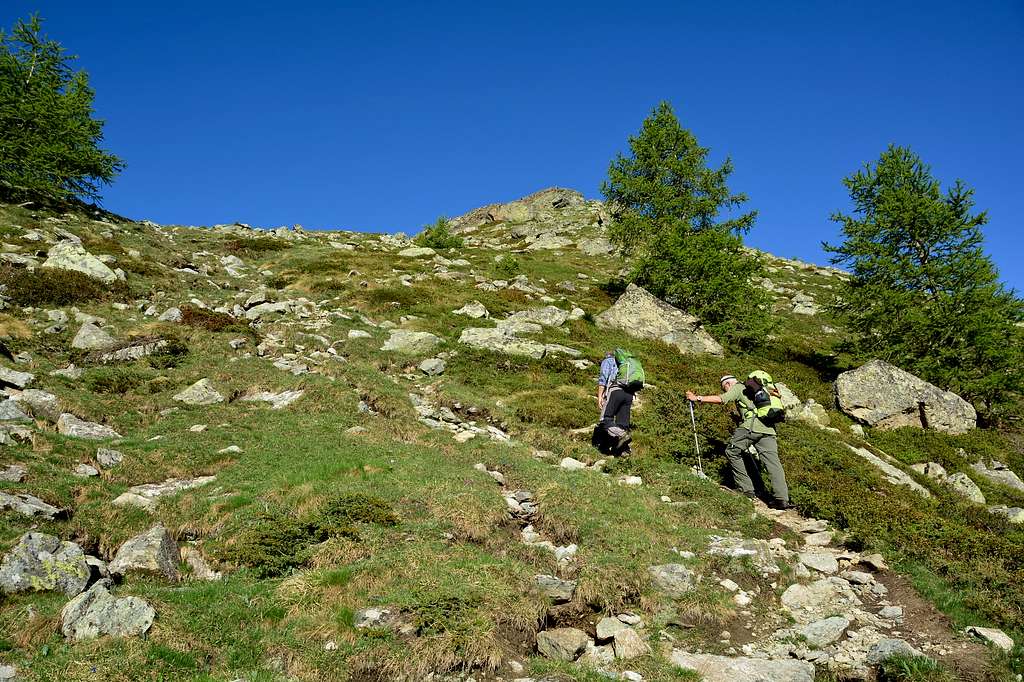
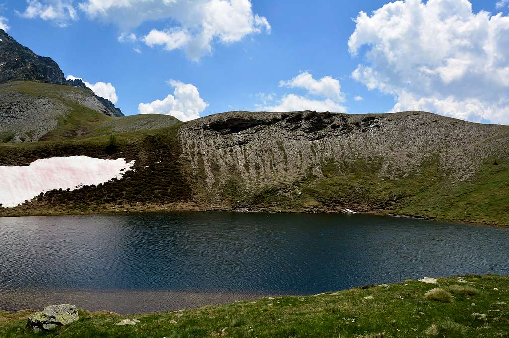
From the car park in front of the Glacier Village (1.562m) go back for about 100 meters and on the right, descending, take path n° 3 that leads to the artificial lake of By (1.987m) and to the Maison Farinet (about 2.000m). After passing a suspended aqueduct and a wooden bridge, go up along the path that becomes quite steep in the central part, after about 1h'00/1h'10 you reach a crossroads from here go up the path marked with the n° 5, continue for another 0h'05 about until you reach a new crossroads, continue on the right path and after a long, almost flat traverse, continue for about 300 meters on the farm road. After having passed the Balme de Bal mountain pasture (about 2.136m) and a new stretch of farm road, go up the path on the right bearing the n° 6 which leads to the Regondi bivouac, after having crossed a small wooden bridge (about 2.213m) and 0h'10 of walking, always continue on the path on the right ignoring the one on the left that leads to the bivouac and after about 0h'30 of steep path which then becomes flat you will be at the lake (2.334m), 2h'15'/2h'30 from the Glacier Village.
 |
Dal parcheggio antistante al Villaggio di Glacier (1.562 m) tornare indietro per circa 100 metri e sulla destra, scendendo, prendere il sentiero n° 3 che porta al Laghetto artificiale di By (1.987 m) e alla Maison Farinet (2.000 metri circa). Dopo aver oltrepassato un acquedotto sospeso e un ponte in legno salire lungo il sentiero che diviene abbastanza ripido nella parte centrale, dopo circa 1h’00/1h’10 si raggiunge un bivio da qui risalire il sentiero contrassegnato con il n° 5, proseguire per altri 0h’05 circa fino a incontrare un nuovo bivio, continuare sul sentiero di destra e dopo un lungo traverso, quasi pianeggiante, proseguire per 300 metri circa sulla strada poderale. Dopo aver oltrepassato l’Alpeggio Balme de Bal (2.136 metri circa) e un nuovo tratto di strada poderale risalire il sentiero sulla destra recante il n° 6 che porta al bivacco Regondi, dopo aver oltrepassato un piccolo ponte in legno (2.213 metri circa) e 0h’10 di cammino proseguire sempre sul sentiero di destra ignorando quello di sinistra che porta al bivacco e dopo circa 0h’30 di ripido sentiero che poi diventa pianeggiante sarete al lago (2.334 m), 2h’15’/2h’30 dal Villaggio di Glacier.
 |
 |
 |
 |
 |
 |
Difficulty
The route can be classified as E.
L'itinerario è classificato E.
Equipment
For Hikings.
Da Escursionismo.
 |
External Links
- REGIONE AUTONOMA VALLE D'AOSTA the official site.
- FONDAZIONE MONTAGNA SICURA Villa Cameron, località Villard de la Palud n° 1 Courmayeur (AO) Tel: 39 0165 897602 - Fax: 39 0165 897647.
- SOCIETA' DELLE GUIDE DELLA VALPELLINE Etroubles-Strada Nazionale, n° 13 - Tel +39 0165 78559 - Valpelline-Loc Capoluogo, n° 1 - Tel +39 0165 713502 (AO) Italia.
- A.I.NE.VA. (Associazione Interregionale Neve e Valanghe).
Useful numbers
- Protezione Civile Valdostana località Aeroporto n° 7/A Saint Christophe (Ao) Tel. 0165-238222.
- Bollettino Meteo (weather info) Tel. 0165-44113.
- Unità Operativa di Soccorso Sanitario Tel. 118.
 |