
-
 6465 Hits
-
 85.35% Score
-
 20 Votes
|
|
Mountain/Rock |
|---|---|
|
|
45.88359°N / 7.83448°E |
|
|
Valle d'Aosta |
|
|
Hiking, Scrambling |
|
|
Summer |
|
|
10450 ft / 3185 m |
|
|
Overview
Alta Luce/Hochlicht 3185 m
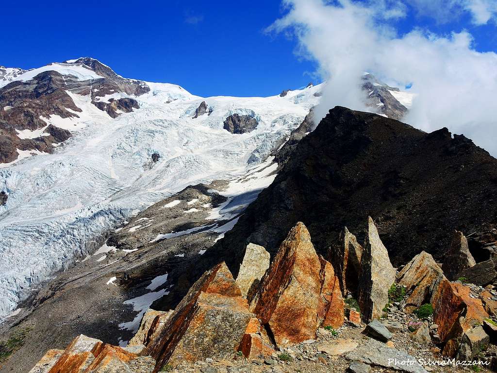
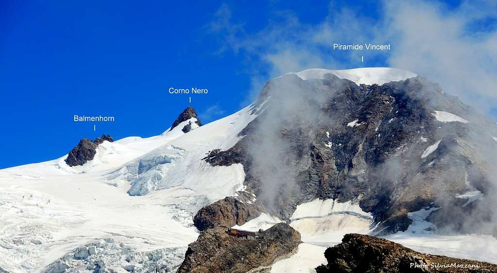
Alta Luce 3185 m is a mountain belonging to the Monte Rosa massif and exceeding the 3000 m of altitude. It stretches South-West of the Piramide Vincent, between the glaciers of the Lys and the Garstelet. Alta Luce is located in the upper Lys Valley and occupies an absolutely privileged position in front of the Monte Rosa group. It therefore offers an extraordinary panorama over most of the icy 4000 peaks of the massif, as Western and Eastern Lyskamm, Piramide Vincent, Corno Nero, Castore and Balmenhorn. Moreover the views of the serac falls of the surrounding glaciers are spectacular!
The interest in this summit is due not only to the exceptional panorama, but also to the interest and the accessibility of the itinerary that allows to reach the summit at over 3000 meters of altitude with a long walking but low difficulties.
Getting There
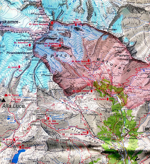
The starting point to climb Alta Luce is the village of Staffal 1825 m, located in the upper Gressoney valley, Valle d'Aosta.
Getting to Stafal (Valle di Gressoney)
From the A5 Motorway (Torino-Aosta-Monte Bianco) exit Pont St Martin and after passing through the town follow the signpost to Gressoney, taking the SR44 entering the Gressoney valley on the right. Drive up the valley, pass the village of Gressoney Saint Jean and then also Gressoney-La-Trinité to reach the village of Staffal 1850 m, a hamlet of Gressoney La Trinité about 4 kilometers away, where there is the cableway to the Monte Rosa massif (38 km from Point Saint Martin).
Info about the Staffal-Alpe Gabiet cable car: Funivie Monte Rosa
Normal Route from Alpe Gabiet
Summit quote: 3185 m
Difficulty: EE, F in presence of snow
Difference in level: 850 m from Alpe Gabiet
Starting point: Alpe Gabiet 2342 m
A fine itinerary. The summit of the Alta Luce is located in the presence of the parade of "4000" that dot the Italian-Swiss border, between the Castore and the Rosa massif, and represents its privileged point of observation.
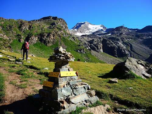
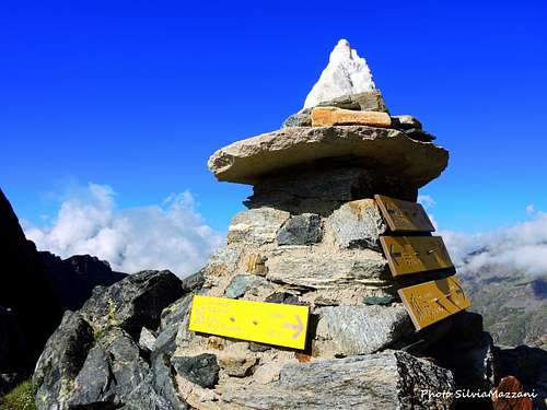
From the Alpe Gabiet (middle station of the Gabiet cable car 2342 m., achievable from Staffal) take the obvious dirt road that heads North-East along the cable car towards the Corno del Camoscio following the signposts to the Rifugio Mantova. Shortly after the start leave the dirt road and take the path to the left (trail signposted 6A), crossing the stream of the Mos valley on a wooden bridge and leading near the Alpe Lavetz 2453 m. Alternatively it is possible (less steep but longer) to continue on the dirt road until you cross a second road, on the left, near the Alpe Wisse 2500 m. Follow it to an artificial basin. After crossing the emissary head to the left to rejoin the path 6A. If you have choosen the first option for a while you walk beside the stream. Reached a vast grassy plateau, ignore the path to the Orestes Hütte on the right and continue on the main path. On the left cross the signposts to the Lago Verde and continue along a rocky spur, leaving Punta Telcio (Teltshô) to your left. At another fork leave the trail on the right, signposted 6A, to the ruins of the Linty Refuge and to the Mantova and Gnifetti Refuges, and keep the left. On steep stony ground climb up to reach Colle Salza 2917 m. On the col there is a big cairn with some signposts, here turn to right (signposts "Alta Luce").
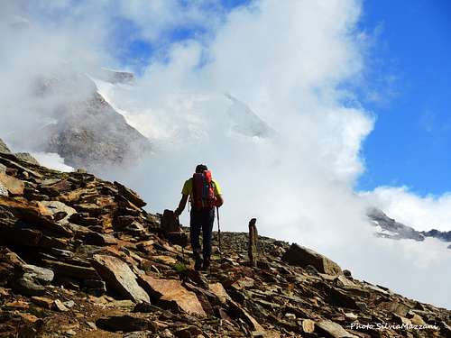
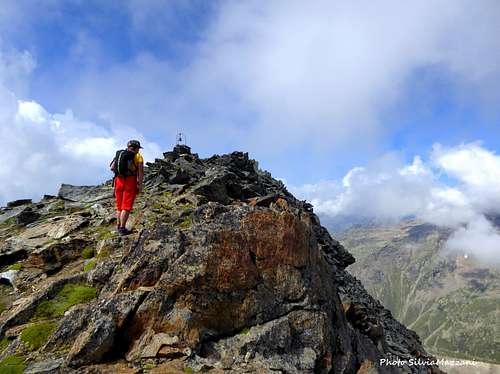
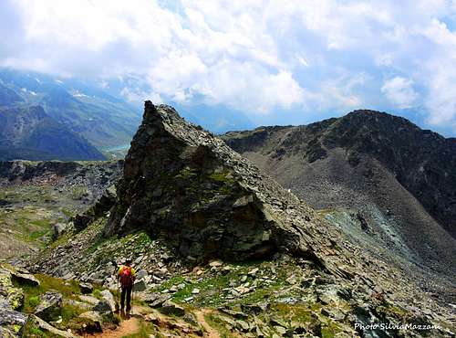
From the col the path (numbers 6b/7C) becomes steep and sometimes a bit exposed and continues to the right along the ridge with fine views towards the Gran Paradiso and the Grivola. Between steep stretches and narrow traverses the path reachs some reddish rocks and goes beyond a nice shelf with wonderful blooming. After a gully it begins a stretch on stony ground where to pay attention to the cairns. The path skirts now the ruins of the Bivacco Passera 3150 m, destroyed by a storm in 1983 and never rebuilt, from where the summit is very close. In fact a few meters further the trail reachs the summit ridge and the characteristic bell of Alta Luce at 3185 m. From the top the view is magnificent on the Lys glacier, on the Piramide Vincent, the Corno Nero, the small isle of Balmenhorn, on the two summits of Lyskamm and on the Castore to the West. To the east the panorama is completed by the Stolemberg, Corno del Camoscio and Corno Rosso.

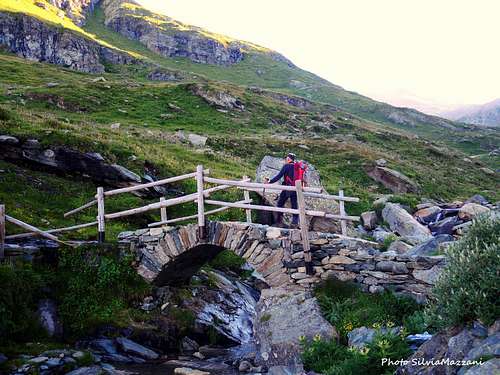
Descent: from the summit reverse the same route to Colle Salza. Here there are two options: to reverse the same route or alternatively (it is worthwhile) to complete the trip leaving the itinerary followed during the ascent and continue to the right in the steep Vallone di Salza. The starting stretch of the path is now very steep, dominated to the left by the North face of Punta Telcio. The route reachs Alpe Salza Inferiore 2321 m and then descends steeply (trail n.7), towards the orographic left of the valley, crossed by the Lys stream which descends with thundering waterfalls. Once you reach the Alpe Cortlys plateau 1991 m, always near the stream, you will soon reach the Staffal bridge.
Normal Route from Staffal
Summit quote: 3185 m
Difficulty: EE, F in presence of snow
Difference in level: 1360 m from Staffal
Starting point: Staffal 1825 m
Quite a worthwhile route, tiring but without technical difficulties! It starts from Staffal without the facilities of the cable car and therefore it involves a decidedly greater difference of level to get the summit compared to the previous route. On Colle Salza 2917 m it joins the route coming from Alpe Gabiet and climb up the summit as described above.
From the Staffal bridge go up a small road on the right of the stream (trail sign 7). After a moraine, the trail at a crossroads at 2155 m takes the right direction and becomes the trail marker 7c. Go up to the lower Alpe Salza 2321 m and after passing the alm continue uphill along a well marked path, reaching a grassy plateau to be crossed to go to the base of the short gully leading to Colle Salza 2917 m.
Here the route joins the itinerary coming from Alpe Gabiet and continues as descrived in the previous chapter (take the steep track on the left that goes up towards the North (yellow stamp with arrow and just above indication of 7C on rock).
Red Tape
No fees no permits required
When to Climb
Best season goes from June to the end of September
Huts along the route
Orestes Hütte
Accomodation
Different possibilities of accomodation in the Gressoney valley
Meteo
Guidebooks and maps

|
|
|
"Monte Rosa - Val d'Ayas e Valle di Gressoney" by Andrea Greci, Federico Rossetti - Idea Montagna ed. 2020
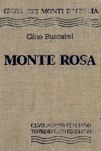
"Monte Rosa” by Gino Buscaini (Club Alpino Accademico Italiano) – Collana Guide dei Monti d'Italia CAI-TCI (Club Alpino Italiano-Touring Club Italiano)
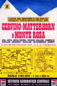
"Breuil/Cervinia-Zermatt" Kompass map 1:50.000 "Cervino-Matterhorn e Monte Rosa" n. 5 - Istituto Geografico Centrale map 1:50.000