
|
|
Route |
|---|---|
|
|
45.91735°N / 7.83162°E |
|
|
Mountaineering |
|
|
Spring, Summer |
|
|
Most of a day |
|
|
PD / PD+ |
|
|
II |
|
|
Overview
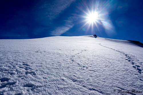
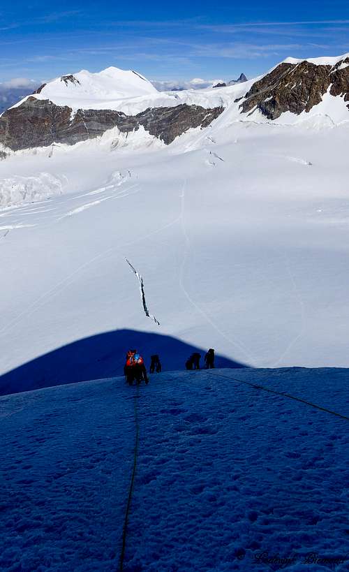
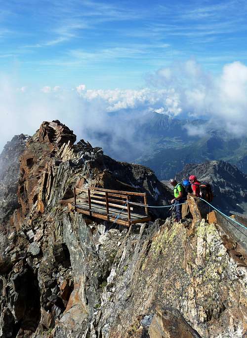
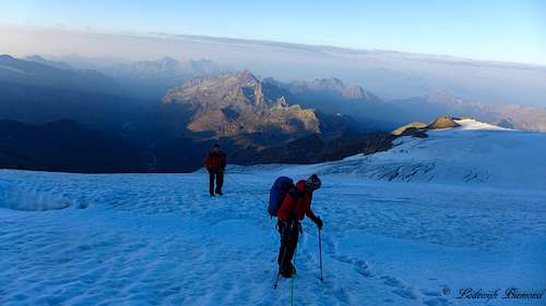 On the Felik Glacier at dawn | 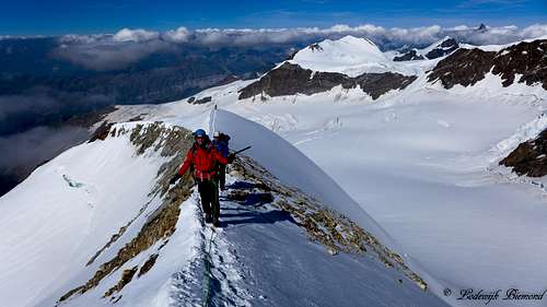 On the summit ridge |
Il Naso del Lyskamm (or Schneedomspitze) has 2 main routes up to its summit. The route along the East Face is considered the normal route on this mountain. This is probably because it is slightly easier compared to the other main route: The West Face, which is described here. The West Face route is graded PD+ and involves mainly snow and ice. The route starts from the Quintino Sella Mountain Hut and crosses both the Felik and Lys Glacier before reaching the base of Il Naso's West Face. The route along the west Face has an angle with a maximum of 45 degrees. If conditions are icy, this steepest part results in an increased difficulty of the climb (at least PD+). In good conditions the route is graded PD.
 On the summit Ridge | 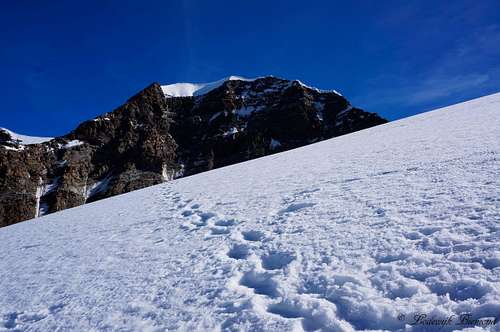 Lyskamm (14852 ft / 4527 m) South Face | 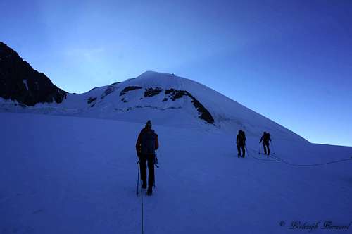 On the Lys glacier; heading to Il Naso |
The route along the West Face is climbed often. It is used as a way up as much as it is used as a way down since Il Naso is mostly traversed. Il Naso is part of the so called Spaghetti Tour where multiple Monte Rosa 4000 meter peaks are collected and therefore a popular objective. There is much debate about Il Naso being a real 4000 meter peak or not. For more information about this matter, see the main mountain page of Il Naso. The route along the West Face is a great outing, especally when combined with the East Face Route making it a traverse route. In my opinion this traverse is one of the more interesting easier routes on a 4000meter peak in the Monte Rosa Group. Last but not least Il Naso offers great views in all directions. For exemple: Almost all Monte Rosa 4000m peaks can be seen from the summit, as well as Castor, Mont Blanc, Gran Paradiso and even La Grande Casse and Monviso when the weather is good enough.
Difficulty: PD+
Rock: UIAA grade II
Time: Most of a day
 Getting close to the summit | 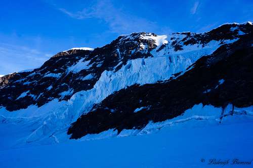 Crossing underneath Lyskamm's South Face | 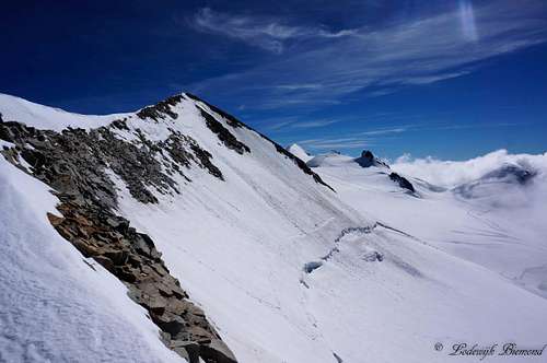 Il Naso as seen from the summit ridge |
Route Description: Sella Hut - Base of the W-Face
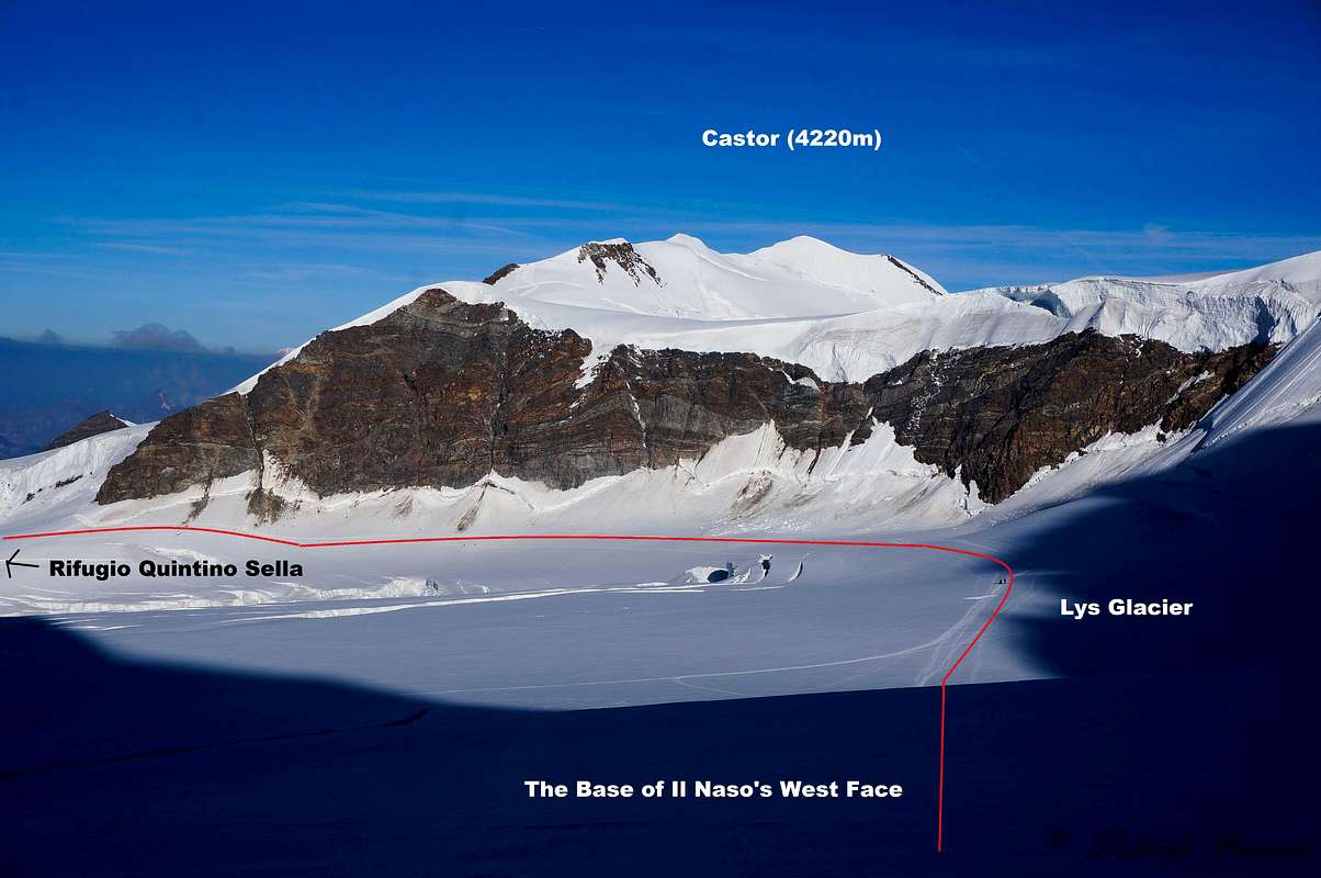
The route starts at the Rifugio Quintino Sella. Behind the hut, the Felik glacier is situated. Enter the Glacier and follow it to towards the north until you reach the Lys Glacier located south of the mighty Lyskamm. You cross the Lys glacier in an eastern direction with Lyskamm’s south face looming above you at all time. This part is not steep and a pure glacier walk with a gradually increasing altitude. Do watch out for crevasses though, the entire route is filled with them. After more or less an hour you will reach the base of Il naso del Lyskamm's West Face.
Route Description: West Face

At this point the climb starts along the West Face. The slope is about 40 to 45°. Depending on the conditions you can choose to climb along the rock band (UIAA II) or climb along the (snow/ice covered) face itself. Even if you choose to climb along the rock band, above it still is a steep part to overcome (snow/ice 45 degrees).
After climbing this section the route gradually becomes less steep and eventually you will reach the Passo del Naso. From here, the route goes to the left along a short slope to reach the snowy ridge, and subsequently climbs up to the right on an easy mixed ridge to reach the summit at 4,272 meters.
 Climbing on the West Face | 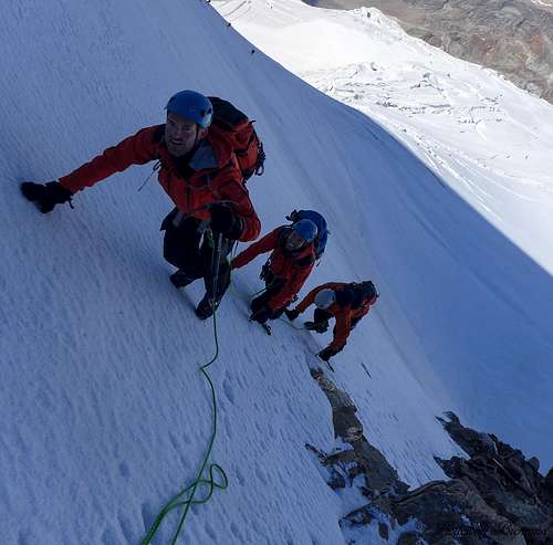 Climbing on the steepest part of the West Face | 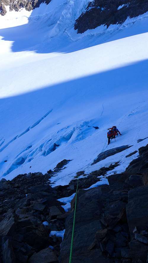 Approaching the Rock section |
The path of descent is the same as described above. Another option is to cross Il Naso and go down in the direction of the Gnifetti Refuge. From passo del Naso descent along the snowy east face of Il Naso until you reach the Lys Glacier. Note: When conditions are icy, most people choose to climb down along the rocks just south of the normal, direct route down towards the Lys glacier. Watch out for loose stones here. Taking this rocky section will also lead to the Lys glacier and joins the other route again on the glacier. From here it’s a glacier walk down to the Gnifetti Hut. This part of the route is described in more detail on the SP Route page.
![]()
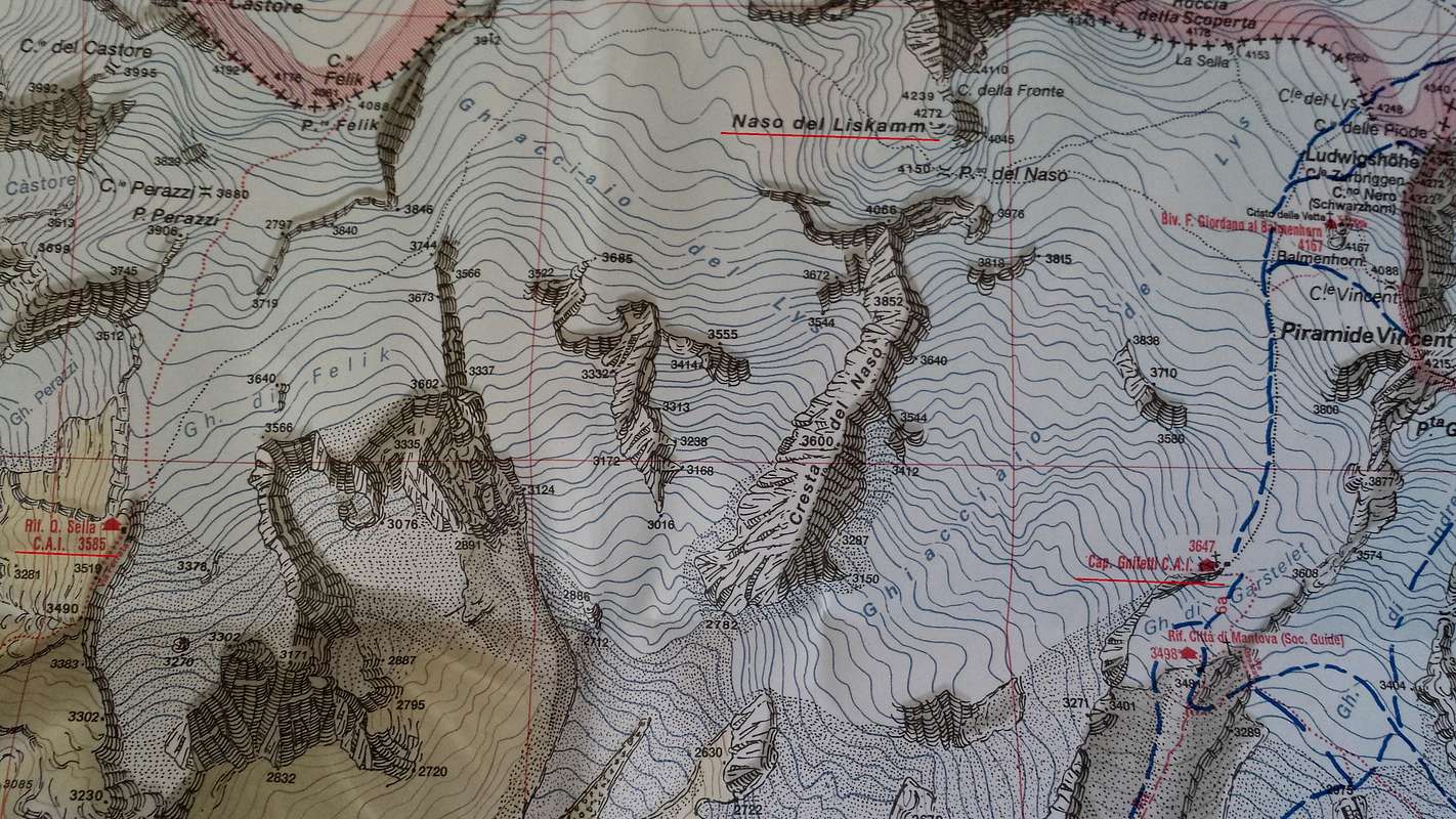
![Monte Rosa IGC Map 1:25.000]()
Route Map
Climbing Equipment
Full glacial equipment is needed: A rope, crampons and ice axe.
Furthermore wear warm (breathable) clothing since you are at high altitude.
If you are traversing Il Naso an ice screw is needed as well for climbing down the West Face
Weather
Approach Route
 Access to Quintino Sella hut by p-mike | 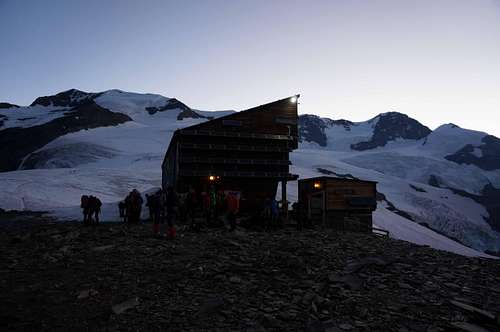 Rifugio Quintino Sella at dawn |
Starting from Gressoney-La-Trinité, continue for about 4 km to reach Stafal, where the paved road ends. The lift to Colle Bettafora, at an altitude of 2680m, departs here. At the ending of the lifts path number 9, indicated by a yellow marker, starts. The first section of the trail, until Colle Bettolina at 3100m, is easy. From the beginning of the season until the end of July this path is usually covered with snow, but due to the amount of hikers, the path is usually well visible. The last section consists of an open ridge (30-40 minutes), there are fixed ropes present though, making this section relatively asy as well. Total time to reach the refuge is about 3 to 4 hours in total.
For more information about getting to the Quintino Sella Refuge see the SP page of the Hut (link below).
Rifugio Quintino Sella:
Elevation: 11762 ft / 3585 m
Telephone: +39 0125 366113 / Mob. +39 348 8107793
SP Page: Click HERE
Official site: www.rifugioquintinosella.com
Maps
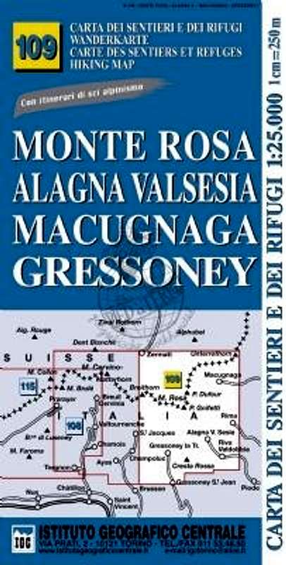
Monte Rosa-Alagna-Valsesia-Macugnagna-Gressoney
No. 109
Instituto Geografico Centrale (IGC)
1:25.000
One of the few 1:25.000 maps that covers the whole Monte Rosa Massif.
External Links
Il Naso on CamptoCamp: Click Here