
|
|
Mountain/Rock |
|---|---|
|
|
32.19563°N / 110.6313°W |
|
|
Pima |
|
|
Mountaineering |
|
|
Spring, Fall |
|
|
7049 ft / 2149 m |
|
|
Overview
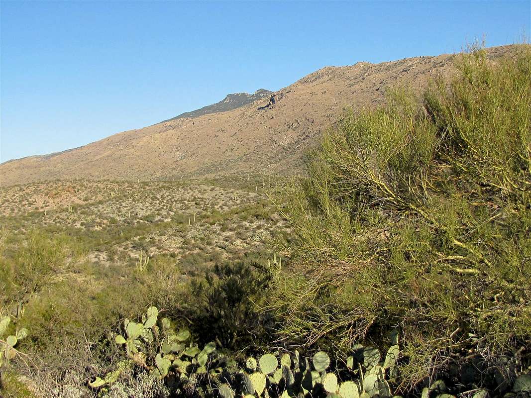
West face of Tanque Verde Peak
Tanque Verde is a long ridgeline that rises in the eastern district of Saguaro National Park. The ridgeline starts just to the east of the city of Tucson, AZ at an elevation of 3100 ft. As it heads east, the ridgeline slowly goes up in elevation to reach a 7049 ft high point known as Tanque Verde Peak. Beyond the high point, the ridgeline drops to the 6100 ft Cow Head Saddle which separates Tanque Verde Peak from Mica Mountain.
Tanque Verde Peak is usually climbed via Tanque Verde Trail, a well-established trail that starts near the city of Tucson and follows the ridge-top to Tanque Verde Peak and Cow Head Saddle where it intersects other local trails. A hike to the summit of Tanque Verde Peak requires an 18 mile roundtrip with 4000 ft of net elevation gain. The hike starts in a Sonoran Desert Cactus Forest. At higher elevations, the environment changes to grassland with scattered small trees. A forest of Juniper trees covers the highest slopes of the ridgeline. The trail provides the hiker with magnificent views of the city of Tucson and its nearby mountains.
The summit of Tanque Verde Peak is made of a large boulder that requires class III climbing. The views from the top of the boulder are superb (but very limited from the base of the boulder).
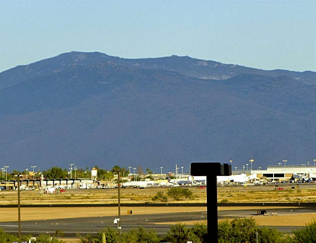 Tanque Verde Peak from near Tucson Airport | (There are officially 6 biotic communities on Tanque Verde Trail. These include: 1) Desert Scrub, 2) Desert Grassland, 3) Chaparral, 4) Oak Woodland, 5) Pine-Oak Woodland, 6) Pine Forest) |
Getting There
The eastern district of Saguaro National Park is accessed via Old Spanish Road in eastern Tucson. Once on the park road, make a right turn at the first and then the second intersections to reach the Tanque Verde Trailhead.Route
Note About Elevation Gain: On its way to Tanque Verde Peak, the trail does a fair amount of ups and downs. A look at the USGS Map reveals that the trail adds roughly 400 ft of vertical on the way up (and another 400 ft on the way back). This means that the hike to the top of Tanque Verde Peak requires an 18 mile roundtrip hike with 4750 ft of vertical gain.The trail is generally easy to follow. In some places, however, you will have to look for cairns.
Lower Trail (3100-4500 ft):
Below 4500 ft, you find yourself in a Cactus Forest. The highest Saguaro Cactus that I saw sat at an elevation of 4900 ft. In this part, the trail goes up the slopes steadily.
 | |
 |  |
 |  |
 | |
Views of Tucson and Nearby Mountains from the Trail:
 Santa Catalina Mountains | ||
 Wasson Peak & Tucson |  Santa Rita Mountains |  Santa Catalina Mountains |
 Santa Catalina Mountains | ||
Mid Trail (4500-6000 ft):
Although some of the smaller cacti can be found all the way to the top of the ridgeline, most Giant Saguaros go away at an elevation of 4500 ft. The environment changes to grassland with scattered trees. As you go higher, the trees become more abundant. Most of the trail’s ups and downs happen in this section. In some places (over slickrock or overgrown areas) you must look for cairns to find the trail.
 | |
 |  |
 |  |
 | |
Upper Trail (6000-7049 ft):
At 6000 ft, you will reach Juniper Basin where there is a designated camp site (see Red Tape section). You will find yourself surrounded by a forest. The trail goes flat for some time before it begins the final ascent to the summit.
 |  |
Summit:
As you near the Tanque Verde Peak, the summit of the peak finally comes to view.
 Summit |  Summit |
Summit Boulder:
Near the top of the Tanque Verde Peak, a sign guides you to a spur trail that goes to the base of the summit boulder (the main trail goes downhill to reach Cow Head Saddle). At the base of the boulder, you will have limited views. The boulder is probably less than 2 stories tall. You must do Class III climbing to reach its top.
 Summit Boulder |
Views From the Top of the Tanque Verde Peak:
 The city of Tucson & Wasson Peak | |
 Santa Catalina Mountains |  Mica Mountain |
Red Tape & Camping
You must pay park entrance fee. Camping is allowed in Juniper Basin but requires a permit.For all rules and regulations, see the site for Saguro National Park.
 |
Weather Forecast & When to Climb
See the forecast for the nearby city of Tucson.Fall and spring are the best time to climb. Summer can become extremely hot.
External Links
http://protrails.com/trail.php?trailID=140.http://hikearizona.com/decoder.php?ZTN=240.