Overview
![The view of Križevski vrh from north]() Križevski vrh
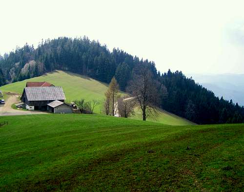
Križevski vrh![On Pohorje, near Marolt farm]() Pohorje, near Marolt farm
Pohorje, near Marolt farm (in German it is called
Bachergebirge,
Bacherngebirge or
Bachern) is a mountain range of medium height in the northern part of Slovenia. It is in the triangle formed by the cities Maribor (in east), Dravograd (in west) and Slovenske Konjice (in south). Its physical geographical borders are the river Drava on north, the small river Mislinja on south-west in the Lavanttal/Labot fault and the plain called Dravsko Polje (or Ptujsko Polje) on east.
Its length in west-east direction is approximately 50 km, while its maximal north-south width is 30 km. Its total area is approximately 1000 square km.
The ridges of the mountain range forms the watershed of the Drava and Sava rivers. Drava is on the north side and Sava is on the south side.
The highest peak of Pohorje is called
Črni vrh – 1543 m. The prominence of the mountain range is relatively big because the saddle linking it to the range with higher peaks on the west is a bit less than 600 m a.s.l. It means that the prominence of the mountain range is 945 m by its highest summit.
The mountain range plays an imporatant role in Slovenian winter tourism. Besides the FIS Women’s Alpine Ski World Cup it gives a wide range of skiing possibilities as well as good hiking possibilities in summer and in winter.
Besides other trails, the European Long Distance Walking Path E6 crosses Pohorje, too. This trail is part of the Baltic-Adriatic Path. It goes from the north to the south of Slovenia, with its highest scent to the
Snežnik mountain (1796). It crosses the Pohorje mountains, the Posavje hills and the lonely hills of the Slovenian Dinaric world until it temporarily ends on the shore of Adriatic, to continue far away in Greece. Hiking duration: aproximitly 20 days; length: 350 km; difficulty rating: easy to middle difficulty. Start in Slovenia: Radelj border crossing, finish in Slovenia: Strunjan.
Unfortunately the trails are not very well marked: even with a map it’s easy to miss your way – unless you know well the area.
Where does Pohorje belong to?
I found 3 different potential answers:
1) Belongs to
Koralpe as its building material is similar, and geographically they are nearby. I haven't seen this relationship stated in any source, it's just my idea
2) According to
SOIUSA (an Italian classification of the Alps) it belongs to the Slovenian Pre-Alps that consists of
- Škofjeloško-Cerkljansko-Polhograjsko-Rovtarsko mountains
- Posavje mountains
- Pohorje
- Mountains of Vitanje e Konjice
3) According to the
classification of Alps shown also on the SP page "
Mountains east of the Mur" Pohorje belongs to the group of Karawanken. Topographically it looks to be a correct approach, though Karawanken and Pohorje are extremely far from each other in their character.
Sharing a common agreement with
Vid I linked Pohorje to the
Lavanttal Alps (Option 1 - Koralpe belongs to the Lavanttal Alps, too)
Summits of Pohorje
Western Part
Velika Kopa![Ärni vrh, 1543 m. Highpoint of Pohorje.]() Črni vrh, 1543 m
Črni vrh, 1543 m
Velika Kopa – together with its subpeak called Mala Kopa – is the westernmost summit of Pohorje exceeding 1500 m. Velika Kopa is the second highest peak of the mountain range. It is 1541 m high, meaning that it’s only 2 meter lower than the highest summit, Črni vrh. Velika Kopa can be translated as ‘High Hill’. This is perhaps the only summit of Pohorje that can be considered as a peak. All other summits of the mountain range are to round shaped - almost flat.
Črni vrh![The east slope of Jezerski vrh]() The east slope of Jezerski vrh
The east slope of Jezerski vrh
Črni vrh is the highest summit of Pohorje, with 1543 m. Črni vrh means ‘black summit’. In German it is called Schwarzkogel. It means black summit, too. This summit doesn’t have a shape of peak. Like the other summits of Pohorje, its shape is more like a dome. The hilltop is mainly a grassy area, though there are trees east to the highpoint, preventing the view in that direction. There is a monument on the summit, erected in 1991. There is also and a metal box with a log book and stamp in it.
Jezerski vrh
Jezerski vrh is the 3rd highest summit of Pohorje. The name Jezerski vrh derives from the fact that there is a lake nearby. “Jezero” in Slovenian means lake. So Jezerski vrh can be translated as ‘Lake Summit’. Jezerski vrh is east to the highest summit of Pohorje (Črni vrh) – in 2.5 km distance. Its altitude is 1537 m, only 6 meter lower than Črni vrh. There is a National Liberation Fight (NOB) memorial on the summit, erected in 1961. The real attraction of Jezerski vrh is the lake nearby the summit. The lake has two peculiarities:
1) It’s "almost" on the summit of Jezerski vrh. Only in 60 meter lower position. It’s not usual to have a lake almost on the top of hills. This is possible here because of the character of Pohorje: relatively flat summits and flat mountain ridge. And the rock of Jezerski vrh doesn’t absorbs water. The result is a marshy area nerby the summit with a lake in the middle
2) There is Mugo pine around the lake. Mugo pine is not usual in Pohorje, the only other place where it grows is around the Lovrenška lakes. Mugo pine normally doesn’t grow in the Alps below 1650 m. This is an exception with the altitude of 1490 m.
Central Part
Mulejev vrh![The outlook tower at Lovrenska Jezera]() The outlook tower at Lovrenska Jezera
The outlook tower at Lovrenska Jezera
Though Rogla is the famous summit of the central part of Pohorje, Mulejev vrh is higher: 1533 m. It is the 4th highest summit of Pohorje. There is an outlook tower here. Similarly to Jezerski vrh, here there is a nearby marshy lake almost on the same level as the summit, in 2.5 km distance to north. Here there is Mungo pine around the lake, too.
Rogla
Rogla is the best-known summit of Pohorje. Not because of its outstanding natural beauty or because of its altitude (1517 m) but because of many other circumstances:
- It is in the very centre of the mountain range
- Perfect destination for lazy tourists: the only south-north road crossing Pohorje is here
- A well-known radio station is here
- The biggest ski resort of Pohorje is here with many hotels and restaurants
- Many marked tourist paths meet here
Eastern part
Žigartov vrh![Autumn forest in low clouds]() Autumn forest of Žigartov vrh
Autumn forest of Žigartov vrh
Žigartov vrh is the highpoint of the eastern part of Pohorje with its 1348 m altitude. There is a high tower construction on the summit. It was built for geodesy purposes. The summit of Žigartov vrh itself is not so much interesting. But 2.5 kn east to it there is the old church Sv. Areh as well as the mountain hut Ruška koča pri Arehu. And 4-5 km west to the summit, at the foot of Žigartov vrh, you can find the valley of Lobnica that provides perhaps the most concentrated natural beauty in the whole mountain range.
Ledinekov kogel
It’s only a 1182 m high summit. Not the summit itslef is interesting for the tourists but its location: it’s only in 7 km distance from Maribor. Tourist infrastructure is well developed around Ledinekov kogel: there are two mountain huts – Andrejev dom and Mariborska koča, many hotels and restaurants, the famous old church Sv. Bolfenk, and the beautiful Fram waterfall.
Waterfalls of Pohorje
On Pohorje you can enjoy in the beauty of few wonderful waterfalls.
![Fram waterfall]() Fram waterfall
Fram waterfall
Among all of them, the most impressive and beautiful is powerfull and 36m high
Šumik (Shumik) waterfall, placed deep in the forest of Pohorje. Here you can come by asphalt road from Maribor town via Hoče village, in Areh direction, following the marks of Šumik. From parking place the marked path continue through the forest to Šumik waterfall (about 30-45 minutes by walk).
Also, on the same way from Hoče village to Areh you can notice the marks for
Skalce waterfall. In comparasion with Šumik, Skalce is not so powerful, but is still very beautiful.
Climbing
There are crags for climbing near Slovenska Bistrica:
Buncove Skale from 4a+ to 7b and
Gromberg from 5b to 7b+.
Geology
![Rare granite rocks in the valley of Bistrica]() Rare granite rocks in the valley of Bistrica
Rare granite rocks in the valley of BistricaPohorje belongs to the eastern part of the Alps. Geologically it has a link to the mountain ranges of Koralpe and Saualpe that are northwest to Pohorje, in Styria province of Austria. The central part of Pohorje is formed of Tonalite (an igneous plutonic rock) and Dacite (igneous, volcanic rock intermediate in compositions between andesite and rhyolite). At the perimeters the most typical rock is metmorphic crystallic Gneiss. In the southeastern part there is an area covered by Triassic–age limestone. Mineralogists also note an area formed of special kind of Quartz-Diorite called Cizlakite, a hard, greenish-greyish rock.
![Geological map of Pohorje]() Geological map of Pohorje
Geological map of PohorjeThis is the present look of the Pohorje. But what is its geo-history?
Though there are some older rocks forming the mountain range, still it is an extremely young formation from geological point of view. Its elevation started approximately 16 million years ago, east to the
Lavanttal/Labot fault. The dome-shaped elevation included not only the present-day Pohorje-range but the mountain range Kozjak north to it. Today Pohorje and Kozjak are separated by the Drava river. It’s interesting that in the old times Drava has cut over the mountain range 3 km south to its present valley. Looking carefully to the topographic maps, the old valley of Drava can be well seen yet. The change of the valley happened around 5 million years ago. It means that the elevation processes of the mountain range was still intensive at this time, forcing the river to abandon its elevating old valley and to cut a new valley farther from the central part of the elevating dome of the new mountain range.
The relatively high precipitation combined with „water-proofing” soil and rocks explains the big number of sources and small streams. It’s said that altogether the most dense network of streams is here in Pohorje. The most famous waterfall in Pohorje is
Veliki Šumik. Nearby this waterfall you can find the last untouched primary forest of Pohorje.
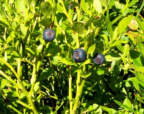
Flora & Fauna
![Large Ringlets (Erebia euryale)]() Large Ringlets (Erebia euryale)
Large Ringlets (Erebia euryale) ![White Waterlily (Nymphaea alba)]() White Waterlily (Nymphaea alba)
White Waterlily (Nymphaea alba)The central and highest parts of Pohorje are flat or almost flat highlands. These highlands are marshy areas with some peculiar ponds there with special flora around. Though there are also some meadows on these highlands, the big majority of the mountain range is covered with dense spruce forest. Scots pine is also usual at lower places, as well as chestnut on warmer slopes. And of course many other kind of trees, too, including silver fir
(Abies Alba) and Swiss pine
(Pinus cembra). There are 11 nature reserve areas in Pohorje.
Typical indicators of silicate-based rocks are alpenroses
(Rhododendron ferrugineum) as well as wolf’s bane
(Arnica montana) and the relatively rare brown gentian
(Gentiana pannonica).
On the flat highlands there are bogs – wetlands with acidic peat – with Mugo pine
(Pinus mugo) and common sundew
(Drosera rotundifolia). Also on higher regions there is a kind of cat's ear flower
(Hypochoeris uniflora) and crocus
(Crocus neapolitanus).
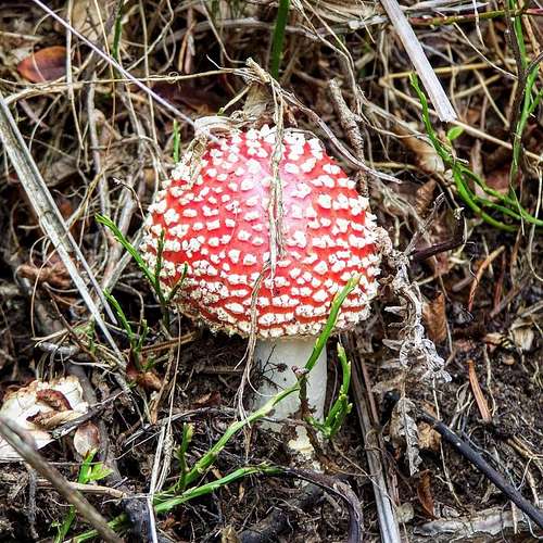
The forests are rich in mushrooms. Pohorje is a good place to find Hygrophorus marzuolus. In the southwestern and southern leafy broad-leaved forests there is Boletus regius as well as Caesar's Mushroom
(Amanita caesarea).
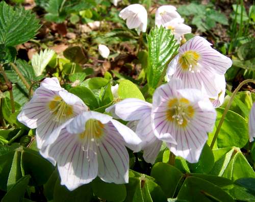
The lower slopes are rich in flowers usual in Central-Europe like wood anemone
(Anemone nemorosa), Corydalis solida, golden saxifrage
(Chrysosplenium alternifolium), common wood sorrel
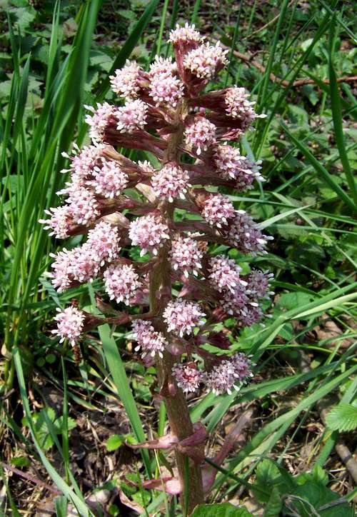
(Oxalis acetosella), Petasites albus, Common Butterbur
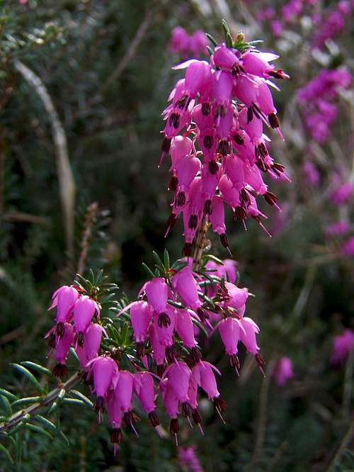
(Petasites hybridus), heath
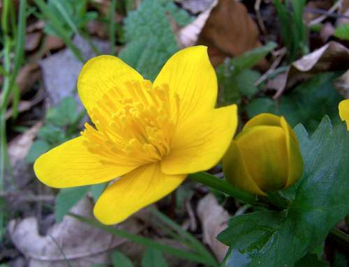
(Erica carnea), kingcup
(Caltha palustris), primrose
(Primula vulgaris), oxlip
(Primula elatior) and many others.
Fauna of Pohorje is rich, too. Lynx, grey wolves, brown bears live here. The population of brown bears is not stable – it’s more a link of the population of
Karawanke.
Red deer, roe deer and rupicapra are intensively hented in order to avoid their overpopulation. Wildcats and otters live only on certain areas of Pohorje.
Pohorje is also rich in birds. Some examples: wood grouse, black grouse, white-throated dipper, Ural owl, besides other bird species live in the forests of this mountain range.
Pohorje is specifically rich in butterflies and moths. There are more than 700 species have been identified. Among them the rare Plebius optilete and Leuctra istenicae. The largest moth of Europe, the Giant Peacock Moth
(Saturnia pyri) lives here, too.
History and Population
![The St Leonard church in Mislinja]() The St Leonard church in Mislinja
The St Leonard church in Mislinja![Sv. Bolfenk]() Sv. Bolfenk
Sv. Bolfenk![Sv. Areh]() Sv. Areh
Sv. ArehIn the Roman times the mountain range belonged to Noricum province. Very likely the mountain range was not inhabited, though people lived in the valleys and plains as there is evidence for it for example by the ruins of a villa rustica in Maribor. The nearest major roman city was Poetovio
(Ptuj), 20 km east to Pohorje.
Slavs (Slovens) settled on the area around 600. At the end of the 8th century the Frank empire conquered this land, and influx of Bavarians and other German tribes started. The area was part of the Styria, and Styria was for most time governed by rulers with Austrian origin. And from 1276 it was possessed by the Habsburgs. Despite the Austrian rule and the German migration lasting for more than 1000 years, only the northern 2/3 of Styria became germanized, belonging to Austria today. The southern 1/3 was given to Yugoslavia after WWI. On this southern 1/3 of Styria the majority of the population was always Sloven, though of course with German minority. Like for example Windischgrätz
(Slovenj Gradec) and Marburg
(Maribor) with 5 villages around were inhabited mainly by Germans before WWI. Yugoslavia doesn’t exist any more: this land belongs to Slovenia now.
Please see a few geographical names in German language from the area of Pohorje:
Mountains, saddles and rivers:
Pohorje /
Bachergebirge
Črni vrh /
Schwarzkogel
Velika Kopa /
Welka Kappa
Hlebov vrh /
Hlebkogel
Preval Šiklarica /
Reifnigger Sattel
Drava /
Drau
Mislinja /
Mißling
Dravinja /
Drann
Oplotnica /
Oplotnitz
Reka /
Reckerbach
Vuhreščica /
Wuchernerbach
Velka /
Wölkabach
Josipdol /
Josefsthal
Cities
Bistrica /
Feistritz
Fram /
Frauheim
Gornji Dolič /
Oberdollitsch
Limbuš /
Lembach b.Marburg
Lovrenc na Pohorju /
St. Lorenzen am Bachern
Maribor /
Marburg
Mislinja /
Missling
Morje /
Mauerbach in Steiermark
Pekre /
Pickerndorf
Radizel /
Radisell
Razvanje /
Roßwein in Steiermark
Šentilj pod Turjakom /
Sankt Ilgen
Slovenj Gradec /
Windischgrätz
Slovenska Bistrica /
Windisch-Feistritz
Slovenske Konjice /
Gonobitz
Spodnje Hoče /
Unterkötsch
Stranice /
Rabensberg in Steiermark
Vitanje /
Weitenstein
Vuhred /
Wuchern
Vuzenica /
Saldenhofen
Zgornja Polskava /
Ober-Pulsgau
Zgornje Hoče /
Oberkötsch
Zreče /
Rötschach
Pohorje is still scarcely populated. The few vilages are at the foot of the mountains, in the valleys of the mountain. The only major village in the mountain range is Lovrenc na Pohorju. The more densly populated areas are in the big valleys and plains around, like in the valley of Drava, in the valley of Mislinja and on the plain called Ptujsko Polje. On the warm southern slopes there were several self-sufficient hamlets, but nowadays a part of them is already abandoned.
In old times charcoal-burning activity was part of the economy, providing energy for glass manufactures. There is no charcoal-burning now, but instead of that money can be made from tourism.
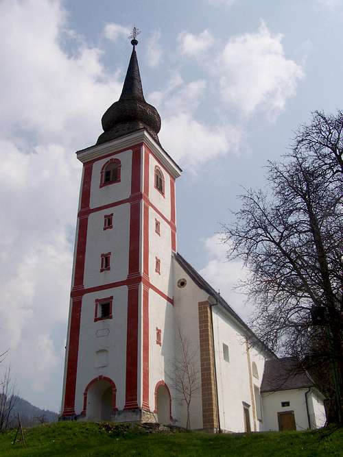
Historic buildings
There are only a few historic buildings in the inner parts of Pohorje due to the scarce popoluation there. Worth to mention two churches:
- Sveti Bolfenk
(St. Wolfgang) church. It was built in 1585 in gothic style.
- Sveti Areh church. It was built at the end of the 15th century
Around Pohorje, at the foot of the hills there are much more historic buildings. I would list here only a few of them:
- Sv. Duh church in Slovenj Gradec. It was built in 1450, in gothic style, with famous frescoes
- Device Marije church in Puščava, near the village Lovrenc na Pohorju. It was built in 1627, in late renaissance-early baroque style
- St. Leonard church in Mislinja. A baroque building with late renaissance style elements, from the 17th century
- Castle of Slovenska Bistrica. The castle was already mentioned in 1311. It was rebuilt between 1623-1651
- Castle ruin of Vuzenica from the 13th century
- Castle of Fala. The first written source of the Fala
(Domus Volmars) is from 1245. There was a monastery here playing the role of an important cultural centre of the region. In 1620 faculty philosophy, theology and economy of Vienna University have been founded here. Now the fortified monastery is abandoned.
Accomodation
![Ribniška koča mountain hut]() Ribniška Koča
Ribniška Koča- Camping Center Kekec, Maribor
- Campsite Menina, Rečica ob Savinji
- Campsite Park, Prebold
Mountain Huts:
Ribniška Koča
On 1507 m. Opened in whole year. Phone: 0602/68246 (from 1996)
Photos:
here.
Grmovškov dom
![RuÅ¡ka koÄa]() Ruška koča
Ruška koča
On 1377 m. Number of beds in rooms: 68.
Phone: 02 8839860 and 031 680547; e-mail: lenka.jeromel@kope.si
Web page in Slovenian
here
Koča Planinc, Primož na Pohorju
On 1010 m. Number of beds: 20
Phone number:
+386 (0)40 39808040 398080")
Koča pod Kremžarjevim vrhom
On 1102 m. Number of beds in rooms: 26
Number of beds in shared rooms: 22Phone number:
+386 (0)2 8844035 ;
+386 (0)41 882035
Planinska koča na Pesniku
On 1101 m. Number of beds in rooms: 6. Number of beds in shared rooms: 10
Phone number:
+386 (0)2 8768500 ;
+386 (0)41 523990
Dom na Pesku
On 1385 m
Address: Cesta na Roglo 15, SI-3214, Zreče
Contact: UNIOR d.d. program TURIZEM, Phone: (03) 757 71 67, Fax: (03) 576 24 46
Ruška Koča pri Arehu
On 1246 m
Address: Ruška Koča pri Arehu, Frajhajm 42, 2208 Pohorje
Contact: Milan Klančnik, Phone:
+386-2-603 50 46, Fax:
+386-2-603 50 47, Mobile:
+386-41-666 552, E-mail: milan.klancnik@siol.net
Mariborska Koča Pohorje
On 1068 m
Address: Slivniško Pohorje 24, , 2208 Pohorje
Phone: (02) 603-27-31
Andrejev dom / Pajkov dom
On 1110 m
Address: Slivniško Pohorje 24a , 2208 Pohorje
Phone (02) 603-24-41
Literature
- Paul Schlosser: Der Sagenkreis der Poštela, Ein Blick ins Bachernreich, Marburg 1912.
![Forest on Sedovec]() Forest on Sedovec
Forest on Sedovec
- Paul Schlosser: Bachern-Sagen, Volksüberlieferungen aus der alten Untersteiermark, Wien 1956
- Helmuth Sölva, Kurt Stüve, Phillip Strauss: The Drava River and the
Pohorje Mountain Range (Slovenia): Geomorphological Interactions, 2004
Map for mountain bikers
here


 11441 Hits
 87.31% Score
 24 Votes
 Križevski vrh
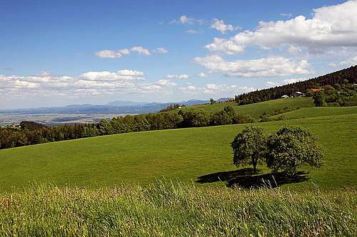 Pohorje, near Marolt farm
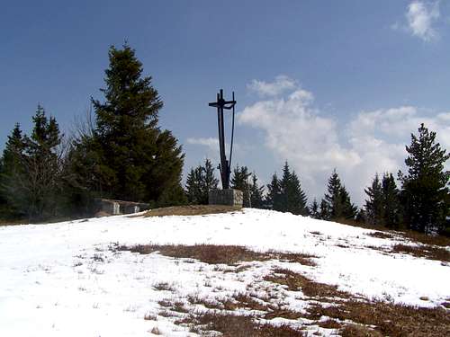 Črni vrh, 1543 m
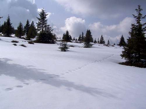 The east slope of Jezerski vrh
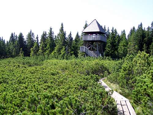 The outlook tower at Lovrenska Jezera
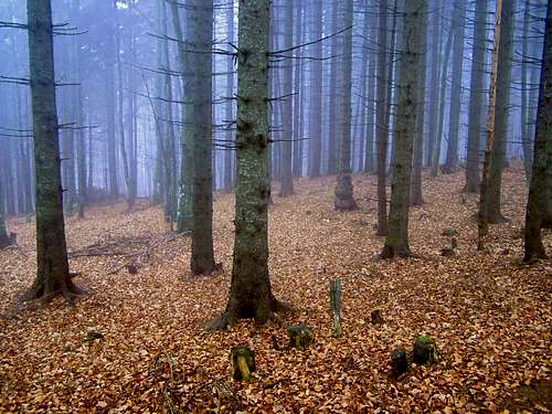 Autumn forest of Žigartov vrh
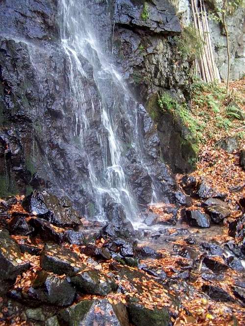 Fram waterfall
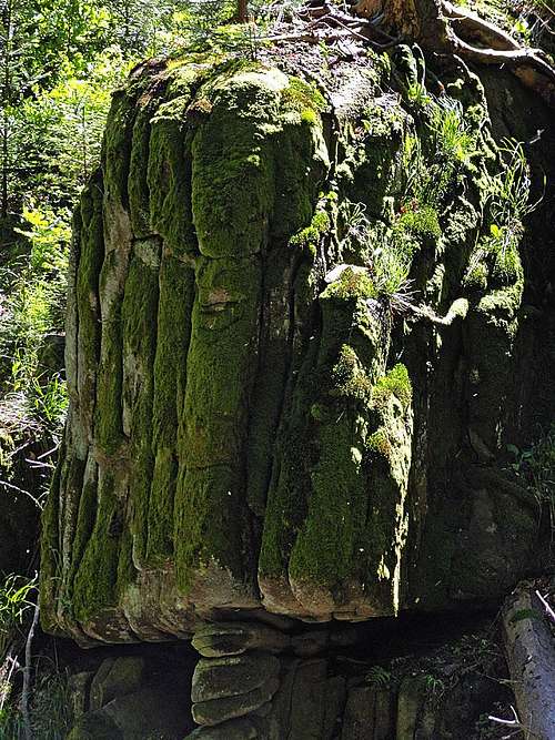 Rare granite rocks in the valley of Bistrica
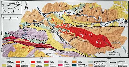 Geological map of Pohorje
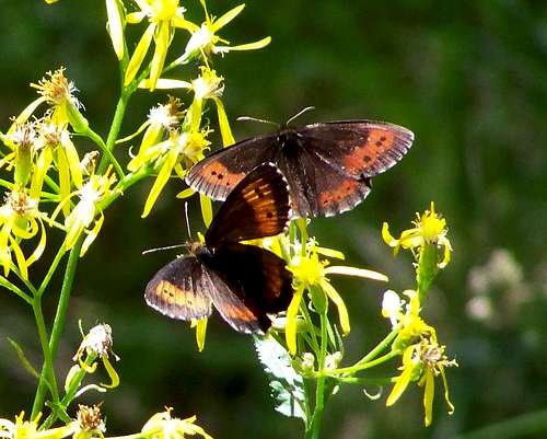 Large Ringlets (Erebia euryale)
 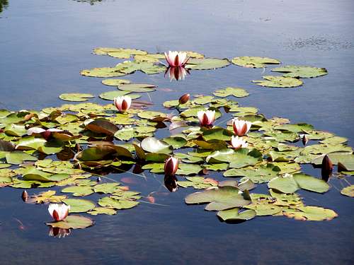 White Waterlily (Nymphaea alba)
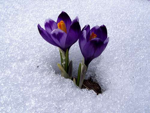
 The St Leonard church in Mislinja
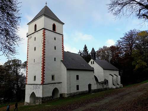 Sv. Bolfenk
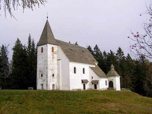 Sv. Areh
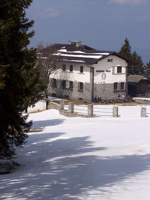 Ribniška Koča
 Ruška koča
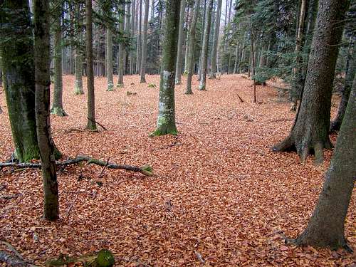 Forest on Sedovec