
-
 1995 Hits
-
 74.92% Score
-
 5 Votes
|
|
Mountain/Rock |
|---|---|
|
|
47.08143°N / 14.79852°E |
|
|
Hiking |
|
|
Spring, Summer, Fall, Winter |
|
|
7067 ft / 2154 m |
|
|
Topographic isolation: 1.5 km
Nearest higher peak: Ameringkogel (2187 m)
Prominence: approximately 60 m![The eastern hillside of Grössenberg, above the cirque]()
The eastern hillside of Grössenberg, above the cirqueThis mountain is called Größenberg as well as Größing. On this page I will refer to the mountain as Grössenberg. I think that it is a good compromise between the original name and a converted format to standard Latin letters. ![Rocks and scree on the southwestern slope of Grössenberg]()
Rocks and scree on the southwestern slope of GrössenbergSo Grössenberg is the 3rd highest named summit of Packalpe. But we can consider it as the second![Karhütte]()
Karhütte ![Rhododendron ferrugineum]()
Rhododendron ferrugineumhighest mountain, too, since Weissenstein is only 500 meter far from Ameringkogel, and Weissenstein has no measurable prominence. So it can be considered as just a named subpeak of Ameringkogel.![Panoramic map]()
Informational map of Packalpe![Ameringkogel - view from GröÃenberg]()
Ameringkogel as you can see it from Grössenberg. The normal route has two variations. One goes through the summit, while the other goes around the right side of AmeringkogelNormal route - from Hirscheggersattel (southeastern approach)![Rappoldkogel as seen from Grössenberg]()
Rappoldkogel as seen from Grössenberg![The summit cross of Grössenberg]()
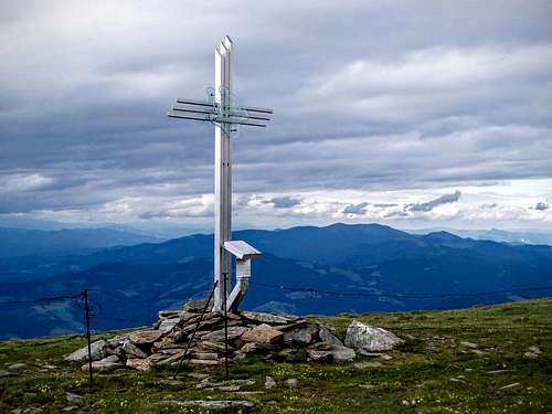
The summit cross of Grössenberg![This red object is the real summit]()
This red object is the real summitAs I already mentioned, the summit cross and the highest point are nont on the same spot. The highest point is 100 meter far from the cross in southern direction. The hilltop is quite a flat longitudinal area that stretches in northern-southern direction. The relatively flat hilltop has a rim at its eastern side and here you can stand above the very steep hillside of the cirque. There is a fence along this rim protecting hikers and kettle from falling down.
![Ameringkogelkogel trailhead]()
Salzstiegelhaus with the trailheadCamping Hirschegg (900 m a.s.l.)
![The summit cross]()
The hilltop of Grössenberg
Nearest higher peak: Ameringkogel (2187 m)
Prominence: approximately 60 m
Overview
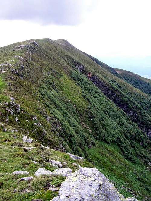
The eastern hillside of Grössenberg, above the cirque
Grössenberg can be translated as “big mountain”. It doesn’t sound as a unique name. I know another mountain with the same name in Fischauer Berge, in Lower Austria. And surely there are other representatives, too. But let’s return to the mountain of our subject that can be found in Styria…
There are four named summits of Pack Alps that are higher than 2000 m:
- Ameringkogel (2187 m)
- Weissenstein (2160 m)
- Grössenberg (2154 m)
- Hofalmkogel (2040 m).
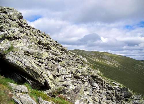
Rocks and scree on the southwestern slope of Grössenberg

Karhütte
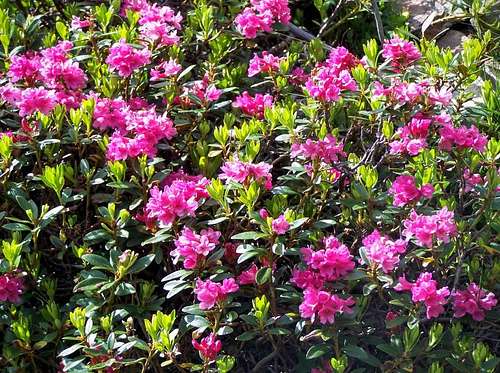
Rhododendron ferrugineum
And a note about the elevation of the mountain. I have two maps showing Grössenberg: one of them is a printed map Freitag&Berndt 41 Graz – Koralpe – Eibiswald 1 : 100000, wile the other one is the online Austria map. Both maps indicate the summit cross on altitude of 2152 meter. But the highest point of the mountain is not the summit cross but it is in southern direction, in distance of 100 meter. According to the printed map the highest point is 2160 meter high. According to the online map it is 2154 meter high. The second figure looks to be more realistic for me.
The top of the mountain is relatively flat, and it can explain why the highest point and the summit cross don’t coincide. Those who erected the cross might have not found the highpoint :-). Luckily this flat grassy hilltop doesn’t mean that the mountain lacks all character of a real mountain. The western slope has some scree. And the eastern hillside is really steep. It is a cirque formed by glacial-erosion in one of the glacial periods in the past. “Cirque” is called “Kar” in German language. There is a hut in the cirque so its name is Karhütte. And a stream has its source in the cirque – it’s called Karbach.
The tree-line on Gössenberg is approximately on 1900 meter. Below the tree line the most dominant tree is Swiss pine (Pinus cembra). Just above the tree-line there is intense vegetation of alpenrose (Rhododendron ferrugineum). The hilltop is grassy.
Routes
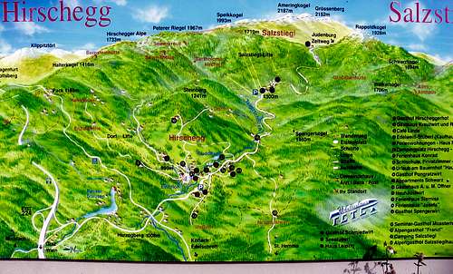
Informational map of Packalpe
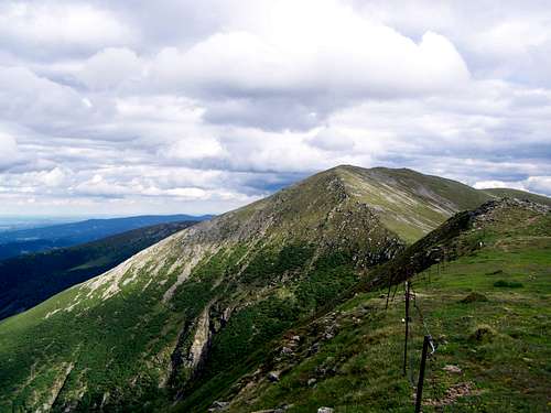
Ameringkogel as you can see it from Grössenberg. The normal route has two variations. One goes through the summit, while the other goes around the right side of Ameringkogel
The trailhead is at 1543 meter above see level. The trailhead can be accessed with car.
Distance: 2 x 8 km
Cumulated elevation gain during ascent: 800 m
Elevation gain when returning: 170 m
Route from Amering (southwestern approach)
The trailhead is at 1025 meter above see level. The trailhead can be accessed with car.
Distance: 2 x 7.5 km
Cumulated elevation gain during ascent: 1220 m
Elevation gain when returning: 70 m
Route from Eppenstein (northwestern approach)
The trailhead is at 720 meter above see level. The trailhead can be accessed with car.
Distance: 2 x 8 km
Elevation gain: 1434 m
On my old printed map some trails are shown leading to Grössenberg from eastern and from western direction, too. Newer maps don't show these routes.
The Summit
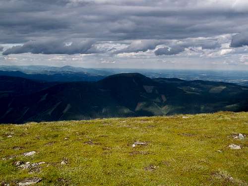
Rappoldkogel as seen from Grössenberg
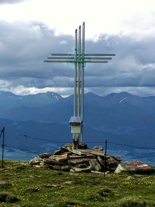
The summit cross of Grössenberg
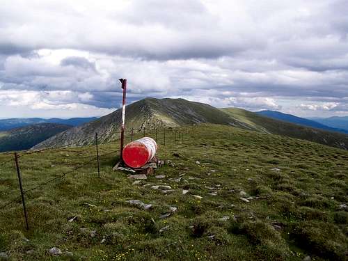
This red object is the real summit
As there are no trees on the summit, there is nice panoramic view all around. These are the best visible peaks:
- N: Seckauer Zinken (2397 m) and Hochreichhart (2416 m)
- NE: Lenzmoarkogel (1991 m) and Speikkogel (1988 m)
- E: Rappoldkogel (1928 m)
- SE: Ameringkogel (2187 m)
- S: Petzen (2126 m) and Grintovec (2558 m)
- SW: Ladinger Spitz (2079 m)
- W: Zirbitzkogel (2396 m)
- NW: Gamskogel (2386 m).
Campings and Tourist Huts
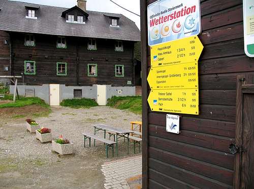
Salzstiegelhaus with the trailhead
This camping is 10 km far from the Hirscheggsattel trailhead.
Website: http://www.camping-hirschegg.at/?lang=en
50Plus Campingpark Fisching (680 m a.s.l.)
This camping is only 6 km far from the trailhead at Eppenstein, and only 1 km far from the trailhead at Zeltweg.
Website: http://www.camping50plus.at/?lang=en
Laikam Hütte (1200 m a.s.l)
On the western slopes of Grössenberg, 6 km far from the peak. Unfortunately there are no marked trails near the hut.
Website: http://www.laikam.at/index.php/laikam-huette
Salzstiegelhaus (1553 m a.s.l.)
The hut is at Hirschegger Sattel that is an optimal trailhead to Ameringkogel and to Grössenberg.
Website: http://www.salzstiegelhaus.at/
Weissensteinhütte (1702 m a.s.l.)
On Weissenstein, 2 km far from its peak.
Address: Kleinprethal 20, 8742 Obdach
Mobile phone: +43 664 212 15 96
External Link
Please click here for online map of Austria
The hilltop of Grössenberg