Overview
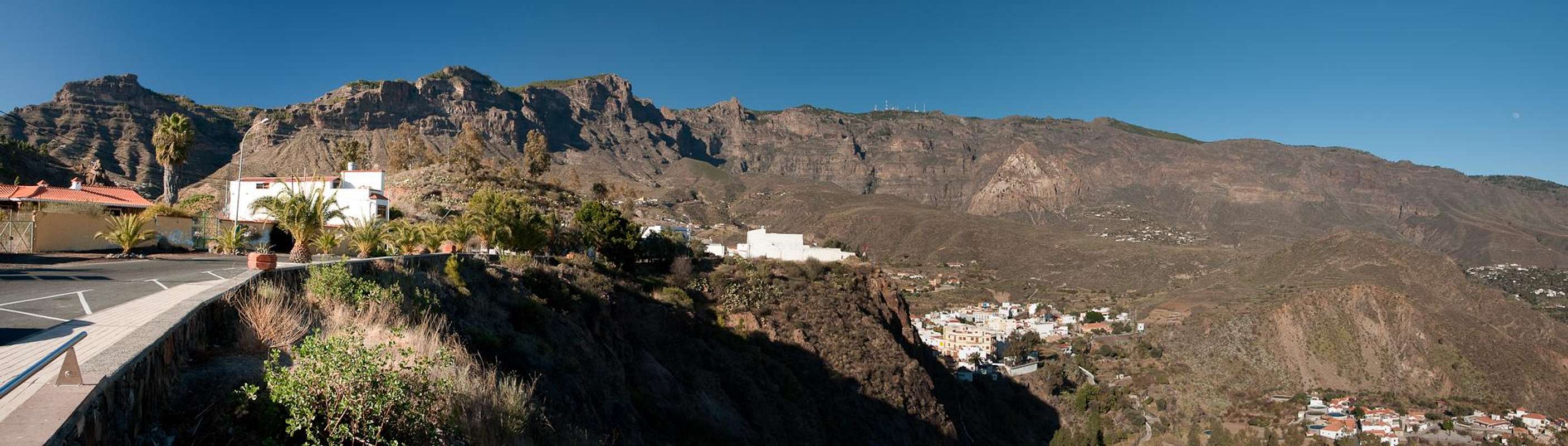
![The summit of El Campanario]() El Campanario summit El Campanario summit |
So, this is the second highest summit of
Gran Canaria, 26m lower than number one and 5m higher than number three. Yet, it is a much more interesting destination than its two neighbours. Why? The highpoint
Pico de las Nieves, less than 1km to the east, carries a military radar installation so that it's very top is off limits if you are not a member of the Spanish military.
Roque Redondo, another km further to the east is home to half a dozen radio and TV antennas and, though still accessible, is not much fun to visit. And then there are paved roads which connect the two with each other.
El Campanario is much more obscure. It starts with the name, which I doubt is official. Both of my maps indicate it with "Pozzo de las Nieves" but the two pozzos (big cavities in which snow and ice were stored for summer usage) can be found farther to the east beyond
Pico de las Nieves which was named for them. So I have to go with the name my guidebook uses for the mountain:
El Campanario, the church steeple.
Unfortunately
El Campanario doesn't look like any church tower. It is a big bulk of a piece of rock, made up from basalt, which culminates in several round topped summit rocks. At least three of them compete for the honour of highest summit and it is impossible to claim to have stepped on the top of
El Campanario unless you have been on all three. Like its brethren,
Pico de las Nieves and
Roque Redondo,
El Campanario is part of
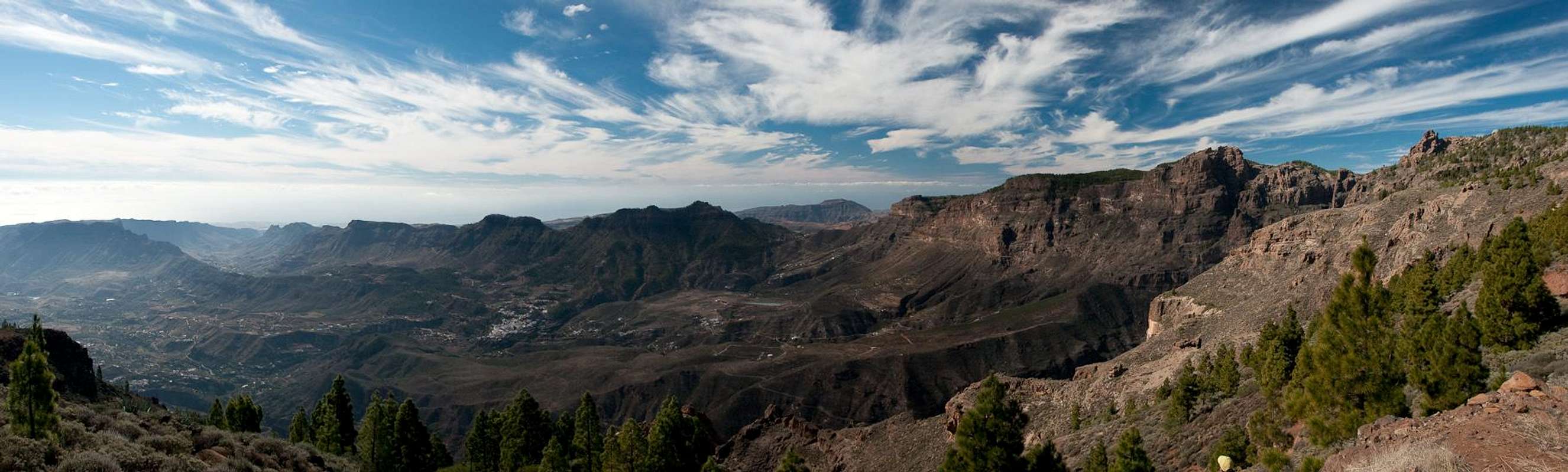
Riscos de Tirajana, the huge wall which encompasses
Caldera de Tirajana, one of the two giant erosion craters of
Gran Canaria.
The riscos, protected as a natural monument, stretch for about 8km around the Tirajana Valley. Their walls are up to 800m high and they reach their greatest height near
Pico de las Nieves and
El Campanario. They are made up from brittle volcanic material and only near the top can you find solid basalt rocks.
El Campanario can be most easily reached from
Degollada de los Gatos, a saddle to the north-west of the mountain, through wich the Camino Real between
Cruz Garande and
Pico de las Nieves runs. From this side the ascent is easy, though a bit ambiguous. It heads for a shoulder to the north-east of the summit structures from where short scrambles take you to the tops. The summit pillar can be found on the northernmost of the structures but at least two others look higher. To the east and south you find the drops into
Caldera de Tirajana. Much of the mountain is covered in Canary Pines so that the ground can be slippery if covered with their needles.
El Campanario is a good lookout summit but should be climbed early in the morning. Around noon the sun spoils any views into the caldera and quite often clouds pile up in the afternoon.
360° Summit Panorama
360° summit panorama El Campanario |
Getting There
Caldera de Tirajana from Caidero de Urian |
can be reached from any major European airport. Usually charter carriers fly there but the spanish airline
Iberia has also regular flights. The airport is on the eastern coast of the island, far away from the tourist centres in the south.
Trailheads for
El Campanario are at
Pico de la Nieve,
La Goleta and
Cruz Grande and all are connected by the Carreteria de la Cumbre.
- From the south
- From Maspalomas take GC60 through Fataga and San Bartolome to the saddle Cruz Grande. Here a wonderful Camino Real starts.
- From the saddle stay on GC60 until you get to Ayacata.
- Turn onto GC600 which will pass La Goleta and hit GC150 near Pico de la Nieve.
- From the north
- From Telde take GC131 which turns into GC130, direction Pico de la Nieve. The road will hit GC150 right at Gran Canaria's highpoint.
- For La Goleta stay on GC150 for a few metres, then turn onto GC600 to Ayacata. La Goleta is the saddle with the Roque Nublo parking lot.
- For Cruz Grande stay on GC600 until you reay Ayacata.
- Turn left onto GC60, direction San Bartolome until you reach the saddle (signs "Cruz Grande").
/ul>
Red Tape
![El Campanario seen from Pico de las Nieves]() El Campanario from Pico de las Nieves
El Campanario from Pico de las Nieves is part of the
Monumento Natural Riscos de Tirajjana. The usual restrictions - stay on trails, don''t disturb plants or wildlife - apply. Also, though it might sound silly: don't smoke in the pine forest. While the pines themselves will survive everything else won't and there's a long history of forest fires on the island.
Accommodation
Riscos de Tirajana with El Campanario left of centre |
Gran Canaria has a lot of options for accommodation. Most visitors book hotel rooms from their travel offices or over the internet. However, you will most certainly end up in the ugly tourist centres along the south coast. Therefore a much better solution is to rent a holiday home, most often a rural finca. This can also be done by travel office or internet.
Camping is a bit of an issue on all the Canary Island. There are designated camping zones but getting a place often involves some bureaucracy. The closest campground is al
Llanos de la Pez between the trailheads at
Pico de las Nieves and
La Goleta. Wild camping is not permitted anywhere on the island.
Weather Conditions
The following table gives a rough general overview over the weather on Gran Canaria, at sea level.
| Month | Jan | Feb | Mar | Apr | May | Jun | Jul | Aug | Sep | Oct | Nov | Dec |
| Avg. day temp.[°C / °F] | 21 / 70 | 21 / 70 | 22 / 72 | 22 / 72 | 22 / 72 | 23 / 73 | 24 / 75 | 25 / 77 | 25 / 77 | 25 / 77 | 24 / 75 | 22 / 72 |
| Avg. night temp.[°C / °F] | 16 / 61 | 16 / 61 | 16 / 61 | 17 / 63 | 16 / 61 | 17 / 63 | 18 / 64 | 20 / 68 | 20 / 68 | 18 / 64 | 18 / 64 | 17 / 63 |
| Water temp.[°C / °F] | 19 / 66 | 18 / 64 | 19 / 66 | 19 / 66 | 19 / 66 | 20 / 68 | 22 / 72 | 23 / 73 | 23 / 73 | 23 / 73 | 21 / 70 | 20 / 68 |
| Rainy days | 4 | 3 | 2 | 2 | 1 | 1 | 1 | 1 | 1 | 3 | 3 | 3 |
The Canarian Islands (as well as Madeira) are located in the trade wind zone. You almost always encounter northeastern winds which carry a lot of humid air. Being forced to climb to higher altitudes this moisture condenses into clouds. This in return means that most of the time the northeastern part of the islands is covered in clouds from altitudes of 1000m through 1500m.
The mountainous region in the centre of the island is of the same alltitude and higher and thus stops the clouds. While the northern parts of the islands can be foggy and rainy the southern parts most often are sunny and hot. On Gran Canaria the north-eastern part of the island collects almost all moisture. However, unlike on the other Canary Islands no cloud forest remains. The laurisilva fell victim to the agricultural development of the island.
Maps & Books
Regular Maps
- Gran Canaria
Kompass Map WK237
Kompass Verlag
1:50000
ISBN 3-85491-114-9
- Gran Canaria North
Public Press Map 442
1:50000
ISBN: 978-3-89920-442-1
- Gran Canaria South
Public Press Map 443
1:50000
ISBN: 978-3-89920-443-8
Digital Maps
Kompass is the only company known to me which offers GPS digital Maps. In addition for those of you with Garmin GPS receivers there is a map source map set of all Canary islands out there.
- Gran Canaria
Kompass GPS4237
Kompass Verlag
ISBN 978-3-85491-219-4
- Islas Canarias
Map Source custom map
By Manfred Pepper
downloadable zip-file
Books
My recommendation is a guidebook by Rother Verlag, available in English and German. The book is an excellent hiking guide covering all the interesting areas of the island. Since it comes with small maps for each excursion it might even be used without a map to support them.
- Gran Canaria
Izabella Gawin
Rother Verlag
ISBN 978-3-7633-4816-9 (English)
ISBN 978-3-7633-4000-2 (German)

 7710 Hits
 80.49% Score
 12 Votes
 El Campanario summit


 El Campanario from Pico de las Nieves