
-
 4201 Hits
-
 79.78% Score
-
 11 Votes
|
|
Route |
|---|---|
|
|
39.95040°N / 77.9367°W |
|
|
Hiking |
|
|
Spring, Summer, Fall, Winter |
|
|
Half a day |
|
|
Moderately Strenuous |
|
|
Overview
Hogback Mountain (1,810 feet / 552 meters) is in Pennsylvania's Buchanan State Forest, just east of Big Mountain (the highpoint of Tuscarora Mountain). This out-and-back route takes one to the summit and nearby scenic overlook on Big Mountain (2,458 feet / 749 meters), but ascends Hogback Mountain as a bonus along the way. The route is moderately steep, but generally less rocky than the Tuscarora Trail. Despite ascending two peaks, it is actually shorter than the route to Big Mountain that starts at Cowans Gap State Park and stays on the Tuscarora Trail for the entire length of the route.
Getting There
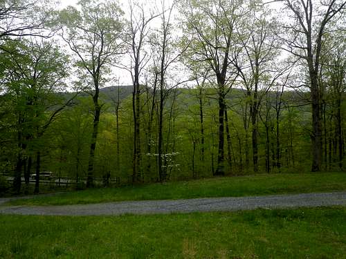
The starting point is just off PA 75. A small sign on the west side of the road simply says, “PARKING.” A somewhat rutted gravel road leads to a grassy area with room for about a dozen cars. (I have never seen more than three other vehicles there.) The turn for the trailhead parking area is VERY easy to miss, so note that it is 2.5 miles north on PA 75 from the intersection of PA 75 and US 30 in Fort Loudon, PA. (Fort Loudon is a small town thirteen miles west of Chambersburg, PA.)
Route Description
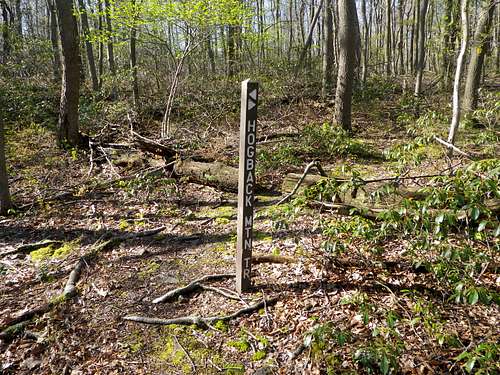
Just uphill from the grassy parking area, there is a trail sign (“CHARCOAL TRAIL”) by a yellow gate.
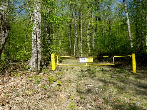
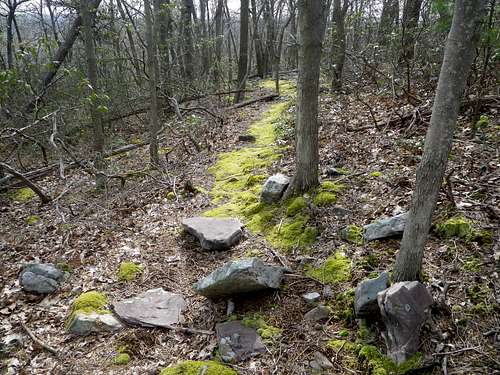
From here, just follow the yellow blazes of the Charcoal Trail. This easy-to-follow trail winds around the north side of Hogback Mountain, taking you from the parking lot on the east side to a saddle on the west side.
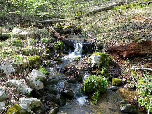
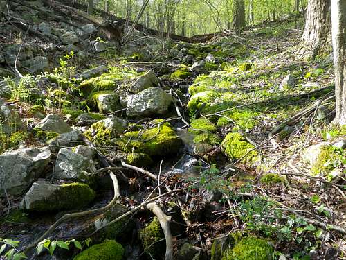
Several streams cross the trail on the east side, so there can be some mud to deal with. These streams are narrow and shallow, however, and the mud is not very difficult to avoid.
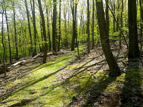
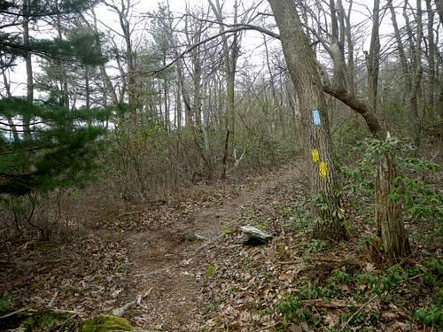
On the north side of Hogback Mountain, the trail is generally flat and straight – a pleasant walk through the woods. Don't be concerned if you see white blazes on trees briefly in this section. If you follow the white blazes you will be staying on the correct path, and eventually the blazes will be all yellow again.
On the west side is arguably the best scenery of the ascent of Hogback Mountain, as the Charcoal Trail ascends alongside more or less picturesque streams.
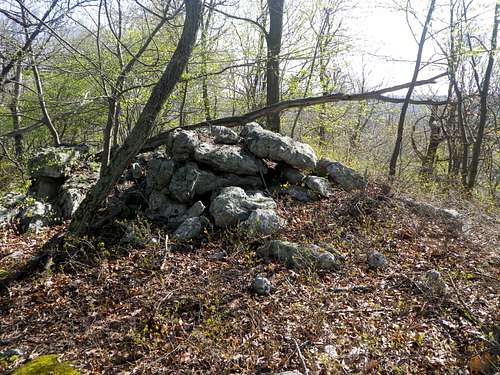
In about 1.8 miles there is a saddle, and the junction of the Charcoal Trail and the Hogback Mountain Trail. The Charcoal Trail ends here; the Hogback Mountain Trail continues to the summit of Hogback Mountain. One can turn left (east) here and hike about 0.3 miles to reach the summit of Hogback Mountain, or turn right (west) to continue toward Big Mountain, saving the summit of Hogback for later.
From the saddle, it is another 0.8 miles on the Hogback Mountain Trail to the top of Big Mountain. It is generally steeper than the Charcoal Trail, but the slope lessens near the top. As before, just follow yellow blazes.
Just below the summit of Big Mountain, the Hogback Mountain Trail reaches a junction with the Tuscarora Trail, which is blazed blue. Turn right here, but within seconds turn left to stay on the yellow-blazed Hogback Mountain Trail (unless you would prefer walking on uneven rocks the rest of the way to the scenic overlook).
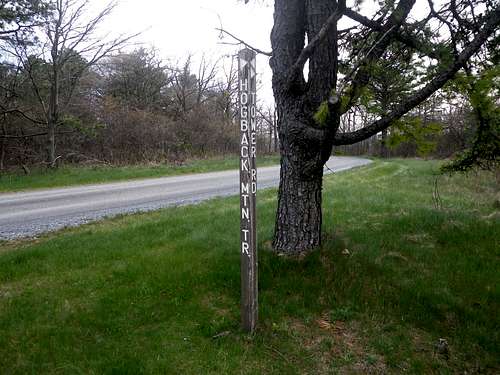
Soon after this point, the trail emerges from the woods and passes a tower. Between this tower and the appropriately named Tower Road is a signpost that marks the terminus of the Hogback Mountain Trail.
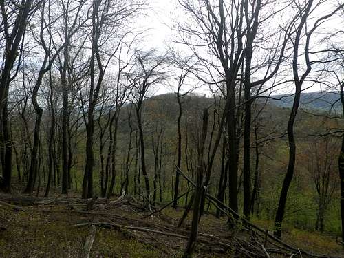
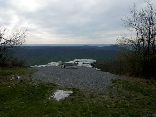
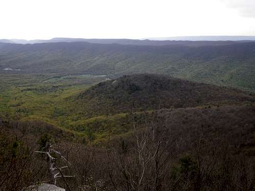
From here, just head north along the road and Big Mountain’s scenic overlook will become obvious on the right within about two minutes. Obviously, Big Mountain has better views than Hogback Mountain, including a view of Hogback Mountain itself.
Simply retrace your steps to get back to your car, again following yellow blazes all the way. Don't forget to visit the summit of Hogback Mountain if you didn't do so on your way up!
The roundtrip is about six miles, including the short walk to the overlook on Big Mountain. The Hogback Mountain Trail itself is 1.1 miles long, from the top of Big Mountain to the summit of Hogback Mountain. The overall elevation gain is about 2,000 feet.
Essential Gear
No special gear is needed, unless one is attempting the route in winter conditions. This is a Class 1 hike.
External Links
See the Tuscarora Mountain page for External Links related to this area.