
|
|
Route |
|---|---|
|
|
46.04892°N / 7.89354°E |
|
|
Half a day |
|
|
F+ |
|
|
Overview
Allalinhorn Normal Route
The normal route on Allalinhorn is the most ascended route on a 4000 meter peak in the Alps together with the normal route on Breithorn. The route, along the West-Northwest flank, is immensely popular
and there are three main reasons for it: 1. The ease of the ascent. The normal route is graded F+ (Facile) and therefore one of the easiest routes on a 4000m+ peak in the Alps. 2. The vicinity of the Mittelallalin top station, which drops climbers off at an altitude of almost 3500 meters. 3. The altitude of 4027 meters, making it one of the 82 mountains above 4000 meters in the Alps.
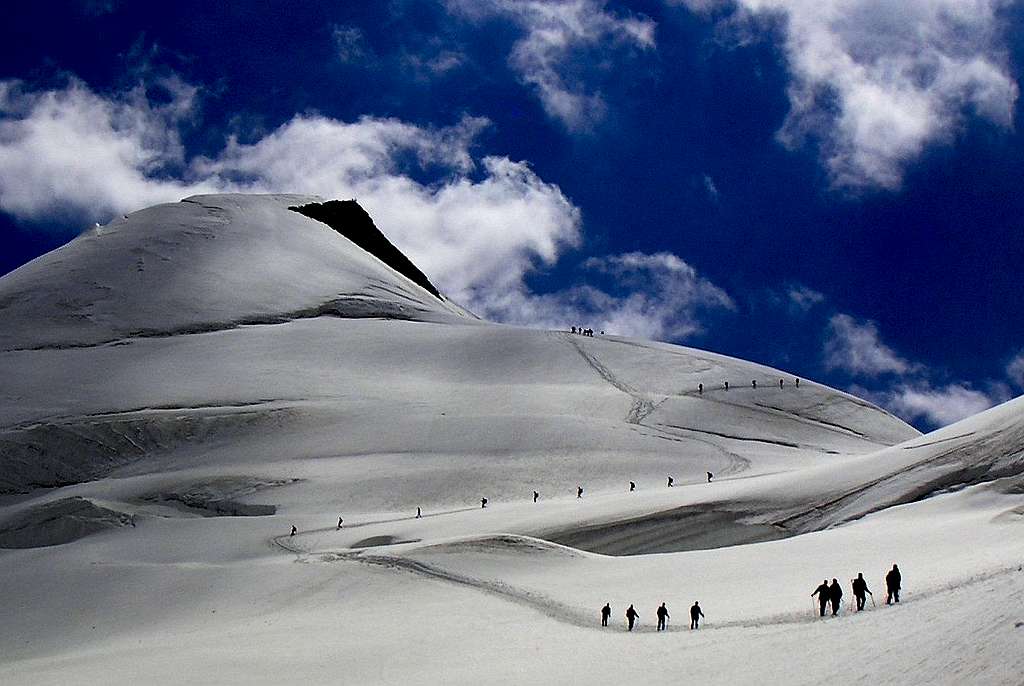
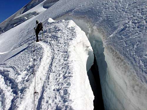
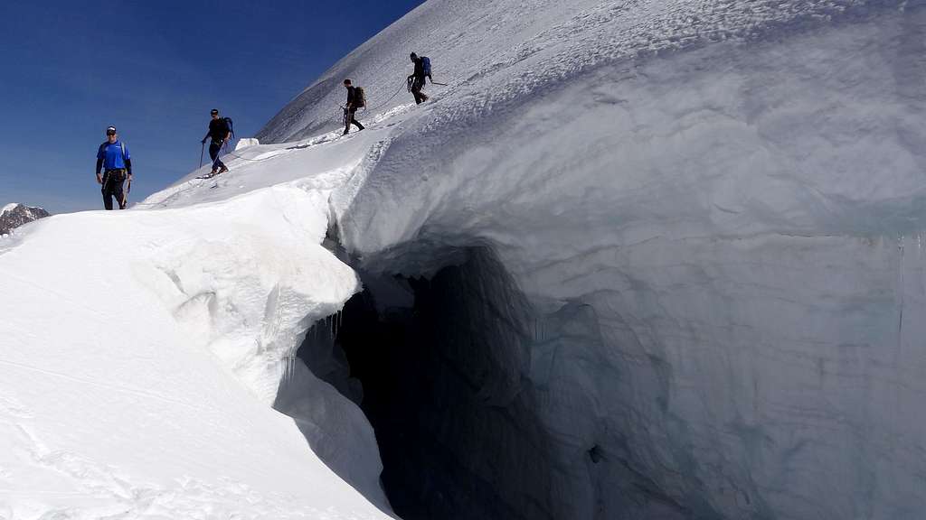 Crevasse along the Route | 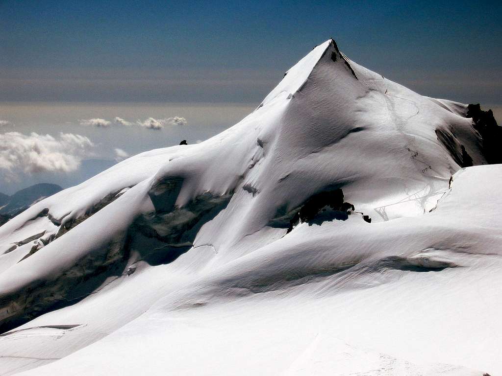 Allalinhorn with the Normal Route visible |
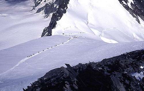
The route starts at the Mittelallalin top station at 3457 meters. As a result, climbers only have to deal with an altitude difference of just over 500 vertical meters to reach the summit. Mittelallalin is the top station of the Saas Fee ski facilities and therefore easily reached from the valley floor. The normal route is graded F+ and can be considered as a mere walk-up on glaciated terrain. It has to be noted that although technically easy, the route is on high altitude and includes glaciated terrrain with crevasses present. The normal route is, due to its popularity, very busy in the summer months. In winter it can be busy as well, due to ski-mountaineering ascents. The normal route does not include rock climbing, just a 'walk' on the glaciated North side of Allalinhorn. The normal route is mostly ascended from Mittelallalin, but also ascents are done from the Britannia-, Tasch- and Langflue mountain huts. Climbing Allalinhorn from Mittelallalin requires half a day. From the other huts most of a day to a full day is required.
 Normal Route as seen from Mittelallalin | 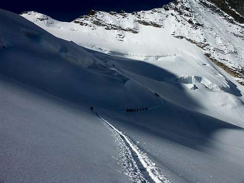 Lower part of the Route |
Still, even if considered easy, the normal route is a real alpine climb and should not te be taken lightly. Weather can change rapidly at these high altitudes and the whole climb along the normal route leads through glaciated terrain with large crevasses present throughout the route. It is advised to take a guide if you do not have the proper experience to climb an alpine peak like Allalinhorn.
The normal route, the northwest flank, was first climbed on 1. August 1860 by Franz-Josef Andenmatten, together with Sir Leslie Stephen, F. W. Short, Frederick William Jacomb, C. Fisher, Moritz Anthamatten, Peter Taugwalder and Johann Kronig.
Route Description
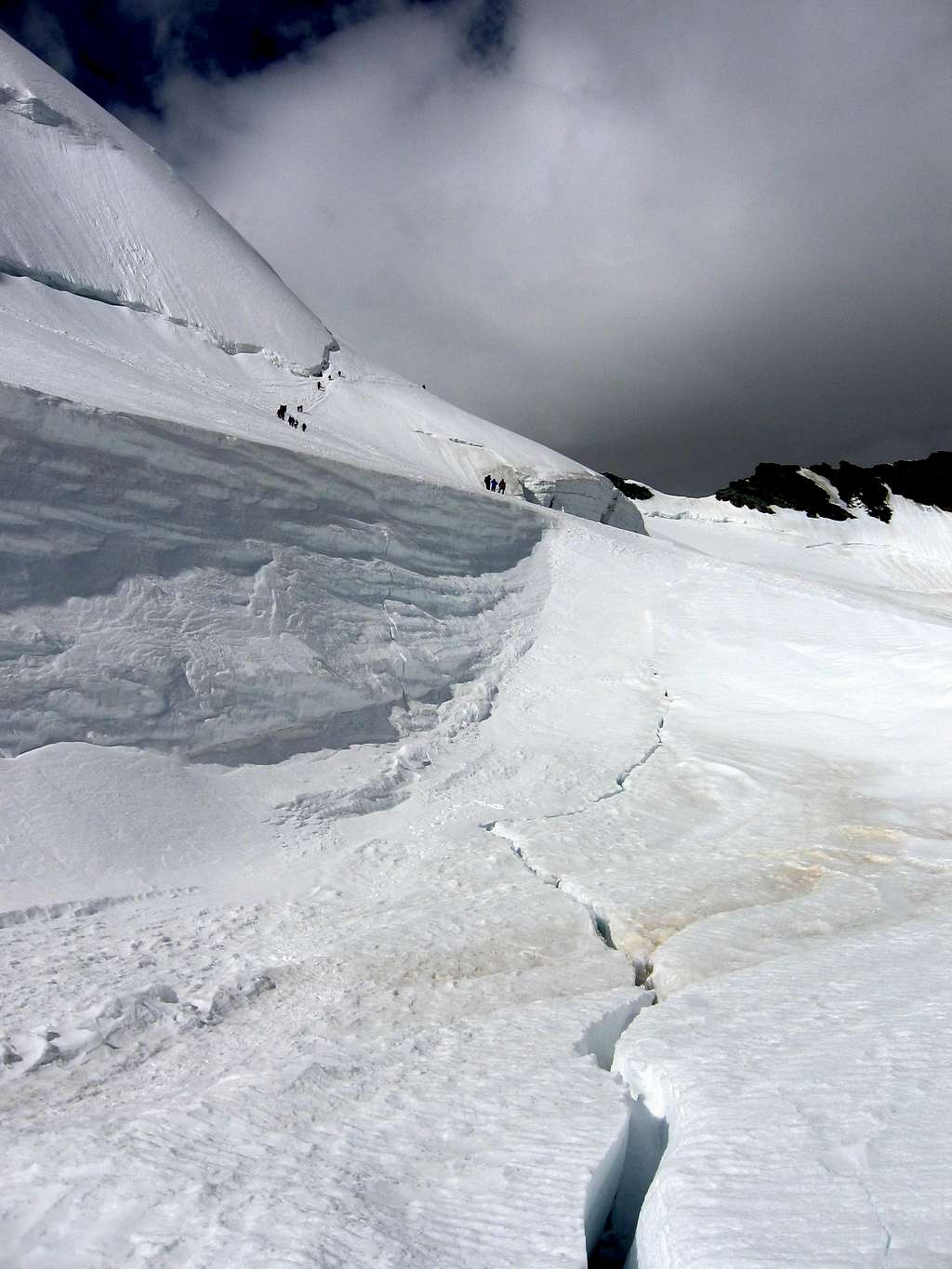 Crevasse along the Route | 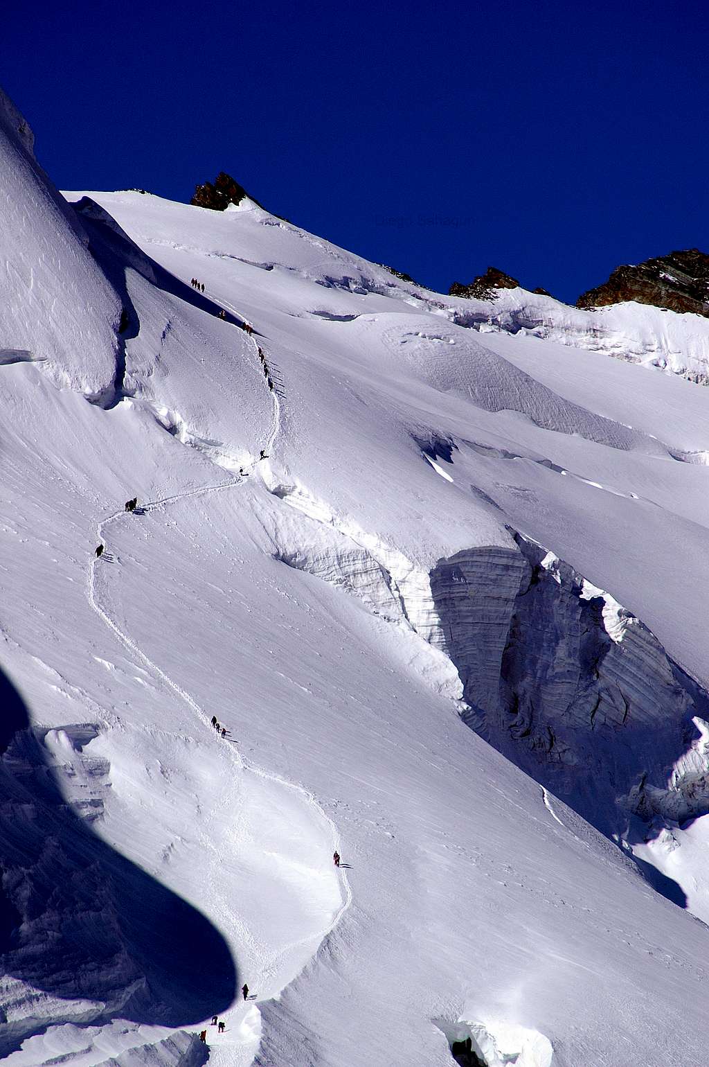 Heading to the Feejoch |
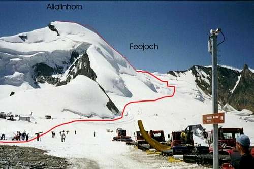
The route starts at Mittelallalin at 3457 meters. Mittelallalin can be reached from Saas Fee via a series of lifts and railways. From Mittelallalin, cross the ski-pistes heading in a SW direction. It will take about 15-30 minutes to leave the ski facilities behind you. In the summer months, a track along the entire route is visible all the way to the summit. (the exception is of course with fresh snowfall). Keep heading up along the glacier in a southwestern direction. You can see Allalinhorn to the left of you and the rocky Feechopf to the right. The col inbetween, the Feejoch at 3826m, is where you need to go. This part of the route is purely on glaciated terrain and although technically easy, do watch out for crevasses. The glacier is filled with them. Head up to the Feejoch at 3820 meters. At this point you will have your first views to the south and peaks like Breithorn, Matterhorn and the Monte Rosa can be seen for the first time. It takes 1 hour to 1,5 to reach this point from Mittelallalin.
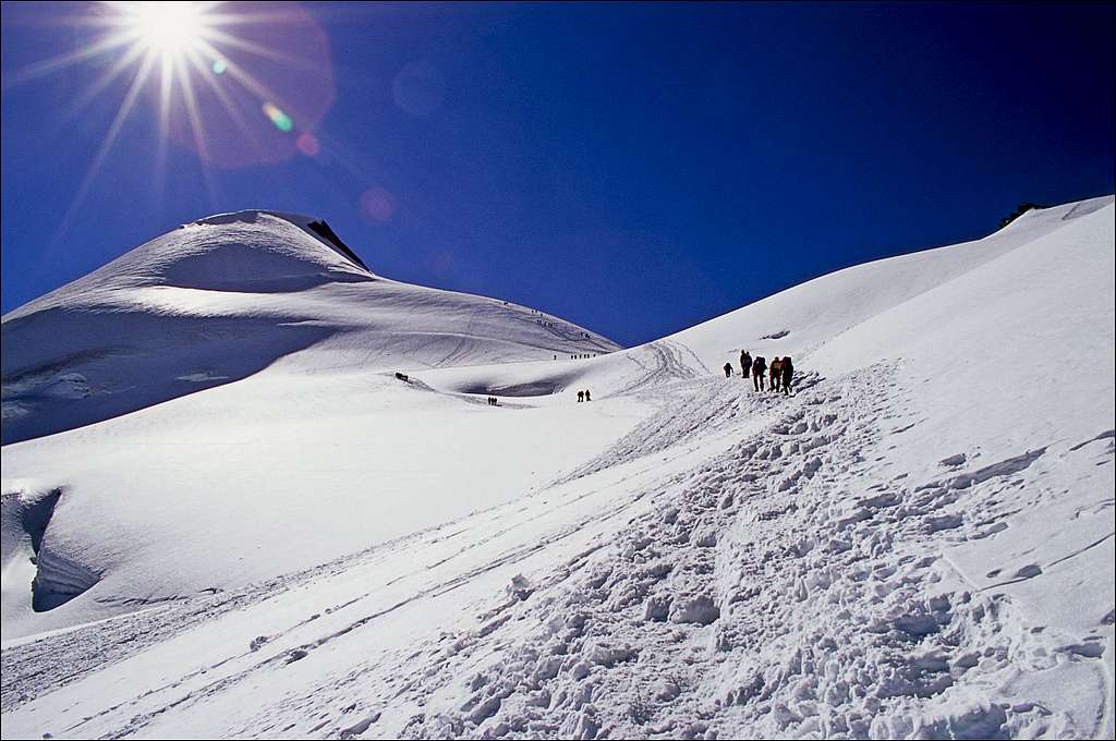 Allalinhorn from near the Feejoch | 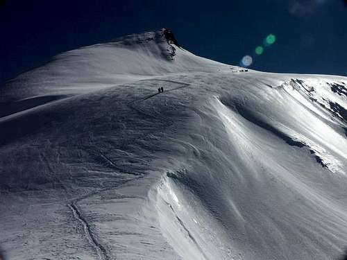 Upper part of the Route |
At the Feejoch, the summit of Allalinhorn is to the east of you. Follow the snow slopes along the West flank in the direction of the summit. Eventually you will reach a point just west of the summit with a steep rock section above you. Reach the summit itself by passing beyond it on the South side and approaching the summit from the East up a short snow/ice rib. An alternative is to pass the rocky section on the North side and then head to the summit. It takes between 45 minutes to an hour to reach the summit from the Feejoch. Descent is the same way back.
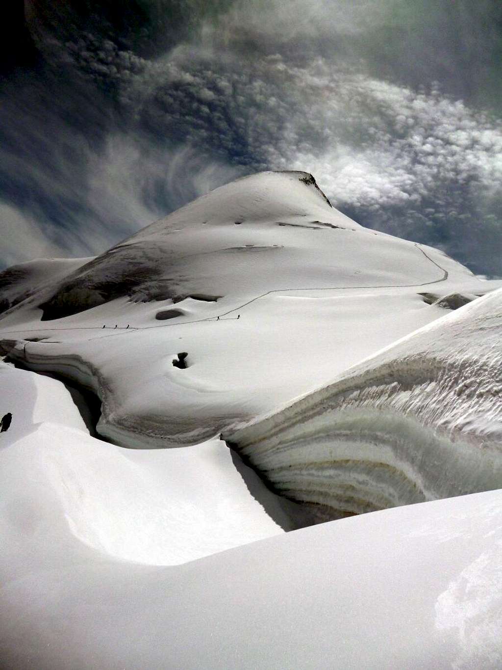
 Hoards on Normal Route; Feejoch below | 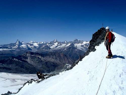 Almost on the Summit |
Alternatively, one can start from the Berghaus Langfluh. From Langfluh the route goes over the Fee glacier in a southern direction. The route joins the normal route above Mittelallalin. Other options are the Tasch and Britannia Huts. The route from the Tasch hut goes over the Alphubel glacier and the rocky Feechopf. After Feechopf it joint the normal route at the Feejoch. From the Britannia Hut, the route goes over the Hohlaubglacier in a western direction. One follows the glacier along the Hinter Allalingrat. At+/- 3600 meters the Hinter Allalingrat is crossed. At this point the route joins the normal route, again, just above the ski pistes belonging to Saas Fee/Mittelallalin.
Getting There
Allalinhorn Normal Route
The starting point for the normal route on Allalinhorn is Saas Fee. From Saas Fee you can access the ski facilities to reach Mittelallalin (start of the Normal route) and Längfluh (alternative start for the normal route) The links below provide information about all cableways mentioned. Also see the section ''Mountain Huts'' on Allalinhorn's Main page for more information about the Tasch Hut and Britannia Hut and how to get to them from Saas.
How to get to Saas Fee: Click Here
Timetable Cableways: Click Here
Lift Prices: Click Here
Essential Gear
The gear needed: full glacier equipment (rope, crampons, ice axe)Maps and Books

4000er Tourenfuhrer
A good guide for the normal route is the 4000er Tourenfuhrer by Richard Goedeke. There are many more books and guides available. See the Books section on the main Allalinhorn Page.
There are several Maps covering the normal route on Allalinhorn. See the Maps section on the main page of Allalinhorn for more information.
4000er Tourenfuhrer
The Normal routes to all 4000 meter peaks of the Alps
ISBN: 978-3-7654-5761-6
Bruckmann Verlag (www.Bruckmann.de)
External Links
Crevasses along the normal Route
Allalinhorn at Camptocamp Description of the normal route on Allalinhorn; Partly in English, mostly French
Mountain Guides for Climbing Allalinhorn: Saas Fee Guides in Saas Fee, Active Dreams Weissmies in Saas Grund.
Webcam Allalinhorn by Bergfex
Webcam Mittelallalin by Bergfex (360 degrees with Allalinhorn)
Weather Forecast by mountain-forecast.com