
|
|
Mountain/Rock |
|---|---|
|
|
47.08560°N / 10.33754°E |
|
|
Hiking, Skiing |
|
|
Spring, Summer, Fall, Winter |
|
|
8760 ft / 2670 m |
|
|
Overview
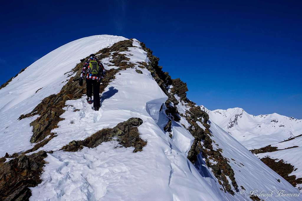
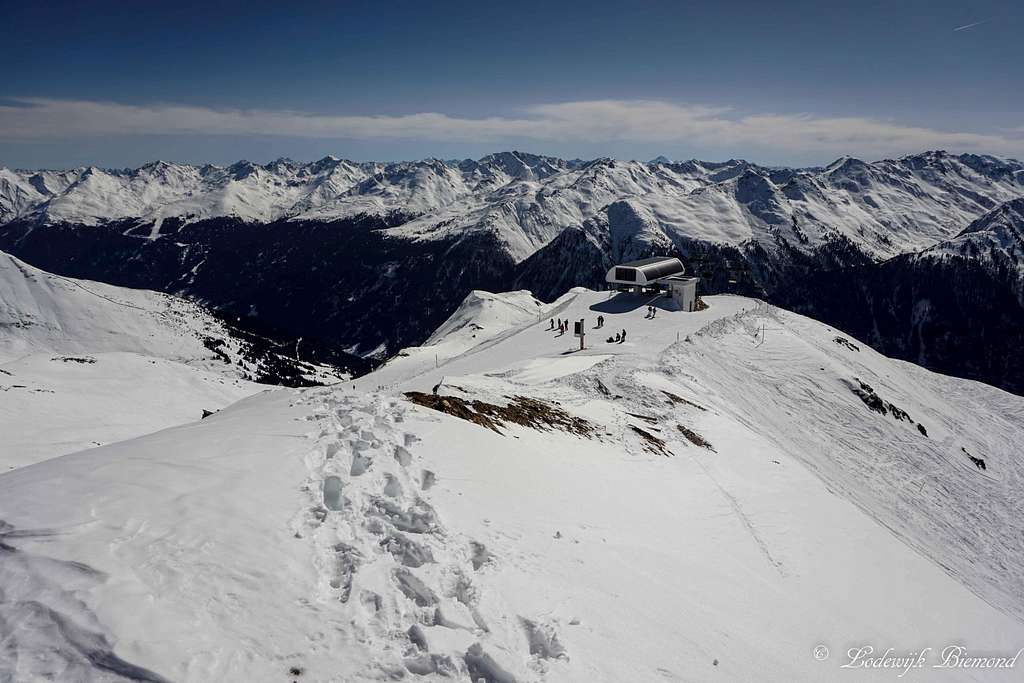
Climbing up to the summit of Alblitkopf
Alblitkopf is a mountain located in the Ferwall (or Verwall) Group in the western part of Tirol, Austria. Alblitkopf is also referred to as Alblittköpfe, since it consists of two summits, the western one being slightly (about 10 meters) higher. Sometimes the mountains name is also spelled with a double “t” making it Alblittkopf. From this point on I will refer to the mountain as Alblitkopf.
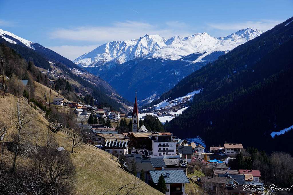
Alblitkopf is not a particularly dominant mountain in the area, but it offers fine views over the Verwall as well as the Samnaun Group mountains. Alblitkopf is located directly north of the village of Kappl. Kappl is, together with Ischgl, Galtur and See, one of the four main villages in the Paznauntal valley. Also, these four villages are the ones with a ski area.
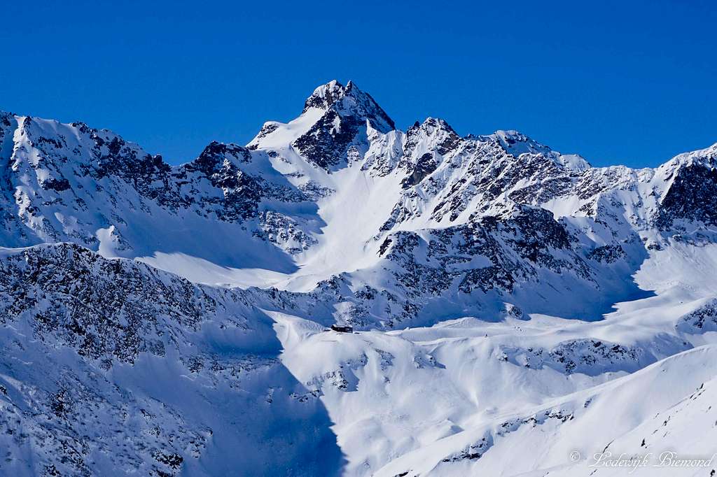 Fatlarspitze and the Niederelbe Hut | 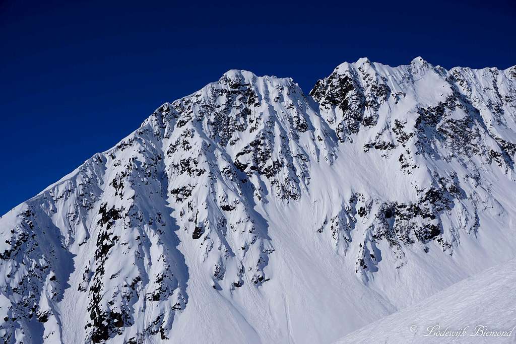 The Karlesturme (2720m) |
The route to Alblitkopf is graded T3 with the larger part of the route graded T2. The route to the summit is rather short due to the vicinity of the Kappl cableway system, which can be used to shorten the ascent. From Dias at 1830 meters a path goes up to just under the summit. Only the last 50 vertical meters involve some hiking in the T3 grade. During the winter season a chairlift goes up the southern flank of the mountain. The climb to the summit is only a mere 50 vertical meters from the top station. Although short, not many people take the effort to climb to the summit.
 Summit view towards Stertarspitze (2738m) | 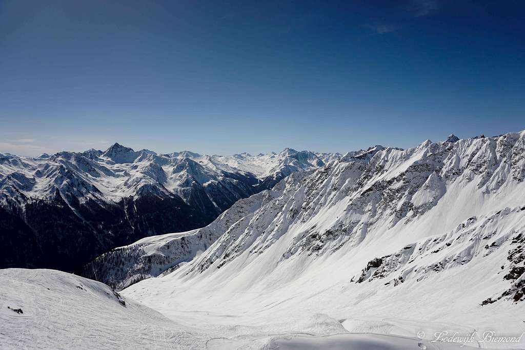 Summit view with Vesulspitze (3089m) |
Because of the ski facilities covering the southern flank of Alblitkopf, it is not the most beautiful mountain to climb, but still, it offers fine views of the surrounding mountains. Towards the south the Samnaun Group dominates the view with mountains like Furgler (3007m), Hexenkopf (3035m) and Vesulspitze (3086m). Also Fluchthorn (3398m), part of the Silvretta Alps, can be seen clearly. In the other directions the mountains of the Verwall group can be seen, among it its highest, Hoher Riffler (3168m).
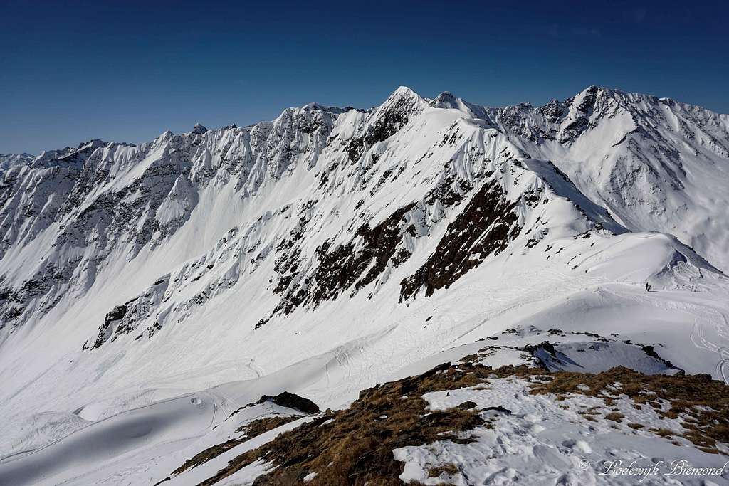
 The double summit of Alblitkopf (2670m) | 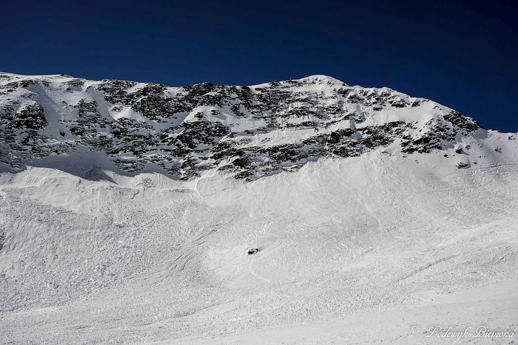 Alblitkopf East Face |
The elevation of Alblitkopf is up to some debate. Some sources claim the mountain to be 2720 meters high (the Kappl ski map for instance), other sources say 2650 meters and others state 2670 meters. When looking close at the topographic maps the altitude must be close to 2670 meters, which is the altitude I will use on this page.
Route Description

Route Map for Alblitkopf
The route to the summit of Alblitkopf starts from Kappl. It is possible to start the hike from the village, but an easy alternative is to use the cableway facilities of the Kappler ski area. From Kappl, take the Diasbahn up to Dias at approximately 1800 meters. Start your hike here by following the unpaved road up the north flank of the mountain (white-green road on the map). Follow this unpaved road up to the top station of the Alblitbahn chairlift at 2300 meters. This chairlift also runs in summer, so it is also possible to take the chairlift up from Dias at 1800 meters. This will save you at least an hour of hiking. This part of the route is easy T1/2.
From the top station of the Alblit chairlift keep following the path up in a northern direction. (see the white road on the map). This path goes all the way up to 50 to 75 vertical meters beneath the summit of Alblitkopf. Until this point the route is easy (T2). Eventually, when getting close to the summit, you can see why the mountain is also referred to as Alblittköpfe: The mountain has two distinct summits. The western one is the main and highest summit. At the base of this summit you can spot a wooden bench. Hike towards it and follow the north flank up to the summit. This last part (only 50 vertical meters) is a hiking trail and is graded T3.
From the Alblitbahn top station is it a 1 to 1,5 hour hike to the summit. The return is the same way back. Alternatively it is possible to take the Kielerweg, route 512, back down (or up). This hiking trail crosses just underneath the Alblitbahn top station at 2300 meters and goes down back to Dias at 1800 meters.
How to get there
Kappl (1258m) with Gamsbergkopf
When to Climb
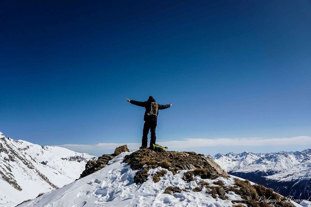
Me on the summit of Alblitkopf
External Links
Alblitkopf summit ; view to the south
Operating hours cableways Kappl
Cableways Kappl prices
Webcam Alblittkopf
Accomodation in Kappl:
Maps
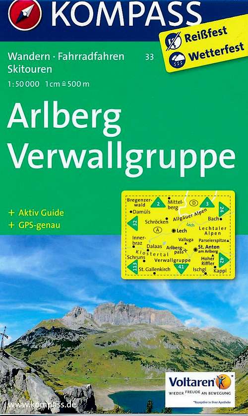
Kompass 33: Arlberg Verwallgruppe - 1:50.000
Summit Panorama
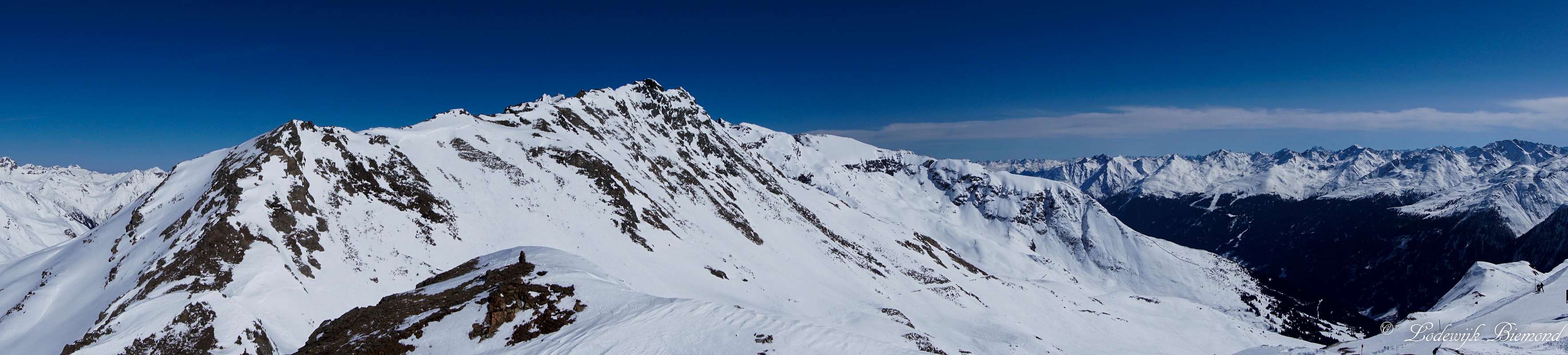  Alblitkopf Summit Panorama with Hohe Spitze (2796m) at left and at right Furgler (3007m) and Hexenkopf (3035m) |