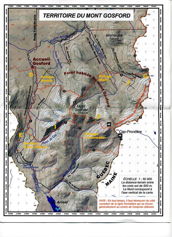
Map of the Mont Gosford Sector of the ZEC Louise-Gosford. Mont Gosford is the highest peak in the Eastern Townships of Quebec. This map is part of a larger map of the trail system of the "Sentiers Frontaliers" a hiking club that is developing trails on the Canadian side of the Quebec-Maine/New Hampshire border. The full map is available for $5.00CAN at the Acueill Gosford (welcome center).


