
-
 13217 Hits
-
 84.13% Score
-
 18 Votes
|
|
Route |
|---|---|
|
|
45.94252°N / 7.86930°E |
|
|
Skiing |
|
|
Spring |
|
|
Most of a day |
|
|
BSA/OSA |
|
|
Overview
What's New on this Page?
* Jan 6, 2023 - Ownership switched by Antonio Giani
* Jan 6, 2023 - Page under review
In this page it will be explained the ski route from Monterosa Hut to the summits of Punta Nordend and Punta Dufour, that have in commons 90% of the route. And also, two different approach to the refuge: from Zermatt (Switzerland) and from Cervinia (Italy).
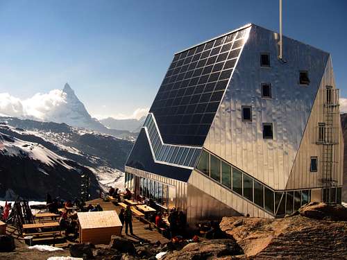
This route follow more or less the same "normal route" of summertime, and due to the position and the altitude, it can be done on ski from march untill june.The brand new refuge, built 100 meters above the old one, is mostly full up, and the booking it is strictly recommended on its website 24h before the arrival.
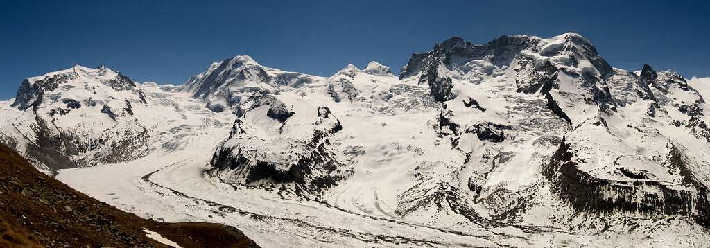
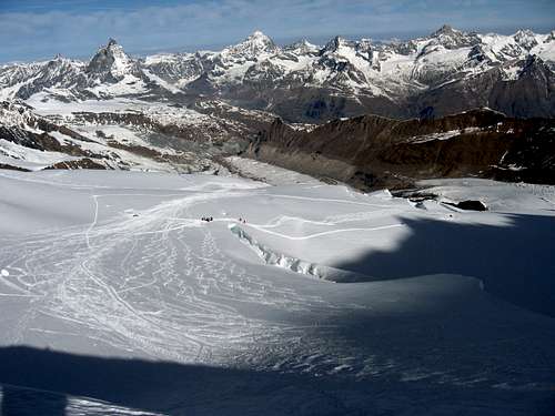
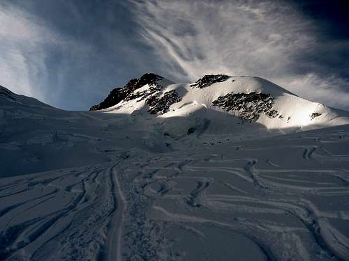
Monterosa group seen from Rotenboden.
Approach from Cervinia (I)
From Cervinia village, take the cable cars to Testa Grigia also known as Plateau Rosà 3480 m, which is the higest point reachable from the italian side. From here ski down shortly on the pists that take to Zermatt, and than leave the pist on the right side to take the begin of the "Unter Theodulgletscher" (below the cables of the Kleine Matterhorn lift). Descent the glacier on the left side avoiding the numerous crevasses in the middle of it, pointing to the flat Gornergletscher which the Theodulgletscher is tributary of. From here, the enormous Gornergletscher is visible coming down from the summits of Monterosa towards the village of Zermatt. Pass through the flat glacier to east direction and below the Breithorn group, untill it's divided in two parts. Above the moraine, the refuge should be visible 100 meters over it, on a rocky area called "Unter Plattje" (2.883m). During the descent of the route, ski down across the entire Gorner glacier, untill it narrows into a canyon that leads to the pastures above Zermatt. Here a cable car station called "Fury" 1.886m, permits to get back to the pists of Testa Grigia and Cervinia. This is a beautiful route, but possible only in early time when the snow is enough, and "Fury" station is reachable easily. Easy to loose the way with bad weather, so recommended a mountain guide. (Also much cheaper than the approach from Zermatt!!)Approach from Zermatt (CH)
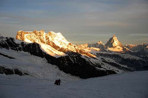
From the village of Zermatt, take the cog railway to "Gornergrat" station (3.089m), and exit to the station called "Rotenboden" (2.819m). From here, awesome view to all the summits of Monterosa group. A blue signal indicates the path that leads to Monterosa Hütte. The path could be covered of snow, or fully clean related to the period. Anyway, get to the glacier with a long traverse and point to a lake at the base of the morraine where the refuge is placed. Few iron ladders helps to get down to the glacier. This is the common way to get the refuge; shorter and faster than the italian one. The negative thing is that the Rotenboden rail station is 250 meters above the galcier. Meters that have to be climbed back after the 1.800 meters drop of the route to the summit! 2.050m in total.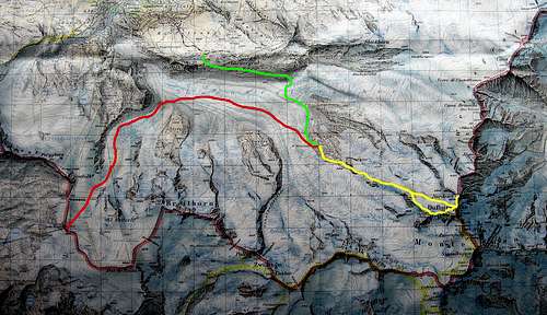
Red line: Route from Cervinia
Green line: Route from Zermatt
Yellow lines: Routes to the summits
Routes
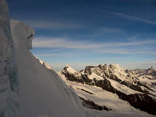
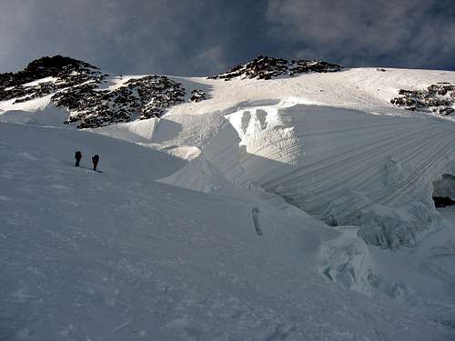
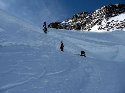
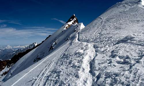
Nordend (4.609m): From the refuge (breackfast time around 4h'00 o'clock am), go up the easy slope at the begin, and than steeper on the rocky promontory called "Ober Plattje". The glacier begin here (Monterosagletscher). It consists in continuous change of slopes between huge serracs. During the spring the crevasses aren't a lot. Once reached the foot of the summits, the slope become more fractured. The last big crevasses as to be crossed with crampons and axe, and the difficulty change year by year. The glacier ends at a snow saddle called Silbersattel (4.517m). Leave the ski in a secure position, and follow the snow ridge on your left side, that takes to the rocky summit of Nordend. The ridge is easy, but big ice framing on the East wall could be very dangerous. BSA/PDDufour spitze (4.634m)
Route A: From the Silbersattel, the Dufour spitze is visible as a long ridge, that descends towards West with rocks at the begin and then with a snow back. From the plateau a couloir rarely clean af ice permits to get the summit, with same fixed ropes placed recently. Same rappeling for the descent. This is the common and easyest way to the summit. Often crowded. BSA/PD+
Route B: As before explained, the Dufour spitze begins from the glacier, with a snow shoulder that leads to the rocky summit. Get the base of the shouder almost at the altitude of 4.000m. Climb it with ski or by foot, depending on the ice conditions. When the ridge become wery narrow, leave the ski, and carry on foot easily till the cross on the summit. Route more direct, but could be dangerous if the ridge is too icy. OSA/PD.
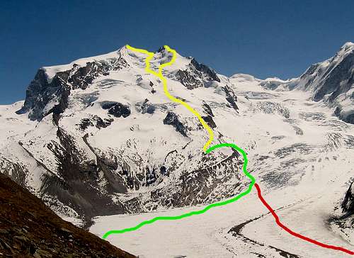
Images of the routes
Hut
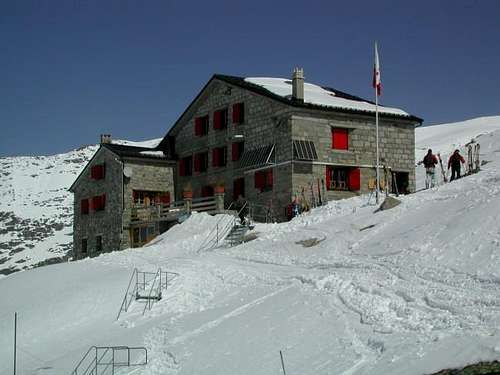
1. Swiss side see Monte Rosa Hut
When to climb
Ski-mountaineering: March to July (long days, cold, covered crevasses)
Meteo
MeteoSwitzerland
Meteo Valle d'Aosta
Guidebooks and maps
Guidebooks


 Guidebook")
"Il grande libro dei 4000" by Marco Romelli, Valentino Cividini - Idea Montagna Editore, 2015
-“Monte Rosa” by Gino Buscaini (Club Alpino Accademico Italiano) – Collana Guide dei Monti d'Italia CAI-TCI (Club Alpino Italiano-Touring Club Italiano)
"Walliser Alpen" Vol. III, Swiss Alpine Club (German and French)
-“Tutti i 4000” – L’aria sottile dell’alta quota” – CLUB 4000 CAI TORINO – Vivalda Editori
-“The 4000 of the Alps” by Richard Goedeke (CAAI) – All the normal routes to the 4000m. summits of the Alps – Libris Edition
-“Le Alpi Pennine, le 100 più belle ascensioni fra il Gran San Bernardo e il Sempione” by Michel Vaucher - Zanichelli Editore“
-“I Quattromila delle Alpi” by Karl Blodig and Helmut Dumler – Zanichelli Editore
-“100 scalate su ghiaccio e misto” by Walter Pause – Gorlich Editore
Maps

"Breuil/Cervinia-Zermatt" Kompass map 1:50.000
"Cervino-Matterhorn e Monte Rosa" n. 5 - Istituto Geografico Centrale map 1:50.000
"Matterhorn - Mischabel" n. 5006 map 1:50'000
"Zermatt" n. 1348 map 1:25'000
External links
- Nordend at www.4000er.de
Images, routes, coordinates and more information about the highest peaks of the Alps