Toggle navigation
Mountains
Routes
Images
Trip Reports
Forum
What's New
People
Areas & Ranges
Articles
Trailheads
Canyons
Huts & Campgrounds
Albums
Logistical Centers
Fact Sheets
Lists
Custom Objects
Gear
Plans & Partners
WELCOME TO SUMMITPOST
SIGN IN
REGISTER
Cone Peak
Additional Parents
Image
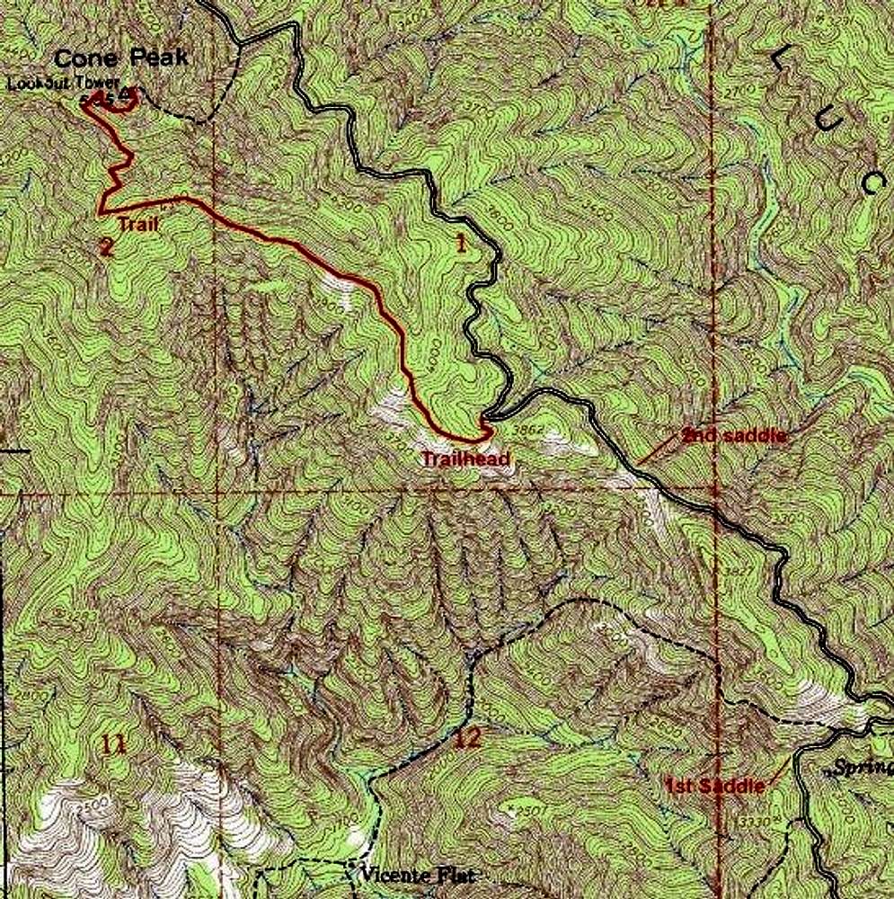
Cone Peak hiking trail. Note...
View High-Resolution Image
Cone Peak hiking trail. Note...
Cone Peak hiking trail. Note the black dashed lines on this map represent old trails that have been re-aligned. For their current alignment, consult Jeffrey Schaffer's book on Ventana Wilderness.
« PREV
NEXT »
gordonye
on
Sep 5, 2001 11:24 am
Comments & voting
Other parents
Lat/Lon:
36.05190°N / 121.495°W
Image Type(s):
Topo/Diagram
Image ID:
1761
12312 Hits
73.09
% Score
4
Votes
Log in to vote
Comments
No comments posted yet.
to post!
Don't have an account?
Cone Peak
(Mountain/Rock)
« PREV
Viewing
#34 of 70
GALLERY
NEXT »
gordonye's Image Gallery
« PREV
Viewing
#152 of 302
GALLERY
NEXT »
×
You need to login in order to vote!
User Name
Password
Remember me
Forgot your password?
Log me out when I close my browser.
Keep me logged in all the time.
sign in as a user
Don't have an account?
Register now for FREE
Rating available
Suggested routes for you
People who climb the same things as you
Comments Available
Create Albums
Register Here


