
Comments
No comments posted yet.
|
|
Trip Report |
|---|---|
|
|
48.25446°N / 120.44195°W |
|
|
Apr 28, 2020 |
|
|
Skiing |
|
|
Spring |
In the Spring of 2020 a friend and I managed a week+ ski traverse weaving the passes and mountainsides of the Sawtooth Range along the east side of Lake Chelan between War Creek Pass and Merchant Basin. This was during the height of the first round of Covid 19 shut-downs of everything, the forest service websites indicated trailheads were closed but said nothing about the wilderness. Indeed, some trailheads had signs indicating the trailheads were closed – but again nothing specifically prohibiting being in the wilderness, just the trailheads. It didn’t quite make sense to us; was it ok to be in the wilderness but we couldn’t walk through a trailhead to get there? Could we walk around a trailhead, say, 100 yards away, and circle back to the trail? Wilderness traveling would be the ultimate in social distancing and we would be using separate solo-style tents, no need to even get close to each other, so it seemed a reasonably responsible activity.
We decided to go despite the trailhead signs, but with a bit of paranoia, wondering if we were committing a violation such that a ranger might take enforcement action. As a result, it seemed obvious to name this trip the “Covid/Covert Traverse”. We even rehearsed our story in advance – “oh, no, officer, actually we parked away from the trailhead and walked through the woods to get here”. We arrived at the turnoff for the spur road to War Creek trailhead and it was gated – it had been open the week before – so we parked on the main road and began preparing our gear to walk the last couple of road miles. Two trucks containing uniformed rangers pulled up to the gate. Our paranoia spiked, but they ignored us as they opened the gate, drove through, then locked the gate behind them. We quietly walked up the road, packs with skis on our backs, feeling like a pair of spies on a clandestine mission behind enemy lines, constantly waiting for the rangers to appear and arrest us. We got to the trailhead where their vehicles were parked and continued on up the trail, paranoia at maximum. When we began to encounter snow patches we found their footprints, but still no sightings. Finally the snow patches became large drifts and the tracks stopped – where did these rangers go? Eventually we began to breath easy, knowing we had moved far beyond the reach of anyone not equipped for snow travel.
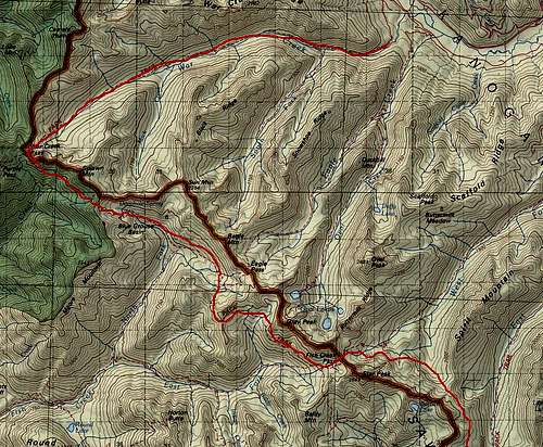
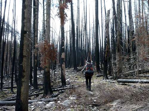
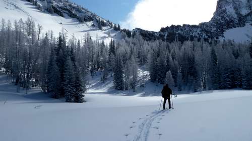
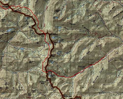
As is normal for these trips this time of year, the start was hiking on low elevation trail. The forest in upper War Creek was burned out rather high, and this meant the snow, exposed to direct sunlight, was absent higher than one would expect. But eventually we made it through the transition and arrived at War Creek Pass where forest was unburnt and snow was abundant and deep. Turning southeast, we contoured the mountainsides, basically traveling where the trail would be, but of course we could not see any sign of trail, it was deep under snow.
Arriving in the area of Eagle Pass, I had the ill-conceived idea that we could climb over the nearly 7800 foot ridge straight southeast from Eagle Pass in a direct line to Tuckaway Lake. Once we got eyes on it, my friend, who has an amazing ability to tolerate some of my more hair-brained schemes, gently convinced me that we should continue to follow the unseen trail route to the southwest, as the terrain looked far more reasonable that way. Of course he was right, as the end-run around the sub-ridge went smoothly, and in fact provided both good views down to Lake Chelan and a great downhill glide from the south side of point 7610 back into Horseshoe Basin.
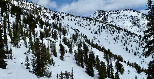
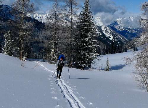
More side-hilling and some climbing took us to the basin of Star Lake where my buddy’s tele-binding broke. Ever-prepared, he had another cable to put in and we were underway within an hour. Up over Fish Creek Pass we went, switching to the other side of the main ridge of the Sawtooth Range. We enjoyed some of the best powder headed down from that pass, carving turns back and forth through larch trees, what a blast!
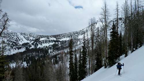
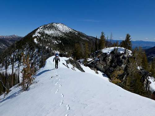
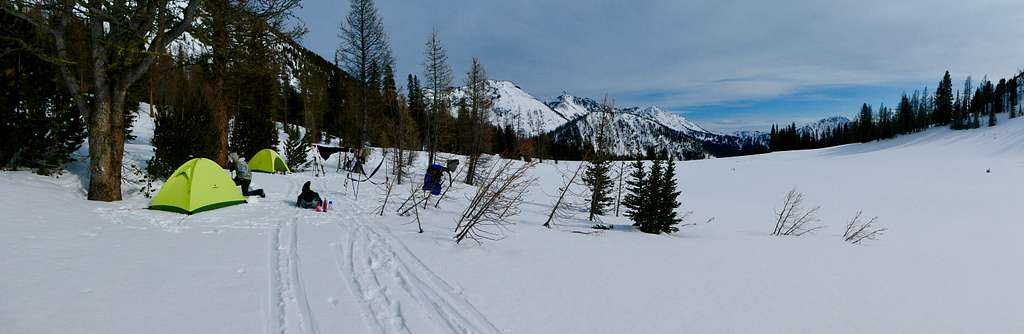
Turning southeast again at about 6800 feet, we worked up and down around minor buttresses and ravines, sometimes switching to crampons, and across small hanging mountainside basins. We found a very pleasant camp in one of these basins mid-way to HooDoo Pass with nice flat spots, some protective trees and flowing water, always a plus on a ski trip.
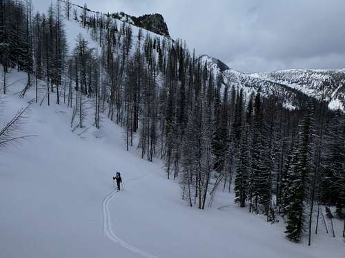
After another day of challenging travel, navigating occasional obstacles, through forest with a number of downed and blocking trees, and scrambling over a rock ridge, we made it over Hoodoo Pass and camped in the open and inviting meadow just south of the pass, again finding running water.
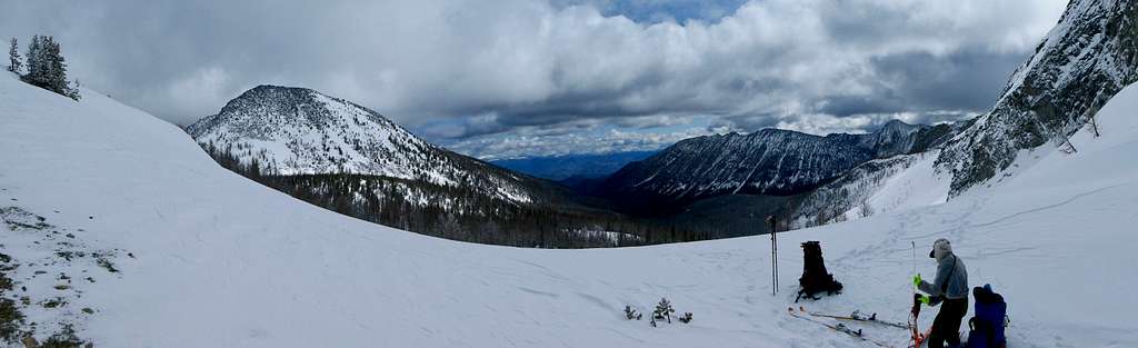
More leisurely skiing the next day took us to the basin of Boiling Lake. We used the minor 7440 pass SSW of Boiling Lake rather than the trail route, and finally made camp at the top of the southern-most branch of the East Fork of Prince Creek, again enjoying far-reaching views down into the valley of Lake Chelan and across to the Emerald Peak-Cardinal Peak group of mountains.
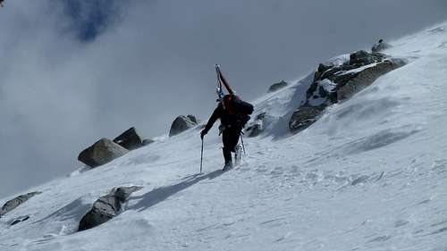
The next day we experienced some very cold and windy weather, of course on the day we needed to cross the steep ridge directly above, due west from camp, to get into Merchant Basin. Careful map study and sat photo study before this trip suggested something that turned out to be true: Crossing this ridge at the lowest point, approximately 7560, was NOT the way to go; the other side was very steep and corniced. We climbed to the ridge about 1000 feet north of that low point to another minor notch at approximately 7640+. The descent there was very steep but reasonable and cornice-free. Once we made the basin floor, expecting a great ski run down valley, we discovered that the blasting winds had scoured all the powder off the basin floor, leaving a sheet of solid ice. Ice skates would have worked. But we carefully skied it anyway, and once making the trees, we found that was where all the powder landed. Some challenging trail skiing eventually took us to the lower Foggy Dew valley and one final camp just as the snow ran out. A couple hours of walking the next morning had us out by lunch.
This turned out to be a fabulous and elegant route, I can highly recommend it for any experienced wilderness skier. There are no extremely technical sections and under the right conditions no long extensive avalanche slopes to cross. At certain points along the route, one looks down over 6000 feet to Lake Chelan, and views to the west into the heart of the North Cascades are great; if you are also a climber, you will spend much time trying to identify dozens of peaks. And this area often offers better weather when the crest of Cascades are storm-ridden.