
|
|
Custom Object |
|---|---|
|
|
test page |
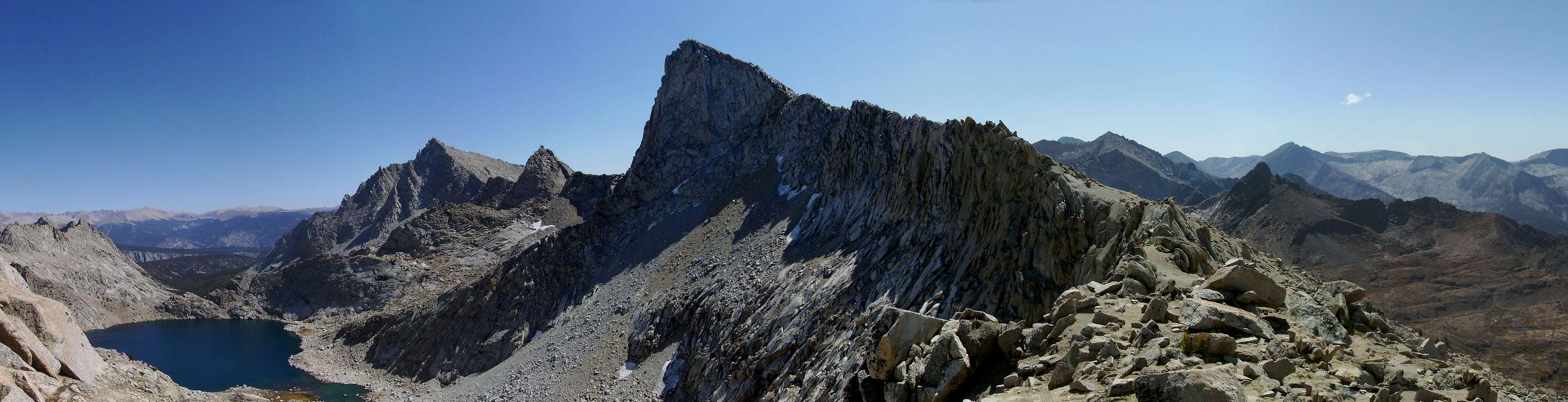
4 pic table
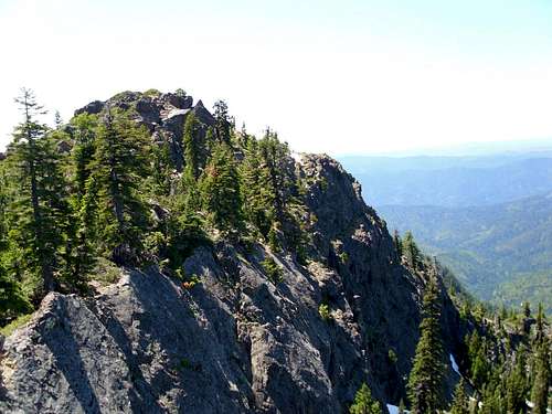
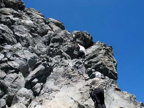
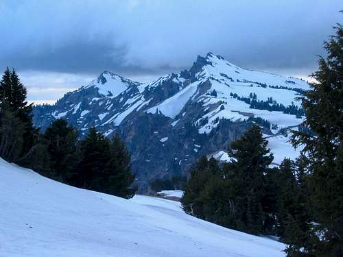
West Ridge (Standard Route): This route begins as a use trail up the scree and talus of the lower mountain, later becoming a class 3 scramble as the ridge steepens. The final climb up the summit pinnacle is a class 4 scramble on the only solid piece of rock on the mountain.
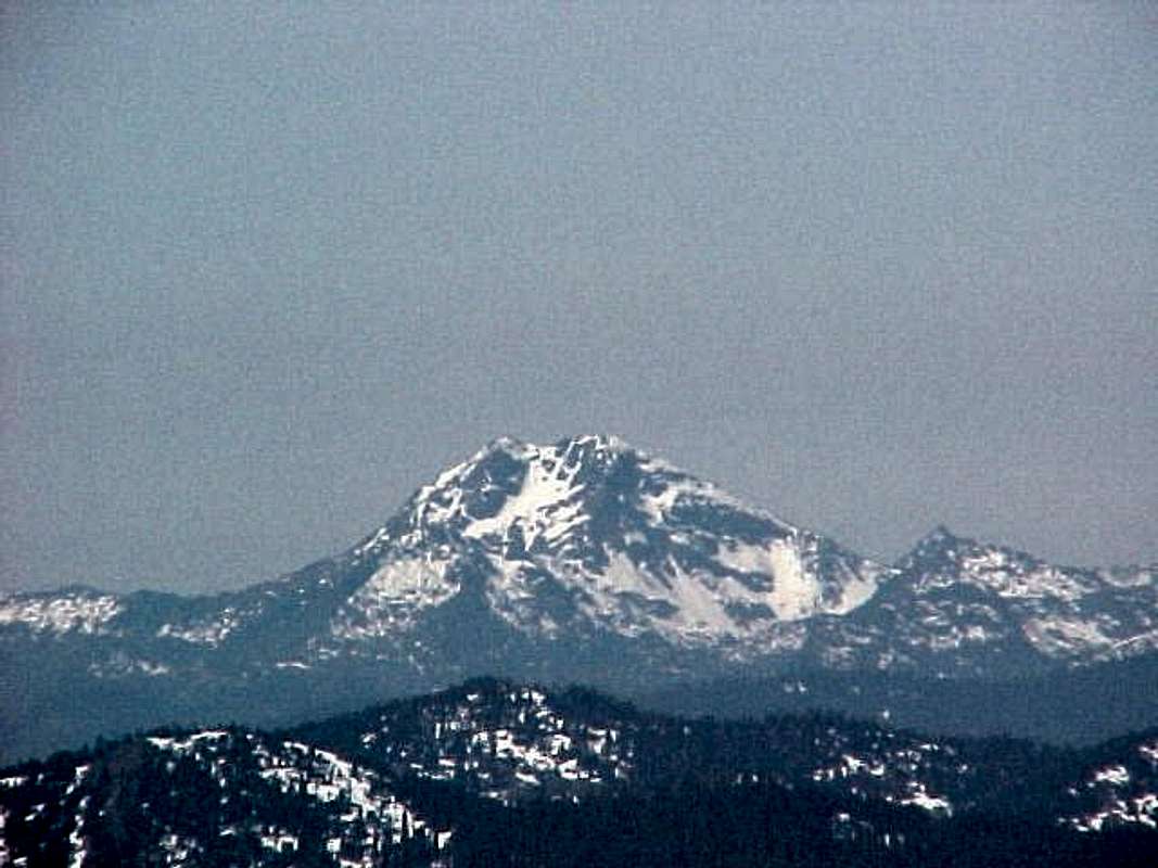
McLaughlin Memorial Route: A seldom done route that follows the NNE ridge of the peak. The rock quality is reportedly very poor, and the route features “an unprotectable 40 foot vertical cinder pitch”. An interesting discussion of this route, including commentary from the first ascensionist, can be found here. A detailed route description can be found in Jeff Thomas's Oregon High.
|  Thielsen's North Face (Brian Jenkins) Thielsen's North Face (Brian Jenkins) |


sliding pann
  |
West Ridge (Standard Route): This route begins as a use trail up the scree and talus of the lower mountain, later becoming a class 3 scramble as the ridge steepens. The final climb up the summit pinnacle is a class 4 scramble on the only solid piece of rock on the mountain.
McLaughlin Memorial Route: A seldom done route that follows the NNE ridge of the peak. The rock quality is reportedly very poor, and the route features “an unprotectable 40 foot vertical cinder pitch”. An interesting discussion of this route, including commentary from the first ascensionist, can be found here. A detailed route description can be found in Jeff Thomas's Oregon High.
| Thielsen's North Face |

large pann


code
 |
5


 |
|
|
|
6
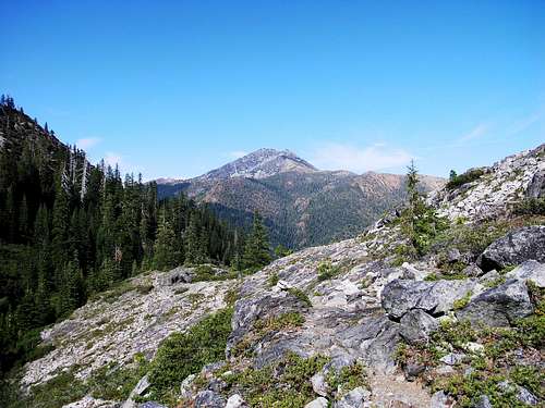
 Valencia Peak From Oats Peak
From San Luis Obispo
From US 101 take Exit 202A for Los Osos Valley Road. Continue on for 11 miles to the city of Los Osos. Continue straight through town on the main street, eventually the road becomes Pecho Valley road. 4 miles on Pecho Valley road will put you at Spooners Cove, where the main trailhead is located. If you want to begin your hike from the Coon Creek trailhead, drive another mile on this now single lane road.
From Moro Bay
From State Route 1, take Exit 277 for South Bay Blvd. After four miles turn right on Los Osos Valley road. Continue on Los Osos Valley road through town on the main street, eventually the road becomes Pecho Valley road. 4 miles on Pecho Valley road will put you at Spooners Cove, where the main trailhead is located. If you want to begin your hike from the Coon Creek trailhead, drive another mile on this now single lane road.
 |
 |
 |
 |
7
 |  |
pix

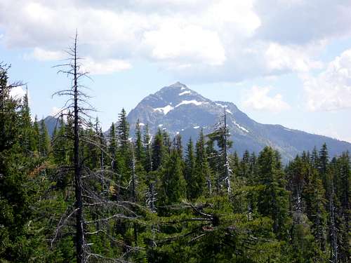
Valencia Peak
 |
|
77867
 |
 |
43
 |
 |
sanger
 |
 |
111
| | |
thir
asdfa
| View Major Peaks Map in a larger map |
lakes
| Name | Location | Description | |
| Kelly Lake | .5 miles from Kelly Lake TH | Located only .5 miles from the trailhead, Kelly Lake is the most popular destination in the Siskiyou wilderness. Most visitors Fishing here |  Kelly Lake (Zach Urness) Kelly Lake (Zach Urness) |
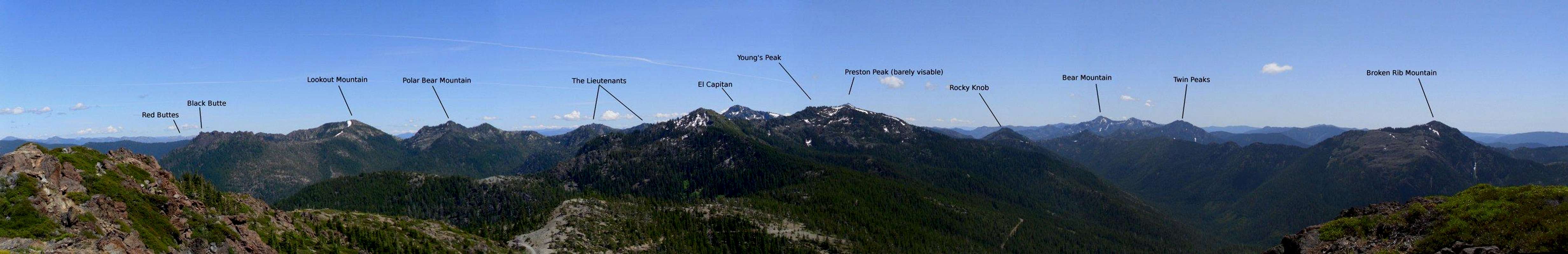
| Lieutenant Lake | Various distances, Young's valley TH, Black Butte TH, Poker Flat TH | Far away from any trailhead, this remote lake is set in a cirque beneath the towering Lieutenant Peaks. Regardless of which trailhead one begins from, reaching this lake will require crossing two mountain passes, meaning solitude is pretty much a guarantee here. The lake is unofficially named on the topo, and is known to some as Private Lake. |  Lieutenant Lake Lieutenant Lake |
| Sanger Lake | Just outside the wilderness boundary on Road 18N07 | Located a stones throw outside the wilderness boundary, Sanger Lake offers a lot of the same qualities one would find at the lakes within the wilderness, but without the hike. The lake is popular with fishermen. |  Sanger Lake Sanger Lake |
| Raspberry Lake | 7 miles from Young's Valley TH | Set beneath the dramatic Preston Peak, this deep mountain lake is one of the most scenic in the wilderness. The lake is packed with trout and offers some of the best fishing in the wilderness. |  Raspberry Lake (Dennis Poulin) Raspberry Lake (Dennis Poulin) |
| Devil's Punchbowl | 6.5 miles from Doe Flat TH | The crown jewel of the Siskiyou Wilderness, Devil's Punchbowl is set in a deep u-shaped glacier carved valley. Steep granite walls shoot thousands of feet directly up from the lake. The lake has little vegetation to use as firewood, so be sure to bring a stove. Despite the strenuous hike required to get here, this is one of the most popular destinations in the wilderness. Solitude is not a guarantee on summer weekends. |  Upper Devils Punchbowl (Dennis Poulin) Upper Devils Punchbowl (Dennis Poulin) |
| Buck Lake | 1.5 miles from Doe Flat TH | A quick stroll from the doe flat trailhead |  Buck Lake Buck Lake |
| Island Lake | 7 miles from Island Lake TH | A steep hike |  Island Lake (Zach Urness) Island Lake (Zach Urness) |
| Bear Lake | 3.2 miles from Elbow Springs TH | bla |  Lower Bear Lake (Zach Urness) Lower Bear Lake (Zach Urness) |
| Harington Lake | Various distances, South Kelsey TH, Elbow Springs TH, Gunbarrel TH | Situated near the geographic center of the wilderness the scenic Harington Lake is set beneath the granite cliffs of Harington mountain. Getting there requires a long hike form any direction, and the section of the Kelsey Trail from Bear lake to Eightmile creek has not been maintained in many years. But those willing to make the hike will be rewarded with some of the best scenery the Siskiyous have to offer. | |
| Flat Iron Lake | 2 miles from the Elk Valley TH | Flat Iron Lake is the most notable of several tarn along the boundary trail. The lake is quite smalla ns shallow, but carries a unique charm other lakes in the wilderness can not match. The boundary trail is not maintained, and offers incredible potential for solitude to those with decent wilderness navigation skills. |
tabl
| Trailhead | Description | Directions | |
| Black Butte | The only westside trailhead accessible from Oregon. High clearance vehicles are helpful for this drive | From Obrein Turn on on Waldo Road/ county road 5550. Turn off on county road 5820 and drive through the "alternative community" of Takilma. If you make it out of Takilma alive turn right on Forest route 4906. Continue on for 5 miles, eventually the route number becomes 053 and you'll come to the signed trailhead. | |
| Youngs Valley | One of the most popular trailheads in the wilderness. The northern access to the Clear Creek National recreation trail. | From US 199 turn on Knopki Creek Road/Forest route 18N07. Continue for 17 miles to the fork with the road to Sanger Lake, turn right for another mile. | |
| Doe Flat | By far the most popular trailhead in in the wilderness. Devils Punchbowl in particular sees a lot of use. | From 199 turn on Forest route 16 / Little Jones Creek Road. After 10 miles turn left on Forest Route 16N02. Follow this road for 3 miles. | |
| Gunbarrel | Access to a campsite on the south fork of the Smith River. | From Little Jones Creek Road, at the junction with 16N02 head straight, this road is also numbered 16N02. Head Straight for 4 miles then turn on Route 16N18. Turn left on 15N34 for another mile. | |
| South Kelsey | This trailhead is accessible year round due to its lower elevation | Just past Hiouchi turn on South Fork Road. Continue on until you reach the junction with forest route 15 (the Gasquet Orleans or GO road). Continue 3 miles to a marked turn off to the trailhead. | |
| Summit Valley | Access to summit valley and a fire lookout. | Head Up the Go road for 15 miles to the signed trailhead. Park on the left | |
| Boundary/GO Road | Climb over the berm at the westside dead end of the GO road. | This is shown on maps as a trail, however this is just an old 4WD road that hasn't been maintained since the wilderness was designaed. | |
| Trailhead | Description | Directions |
| Poker Flat | Access to the remote Twin valleys. | At Happy Camp turn left on road 7C01 (The State of Jefferson Scenic Byway). Pass West Branch Campground and turn left On Forest Route 18N33. |
| Kelly Lake | The most popular eastside trailhead, Kelly lake is only a .5 mile hike and sees a lot of day use. | On 7C01 Turn on Route 18N30 before West Branch campground. Trailhead is 5 miles up the road. |
| No Mans | This trailhead is accessible year round due to its lower elevation. This is the southern access to the Clear Creek National Recreation Trail | From the community of Clear Creek turn on Route 15N35 and follow it until it dead ends. |
| Elbow Springs | This is the Eastern Access to the Kelsey Trail. | From Clear Creek turn on Route 15N19 and follow it for about nine miles. |
| Elk Valley | Access to the boundary trail, a ridge top route that hasn't been maintained in decades. | Head north on the Forest Route 15 from Orleans (this is the eastern half of the GO road). After 16 miles turn right on Route 14N03. The trailhead is three miles up the road. |
| Forks of Blue | True No mans Land. | Head 14 miles up the Orleans half of the GO road. Trailhead is on the left. |
may
|  High resolution map of the Siskiyou Wilderness High resolution map of the Siskiyou Wilderness  Devils Punchbowl and Preston Peak (by Dean) Devils Punchbowl and Preston Peak (by Dean) |
ll

|