Toggle navigation
Mountains
Routes
Images
Trip Reports
Forum
What's New
People
Areas & Ranges
Articles
Trailheads
Canyons
Huts & Campgrounds
Albums
Logistical Centers
Fact Sheets
Lists
Custom Objects
Gear
Plans & Partners
WELCOME TO SUMMITPOST
SIGN IN
REGISTER
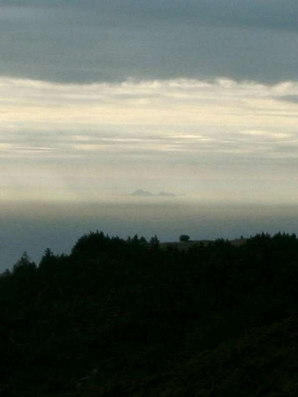
Southeast Farallon Island...
View High-Resolution Image
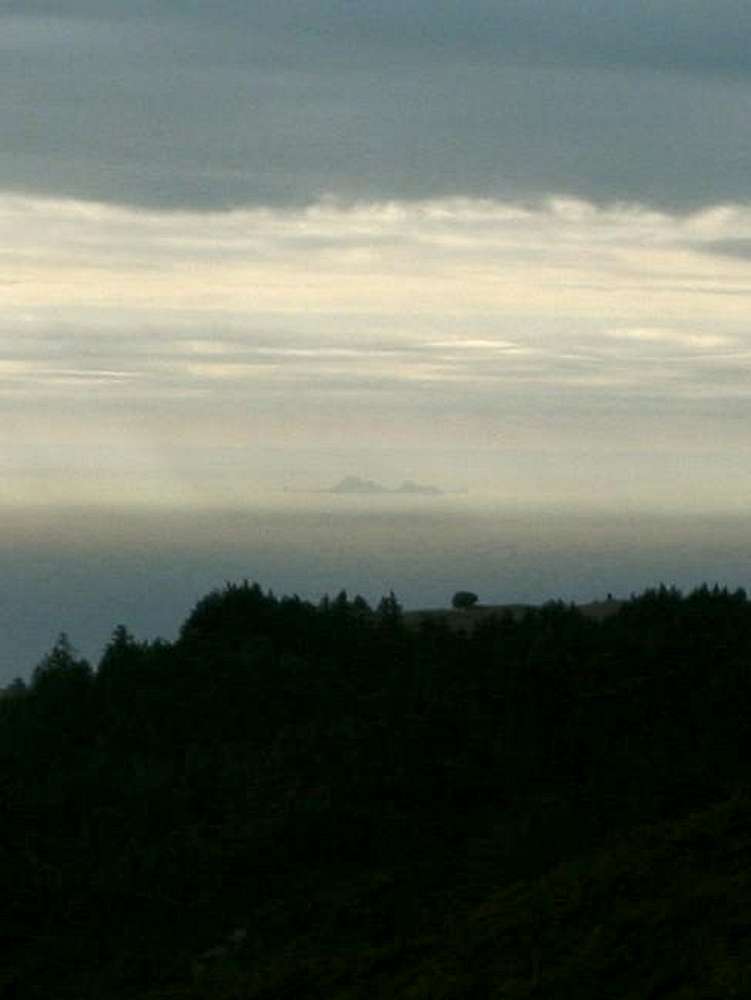
Southeast Farallon Island...
Southeast Farallon Island from the summit of Mount Tamalpais, about 27 miles northeast. Lighthouse Hill is the high summit on the left. Photo taken mid-afternoon on 24Dec2002.
« PREV
NEXT »
mpbro
on
Dec 29, 2002 3:46 pm
Comments & voting
Other parents
Lat/Lon:
37.69800°N / 123.001°W
Image ID:
15410
3076 Hits
72.08
% Score
2
Votes
Log in to vote
Comments
No comments posted yet.
to post!
Don't have an account?
Lighthouse Hill
(Mountain/Rock)
You are at
the First
Image
Viewing
#1 of 1
GALLERY
You are at
the Last
Image
mpbro's Image Gallery
« PREV
Viewing
#205 of 305
GALLERY
NEXT »
Lighthouse Hill
(Mountain/Rock)
Loading....
×
You need to login in order to vote!
User Name
Password
Remember me
Forgot your password?
Log me out when I close my browser.
Keep me logged in all the time.
sign in as a user
Don't have an account?
Register now for FREE
Rating available
Suggested routes for you
People who climb the same things as you
Comments Available
Create Albums
Register Here


