
-
 106565 Hits
-
 91.74% Score
-
 36 Votes
|
|
Mountain/Rock |
|---|---|
|
|
43.52060°N / 122.1486°W |
|
|
8750 ft / 2667 m |
|
|
Overview
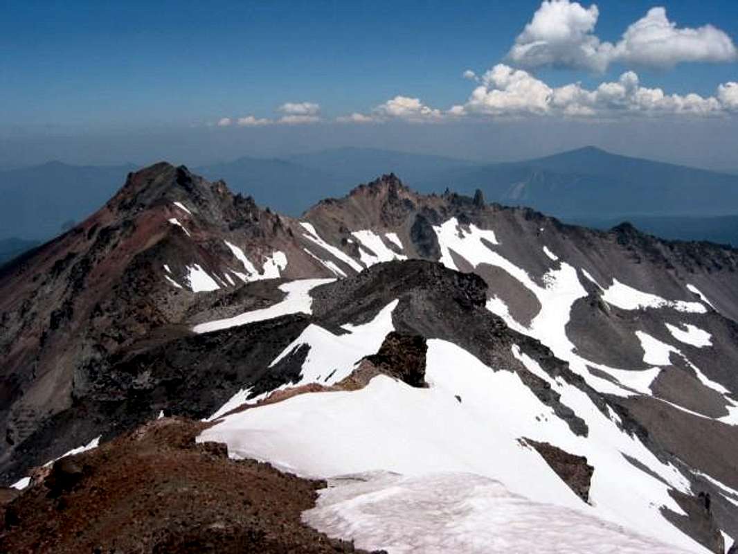
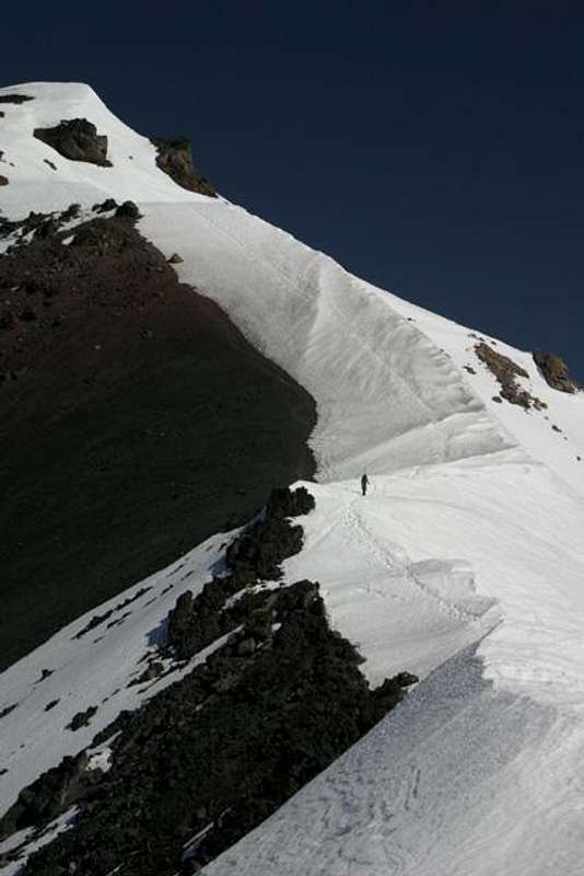
Diamond Peak stands above the Willamette Pass area of Oregon about 50 miles southwest of Bend. It's a little further west than the other peaks in the Cascade Range which accounts for high snowfalls and a few glacial remnants near the peak. It's reachable by several trails and is a popular ski mountaineering peak in winter with over 4000 skiable vertical feet. The summit was carved by glaciers and has many cirques. Pinnacled lava ridges connect the peaks. The glaciers left behind dozens of lakes around this peak as well.
While it is not one of the better-known Cascade Peaks, it's bulkiness can easily be seen from Mt. McLoughlin to Mt. Jefferson. It's not a difficult summit but it is a more remote peak and the trails can be long (up to 21 miles round trip from the Willamette Pass and around 40 miles round trip fom the west trails). The shortest and most popular path climbs the South Ridge and can be done in about half a day or so (10 to 12 miles).
The first ascent was in 1852 by John Diamond (namesake) and William Macy. It's a shield volcano unlike most of the other big classic Cascade peaks like Hood or Rainier which are stratovolcanoes. It does sit in an area with some other shield volcanoes such as Sawtooth Mountain and Cowhorn Mountain. Depending on the trail you take, the elevation gain can be from 2700 feet to 4100 feet.
 |
 |
 |
 |
 |
Getting There
The South Ridge is accessed through small gravel roads. See the South Ridge Route page for directions.
Another popular route is from the Willamette Pass area. The Pacific Crest Trail can be accessed from Highway 58 near the Pass. The PCT runs along the east side of the mountain and you can pick up a climbers trail to the summit. From Eugene, it's about 50 miles east on Highway 58 or, from the Bend area, you can take the Cascade Lakes Highway to Highway 58 and head west towards the Pass.
There are also many options to get into the Diamond Lakes Wilderness off Highway 58 including the Pengra Pass trailhead on Hwy 58 as well as Road 23, 2419, 5810 to the Yoran Trailhead, and Road 60. Marie Lake, Divide Lake and Rockpile Lake are popular basecamps for the climb.
Red Tape
A Northwest Forest Pass is required to park at the trailhead. You can pick these up at a Ranger District or one of many sporting goods or outdoor stores in the area (or in the Northwest).
Day and overnight visitors are required to obtain a permit between Memorial Day and October 1st. These are free and are self-issued at the trailhead.
When To Climb
Can be climbed year-round. Ski mountaineering (see link above) in the winter and hiking in the warm months.
Camping
Camping is allowed on the mountain. No fees but check the Red Tape section for requirements.
There are tons of camping sites along Road 21 which runs a bit west of Diamond Peak. For the South Ridge, there is also free camping at Summit Lake. (However, beware of the sign that says Diamond Peak Trail 1 mile from Summit Lake as I tried it and a large tree blocked the way in July of 2002). Note that the "road" into Summit Lake is a rutted and potholed dirt road that you really need a vehicle with some clearance to drive.
 |
Mountain Conditions
This is the latest conditions site for the Willamette Pass ski area located about 10 miles north of the mountain. It has a live webcam.
Middle Fork Ranger District
49098 Salmon Creek Rd.
PO Box 1410
Oakridge, OR 97464
(541) 782-2283
Map
USGS Topo Map with 40 foot increments is good.
Geo Graphics one with 80 foot increments is good also and has history, driving directions from Oakridge, OR, picture and a 3-D rendering on reverse side.
Have seen both of these in the Portland, OR area at REI and at The Mountain Shop.
cascadetraveler - Mar 18, 2006 7:25 am - Voted 10/10
summit routes.It is true the south route up diamond peak is the most used. The west ridge(corrigan lake) and the southwest ridge(pioneer gulch)are however the shortest roundtrip access to the summit of diamond peak. Both of these bieng eight miles round trip from there respective traiheads.