
|
|
Mountain/Rock |
|---|---|
|
|
37.40570°N / 118.733°W |
|
|
13748 ft / 4190 m |
|
|
Overview
Mount Morgan 13,748' is located south of Mammoth Lakes and north of Bishop in the Eastern Sierra Nevada Mountains. It is the 31st highest peak in California and the highest in the Rock Creek area. Despite its lofty height, it is very accessible and relatively simple to hike in one day. It is referred to as Mount Morgan (S) because another Mount Morgan is located less than 8 miles north at an elevation of 13,001'.
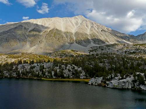
The area is beautiful and full of hiking trails and other mountains. A multi-day trip is highly recommended to explore all the area has to offer. Mount Morgan S is the highest summit in the area but can be hiked in 5-7 hours without too much trouble.
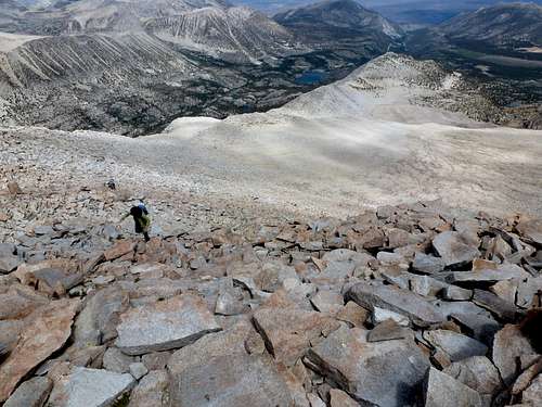
The easiest route on Mount Morgan is the Tamarack lakes trailhead to Francis Lake then the obvious ridge to the peak. The views are truly excellent from this peak. Mount Morgan is on the Sierra Peaks List.
 |
 |
 |
 |
 |
Getting There
Coming from the north or south on 395 turn west at Toms Place and drive up Rock Creek Road to Rock Creek Lake. The road is paved. Once you are at the Tamarack Lakes Trailhead it is easy to follow.
 |
 |
 |
Red Tape
No permit is required to day hike the peak. If you are planning a overnight stay at Francis Lake you need a permit which can be obtained at the Ranger station in Bishop, CA. Inyo National Forest White Mountain Ranger District 798 North Main Street (395) #760-873-2500.
When To Climb
Summer is the best time to climb Mount Morgan. There are skiing options, but access is limited in winter.
 |
 |
 |
 |
Camping
There is plenty of camping options in the area, as well as at the trailhead. For more information, see the Little Lakes Valley page.
Mountain Conditions
Call the Ranger Station in Bishop 760-873-2500
External Links
- Eastern Sierra Web Page General info on the Eastern Sierra
- Forest Service Web Site Inyo National Forest website
- A dayhike - Jul 8, 2001
Bob Burd - Oct 29, 2002 8:37 pm - Voted 10/10
Untitled CommentAs far as I know you don't need a permit to dayhike the peak.
This is true of every Sierra peak except those accessed through the special Whitney Zone out of Whitney Portal.
Bob Burd - Oct 29, 2002 8:41 pm - Voted 10/10
Untitled Comment"The mountain was named in 1878 by the Wheeler Survey for one of its members, J. H. Morgan, of Alabama. (Gudde, Place Names, 211; SCB 4, no. 4, June 1903: 290; USGS Bulletin 310, 161.) The mountain and creek are named on the first Mt. Goddard 30' map, 1912. The other names first appear on the 15-minute quads."
- Peter Browning, Place Names of the Sierra Nevada
Bob Burd - Oct 29, 2002 8:46 pm - Voted 10/10
Untitled CommentYou can add these coords on the main page to activate the Topozone Map feature:
lat=37.4053
lon=-118.7323
hgrapid - Mar 22, 2021 2:56 pm - Hasn't voted
Re: Mount Morgan SouthThe person who owns this page hasn't been on the site since 2015. I asked them if they are able to provide updates. If I don't hear from them by the end of March, I will take over the page. I have hiked this peak and should be able to flesh out the page more fully.