


-
 3810 Hits
-
 82.48% Score
-
 15 Votes
|
|
Route |
|---|---|
|
|
45.50820°N / 7.19341°E |
|
|
Mixed |
|
|
Spring |
|
|
Half a day |
|
|
Various according to the steepness of the slopes (by snowshoes) |
|
|
Note
|
La montagna chiama i suoi figli, ed essi rispondono fedelmente al suo appello… Osvaldo Cardellina, Diario alpinistico, 1964-65 Page texts: @ OsvaldoCardellina "Osva", passed away on May 2, 2022. Page owners: Christian Cardellina e Osvaldo Cardellina. Any updates from September 12, 2022: Antonio Giani, page administrator, friend and climbing companion. Testi della pagina: @ OsvaldoCardellina "Osva", scomparso il 2 maggio 2022. Proprietari pagina: Christian Cardellina e Osvaldo Cardellina. Eventuali aggiornamenti dal 12 settembre 2022: Antonio Giani, amministratore della pagina, amico e compagno di salite. |
Snow Rackets Overview
This work is aimed at Lovers of Nature and the great Open Spaces. It has no goals nor obliged points of "absolute conquest", but only Ideas of days to live outdoors in an alpine environment with the goal "to collect" all that the mountain is able to give to those who know it approach with the right motivation. And it is for this reason that the title of 7 could be 77, since each of these routes, let's call them basic, can in turn be divided into several stages or fractions; depending on the snow conditions, weather, and even their own personal wants or those of friends who accompany you. Here the goals are clear, and sometimes, as often there is success, improvised or invented by surprise. There are obliged goals and everyone can choose not only where to start, but also where to stop, maybe sitting on a warm rock in the Sun ...
***
"As you start, you know, how it ends no ... / Come si inizia si sà, dove finisce no ..., by emilius
*******
Questo lavoro é rivolto agli Amatori della Natura e dei grandi Spazi Liberi. Non presenta mete obbligate e neppur punti di "conquista assoluti", ma soltanto Idee di giornate da vivere all'aria aperta in ambiente alpino con l'obiettivo di "raccogliere" tutto quel che la montagna é capace di donare a coloro che san ad essa avvicinarsi con le giuste motivazioni. Ed é per questo motivo che il titolo di 7 potrebbe diventare 77, poiché ognuno di questi itinerari, chiamiamoli così di base, può a sua volta essere diviso in diverse tappe o frazioni; a seconda delle condizioni della neve, del tempo ed anche della propria personale voglia o di quella degli amici che ti accompagnano. Qui le mete son libere ed a volte, come spesso ci é successo, improvvisate oppure inventate a sorpresa. Non ci sono obiettivi obbligati ed ognuno può scegliere non solo donde iniziare, ma anche ove terminare, magari sedendosi sopra un caldo sasso a prendere il Sole ...
![]()
"As you start, you know, how it ends no ... / Come si inizia si sà, dove finisce no ..., by emilius
 |
 |
 |
 |
 |
Questo lavoro é rivolto agli Amatori della Natura e dei grandi Spazi Liberi. Non presenta mete obbligate e neppur punti di "conquista assoluti", ma soltanto Idee di giornate da vivere all'aria aperta in ambiente alpino con l'obiettivo di "raccogliere" tutto quel che la montagna é capace di donare a coloro che san ad essa avvicinarsi con le giuste motivazioni. Ed é per questo motivo che il titolo di 7 potrebbe diventare 77, poiché ognuno di questi itinerari, chiamiamoli così di base, può a sua volta essere diviso in diverse tappe o frazioni; a seconda delle condizioni della neve, del tempo ed anche della propria personale voglia o di quella degli amici che ti accompagnano. Qui le mete son libere ed a volte, come spesso ci é successo, improvvisate oppure inventate a sorpresa. Non ci sono obiettivi obbligati ed ognuno può scegliere non solo donde iniziare, ma anche ove terminare, magari sedendosi sopra un caldo sasso a prendere il Sole ...
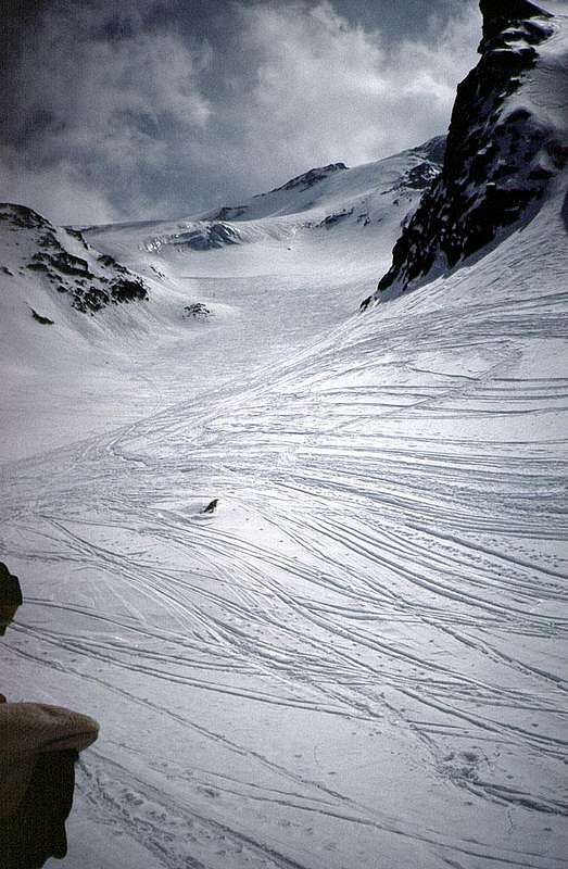
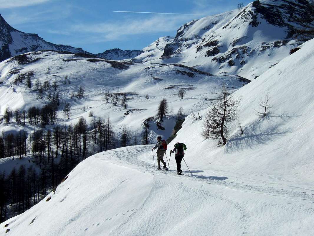
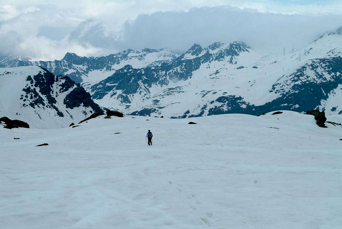
But sometimes, you find a little surprise: in Good and Evil. You left convinced that the conditions were good, and instead you face unexpected obstacles or unpredictable. The snow is too high and soft for which reason, in spite of the tool, equally sinks; or just the opposite, ie is scarce and should untie the clutter by foot because useless. Worse, the tranquil trip unexpectedly becomes difficult and dangerous because the slope is too steep and icy and the small harpoon that are "glued" to the racket does not "bite" to the extent necessary. Looking for an alternative solution looking for some "trick" to change radically the way. And it is in such a way that you find yourself jumping out "of the frying pan into the fire". Like that, now that looking from above, said "guatando dal pelago alla riva" (exchanging glances, from the open sea to the shore), you can look down the danger just escaped ...
Però, a volte, qualche sorpresina la trovi: nel Bene e nel Male. Sei partito convinto che le condizioni fosser buone ed invece ti trovi ad affrontare ostacoli imprevisti oppure imprevedibili. La neve é troppo alta e molle per la qual cosa, nonostante l'attrezzo, ugualmente si sprofonda; oppure esattamente il contrario, cioé é scarsa e convien slegare l'ingombro da piedi perché diventato inutile. Peggio, la tranquilla escursione imprevedibilmente diventa difficile e pericolosa perché il pendio risulta eccessivamente ghiacciato e ripido ed il piccolo rampone che trovi "incollato" alla racchetta non "morde" in misura necessaria. Cerchi una soluzione alternativa inventando qualche "escamotage" nel cambiare radicalmente il percorso. Ed é in siffatto modo che all'improvviso ti ritrovi a cader "dalla padella nella brace". Così, come quel che dicea "guatando dal pelago alla riva", puoi guardar dall'alto il pericolo testé scampato ...
![]()
Però, a volte, qualche sorpresina la trovi: nel Bene e nel Male. Sei partito convinto che le condizioni fosser buone ed invece ti trovi ad affrontare ostacoli imprevisti oppure imprevedibili. La neve é troppo alta e molle per la qual cosa, nonostante l'attrezzo, ugualmente si sprofonda; oppure esattamente il contrario, cioé é scarsa e convien slegare l'ingombro da piedi perché diventato inutile. Peggio, la tranquilla escursione imprevedibilmente diventa difficile e pericolosa perché il pendio risulta eccessivamente ghiacciato e ripido ed il piccolo rampone che trovi "incollato" alla racchetta non "morde" in misura necessaria. Cerchi una soluzione alternativa inventando qualche "escamotage" nel cambiare radicalmente il percorso. Ed é in siffatto modo che all'improvviso ti ritrovi a cader "dalla padella nella brace". Così, come quel che dicea "guatando dal pelago alla riva", puoi guardar dall'alto il pericolo testé scampato ...
Getting There
BY CAR:
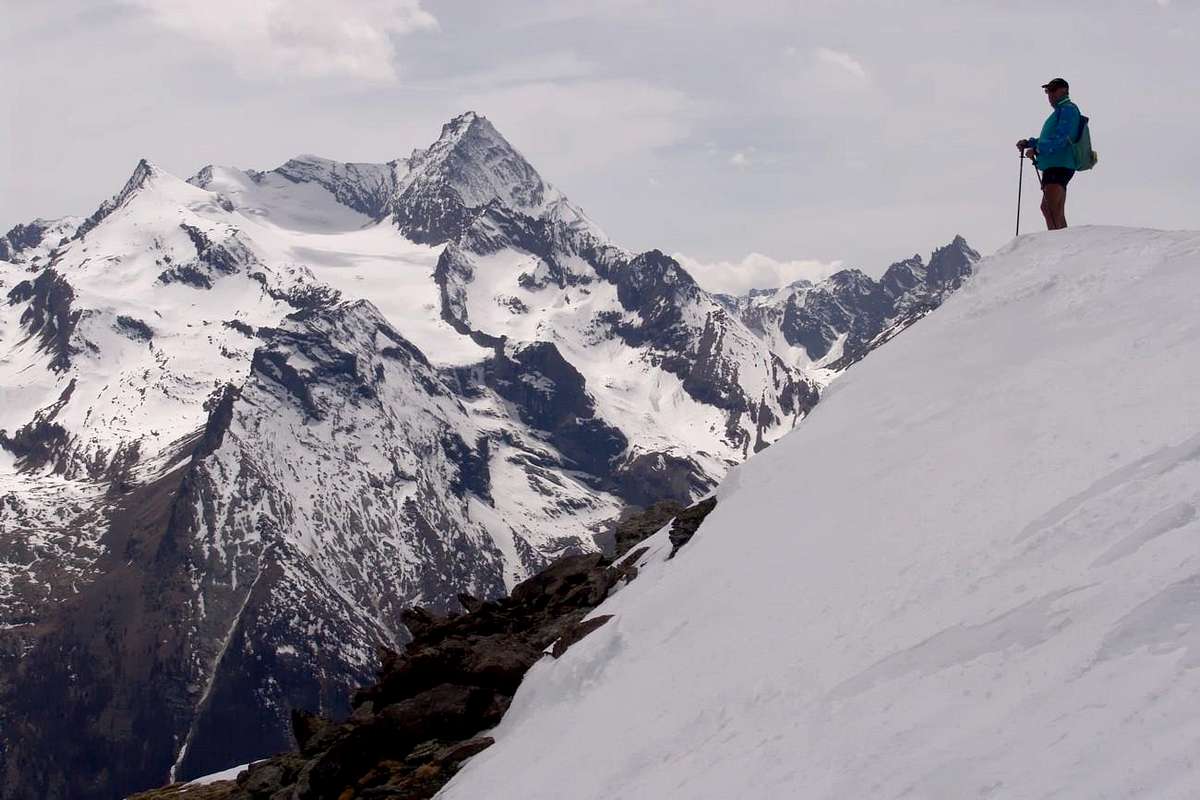
"From here the Valley royally domains ... / Da qui regalmente domini la Valle ..."
![]()
- From TORINO, MILANO, etc: Motorway A5. Exit at IVREA or Quincinetto (PIEDMONT) also Pont Saint Martin, Verrès, Châatillon, AOSTA East (Nus) and West (Aymavilles) Municipalities (AOSTA Valley).
- From IVREA Town to Hone-Bard, Pont Bozet, Champorcher, Aymavilles, Villeneuve.
From Hone-Bard to Champorcher Valley
From Pont Bozet (775m) to Champorcher Valley: Camporcher-Château (1.427m), Petit, Grand Mont Blanc, La Cort Villages, to Dondena Village (2.092m), Dondena & Miserin Refuges, through Royal Road & secondary dirt roads; Barbustel Refuge, through Royal Road, path towards Champdepraz Vallon.
From Aymavilles to Cogne and from Villeneuve to Valsavarenche Valleys - From Aymavilles (646m) towards Cogne Valley with Regional Main Road: Vieyes (1.132m) Fraction, Mario Gontier private Shelter, through small path in Nomenon Vallon. Continue to Silvenoire, Epinel & Crétaz Hamlets, Cogne (1.534m) Resort, through Main Road. To Valnontey (1.678m), through Municipal Road: to Money, Alessandro Martinotti, Stefano Borghi, Carlo Pol, Marcello Gerard & Ettore Grappein, Lionello & Lucio Leonessa, Mario Balzola, Luciano Gratton (this last from Epinel or Crétaz) Bivouacs, through paths, moraines and glacier, & Vittorio Sella Refuge, through muletrack). From Lillaz Fraction (1.607m) to Sogno di Berdzé, Denis Gérard & Guido Antoldi & Laura Malvezzi Refuges, by dirt road, muletrack or paths in Urtier and Valeille Vallon. To Gimillan Village (1.785m), Franco Nebbia Bivouac, with path in Upper Arpisson Vallon. All the three last through Regional Roads from Cogne.
- From Villeneuve (670m) to Savarenche Valley, Dégioz-Valsavarenche (1.541m) up to the Pont Valsavarenche (1.946m). From this or neighbor to Federico & Renato Chabod, below North Buttress of Gran Paradiso; Vittorio Emanuele II° (Old & New). Albergo Savoia & Città di Chivasso Refuges at the end of Nivolé, through muletracks and Renzo & Sebastiano Sberna Bivouac, through path, moraines of Montandayné Glacier and below the Herbetet.
- From Villeneuve (670m) to Rhêmes Valley: Introd (880m), Rhêmes Saint Georges (1.171m), Notre Dame (1.725m) Communes, through Regional Main Road, up to the Thumel Village (1.887m) with Municipal Road and to Gian Federico Benevolo Refuge (2.280m), through dirt farms road or underlying path. It is not necessary to take Motorway A5: you can drive on SR.26, in the direction of AOSTA - IVREA - TURIN.
BY PLANE:
- Aeroporto "Corrado Gex" Saint Christophe (Aosta).
Technical Overview
This work, momentarily directed to the valleys and vallons sited in the South of Baltea, will soon be completed directing a look also to the possible routes on the opposite side. A third phase will be devoted to those, facing the central axis of the Valley of Aosta, Courmayeur in Pont Saint Martin, and then turned to the same river. After these first seventy-seven, then another long series allow you to collect more than two hundred proposals for snowshoeing, tool in vogue now for twenty years, but there is no reason that the same can be considered valid, in summer, in Hiking in respect of the genre with some prodrome to the small mountain climbing. An "escalation" which, in my view, requires some care and a basic and brief annotation of general approach.
We give some information on how this technique work against the classification of trips according to certain factors set out below.
a) - of the same classification based on the length of the route:
1) - Basic Itinerary: it is a crucial path for the visit of a valley or ravine.
2) - Minimum Route: path of short duration, usually donated to beginners.
3) - Intermediate Step: partial section of a path integral, but aimed at a fixed point of arrival and of a certain size (known as popular).
4) - Intermediate Step with Variant: partial tract but with digression into the end of a Basic Route or in a Way Exceptional.
5) - Exceptional Via: the way of great length and with considerable difficulty with use of the tool; ability to pause and resume the climb with and without snowshoes.
6) - Variant: significant change in the initial part of the path, in that the media and, especially, in the final.
b) - Classification of the same according to the technical difficulties of the route; always in relation to the length but mainly through the analysis of the "land of the game" to deal with. Since there is no one currently in force scale of the difficulties with snowshoes, I propose a four-level reported with a precise theme:
T or E) -: simply elementary and primary tourist, for easy routes aimed at Tourists or for Hikers, often referred to beginners;
F) -: easy and hikers with good experience and knowledge of the use of rackets;
M) -: medium difficulty and length, where it is already required a good use dell'attrezza and a sure sense of direction; calls for knowledge, at least from the point of view of information, of course. Also you can already see quite steep uphill and downhill.
D) -: path usually long and rocky obstacles or steep slopes, such as power also compel a partial use of snowshoes or a frequent lieu thereof; may be present whether exposed or very delicate and also small glacier crossings.
* At the initials can be added to the sign + or - to further differentiate the assessment with a greater or lesser degree.
c) - Time required: is calculated by the average of the hill a temple during the summer with an increase of about half of that.
d) - General Technical notes and details: special passages are reported as the ford torrents without bridges or boardwalks, stretches of trail exposed or overcome unexpected obstacles (tracts of forest with fallen trees, passing stone small walls in general across meadows, transit below slopes subject to landslides unsafe etc.).
e) - Comments on the snow conditions and recommended period or with contraindications: clearly are suggestions that come from the experiences made and then changing somewhat from year to year; it then uses a statistical observation and strictly personal.
f) - weather situations: notes about the possibility of making the trip in different weather situations; where there are made means that they are to be understood as superficial and useless discounted.
"There are many roads that lead to the High. Pick one ... / Molte son le vie che adducon all'Alto. Sceglietene una ...", by Gabriele
![]()
We give some information on how this technique work against the classification of trips according to certain factors set out below.
a) - of the same classification based on the length of the route:
1) - Basic Itinerary: it is a crucial path for the visit of a valley or ravine.
2) - Minimum Route: path of short duration, usually donated to beginners.
3) - Intermediate Step: partial section of a path integral, but aimed at a fixed point of arrival and of a certain size (known as popular).
4) - Intermediate Step with Variant: partial tract but with digression into the end of a Basic Route or in a Way Exceptional.
5) - Exceptional Via: the way of great length and with considerable difficulty with use of the tool; ability to pause and resume the climb with and without snowshoes.
6) - Variant: significant change in the initial part of the path, in that the media and, especially, in the final.
b) - Classification of the same according to the technical difficulties of the route; always in relation to the length but mainly through the analysis of the "land of the game" to deal with. Since there is no one currently in force scale of the difficulties with snowshoes, I propose a four-level reported with a precise theme:
T or E) -: simply elementary and primary tourist, for easy routes aimed at Tourists or for Hikers, often referred to beginners;
F) -: easy and hikers with good experience and knowledge of the use of rackets;
M) -: medium difficulty and length, where it is already required a good use dell'attrezza and a sure sense of direction; calls for knowledge, at least from the point of view of information, of course. Also you can already see quite steep uphill and downhill.
D) -: path usually long and rocky obstacles or steep slopes, such as power also compel a partial use of snowshoes or a frequent lieu thereof; may be present whether exposed or very delicate and also small glacier crossings.
* At the initials can be added to the sign + or - to further differentiate the assessment with a greater or lesser degree.
c) - Time required: is calculated by the average of the hill a temple during the summer with an increase of about half of that.
d) - General Technical notes and details: special passages are reported as the ford torrents without bridges or boardwalks, stretches of trail exposed or overcome unexpected obstacles (tracts of forest with fallen trees, passing stone small walls in general across meadows, transit below slopes subject to landslides unsafe etc.).
e) - Comments on the snow conditions and recommended period or with contraindications: clearly are suggestions that come from the experiences made and then changing somewhat from year to year; it then uses a statistical observation and strictly personal.
f) - weather situations: notes about the possibility of making the trip in different weather situations; where there are made means that they are to be understood as superficial and useless discounted.
Questo lavoro, momentaneamente indirizzato a valli e valloni siti a Mezzogiorno della Dora Baltea, sarà prossimamente completato rivolgendo uno sguardo anche agli itinerari possibili sul lato opposto. Una terza fase sarà dedicata a quelli prospicenti l'asse centrale della Valle di Aosta da Courmayeur a Pont Saint Martin e quindi rivolti al fiume medesimo. Dopo questi primi settantasette, quindi, un'altra serie permetterà di raccogliere oltre duecento proposte per le racchette da neve, attrezzo in voga ormai da una ventina di anni, ma nulla vieta che i medesimi possan essere considerati validi, nella bella stagione, nei confronti dell'Escursionismo in genere con qualche piccolo prodromo verso l'Alpinismo. Un'"escalation" che, a mio avviso, richiede qualche precauzione ed una basilare e sintetica annotazione d'impostazione generale.
Diamo qualche ragguaglio sull'impostazione tecnica di questo lavoro nei confronti della classificazione delle gite in base ad alcuni fattori sotto esposti.
a) - Classificazione delle medesime in base alla lunghezza del percorso:
1) - Itinerario di Base: si tratta di un percorso fondamentale per la visita di una valle o di un vallone.
2) - Percorso minimo: percorso di breve durata, in genere devoluto ai principianti.
3) - Tappa Intermedia: tratto parziale di un percorso integrale, ma mirato ad un punto di arrivo prefissato e di una certa consistenza (conosciuto e frequentato).
4) - Tappa Intermedia con Variante: tratto parziale ma con divagazione nella parte terminale di un Itinerario di Base od in una Via Eccezionale.
5) - Via Eccezionale: via di grande lunghezza e con notevoli difficoltà in base all'uso dell'attrezzo; possibilità d'interrompere e riprendere la salita con e senza racchette.
6) - Variante: significativa variazione del percorso nella parte iniziale, in quella media e, soprattutto, nella finale.
b)- Classificazione delle medesime in base alle difficoltà tecniche del percorso; sempre in rapporto alla lunghezza ma soprattutto tramite l'analisi del "terreno di giuoco" da affrontare. Non esistendo in vigore attualmente una scala delle difficoltà con le racchette da neve, ne proponiamo una con quattro livelli segnalati con una precisa sigla:
T o E) -: turistico ed elementare, per tracciati facili rivolti a Turisti oppure ad Escursionisti, spesso indicati ai principianti;
F) -: facile e per Escursionisti con discreta esperienza e conoscenza dell'uso delle racchette;
M) -: di media difficoltà e lunghezza, dove é già richiesto un buon uso dell'attrezza ed una sicura capacità di orientamento; esige una conoscenza, almeno dal punto di vista informativo, del percorso. Inoltre si possono già incontrare dei tratti abbastanza ripidi sia in salita che in discesa.
D) -: percorso in genere lungo e con ostacoli rocciosi od elevate pendenze, tali da potere anche costringere ad un impiego parziale delle racchette oppure ad una frequente sostituzione delle medesime; possono essere presenti tratti molto esposti o delicati ed anche piccole traversate su ghiacciaio.
* Alla sigla possono essere aggiunti i segni + oppure - per ulteriormente differenziare la valutazione d'insieme.
c) - Orario di percorrenza: viene calcolato un tempio medio della salita durante la bella stagione con un aumento del medesimo di circa la metà.
d) - Note tecniche generali e particolari: sono segnalati passaggi particolari come il guado di torrenti senza ponti o passerelle, tratti di percorso esposti o superamento di ostacoli imprevisti (tratti di bosco con alberi caduti, passaggio di muretti in pietra in genere di traverso ai prati, transito al di sotto di pendii franosi e pericolanti ecc.).
e) - Osservazioni sulle condizioni del manto nevoso e periodo consigliato o con controindicazioni: chiaramente sono suggerimenti che provengono da esperienze effettuate e quindi alquanto mutevoli di anno in anno; si utilizza quindi un'osservazione ed una statistica strettamente personali.
f) - Situazioni Metereologiche: annotazioni sulla possibilità di effettuare la gita in diverse situazioni meteo; laddove non vengono effettuate significa che sono da intendersi come superficiali, scontate ed inutili."Take a good look around and observe carefully the sky, weather, wind and snow ... / Vàrdati con cura attorno e osserva ciel, tempo, vento e neve ...", by emilius
![]()
"Against the current towards the Dream of Berdzé .. / Contro corrente verso il Sogno di Berdzé ...", by emilius
![]()
"Hey, Dude, with this gale I'll stop here ... / Hey, Amigo, yo estaba aquí con este feroz vendaval..." by emilius
![]()
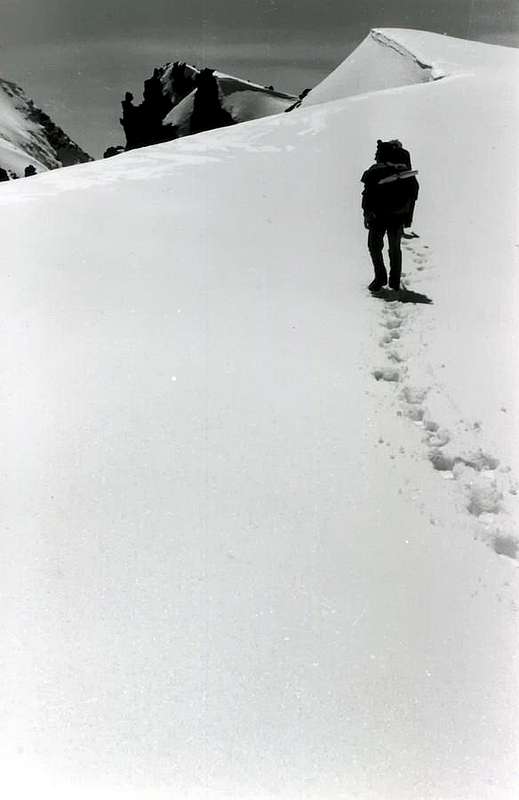
"Are always different snow conditions. Choose well how to proceed ... / Sempre diverse son le condizioni della neve. Scegli ben com'andare ..."by Osw
![]()
"Sometimes the snow is so soft that the boots are better ... / A volte la neve é così molle che son meglio gli scarponi ..."by Armando Poli
![]()
In the sense diametrically opposed, it should be noted that if the same is hard, well-turned is also more cost-effective progress without snowshoes, especially during the descent. Other times, situations arise "mixed" and in this case you have to know when to use and when storing the tool over the backpack; when the snow cover leaves room for ice, water, or the opposite, you have to know the alternating use of the same. Removing it and then maybe replacing it. With great and infinite patience. Like all sporting goods, this requires the technique and use progression, not knowing involves substantial risks, especially in steep hard snow and frost. Also in case of a fall or simple slip becomes absolutely the same can not be controlled because it tends to cross his legs without practically no chance (personal experience) reactivity, is certainly, in this situation, somewhat more dangerous than the crampons. On the other hand allows for day trips where, as mentioned, only the skis allow it, and indeed the size of that facilitate the passage in tight places or simply paths with very dense wooded areas. Among the suggestions are based in the streetscape of all seven valleys; in some more or less, depending on the popularity that they collect among fans of this sport. Others are new to a personal "discovery" in the many years of wandering; all have a minimum base path, to meet the needs of beginners, intermediate traits or offer suggestions depending on the degree of personal training or simply with respect to snow conditions and weather encountered. Some " Exceptional Via" has also been referred to as such; certainly feasible, as from personal experience, but keeping in mind that the term used is not bombastic. Just what adjective should be considered in relation to the use of snowshoes and the period of transit; In fact, those who in the summer may seem like long but simple hiking or climbing in a different season and with the use of these tools take on a completely new and different, fascinating but check carefully.
Always taking into account the Maximum Prudence, good excursions to All ...
"Sometimes snow march and hard ice alternating continuously ... / A volte neve marcia e ghiaccio s'alternano di continuo ..."by emilius
![]()
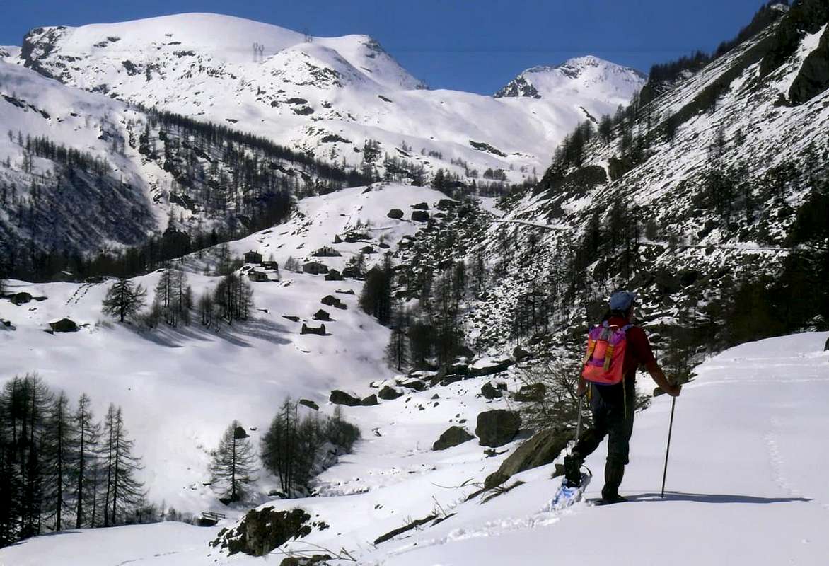
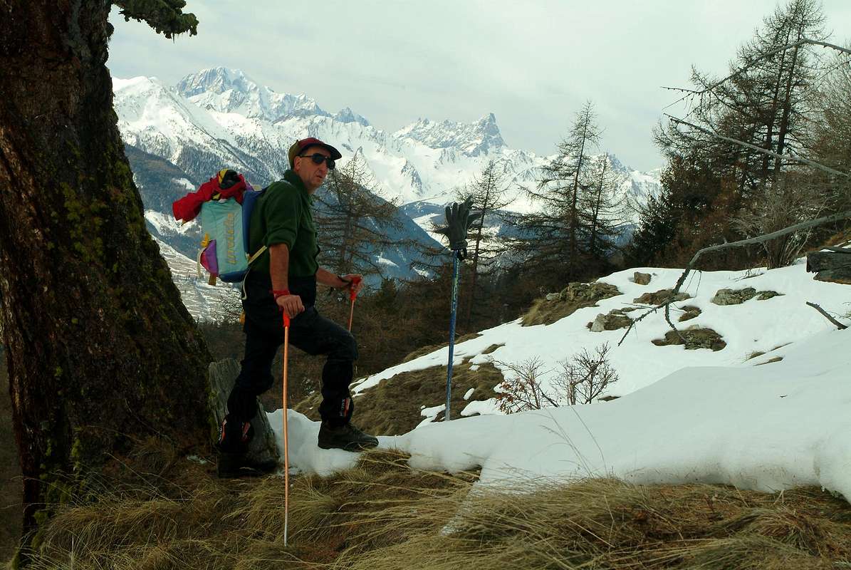
"Sometimes the snow alternate with meadows ... / A volte la neve si alterna ai prati ..." by emilius
![]()
In senso diametralmente opposto, va rilevato che qualora la stessa si presenti dura e ben trasformata é altresì più conveniente progredire senza racchette da neve, soprattutto in fase di discesa. Altre volte si presentano situazioni "miste" ed in questo caso si deve saper quando utilizzare l'attrezzo e quando riporlo sopra lo zaino; quando la coltre nevosa lascia spazio al ghiaccio, oppure all'opposto all'acqua, bisogna sapere alternare l'uso del medesimo. Togliendolo e poi, magari, rimettendolo. Con somma ed infinita pazienza. Come tutti gli attrezzi sportivi, anche questo richiede tecnica d'uso e di progressione; non saperlo comporta notevoli rischi, soprattutto nei tratti ripidi con neve dura e gelata. In caso di caduta o semplice scivolata lo stesso diventa assolutamente incontrollabile poiché tende ad incrociare gli arti inferiori senza in pratica nessuna possibilità (esperienza personale) di reattività; é sicuramente, in simile situazione, alquanto più pericoloso rispetto ai ramponi. Per contro consente di effettuare gite laddove, come detto, soltanto gli sci lo permetterebbero; anzi le dimensioni del medesimo facilitano il passaggio in posti stretti ed angusti oppure semplicemente nei percorsi con aree boschive molto fitte. Tra i suggerimenti proposti ci sono delle Vie di base in tutte e sette le valli; in qualcuna di più o di meno, a seconda della popolarità che esse riscuotono tra gli appassionati di questa disciplina. Altre son novità per personale "scoperta" nei numerosi anni di vagabondaggi; tutte presentano un minimo percorso di base, per andare incontro all'esigenze dei neofiti, oppure propongono dei tratti intermedi suggeriti a seconda del grado di allenamento personale oppur, semplicemente, rispetto alle condizioni di innevamento e metereologiche riscontrate. Qualche "Via Eccezionale" é stata inoltre indicata come tale; sicuramente fattibile, come da personale esperienza, ma tenendo bene in mente che il termine utilizzato non é roboante. Semplicemente quell'aggettivo dev'esser considerato in rapporto all'uso delle racchette da neve e del periodo di transito; infatti quelle che in estate posson apparir come lunghe ma semplici escursioni od ascensioni in diversa stagione e con l'uso di questi attrezzi assumon aspetto completamente nuovo e diverso, affascinante ma da controllare con attenzione.
Sempre tenendo conto della Massima Prudenza, buon'escursioni a Tutti ...
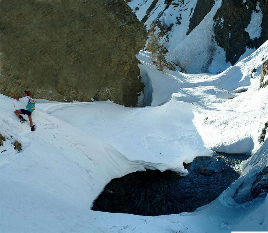
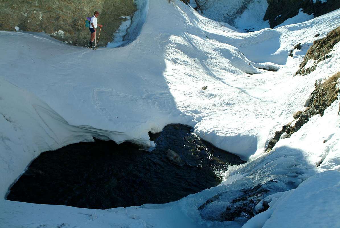
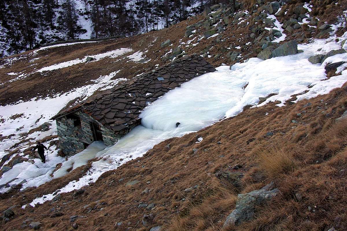
"Others, while leg you found ice, on the way back to find water ... / Altre, mentre all'andata trovavi ghiaccio, al ritorno acqua ..."by Antonio
![]()
"In silence, one after the other ... / In silenzio, un appresso l'altro ...", by lucabertollo
![]()
Diamo qualche ragguaglio sull'impostazione tecnica di questo lavoro nei confronti della classificazione delle gite in base ad alcuni fattori sotto esposti.
a) - Classificazione delle medesime in base alla lunghezza del percorso:
1) - Itinerario di Base: si tratta di un percorso fondamentale per la visita di una valle o di un vallone.
2) - Percorso minimo: percorso di breve durata, in genere devoluto ai principianti.
3) - Tappa Intermedia: tratto parziale di un percorso integrale, ma mirato ad un punto di arrivo prefissato e di una certa consistenza (conosciuto e frequentato).
4) - Tappa Intermedia con Variante: tratto parziale ma con divagazione nella parte terminale di un Itinerario di Base od in una Via Eccezionale.
5) - Via Eccezionale: via di grande lunghezza e con notevoli difficoltà in base all'uso dell'attrezzo; possibilità d'interrompere e riprendere la salita con e senza racchette.
6) - Variante: significativa variazione del percorso nella parte iniziale, in quella media e, soprattutto, nella finale.
b)- Classificazione delle medesime in base alle difficoltà tecniche del percorso; sempre in rapporto alla lunghezza ma soprattutto tramite l'analisi del "terreno di giuoco" da affrontare. Non esistendo in vigore attualmente una scala delle difficoltà con le racchette da neve, ne proponiamo una con quattro livelli segnalati con una precisa sigla:
T o E) -: turistico ed elementare, per tracciati facili rivolti a Turisti oppure ad Escursionisti, spesso indicati ai principianti;
F) -: facile e per Escursionisti con discreta esperienza e conoscenza dell'uso delle racchette;
M) -: di media difficoltà e lunghezza, dove é già richiesto un buon uso dell'attrezza ed una sicura capacità di orientamento; esige una conoscenza, almeno dal punto di vista informativo, del percorso. Inoltre si possono già incontrare dei tratti abbastanza ripidi sia in salita che in discesa.
D) -: percorso in genere lungo e con ostacoli rocciosi od elevate pendenze, tali da potere anche costringere ad un impiego parziale delle racchette oppure ad una frequente sostituzione delle medesime; possono essere presenti tratti molto esposti o delicati ed anche piccole traversate su ghiacciaio.
* Alla sigla possono essere aggiunti i segni + oppure - per ulteriormente differenziare la valutazione d'insieme.
c) - Orario di percorrenza: viene calcolato un tempio medio della salita durante la bella stagione con un aumento del medesimo di circa la metà.
d) - Note tecniche generali e particolari: sono segnalati passaggi particolari come il guado di torrenti senza ponti o passerelle, tratti di percorso esposti o superamento di ostacoli imprevisti (tratti di bosco con alberi caduti, passaggio di muretti in pietra in genere di traverso ai prati, transito al di sotto di pendii franosi e pericolanti ecc.).
e) - Osservazioni sulle condizioni del manto nevoso e periodo consigliato o con controindicazioni: chiaramente sono suggerimenti che provengono da esperienze effettuate e quindi alquanto mutevoli di anno in anno; si utilizza quindi un'osservazione ed una statistica strettamente personali.
f) - Situazioni Metereologiche: annotazioni sulla possibilità di effettuare la gita in diverse situazioni meteo; laddove non vengono effettuate significa che sono da intendersi come superficiali, scontate ed inutili.
Routes Description
We present this basic proposal addressed to each of the six valleys to the South of Dora Baltea and a vallon, the Little Saint Bernard turned to the West and France, closely related to them; it is deliberately excluded the Val Veny that we attach, being adjacent to the Chain of Mount Blanc, along with that of Ferret in a subsequent work we propose the same number of trips based on the opposite side, or Northerner basin and the central axis in respect of the Orographic/Hydrographic Aosta Valley.
IMPORTANT NOTE: this work has been split at a later time, in order to make easier the consultation and reading. In practice, the area is divided on the Gran Paradiso National Park in the strict sense (Cogne and Valsavarenche Valleys), adding the Champorcher Valley which is outside of that, and excluding the Eastern slope of the Rhemes that instead belongs still at it. So were separated by the valleys of the Graian Alps Southeast from the more Western to La Thuile Valley preceding the Chain of Mount Blanc; the areas most "internal" and addressed to the Central Valley of Baltea have been treated in another page in its own right.
For each of these valleys give the cue for an outing by snowshoes, but others could be identified on the basis of personal inspiration. We offer this as a suggestion, relying on the fact of having made and confident of their feasibility. As mentioned above, we give an indicative track with a specific end goal, but nothing prevents you to make changes to the same stretching, decreasing or changing the route. These excursions are the result of ten long years of beautiful and sweaty days with friends, to which must be added an even longer period of time trips previously made; when the snowshoes did not exist, or were those almost useless wood that you wrapped with ropes, rope and even freezing froze his feet. Then your boot became the snowshoes and you learned to "float" above the same. Even in this case, the trips are proposed here, as well as indicative, basis for this tool, sure not give erroneous information. Do not you think you got the "Master Streets", but the good basic Routes. Everyone chooses what he prefers, but always respecting the rules of the safety of yourself and others and prudence.
Except that there, suddenly and unexpectedly, is no lack snow ... With this bad wind & gale!
Presentiamo sta proposta di base indirizzata ad ognuna delle sei valli a Sud della Dora Baltea ed un vallone, quello del Piccolo San Bernardo rivolta ad Occidente ed alla Francia, ad esse strettamente connesso; volutamente s'é esclusa la Val Veny che pensiamo di allegare, essendo limitrofa alla Catena del Monte Bianco, insieme a quella di Ferret in successivo lavoro che proporrà identico numero di gite base sul versante opposto, ovvero Settentrionale Idrografico ed Orografico rispetto all'asse centrale della Valle di Aosta.
NOTA IMPORTANTE: questo lavoro é stato sdoppiato in un successivo momento, onde renderne più agevoli la consultazione e la lettura. In pratica s'é divisa l'area concernente il Parco Nazionale del Gran Paradiso in senso stretto (Valli di Cogne, Valsavarenche), aggiungendovi la Valle di Champorcher che risulta al di fuori del medesimo ed escludendo il versante Orientale di quella di Rhemes invece appartenente ancora a questo. Quindi son state separate le valli delle Alpi Graie del Sudest da quelle più Occidentali insino alla Valle di La Thuile precedente la Catena del Monte Bianco; le zone maggiormente "interne" e rivolte alla Valle Centrale della Dora Baltea sono state trattate in altra pagina a se stante.
Per ognuna delle valli in questione diamo lo spunto per una gita con le racchette da neve, ma altre potrebbero essere individuate a seconda del personal estro. Noi queste offriamo come suggerimento, forti del fatto di averle effettuate e sicuri della loro fattibilità. Come sopra detto, diamo una traccia indicativa con una precisa meta finale, ma nulla impedisce di effettuare dei cambiamenti alla medesima allungando, diminuendo o variando il percorso. Quest'escursioni son frutto di dieci lunghi anni di belle e sudate giornate con gli amici, alle quali va aggiunto un periodo ancor più lungo nel tempo d'escursioni precedentemente effettuate; quando le racchette da neve ancor non esistevano, oppur eran quelle quasi inutili in legno che avvolgevi con funicelle in corda e gelavano gelando pure i piedi. Allora il tuo scarpone diventava la racchetta da neve ed imparavi a "galleggiare" sulla medesima. Anche in questo caso le gite qui proposte sono, oltre che indicative, indicate per questo attrezzo, sicuri di non darvi informazioni errate. Non si pensa di avervi proposto delle "Vie Maestre", ma delle buone Routes di base si. Ognun scelga ciò che più aggrada, sempre rispettando regole di sicurezza e prudenza.
Tranne che di colpo non venga a mancar la neve ... Con stò ventaccio!
Small observations & remarks before starting
It is not always the one with snowshoes is a simple, easy and pleasant stroll. This tool, when the snow is high, it takes you farther; not like skiing, where he also will find a descent faster and less tiring. But it takes you. Surely most of the boots, which, to "float" require patience, instinct but especially more experience and ability to learn to "read" the snow, its layers, its sounds, its smells and even his little noises. Because she apparently lifeless body, however is alive and turns continuously and tirelessly throughout the day and also at night. Season by season, month by month , day by day and hour by hour. A process of course vital, but also dangerous for those who do not observe the phenomenon; is a serious oversight that can lead to unpleasant incidents. A note not to trivialize and to hold, however, in good memory. This tool, as well as designed and built today , but it gets easier the climb, yet it useless in the face of very high snow and powder, or worse, running; then it becomes not only useless but also dangerous because it will trap and, in case of snowslides or worse avalanche, not allow any more movement. But it is so well if you fall into a pool of water or sinks between "clapeys" (boulders and blocks with large gaps between one and the other); at this point are better boots, which maybe allow skipping between a rock and the other and, in case of fall, definitely allow easier extraction of the limbs compressed by snow.

In the sense diametrically opposed, it should be noted that if the same is hard, well-turned is also more cost-effective progress without snowshoes, especially during the descent. Other times, situations arise "mixed" and in this case you have to know when to use and when storing the tool over the backpack; when the snow cover leaves room for ice, water, or the opposite, you have to know the alternating use of the same. Removing it and then maybe replacing it. With great and infinite patience. Like all sporting goods, this requires the technique and use progression, not knowing involves substantial risks, especially in steep hard snow and frost. Also in case of a fall or simple slip becomes absolutely the same can not be controlled because it tends to cross his legs without practically no chance (personal experience) reactivity, is certainly, in this situation, somewhat more dangerous than the crampons. On the other hand allows for day trips where, as mentioned, only the skis allow it, and indeed the size of that facilitate the passage in tight places or simply paths with very dense wooded areas. Among the suggestions are based in the streetscape of all seven valleys; in some more or less, depending on the popularity that they collect among fans of this sport. Others are new to a personal "discovery" in the many years of wandering; all have a minimum base path, to meet the needs of beginners, intermediate traits or offer suggestions depending on the degree of personal training or simply with respect to snow conditions and weather encountered. Some " Exceptional Via" has also been referred to as such; certainly feasible, as from personal experience, but keeping in mind that the term used is not bombastic. Just what adjective should be considered in relation to the use of snowshoes and the period of transit; In fact, those who in the summer may seem like long but simple hiking or climbing in a different season and with the use of these tools take on a completely new and different, fascinating but check carefully.
Always taking into account the Maximum Prudence, good excursions to All ...
Non sempre quella con le racchette da neve risulta semplice, facile e piacevole passaggiata. Quest'attrezzo, quando la neve é alta, ti porta più lontano; non come gli sci, dove poi, inoltre, troverai una discesa sicuramente più veloce e meno faticosa. Ma ti porta. Certamente più degli scarponi, che, per "galleggiare" richiedon pazienza, istinto ma soprattutto più esperienza e capacità di saper "leggere" la neve, i suoi strati, i suoi movimenti impercettibili, i suoi odori ed anche i suoi piccoli rumori. Perché lei, apparente corpo inerte, invece é viva e va trasformandosi continuamente ed incessantemente durante l'intera giornata e pure con la notte. Stagione per stagione, mese per mese, giorno per giorno ed in ora in ora. Un processo naturale e vitale, ma pericoloso per coloro che non sanno osservarne il fenomeno; può divenire una grave mancanza con spiacevoli, se non tragiche, conseguenze finali. Un'annotazione da non banalizzare sottovalutandola e tenendola, invece, ben stretta in memoria. Quest'attrezzo, così come concepito e realizzato oggi, facilita la salita ma diventa, pur esso inutile, di fronte a neve molto alta e farinosa o, peggio, marcia; allora si presenta non solo come inutile ma anche pericoloso perché v'intrappola e, in caso di slavine o peggio di valanga, non permette più movimento alcuno. Ma é così pure se si cade in una pozza d'acqua o si sprofonda tra i "clapeys" (grandi massi con interspazi tra un l'altro); a questo punto son meglio gli scarponi, che magari permetton di saltare tra un masso e l'altro ed, in caso di caduta, sicuramente acconsentono ad una più facile estrazione degli arti compressi dalla neve.
In senso diametralmente opposto, va rilevato che qualora la stessa si presenti dura e ben trasformata é altresì più conveniente progredire senza racchette da neve, soprattutto in fase di discesa. Altre volte si presentano situazioni "miste" ed in questo caso si deve saper quando utilizzare l'attrezzo e quando riporlo sopra lo zaino; quando la coltre nevosa lascia spazio al ghiaccio, oppure all'opposto all'acqua, bisogna sapere alternare l'uso del medesimo. Togliendolo e poi, magari, rimettendolo. Con somma ed infinita pazienza. Come tutti gli attrezzi sportivi, anche questo richiede tecnica d'uso e di progressione; non saperlo comporta notevoli rischi, soprattutto nei tratti ripidi con neve dura e gelata. In caso di caduta o semplice scivolata lo stesso diventa assolutamente incontrollabile poiché tende ad incrociare gli arti inferiori senza in pratica nessuna possibilità (esperienza personale) di reattività; é sicuramente, in simile situazione, alquanto più pericoloso rispetto ai ramponi. Per contro consente di effettuare gite laddove, come detto, soltanto gli sci lo permetterebbero; anzi le dimensioni del medesimo facilitano il passaggio in posti stretti ed angusti oppure semplicemente nei percorsi con aree boschive molto fitte. Tra i suggerimenti proposti ci sono delle Vie di base in tutte e sette le valli; in qualcuna di più o di meno, a seconda della popolarità che esse riscuotono tra gli appassionati di questa disciplina. Altre son novità per personale "scoperta" nei numerosi anni di vagabondaggi; tutte presentano un minimo percorso di base, per andare incontro all'esigenze dei neofiti, oppure propongono dei tratti intermedi suggeriti a seconda del grado di allenamento personale oppur, semplicemente, rispetto alle condizioni di innevamento e metereologiche riscontrate. Qualche "Via Eccezionale" é stata inoltre indicata come tale; sicuramente fattibile, come da personale esperienza, ma tenendo bene in mente che il termine utilizzato non é roboante. Semplicemente quell'aggettivo dev'esser considerato in rapporto all'uso delle racchette da neve e del periodo di transito; infatti quelle che in estate posson apparir come lunghe ma semplici escursioni od ascensioni in diversa stagione e con l'uso di questi attrezzi assumon aspetto completamente nuovo e diverso, affascinante ma da controllare con attenzione.
Sempre tenendo conto della Massima Prudenza, buon'escursioni a Tutti ...
Champorcher (Royal Road to Dondena & Surroundings)
This first area concerns the Champorcher Valley is characterized by the Basic Route from Champorcher-Château/La Cort leads, via the Royal Road built by Victor Emmanuel first King of Italy, in the upper part of the valley to the Village of Dondena. In addition branching paths for Mount Glacier, Mount Delà, Tower Ponton and for Fussi, Moutsaillon, Fénis-Clavalité, Pontonnet and Fenêtre de Champorcher Hills. But this is not the area that can affect the snowshoes; are, in fact, way too long and mostly aimed at hiking. The ways that we show concern mainly Dondena and its surroundings, much more suited to this discipline, at least as carried out personally. Always starting from here, we can consider as the climb to the Via Exceptional Gran Rossa (Great Red) through its two Western Passes, while on the other side, a visit to Miserin Lake (meaning is extended to Mount Rasciàs) and one, starting from Larìs or Refuge Dondena to Cimetta Rossa (Little Red Summit) complete our discussion on long-haul routes. Also note the "low variant" or Southern than the Royal Route, with the view that, while on the North Slope than the Ayasse Torrent often the blanket of snow late to achieve the transformation process, on the South is often at an advanced stage and you can meet different "mixed areas", meaning those routes that alternate sections snowy fields now bare of snow or even ice. These are the areas that affect the lakes, however, the most interesting: the Miserin (wanting the neighbors Lochs Nero and Bianco) to "twins" Giasset/Raty, Vernouille and Muffet, the latter two just above Champorcher-Chateau/Grand and Petit Mont Blanc Hamlets.
Champorcher Valley, adjacent to Soana Valley (Piedmont), Champdepraz, Fénis-Clavalité-High Comba Tersiva Vallons, Val di Cogne.
It reaches from Pont Saint Martin/Donnas(z)/Hone/Bard/Arnad/Verrès Municipalities (345m, 322m, 364m, 566m, 354m, 390m) towards Pont Bozet Commune (775m) and Main tourist Champorcher-Château (1.427m) to Dondena ancient Village (2.097m).
From Dondena to Cimetta Rossa
1) - Basic Itinerary: from Château Champorcher Center (1.427m) towards Gontier, Byron (1.574m; * short deviation to Northeast), Collin (1.614m), Mont Blanc (1.643m), La Cort (1.775m) small Villages at the end of aphalt road; continue West, with Royal Road King Vittorio Emanuele also "King Toio"", to upper small parking (about 1.875/80 meters; ** path in North and, crossing Lago Bianco Hill 2.308m, to Barbustel Refuge (2.209m) neighbor Bianco Lake in Champdepraz Vallon). With traverse same direction on large dirt road towards the following alternative (*** to Chapy or Tsapy Alp 1.979 meters, at the entrance of homonym vallon), Vardette, Brenvei (1945m) Pastures, subsequent alternative (**** to nearby Grand Champlong about 1.920 meters), Grand Letuirie Alp (2.066m; source) to Dondena (2.097m; various panneaux, signals on dirt parking before a short descent), near the footbridge on Ayasse Torrent (F; 2h'00/2h'15).
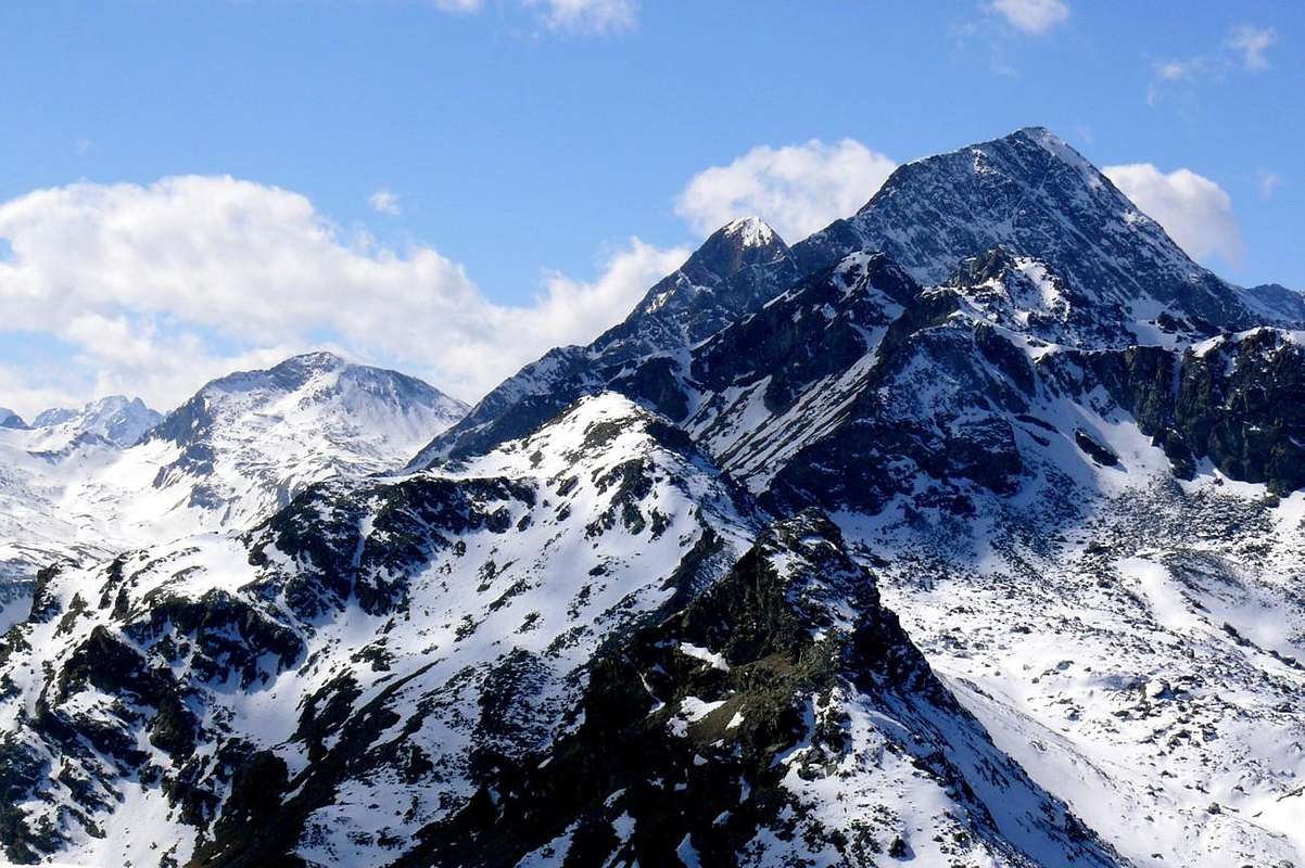
"The long watershed from Gran Rossa to Mount Glacier (3.186m) ...", by emilius
![]()
^^^^^^^
2) - Exceptional Via n° 1: from Royal Road Dondena (about 2.125m), with short dirt road and following path, to Giasset Loch (2.307m) and upper Collar (about 2.400m); from this descent through diagonal path to Raty Loch (2.283m). Going North with traces in narrow vallon to Gran Rossa Eastern Pass (2.763m) and Western; from the first, through easy but steep Western Crest (snowy corniches on last part) to Eastern Summits (about 2.855/60m). With caution continues to true Summit (2.866m) always through Western Ridge (dangerous frames in final part; D; 4h'00/4h'30).
3) - Minimum Route: from Mont Blanc Hamlet (1.683m), with Royal Road, to second fork on the same; tourning Northwest and with path in final part to Chapy Alp (1.979m), below Bec Raty Oriental Antesummit (E; 1h '00/1h '15).
"A small and pleasant walk digress from the Royal Road ...", by emilius
![]()
^^^^^^^
4) - Intermediate step n° 1: from Petit Mont Blanc Village (parking 1.537m), with preceding routes on dirt Royal Road, to Leituerie Alpage (2.066m; source just after), immediately before the small parking of Dondena (E; 1h'40/1h'50).
5) - Intermediate step n° 2: from Royal Road Dondena Parking to tiny Giasset Loch (2.307m) (F; 2h'30/2h'45).
6) - Variant n° 1: from Giasset Lake traverse to 1) - Raty Loch (2.289m), through Giasset Collar (about 2.400m) and diagonal descent; also from little hill crossing on ridge 2) - towards Western, Central, Eastern Becs Raty (2.417m, 2.399m, 2.382m) (M-/D+; a interesting short passage; 3h'15 for the lake; 4h'00/4h'30 for the complete traverse).
7) - Variant n° 2: from Royal Road, near parking, with path in North towards La Grand Cort (1.944m) to Muffé Lake and nearby Alp (2.079; F+; 1h'45/2h'00), below Western slopes of Pana Pass (2.319m)/Cima Perché or Perche (2.388m).
8) - Variant n° 3: with previous route to Muffé Loch (2.070m); from this through path in West-southwest to Vernoille or Vernouille Loch (2.143m), into homonym wide stony basin and below Tête des Hommes (2.618m; F+; 2h'30/2h'45).
9) - Variant n° 4: from fork before Raty Lake (about 2.215m) to 1) - Bec Barmasse (2.303m), throuhg path in East; also crossing more to 2) - Mount Ros (2.289m), the both on rocky promontories over Royal Road. (F+; 3h'15/3h'30).
"On the trail of a Procession, Sacred over the Centuries ...",by Gabriele Corvini aka Corvus
![]()
^^^^^^^
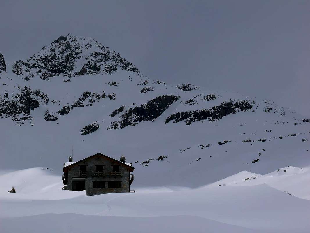
10) - Exceptional Via n° 2: from Dondena Village to Dondena Refuge (+; 2.193m), Miserin Lake, Shelter, Sanctuary and neighbor alp (2.579m, 2.588m), in Upper Southwestern Champorcher Valley, always with dirt road (F+; 1h'45/2h'00).
11) - Exceptional Via n° 3: from Dondena Village to Dondena Refuge; leaving West the route to Miserin Lake, continue in South and, abandoning right (West and South) the three subsequent alternatives (* to Gran Bese, to Cima Dondena (2.548m) and to Pian di Roche Pastures), go Southeast with dirt road to a four alternative preceding Lower Pendant Alp (2.297m). Discarding even this last, carry on, short time, to Cimetta Rossa small Summit (2.466m; arrival Cableway from Larìs Damon (1.949m), below Bec (Beak) Pendent, with next dirt roads to adjacent Larìs Vallon (M-; 3h'00/3h'15).
"Like a ghost appears the Summit ... / Come un Fantasma appar la Cima ...",by emilius
![]()
"Remember that you must go Home .. / Ricordati che devi tornar Casa ...", by emilius
![]()
"Do not knock, just does not live here no ... / Non bussare, tanto qui non abita nessuno ...", by emilius
![]()
It reaches from Pont Saint Martin/Donnas(z)/Hone/Bard/Arnad/Verrès Municipalities (345m, 322m, 364m, 566m, 354m, 390m) towards Pont Bozet Commune (775m) and Main tourist Champorcher-Château (1.427m) to Dondena ancient Village (2.097m).
From Dondena to Cimetta Rossa
1) - Basic Itinerary: from Château Champorcher Center (1.427m) towards Gontier, Byron (1.574m; * short deviation to Northeast), Collin (1.614m), Mont Blanc (1.643m), La Cort (1.775m) small Villages at the end of aphalt road; continue West, with Royal Road King Vittorio Emanuele also "King Toio"", to upper small parking (about 1.875/80 meters; ** path in North and, crossing Lago Bianco Hill 2.308m, to Barbustel Refuge (2.209m) neighbor Bianco Lake in Champdepraz Vallon). With traverse same direction on large dirt road towards the following alternative (*** to Chapy or Tsapy Alp 1.979 meters, at the entrance of homonym vallon), Vardette, Brenvei (1945m) Pastures, subsequent alternative (**** to nearby Grand Champlong about 1.920 meters), Grand Letuirie Alp (2.066m; source) to Dondena (2.097m; various panneaux, signals on dirt parking before a short descent), near the footbridge on Ayasse Torrent (F; 2h'00/2h'15).
2) - Exceptional Via n° 1: from Royal Road Dondena (about 2.125m), with short dirt road and following path, to Giasset Loch (2.307m) and upper Collar (about 2.400m); from this descent through diagonal path to Raty Loch (2.283m). Going North with traces in narrow vallon to Gran Rossa Eastern Pass (2.763m) and Western; from the first, through easy but steep Western Crest (snowy corniches on last part) to Eastern Summits (about 2.855/60m). With caution continues to true Summit (2.866m) always through Western Ridge (dangerous frames in final part; D; 4h'00/4h'30).
3) - Minimum Route: from Mont Blanc Hamlet (1.683m), with Royal Road, to second fork on the same; tourning Northwest and with path in final part to Chapy Alp (1.979m), below Bec Raty Oriental Antesummit (E; 1h '00/1h '15).
4) - Intermediate step n° 1: from Petit Mont Blanc Village (parking 1.537m), with preceding routes on dirt Royal Road, to Leituerie Alpage (2.066m; source just after), immediately before the small parking of Dondena (E; 1h'40/1h'50).
5) - Intermediate step n° 2: from Royal Road Dondena Parking to tiny Giasset Loch (2.307m) (F; 2h'30/2h'45).
6) - Variant n° 1: from Giasset Lake traverse to 1) - Raty Loch (2.289m), through Giasset Collar (about 2.400m) and diagonal descent; also from little hill crossing on ridge 2) - towards Western, Central, Eastern Becs Raty (2.417m, 2.399m, 2.382m) (M-/D+; a interesting short passage; 3h'15 for the lake; 4h'00/4h'30 for the complete traverse).
7) - Variant n° 2: from Royal Road, near parking, with path in North towards La Grand Cort (1.944m) to Muffé Lake and nearby Alp (2.079; F+; 1h'45/2h'00), below Western slopes of Pana Pass (2.319m)/Cima Perché or Perche (2.388m).
8) - Variant n° 3: with previous route to Muffé Loch (2.070m); from this through path in West-southwest to Vernoille or Vernouille Loch (2.143m), into homonym wide stony basin and below Tête des Hommes (2.618m; F+; 2h'30/2h'45).
9) - Variant n° 4: from fork before Raty Lake (about 2.215m) to 1) - Bec Barmasse (2.303m), throuhg path in East; also crossing more to 2) - Mount Ros (2.289m), the both on rocky promontories over Royal Road. (F+; 3h'15/3h'30).
10) - Exceptional Via n° 2: from Dondena Village to Dondena Refuge (+; 2.193m), Miserin Lake, Shelter, Sanctuary and neighbor alp (2.579m, 2.588m), in Upper Southwestern Champorcher Valley, always with dirt road (F+; 1h'45/2h'00).
11) - Exceptional Via n° 3: from Dondena Village to Dondena Refuge; leaving West the route to Miserin Lake, continue in South and, abandoning right (West and South) the three subsequent alternatives (* to Gran Bese, to Cima Dondena (2.548m) and to Pian di Roche Pastures), go Southeast with dirt road to a four alternative preceding Lower Pendant Alp (2.297m). Discarding even this last, carry on, short time, to Cimetta Rossa small Summit (2.466m; arrival Cableway from Larìs Damon (1.949m), below Bec (Beak) Pendent, with next dirt roads to adjacent Larìs Vallon (M-; 3h'00/3h'15).

Questa prima area, concernente la Valle di Champorcher, é caratterizzata dalla Via di Base che da Château-La Cort conduce, tramite la Strada Reale fatta costruire da Vittorio Emanuele Re d'Italia, nella parte superiore della valle fino al Villaggio di Dondena. Oltre si dipartono i sentieri per il Mont Glacier, Delà, Torre Ponton e per i Colli Fussì, Moutsaillon, Fénis-Clavalité, Pontonnet e Fenêtre de Champorcher. Ma non é questa la zona che può interessar le racchette da neve; son, infatti, vie troppo lunghe e maggiormente rivolte all'escursionismo. Quelle che indichiamo riguardano principalmente Dondena e dintorni, molto più adatte a questa disciplina, almeno per quanto effettuato personalmente. Sempre partendo da qui, possiamo considerare come Via Eccezionale la salita alla Gran Rossa attraverso i suoi due Colli Occidentali, mentre, dall'altro versante, una visita al Lago Miserin (volendo viene prolungata al Mont Rasciàs) ed una, partendo dal Larìs o dal Rifugio di Dondena, alla Cimetta Rossa completano il nostro discorso sulle vie di lunga percorrenza. Da tener presente le "varianti basse" o Meridionali rispetto alla Strada Reale, con la considerazione che, mentre sul Versante Settentrionale rispetto al Torrente Ayasse, spesso la coltre nevosa tarda a raggiungere il processo di trasformazione, su quello Meridionale spesso é in fase avanzata e si posson incontrar diverse "zone miste", intendendo per tali percorsi alternanti tratti innevati a campi ormai spogli di neve od addirittura ghiacciati. Son le zone che riguardano i laghi comunque le più interessanti: dal Miserin (volendo anche i vicini Nero e Bianco) al Giasset/Raty, Vernouille e Muffet, questi ultimi sopra Mont Blanc.
Cogne ( neighboring Sogno di Berdzé Shelter & Other)
Even for the Cogne Valley, being positioned as the previous year on a "oblique axis" with respect to Dora Baltea, the same considerations expressed for the Champorcher. Spreading like a large fan, offers many opportunities for snowshoeing, but even here we find a Route Basis as to offer the greatest insights: the long Urtier Walloon, which, starting from the Lillaz Hamlet, stretches Eastward in direction of Refuge Sogno di Berdzé (Dream of Sheperd) and overlying Hills Fenêtre and Pontonnet. From this private farms dirt road, in some stretches concomitant with the path to the South is "wind" of the Vallons Valeille, Bardoney and Acque Rosse (Red Waters); while in the North it is proposed the great plateau that goes from the Pass of the Invergneux, two Mounts Penne Blanche to reach the Mount Creya. From Cogne instead we will have, similarly, the Valnontey and opposite the two Vallons of Grauson and Arpisson respectively towards the hills of Invergneux, Coronas or Saint Marcel, Laures, Pas du Valaisan, Garin and Tsa Setze. This last area, as well sunny, lends itself to the first seasonal, while the Urtier you will have to wait for a certain time, which can cause snowslides fall from above the Cote du Piemont. Valnontey offers easy hike to Sella Shelter, while other routes are often very dangerous and inappropriate by this tool; the same goes for the Vallons Pousset, Trajo and Nomenon at the entrance of the Valley of Cogne, specially that we have here neglected.
Cogne Valley, adjacent to Soana Valley (Piedmont), Champorcher, Fénis-Clavalité-High Comba Tersiva Vallons, Pila Basin, Valsavarenche.
It reaches from Aymavilles Municipality (646m) to Main tourist centers Cogne (1.531m), Valnontey (1.678m), Lillaz (1.612m) and Gimillan (1.788m) Fractions.
From Lillaz to Gimillan Fractions
1) - Basic Itinerary n° 1 and Variant n° 1: from Cogne to Lillaz Hamlet (great parking 1.612m near the bridge at the entrance of "historic houses"; stone fountain), at the end of Regional Road Cogne Valley. Through dirt farms road or path towards Upper Goilles (1.869m; wooden fountain), passing below Cote Piedmont, Tsavanis (2.293m; fountain), Manda Pastures, fork 2.465 meters along Peradzà Torrent to Sogno di Berdzé Refuge (2.532m), nearby Peradzà Alp (2.546m), below Champorcher Fenêtre (2.826m) and West Face of Bec (Beak) Costazza (3.092m; F+; 4h'45/5h'15).
Small Variant n° 1: from Lillaz, leaving South the dirt road to Bioulé Pasture (1.721m) and Lillaz famous waterfalls, directly through the path Alta Via n° 2 along Urtier Torrent to Goilles Dèsott (1.831m; source; T/E; 0h'45/1h'00).
2)- Exceptional Via n° 1: from shelter, crossing without footbridge the Peradzà Torrent and through traces on debris, rotten blocks and snowfields on Lower and Upper Cote Peradzà to saddle 2.946 meters. From this in North to a) - Bec Costazza (3.092m), through easy but long South Ridge. In Southwest to b) - Peradzà Summit (3.021m), through Bassa of Peradzà, previous saddle and short Northeast Crest on watershed with Piedmont (D-; 2h'30/3h'15 from hut).
"From Urtier Vallon, you can go to Costazza, Peradzà and Lakes Miserino ...", by Antonio
![]()
^^^^^^^
3) - Minimum Route n° 1: from Lillaz towards Goilles Desott Pastures, through dirt road in Northeast or with path Alta Via n° 2 in East-southeast on valley floor to Bouc (1.861m), Planes (2.023m) Pastures, P.N.G.P. private Park Rangers Cabin (2.156m) above Longues Teppes Tableland and at the beggining of lonely Bardoney Vallon (E; 1h'45/2h'15).
4) - Variant n° 2 and Minimum Route n° 2: from Lillaz, through path in East-sotheast into magnificent forest (various signals) to Lillaz three famous Waterfalls (between 1.650/1.750 meters), above Urtier Torrent (T; 0h'40/0h'50).
5) - Intermediate step n° 1: from Lillaz before in North to winding road 1.821 meters, after in East to point 1.853 meters (+; arrival of ski lift; panoramic views above the waterfalls); from this continue towards Goilles Damon, alternatives 1.869 meters (to Etsélei Alp 1.950m) and 1.905 meters (to Bouc Pasture 1.861m), crossing under Cote Piemont to Crêt Alp (2.024m, ruins; + little Chapel of Alpine Troops; fountain). With dirt road over Urtier Torrent and always below Cote Piemont, briefly, to Tsavanis Waterfall and subsequent Alp (2.293m; fountain; E; 2h'30/2h'45).
6) - Variant n° 3: from Tsavanis continue East up to the alternative 2.363 meters; leaving left the dirt to Sogno di Berdzé Shelter, continue with the secondary to Broillot Pastures (2.399m); from this, through small path on grassyfields in East chancing completely direction in South in altitude around 2.450 meters and near the cross of various torrents, continue through a secondary more small path amongst brooks with route on moraines in terminal part up to the point 2.525 meters, at the entrance of Miserino Vallon and three lochs (F; 0h'50/1h'00 from Tsavanis Pasture).
7) - Exceptional Via n° 2: from Broillot Alp, with previous route and zigzagging amongst great slabs in final part, to three Miserino(i) Lakes (2.665m), among P. del Miserino (3.010m)/Miserino(i) Pass (2.842m)/P. della Scaletta (3.020m)/P. Nera (3.063m), in a splendid and narrow basin in parellel to West with Arietta/Nouva Vallon (M; 2h'00/2h'15).
8) - Variant n° 4: from fork in altitude 2.250 meters, before Tsavanis Alp, trough dirt road in West, to Gueula Desot and Damon (2.342m, 2.377m), Seutse (2.389m), Taveron(n)a (2.369m) Pastures on Cote Piedmont (F; 1h'45/2h'15).
9) - Exceptional Via n° 3: from Taveronna Pasture, through small path in Northwest and crossing Liconi Torrent to Colonna (2.390m) and Liconi (2.495m) Ironmines (renowned Magnetite); from this, through small path and traces on South Slope, to Mount Creya (3.015m), amongst Liconi/Grauson-Money Vallons (M+; 2h'30/2h'45 from alp).
10) - Intermediate step n° 2, Exceptional Via n° 4: from Tsavanis Alp towards fork 2.360 meters; crossing Urtier Torrent on stone bridge, with dirt road, to Pianas (2.405m), fork in winding road 2.404 metres, following alternative on dirt roads 2.507 meters to Invergneux or Hevergnes ancient Alp (2.524m; in the past inhabited year-round).
rExceptional Via n° 4: from alp through small, steep path in North to Invergneux Pass (2.902m), between Serra Madù (3.220m)/Tête de Vallonet (3.152m). Descent to Doreire Upper, Middle Lower Lochs (2.844m, 2.829m, 2.774m, 2.734m), in Grauson/Doreire Vallon and below Penne Blanche/Mont Creya transversal small range (F+; 3h'10/3h'30).
"But if the snow is hard & transformed, downhill can remove shoe ...", by emilius
![]()
^^^^^^^
11) - Exceptional Variant n° 5: from Lillaz to alternative 2.507 meters, before Invergneux Alp, with preceding routes; from this in Northeast to "Baita dei Cacciatori Orlando" (Hunters private Hut; 2.641m). From cabin through path, before in North after East, to a round promontory before Pontonnet two Lochs (2.808m, 2.816m) and just the subsequent Pontonnet Hill (2.897m). Tourning right (South), through small traces on debris in Northern Slope and easy rocks in terminal part before the connection with West-northwest Ridge, to Ponton Tower (+; 3.101m) ((D-; 3h'00/3h'15).
12) - Basic Itinerary n° 2: from Valnontey (1.674m; parking; fountain near bar-restaurant) towards the bridge up Valnontey Torrent, Alpine Garden "Paradisia" (1.771m), waterfall 1.991 meters, Troules (2.111m), Pascieux (2.222m), Grand Lauson (2.506m) Alpages to Vittorio Sella Refuge (2.579m), nearby Cabin P.N.G.P (F+; 2h'45/3h'15).
13) - Basic Itinerary n° 3, Variant n° 6 and Minimum Route n° 2: from Gimillan Hamlet (great stone-wooded bridge about 1.800 meters up Gimillan Torrent), through private dirt road, to fork neighbor Tarabouc mini Village (1831m; little church closed and abandoned; source); leaving East the same, continue Northeast through path and passing Reventis Alp (1.906m; ruins), immediately subsequent little chapel (before the same and neighbor an other altar "special succulents"), Ecloseur wooden Bridge up Gru Torrent (1.903m), near Tzeuchet Lower Alp, to very old Ecloseur Village, the border of the forest (source hidden) and now exclusively pastures (1.920/5m; E/T/F+; 2h'00/2h'30), below western steep slopes of Mont Creya (+; 3.015m/Mont Salet (2.764m; Old Mine magnetite or loadstone Costa del Pino out front).
Basic n° 3: with previous route go North through diagonal path on wide grassy and towards Pila Pasture with beautiful Waterfall (2.021m; leaving the same just in Northwest in foreground), crossing into forest above Lussert-Grauson Torrent, to Crouzet Alp (2.244m); continue to Cross 2.296 meters just before Grauson Vieux or Desot (2.273m; recently restructured) small Village, at the foot of Southeast Face Grauson Tower. Leaving this last immediately North, through path in Northeast and towards Pikaciù small Bridge (2.298m), "Baita dei Cacciatori" (2.479m; Hunters Cabin private and closed) to Grauson News or Upper Alp, near the old Tentori Bivouac (2.540m; burned in June 2001) (M-; 3h'30/4h'15).
Variant n° 6: from pasture or (better) from fork immediately before the same, through path in Northeast to Lago delle Rane (Frogs Lake; 2.641m); continue on semicircular promontory to Lake Corona (2.702m; EE/M-; 4h'30/5h'00).
14) - Exceptional Via n° 4: from Gimillan Hamlet (Center 1.778m, near small Church; fountain below bell tower), with before in asphalt after dirt road, towards Pian di Teppe (1923m) Pastures to alternative 2.025/30 meters around; from this, abandoning West the path to adjacent Arpisson Vallon, continue through deviation in Northeast and passing Perché Alp (2.398m; ruins), point 2.503 meters to Tsaplana or Chaplanne Summit (Virgin Mary little statue; 2.681m; with high snow a dangerous passage into a couloir in terminal part). Continue outline left through easy Eastern Slope to Southern Antesummit; short traverse in North to Arpisson Top (about 3.000m, 3.035m) (cairn; M+; 3h'30/3h'45).
"If you do not have snowshoes, go down from here is a big problem ...", by "Crevassino Mount Emilius '75"
![]()
^^^^^^^
15) - Exceptional Via n° 5: from Gimillan Hamlet, before through dirt road and after path, towards fork 2.025/30 meters, small saddle 2.264 meters, wooden mini bridge on Arpisson Torrent (about 2.200m) to Arpisson Alp (2.228m; source); continue North and through progressively steep path towards Pian Bessey (Tableland; 2.456m/2.543m; in the middle route source) to Franco Nebbia Bivouac (2.740m), near Garin Loch (2.854m; source just over bivouac to Northeast) and, bending Northwest through narrow hairpin bends reach Garin Hill (2.815m). Descent Northwest, through traces among boulders and blocks, to wateroutlet at the beginning of Arbolle Torrent; continue West towards Modzon, Poulains Barracks (2.574m; ruins), Arbolle two Lakes (2.497m, 2.495m) to Refuge (2.516m) (M+; 4h'30/5h'15).
"Mr. Aeolus has blown away almost completely ... / Mister Eolo l'ha soffiata quasi via tutta ...", by Antonio
![]()
It reaches from Aymavilles Municipality (646m) to Main tourist centers Cogne (1.531m), Valnontey (1.678m), Lillaz (1.612m) and Gimillan (1.788m) Fractions.
From Lillaz to Gimillan Fractions
1) - Basic Itinerary n° 1 and Variant n° 1: from Cogne to Lillaz Hamlet (great parking 1.612m near the bridge at the entrance of "historic houses"; stone fountain), at the end of Regional Road Cogne Valley. Through dirt farms road or path towards Upper Goilles (1.869m; wooden fountain), passing below Cote Piedmont, Tsavanis (2.293m; fountain), Manda Pastures, fork 2.465 meters along Peradzà Torrent to Sogno di Berdzé Refuge (2.532m), nearby Peradzà Alp (2.546m), below Champorcher Fenêtre (2.826m) and West Face of Bec (Beak) Costazza (3.092m; F+; 4h'45/5h'15).
Small Variant n° 1: from Lillaz, leaving South the dirt road to Bioulé Pasture (1.721m) and Lillaz famous waterfalls, directly through the path Alta Via n° 2 along Urtier Torrent to Goilles Dèsott (1.831m; source; T/E; 0h'45/1h'00).
2)- Exceptional Via n° 1: from shelter, crossing without footbridge the Peradzà Torrent and through traces on debris, rotten blocks and snowfields on Lower and Upper Cote Peradzà to saddle 2.946 meters. From this in North to a) - Bec Costazza (3.092m), through easy but long South Ridge. In Southwest to b) - Peradzà Summit (3.021m), through Bassa of Peradzà, previous saddle and short Northeast Crest on watershed with Piedmont (D-; 2h'30/3h'15 from hut).
3) - Minimum Route n° 1: from Lillaz towards Goilles Desott Pastures, through dirt road in Northeast or with path Alta Via n° 2 in East-southeast on valley floor to Bouc (1.861m), Planes (2.023m) Pastures, P.N.G.P. private Park Rangers Cabin (2.156m) above Longues Teppes Tableland and at the beggining of lonely Bardoney Vallon (E; 1h'45/2h'15).
4) - Variant n° 2 and Minimum Route n° 2: from Lillaz, through path in East-sotheast into magnificent forest (various signals) to Lillaz three famous Waterfalls (between 1.650/1.750 meters), above Urtier Torrent (T; 0h'40/0h'50).
5) - Intermediate step n° 1: from Lillaz before in North to winding road 1.821 meters, after in East to point 1.853 meters (+; arrival of ski lift; panoramic views above the waterfalls); from this continue towards Goilles Damon, alternatives 1.869 meters (to Etsélei Alp 1.950m) and 1.905 meters (to Bouc Pasture 1.861m), crossing under Cote Piemont to Crêt Alp (2.024m, ruins; + little Chapel of Alpine Troops; fountain). With dirt road over Urtier Torrent and always below Cote Piemont, briefly, to Tsavanis Waterfall and subsequent Alp (2.293m; fountain; E; 2h'30/2h'45).
6) - Variant n° 3: from Tsavanis continue East up to the alternative 2.363 meters; leaving left the dirt to Sogno di Berdzé Shelter, continue with the secondary to Broillot Pastures (2.399m); from this, through small path on grassyfields in East chancing completely direction in South in altitude around 2.450 meters and near the cross of various torrents, continue through a secondary more small path amongst brooks with route on moraines in terminal part up to the point 2.525 meters, at the entrance of Miserino Vallon and three lochs (F; 0h'50/1h'00 from Tsavanis Pasture).
7) - Exceptional Via n° 2: from Broillot Alp, with previous route and zigzagging amongst great slabs in final part, to three Miserino(i) Lakes (2.665m), among P. del Miserino (3.010m)/Miserino(i) Pass (2.842m)/P. della Scaletta (3.020m)/P. Nera (3.063m), in a splendid and narrow basin in parellel to West with Arietta/Nouva Vallon (M; 2h'00/2h'15).
8) - Variant n° 4: from fork in altitude 2.250 meters, before Tsavanis Alp, trough dirt road in West, to Gueula Desot and Damon (2.342m, 2.377m), Seutse (2.389m), Taveron(n)a (2.369m) Pastures on Cote Piedmont (F; 1h'45/2h'15).
9) - Exceptional Via n° 3: from Taveronna Pasture, through small path in Northwest and crossing Liconi Torrent to Colonna (2.390m) and Liconi (2.495m) Ironmines (renowned Magnetite); from this, through small path and traces on South Slope, to Mount Creya (3.015m), amongst Liconi/Grauson-Money Vallons (M+; 2h'30/2h'45 from alp).
10) - Intermediate step n° 2, Exceptional Via n° 4: from Tsavanis Alp towards fork 2.360 meters; crossing Urtier Torrent on stone bridge, with dirt road, to Pianas (2.405m), fork in winding road 2.404 metres, following alternative on dirt roads 2.507 meters to Invergneux or Hevergnes ancient Alp (2.524m; in the past inhabited year-round).
rExceptional Via n° 4: from alp through small, steep path in North to Invergneux Pass (2.902m), between Serra Madù (3.220m)/Tête de Vallonet (3.152m). Descent to Doreire Upper, Middle Lower Lochs (2.844m, 2.829m, 2.774m, 2.734m), in Grauson/Doreire Vallon and below Penne Blanche/Mont Creya transversal small range (F+; 3h'10/3h'30).

11) - Exceptional Variant n° 5: from Lillaz to alternative 2.507 meters, before Invergneux Alp, with preceding routes; from this in Northeast to "Baita dei Cacciatori Orlando" (Hunters private Hut; 2.641m). From cabin through path, before in North after East, to a round promontory before Pontonnet two Lochs (2.808m, 2.816m) and just the subsequent Pontonnet Hill (2.897m). Tourning right (South), through small traces on debris in Northern Slope and easy rocks in terminal part before the connection with West-northwest Ridge, to Ponton Tower (+; 3.101m) ((D-; 3h'00/3h'15).
12) - Basic Itinerary n° 2: from Valnontey (1.674m; parking; fountain near bar-restaurant) towards the bridge up Valnontey Torrent, Alpine Garden "Paradisia" (1.771m), waterfall 1.991 meters, Troules (2.111m), Pascieux (2.222m), Grand Lauson (2.506m) Alpages to Vittorio Sella Refuge (2.579m), nearby Cabin P.N.G.P (F+; 2h'45/3h'15).
13) - Basic Itinerary n° 3, Variant n° 6 and Minimum Route n° 2: from Gimillan Hamlet (great stone-wooded bridge about 1.800 meters up Gimillan Torrent), through private dirt road, to fork neighbor Tarabouc mini Village (1831m; little church closed and abandoned; source); leaving East the same, continue Northeast through path and passing Reventis Alp (1.906m; ruins), immediately subsequent little chapel (before the same and neighbor an other altar "special succulents"), Ecloseur wooden Bridge up Gru Torrent (1.903m), near Tzeuchet Lower Alp, to very old Ecloseur Village, the border of the forest (source hidden) and now exclusively pastures (1.920/5m; E/T/F+; 2h'00/2h'30), below western steep slopes of Mont Creya (+; 3.015m/Mont Salet (2.764m; Old Mine magnetite or loadstone Costa del Pino out front).
Basic n° 3: with previous route go North through diagonal path on wide grassy and towards Pila Pasture with beautiful Waterfall (2.021m; leaving the same just in Northwest in foreground), crossing into forest above Lussert-Grauson Torrent, to Crouzet Alp (2.244m); continue to Cross 2.296 meters just before Grauson Vieux or Desot (2.273m; recently restructured) small Village, at the foot of Southeast Face Grauson Tower. Leaving this last immediately North, through path in Northeast and towards Pikaciù small Bridge (2.298m), "Baita dei Cacciatori" (2.479m; Hunters Cabin private and closed) to Grauson News or Upper Alp, near the old Tentori Bivouac (2.540m; burned in June 2001) (M-; 3h'30/4h'15).
Variant n° 6: from pasture or (better) from fork immediately before the same, through path in Northeast to Lago delle Rane (Frogs Lake; 2.641m); continue on semicircular promontory to Lake Corona (2.702m; EE/M-; 4h'30/5h'00).
14) - Exceptional Via n° 4: from Gimillan Hamlet (Center 1.778m, near small Church; fountain below bell tower), with before in asphalt after dirt road, towards Pian di Teppe (1923m) Pastures to alternative 2.025/30 meters around; from this, abandoning West the path to adjacent Arpisson Vallon, continue through deviation in Northeast and passing Perché Alp (2.398m; ruins), point 2.503 meters to Tsaplana or Chaplanne Summit (Virgin Mary little statue; 2.681m; with high snow a dangerous passage into a couloir in terminal part). Continue outline left through easy Eastern Slope to Southern Antesummit; short traverse in North to Arpisson Top (about 3.000m, 3.035m) (cairn; M+; 3h'30/3h'45).
15) - Exceptional Via n° 5: from Gimillan Hamlet, before through dirt road and after path, towards fork 2.025/30 meters, small saddle 2.264 meters, wooden mini bridge on Arpisson Torrent (about 2.200m) to Arpisson Alp (2.228m; source); continue North and through progressively steep path towards Pian Bessey (Tableland; 2.456m/2.543m; in the middle route source) to Franco Nebbia Bivouac (2.740m), near Garin Loch (2.854m; source just over bivouac to Northeast) and, bending Northwest through narrow hairpin bends reach Garin Hill (2.815m). Descent Northwest, through traces among boulders and blocks, to wateroutlet at the beginning of Arbolle Torrent; continue West towards Modzon, Poulains Barracks (2.574m; ruins), Arbolle two Lakes (2.497m, 2.495m) to Refuge (2.516m) (M+; 4h'30/5h'15).
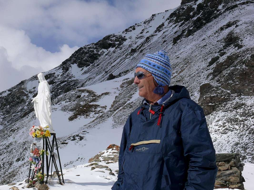
Anche per la Valle di Cogne, essendo posizionata come la precedente su d'un "asse obliquo" rispetto alla Dora, valgon le medesime considerazioni espresse per Champorcher. Allargandosi a guisa di grande ventaglio, offre svariate opportunità per le racchette, ma anche qui troviamo un Itinerario di Base tal da offrire maggior spunti: il lungo Vallone dell'Urtier, che, dal Villaggio di Lillaz, s'allunga verso Oriente in direzione del Rifugio Sogno di Berdzé (Sogno del Pastore) e dei soprastanti Colli Fenêtre e Pontonnet. Da questa strada poderale, in alcuni tratti concomitante con il sentiero, a Mezzogiorno si "snodano" i Valloni di Valeille, del Bardoney ed Acque Rosse; mentre a Settentrione si propone il grande altipiano dal Passo di Invergneux ai Penne Blanche sino al Monte Creya. Da Cogne invece avremo, similmente, la Valnontey ed all'opposto i due Valloni del Grauson e dell'Arpisson rispettivamente verso i Colli di Invergneux, Coronas o Saint Marcel, Laures, Pas du Valaisan, Garin e Tsa Setze. Quest'ultima area, poiché ben soleggiata, si presta alle prime uscite stagionali, mentre per l'Urtier si dovrà attendere per un certo tempo, causa le slavine che posson precipitare dalla soprastante Cote du Piemont. La Valnontey offre la facile escursione al Rifugio Sella, mentre le altre vie sono spesso molto pericolose ed inopportune tramite questo attrezzo; identico discorso vale per i Valloni del Pousset, Trajo e Nomenon, all'imbocco della Valle di Cogne, che appositamente abbiam qui trascurato.
"Against a bad sky can not do anything .. / Se il ciel gira storto, puoi far gnènte ...", by emilius
![]()
"It looks like Snow, instead it is Heaven. It looks like heaven, but it is snow. And the Mountains? They are Snow and Sky ... / Sembra Neve, invece é Cielo. Par cielo, ma é neve. E le Montagne? Son Neve e Cielo ...", by Marco Cossard "Crevassino"
![]()
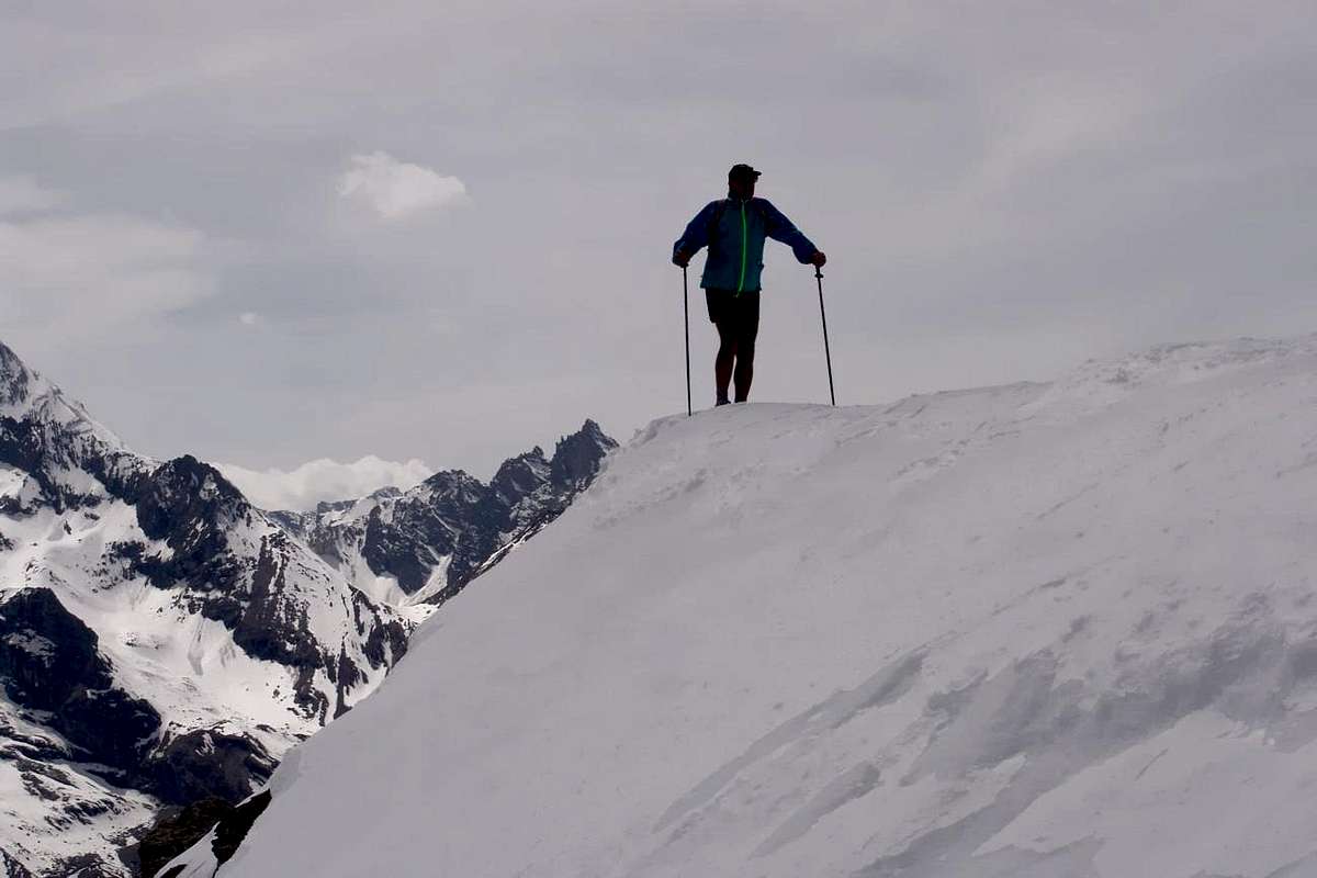
Valsavara (To Entrelor, Lauson or towards Nivolé Tableland & Refuges)
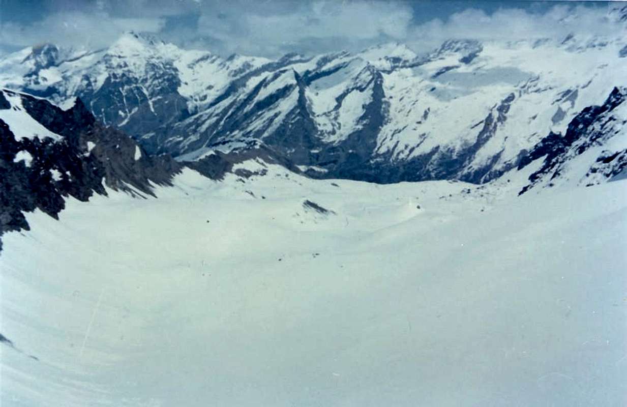
Apart from the "Exceptional Via" to Entrelor-Percià, Lauson-Tuf and Basei Hills and Summits, certainly a little " extravagant" for the tool is definitely more suitable for ski-mountaineering are Routes of the Base offering greater guarantees for this discipline. The Tableland Nivolet parallel with the plateau and the two Refuges Chabod and Emanuele are assumptions of climbs certainly more "feasible" and less complicated. We must keep in mind that, unlike the valleys of Cogne and Champorcher, that Valsavarenche and subsequent valleys are arranged perpendicular to the Baltea; then here 's speech, compared to the transformation of the snowpack, is addressed not to the South and the North, but to the East/West. We can say that the trips to the Plan Nivolet lend themselves earlier than those at the two shelters, while other areas offer fewer and more difficult transit possibilities. The climb to the two shelters also gives opportunity, in these early season, to avoid the masses addressed to the Gran Paradiso, although lately the practice of ski-mountaineering touring is becoming more widespread. A surprise, "two steps away" from the car park at Pont, the Walloon of the Seyva such as to provide a path to the west of the River to the Hills Savara Grand Etret (very far away, but it may be sufficient to reach the alp of the same name).
Valsavarenche, adjacent to Soana Valley (Piedmont), Rhêmes and Cogne Valleys.
It reaches from Villeneuve 670m) towards Dégioz (1525m) Municipalities, Eaux Rousses Fraction (1.666m) to Main tourist center Pont-Valsavarenche (1.951m).
From Eaux Rousse to Grand Etret Pass
"A Man that crosses the Wind of the Long Life ...", by Marco Cossard "Crevassino"
![]()
^^^^^^^
1) - Basic Itinerary n° 1: from Eaux Rousses Fraction in Main Road (1.666m; parking above Savara Torrent), through path Alta Via number 2 into le Grand Bois (forest; ferrous source), Rondzegou Pasture (1.974m) to Orfeuille Alp (Royal Pavillon of Hunting; Cabin National Park; 2.168m), nearby Montagna (alpage) of Djouan (2.226m) (F+; 2h'30/2h'45).
2) - Exceptional Via n° 1: from Eaux Rousses to Orfeuille with preceding route; leaving North the muletrack to Fourquins de Bioula, Tour de Notre Dame and Punta Bioula (+; 3.413m) continue in opposite through path Alta via 2 to Soprana zone neighbor Tramouail Alp (2.425m). Progressively bending more West towards Djouan and Noir Lakes (2.507m, 2.516m, 2.670m) to Entrelor Hill (3.007m), below Southern Gollien Summits (3.128m); from pass in South to Punta Percià or Pertcha also Fourà Northern and Southern Summits (3.204m, 3.209m) (D-; 4h'30/5h'15), through snowfields or sparce traces on debris slope and easy small rocks in terminal part with a rocky little turret in final climbing.
3) - Minimum Route: from Eaux Rousses to Rondzegou Pasture with preceding routes to old and regal Orfeuille at the base of triple Fourquin de Bioula/Entrelor opposite and parallel from North to South Vallons (T; 1h'00/1h'15).
"Up to here we got there, now we have to go down ...", by Marco Cossard "Crevassino"
![]()
^^^^^^^
4) - Intermediate step n° 1: from Eaux Rousses towards Orfeuille (*** Real Camp in 1861 from which the first "King Toio" telegraphed in Turin for information political, economic and military chary of the newly created Kingdom of Italy), through path in West into forest, to two Djouan and Noir Lakes and homonym alpages (2.670m; F+; 2h'45/3h'15).
5) - Basic Itinerary n° 2: from Eaux Rousses, 50 meters before parking-Hotel, towards small bridge on Savara Torrent and crossing North the Chaud Torrent in East to Leviona(z) Dèsot Alp (+; 2.285m; Cabine P.N.G.P.; F; 2h'30/2h'45).
6) - Exceptional Via n° 2 with Variant n° 1: from Eaux Rousses footbridge (signals) to Leviona(z) Dèsot Alp with previous route; after continue East with two alternatives on Southern and Northern Leviona Torrents (forks 2.424m, 2.513m). Discarding the detour to the Southeast towards Levionaz Damon (Upper; 2.646m) and Leyser Vallon, instead continue Northeast, always through path-muletrack Alta Via number 2, to Lauson or Lozon Hill (3.202m), between Becca Vermiana (3.407m)/Punta del Tuf (3.392/3m). Two possibilities: in East descent (at the beginning an exposed traverse through path overhanging a rock band just under the hill) to a) - Sella Refuge and nearby alp, in adjacent Valnontey.
Variant n° 1: also from the pass b) - possibility of the ascent to Tuf Summit, on watershed between Savara/Cogne Valleys, through short North Crest; starting before immediately after the hill, climb South tourning left (East) a small pinnacle in first part through a brief East traverse on slab with rotten rock. After easily with even more broken rocks to Summit (D; 6h'30/7h'15). If desired, navigate, crossing or tourning West the Quota 3.215 meters, easily to the neighbor Crête du Tuf through, rare traces on debris and easy rocks (3.322m, F +: 0h'50; 1h'30 more, round trip).
"But who gets to do it. Boys Meditate, meditate ...", by Osw
![]()
^^^^^^^
7) - Basic Itinerary n° 3: from Regional Road from Villeneuve towards Chevrères (1.108m), Molère (1.192m), Fenille (1.304m), Boise de Clin (1.392m), Rovenaud (1.462m) Villages and Fractions to Dégioz-Valsavarenche Chef-lieu (1.525m; parking; fountain; restaurants); from this to Camping Grivola (1.584m), Holiday Farm "Lo Mayen", Maisonnasse (1.652m) to Eaux rousses (1.686m; parking; depatures in East to Lauson, in West to Entrelor/Fourquin de Bioula Wallons). Continue, always in South,and towards VPont (bridge) du Grand Clapey (1.726m), Camping Gran Paradiso on Plan de Pesse to fork near Praviou Dèsot (1.829m; ground parking); leaving the road and through good path in East to Lavassey Alp (2.194m), Cote Savatère (2.575m), Federico & Renato Chabod Refuge (2.710m), at the end of Laveciaou Glacier and below the Northern watershed of Gran Paradiso (4.061m Northwest Wall in foreground; from "Granpa" to Little Paradiso (various summits, the most high 3.926m/Becca de Montandayné (3.838m)/The Herbetet (3.778m); F; 2h'45/3h'00).
8) - Basic Itinerary n° 4: from fork to Refuge Chabod continue more in Southwest with Main Road and passing neighbor Maison Vieille, Pessey, Giomey, Donzel Pastures to Pont Djouan (1.994m; parking) and Pont Valsavarenche (1.951m; P.N.G.P. Cabin). Abandoning the terminal part of the road in Breuil (two camping, hotel-restaurant; fountain; departure to Refuges Vittorio Emanuelle II°; office Valsavarenche Mountain Guide) continue through path in West to a splendid waterfall and impending Cross de La Roley (+; 2.319m) at ther entrance of Nivolé Tableland (11 Kilometres, the most high of Europe?). Changing Southwest and crossing Nivolé(t) Torrent on footbridge 2.377 meters reach the Grand Collet Montagne (2.409m; in East path to Grand Collet Pass 2.832m), subsequent Nivolet Alp (2.407m; below Black Lake to West) up to the two Nivolé Lochs (2.533/7m) just before Savoia (2.610m) and Città of Chivasso (2.600m) Refuges, at Nivolé(t) Hill (2.597m), below Northeastern Slope of Punta Basei with homonym and overhanging small glacier (F+; 4h'00/4h'15). (*** Possibility of reaching the hill also from Piedmont with in asphalt road, which goes up in the Valley of Locana/Ceresole Reale also Torrent Orco Valley; departure from Castellamonte Town near Ivrea City in Canavese Area.
9) - Exceptional Via: n° 3 from two shelters to Basei Hill (3.160m) and Summit (3.338m; D+; 3h'45/4h'15).
"Too high! We are here just, to Nivolet ... / Troppo alta! A noi qui basta, al Nivolet ...", by andrea.it
![]()
^^^^^^^
10) - Minimum Route n° 2: from Pont Valsavarenche to La Roley Waterfall (about 2.200 meters) and Cross (+; 2.313m; wooden table with benches near Nivolet Torrent; highly scenic place to Gran Paradiso Chain; E; 1h'30/2h'00).
11) - Northern Variant n° 2: from La Roley Cross (wooden benchs), crossing by footbridge Nivolet Torrent, continue on small path in North, to Turin or Teureun Alp (2.396m), in Northern sector of tableland (F+; 2h'15/2h'30).
"To Emanuele Refuges Spring Ascent ...", by Antonio
![]()
^^^^^^^
12) - Basic Itinerary n° 5: from Pont-Breuil parking towards great stone bridge on Savara Torrent and through the path in East of the same to alpage new restructured 1.991 meters, frpm this, torning decisively in East and zigzagging on numerous hairpin bends, passing above old Chanté Alp (2.372m; ruins), to Montcorvé Pond (2.714m) and two Old and New Vittorio Emanuele II° Refuges (2.734m, about 2.755 meters), at the beginning of Normal "Granpa" with departures to La Tresenta (3.609m), Ciarforon (3.642m) and Becca of Monciair (3.544m) with relative passes (F; 2h'45/3h'00).
13) - Lower Variant n° 3 and n° 4: from Breuil parking in Bois de la Rolay go South along Savara Torrent to a) - fork around 2.000 meters in opposite side of an alp unnamed (1.991m; to Refuges Emanuele); from this point, climb South to a rocky promontory and, after one hairpin bend, continue same direction and crossing a secondary torrent reach Seyvaz Alp (2.364m). Continue South few time up to the point 2.603 meters; changing West into a small but wide wild vallon to altitude (2.777m; herds of splendid steinbocks) just below the Grand Collet Pass (2.832m; (M+; 3h'45/4h'15).
Variant n° 4: always neighbor the Savara Torrent, from fork about 2.000 meters continue South route, along West shore of the same, reaching b) - Grand Etret Alp (2.178m), in the middle part of Syvaz Vallon (T; 1h'20/1h'30).
"That steppppp, guys! ... / Che passssso, Ragassi! ...", by Marco Cossard "Crevassino"
![]()
It reaches from Villeneuve 670m) towards Dégioz (1525m) Municipalities, Eaux Rousses Fraction (1.666m) to Main tourist center Pont-Valsavarenche (1.951m).
From Eaux Rousse to Grand Etret Pass
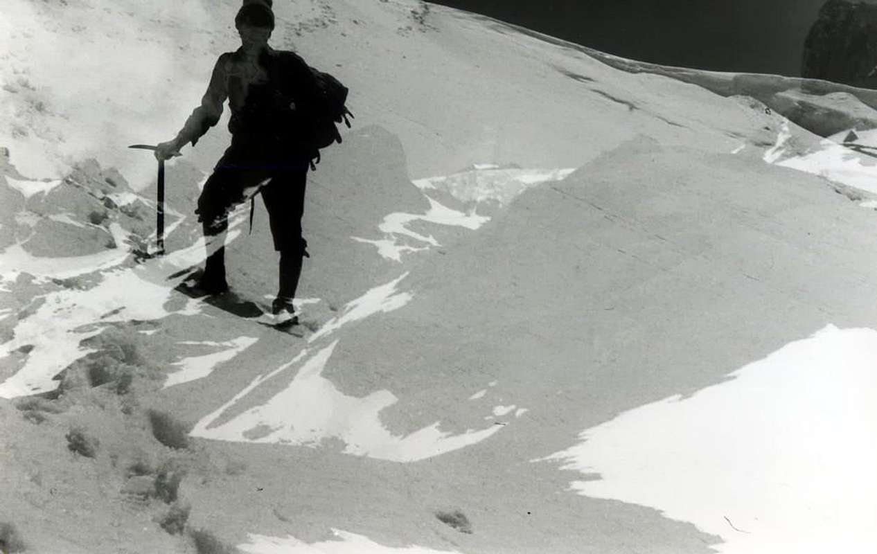
1) - Basic Itinerary n° 1: from Eaux Rousses Fraction in Main Road (1.666m; parking above Savara Torrent), through path Alta Via number 2 into le Grand Bois (forest; ferrous source), Rondzegou Pasture (1.974m) to Orfeuille Alp (Royal Pavillon of Hunting; Cabin National Park; 2.168m), nearby Montagna (alpage) of Djouan (2.226m) (F+; 2h'30/2h'45).
2) - Exceptional Via n° 1: from Eaux Rousses to Orfeuille with preceding route; leaving North the muletrack to Fourquins de Bioula, Tour de Notre Dame and Punta Bioula (+; 3.413m) continue in opposite through path Alta via 2 to Soprana zone neighbor Tramouail Alp (2.425m). Progressively bending more West towards Djouan and Noir Lakes (2.507m, 2.516m, 2.670m) to Entrelor Hill (3.007m), below Southern Gollien Summits (3.128m); from pass in South to Punta Percià or Pertcha also Fourà Northern and Southern Summits (3.204m, 3.209m) (D-; 4h'30/5h'15), through snowfields or sparce traces on debris slope and easy small rocks in terminal part with a rocky little turret in final climbing.
3) - Minimum Route: from Eaux Rousses to Rondzegou Pasture with preceding routes to old and regal Orfeuille at the base of triple Fourquin de Bioula/Entrelor opposite and parallel from North to South Vallons (T; 1h'00/1h'15).

4) - Intermediate step n° 1: from Eaux Rousses towards Orfeuille (*** Real Camp in 1861 from which the first "King Toio" telegraphed in Turin for information political, economic and military chary of the newly created Kingdom of Italy), through path in West into forest, to two Djouan and Noir Lakes and homonym alpages (2.670m; F+; 2h'45/3h'15).
5) - Basic Itinerary n° 2: from Eaux Rousses, 50 meters before parking-Hotel, towards small bridge on Savara Torrent and crossing North the Chaud Torrent in East to Leviona(z) Dèsot Alp (+; 2.285m; Cabine P.N.G.P.; F; 2h'30/2h'45).
6) - Exceptional Via n° 2 with Variant n° 1: from Eaux Rousses footbridge (signals) to Leviona(z) Dèsot Alp with previous route; after continue East with two alternatives on Southern and Northern Leviona Torrents (forks 2.424m, 2.513m). Discarding the detour to the Southeast towards Levionaz Damon (Upper; 2.646m) and Leyser Vallon, instead continue Northeast, always through path-muletrack Alta Via number 2, to Lauson or Lozon Hill (3.202m), between Becca Vermiana (3.407m)/Punta del Tuf (3.392/3m). Two possibilities: in East descent (at the beginning an exposed traverse through path overhanging a rock band just under the hill) to a) - Sella Refuge and nearby alp, in adjacent Valnontey.
Variant n° 1: also from the pass b) - possibility of the ascent to Tuf Summit, on watershed between Savara/Cogne Valleys, through short North Crest; starting before immediately after the hill, climb South tourning left (East) a small pinnacle in first part through a brief East traverse on slab with rotten rock. After easily with even more broken rocks to Summit (D; 6h'30/7h'15). If desired, navigate, crossing or tourning West the Quota 3.215 meters, easily to the neighbor Crête du Tuf through, rare traces on debris and easy rocks (3.322m, F +: 0h'50; 1h'30 more, round trip).
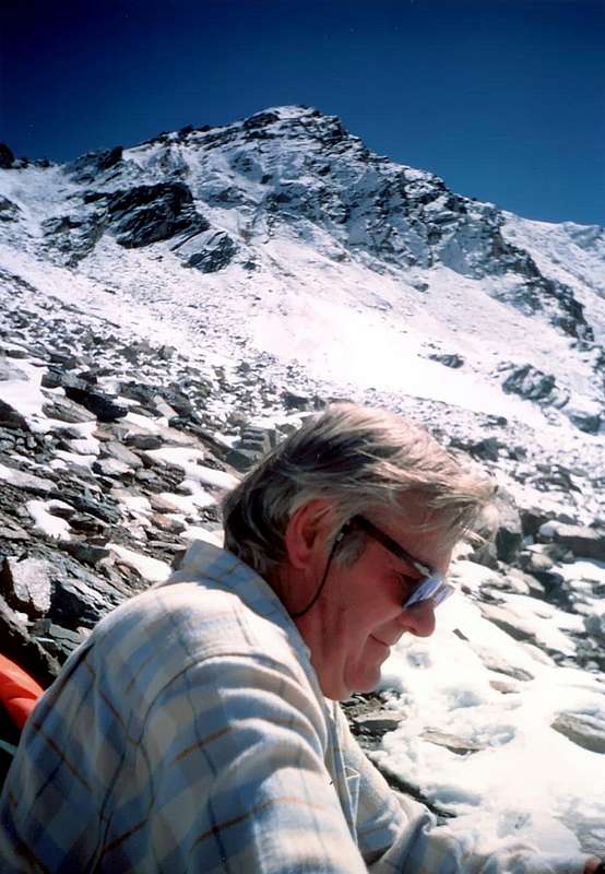
7) - Basic Itinerary n° 3: from Regional Road from Villeneuve towards Chevrères (1.108m), Molère (1.192m), Fenille (1.304m), Boise de Clin (1.392m), Rovenaud (1.462m) Villages and Fractions to Dégioz-Valsavarenche Chef-lieu (1.525m; parking; fountain; restaurants); from this to Camping Grivola (1.584m), Holiday Farm "Lo Mayen", Maisonnasse (1.652m) to Eaux rousses (1.686m; parking; depatures in East to Lauson, in West to Entrelor/Fourquin de Bioula Wallons). Continue, always in South,and towards VPont (bridge) du Grand Clapey (1.726m), Camping Gran Paradiso on Plan de Pesse to fork near Praviou Dèsot (1.829m; ground parking); leaving the road and through good path in East to Lavassey Alp (2.194m), Cote Savatère (2.575m), Federico & Renato Chabod Refuge (2.710m), at the end of Laveciaou Glacier and below the Northern watershed of Gran Paradiso (4.061m Northwest Wall in foreground; from "Granpa" to Little Paradiso (various summits, the most high 3.926m/Becca de Montandayné (3.838m)/The Herbetet (3.778m); F; 2h'45/3h'00).
8) - Basic Itinerary n° 4: from fork to Refuge Chabod continue more in Southwest with Main Road and passing neighbor Maison Vieille, Pessey, Giomey, Donzel Pastures to Pont Djouan (1.994m; parking) and Pont Valsavarenche (1.951m; P.N.G.P. Cabin). Abandoning the terminal part of the road in Breuil (two camping, hotel-restaurant; fountain; departure to Refuges Vittorio Emanuelle II°; office Valsavarenche Mountain Guide) continue through path in West to a splendid waterfall and impending Cross de La Roley (+; 2.319m) at ther entrance of Nivolé Tableland (11 Kilometres, the most high of Europe?). Changing Southwest and crossing Nivolé(t) Torrent on footbridge 2.377 meters reach the Grand Collet Montagne (2.409m; in East path to Grand Collet Pass 2.832m), subsequent Nivolet Alp (2.407m; below Black Lake to West) up to the two Nivolé Lochs (2.533/7m) just before Savoia (2.610m) and Città of Chivasso (2.600m) Refuges, at Nivolé(t) Hill (2.597m), below Northeastern Slope of Punta Basei with homonym and overhanging small glacier (F+; 4h'00/4h'15). (*** Possibility of reaching the hill also from Piedmont with in asphalt road, which goes up in the Valley of Locana/Ceresole Reale also Torrent Orco Valley; departure from Castellamonte Town near Ivrea City in Canavese Area.
9) - Exceptional Via: n° 3 from two shelters to Basei Hill (3.160m) and Summit (3.338m; D+; 3h'45/4h'15).
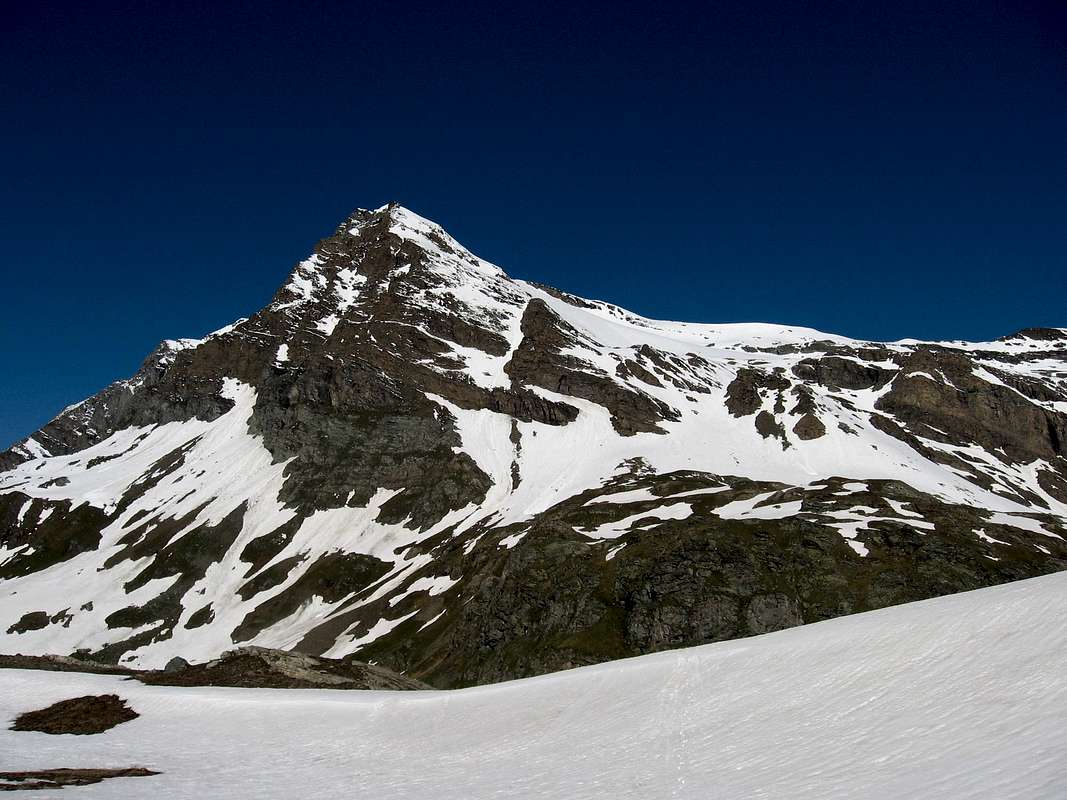
10) - Minimum Route n° 2: from Pont Valsavarenche to La Roley Waterfall (about 2.200 meters) and Cross (+; 2.313m; wooden table with benches near Nivolet Torrent; highly scenic place to Gran Paradiso Chain; E; 1h'30/2h'00).
11) - Northern Variant n° 2: from La Roley Cross (wooden benchs), crossing by footbridge Nivolet Torrent, continue on small path in North, to Turin or Teureun Alp (2.396m), in Northern sector of tableland (F+; 2h'15/2h'30).
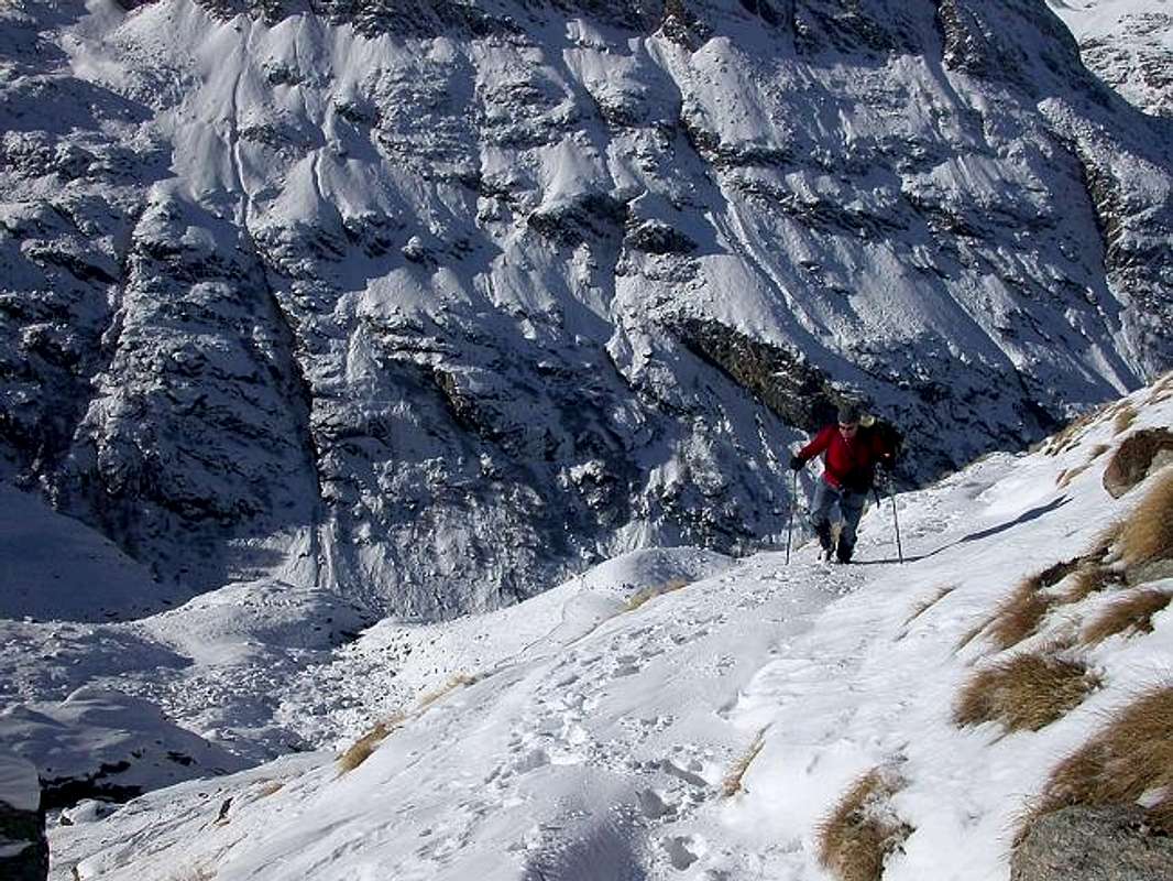
12) - Basic Itinerary n° 5: from Pont-Breuil parking towards great stone bridge on Savara Torrent and through the path in East of the same to alpage new restructured 1.991 meters, frpm this, torning decisively in East and zigzagging on numerous hairpin bends, passing above old Chanté Alp (2.372m; ruins), to Montcorvé Pond (2.714m) and two Old and New Vittorio Emanuele II° Refuges (2.734m, about 2.755 meters), at the beginning of Normal "Granpa" with departures to La Tresenta (3.609m), Ciarforon (3.642m) and Becca of Monciair (3.544m) with relative passes (F; 2h'45/3h'00).
13) - Lower Variant n° 3 and n° 4: from Breuil parking in Bois de la Rolay go South along Savara Torrent to a) - fork around 2.000 meters in opposite side of an alp unnamed (1.991m; to Refuges Emanuele); from this point, climb South to a rocky promontory and, after one hairpin bend, continue same direction and crossing a secondary torrent reach Seyvaz Alp (2.364m). Continue South few time up to the point 2.603 meters; changing West into a small but wide wild vallon to altitude (2.777m; herds of splendid steinbocks) just below the Grand Collet Pass (2.832m; (M+; 3h'45/4h'15).
Variant n° 4: always neighbor the Savara Torrent, from fork about 2.000 meters continue South route, along West shore of the same, reaching b) - Grand Etret Alp (2.178m), in the middle part of Syvaz Vallon (T; 1h'20/1h'30).
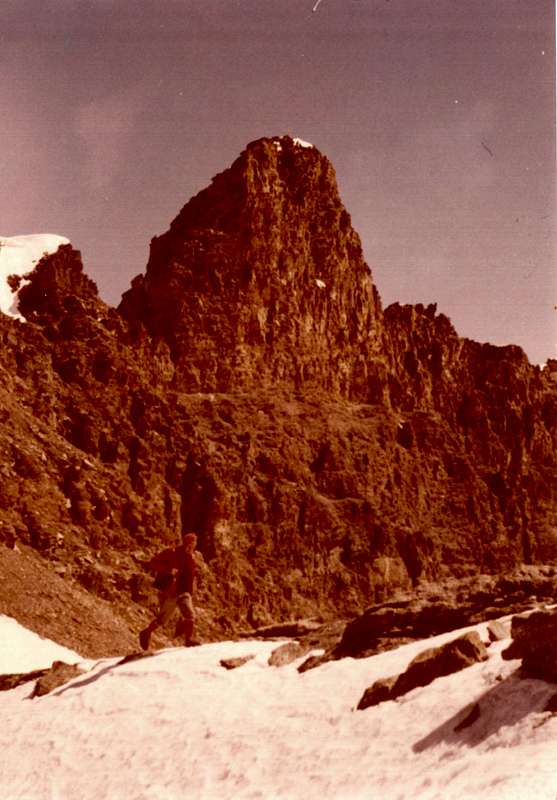
A parte le "Vie Eccezionali" all'Entrelor-Percià, Lauson-Tuf e Basei Colli e Cime, certamente un poco "stravaganti" per questo attrezzo e sicuramente più indicate per lo sci-alpinismo, son le Vie di Base che offrono maggiori garanzie per questa disciplina. Il grande Vallone parallelo con l'altipiano del Nivolet ed i due Rifugi Chabod ed Emanuele costituiscon ipotesi di salite sicuramente più "fattibili" e men complicate. Dobbiamo tener presente che, differentemente alle Valli di Champorcher e Cogne, quella di Valsavarenche e successive sono valli disposte perpendicolarmente rispetto alla Dora Baltea; quindi qui il discorso, rispetto alla trasformazione del manto nevoso, é rivolto non più a Sud e Nord, bensì ad Est/Ovest. Possiamo affermare che le gite verso il Piano del Nivolet si prestano in anticipo rispetto a quelle verso i due rifugi, mentre altre zone offron minori e più difficoltose possibilità di transito. La salita ai due rifugi, inoltre, concede opportunità, in questi inizi di stagione, di evitare le grandi masse indirizzate al Gran Paradiso, anche se ultimamente la pratica del turismo sci-alpinistico é sempre più diffusa. Una sorpresa, "a due passi" dal parcheggio di Pont, il Vallone della Seyva tale da offrire un percorso ad Ovest del Torrente Savara verso i Colli del Grand Etret (ben lontani, ma ci si può accontentare di raggiunger l'omonima alpe).
"From here you taste the Granpa, Sovereign .. / Da qui ti gusti il Granpa, Sovrano ...", by emilius
![]()
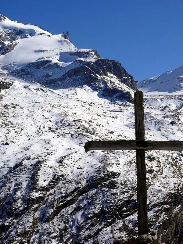
Campings
Remember that free camping is forbidden (except for emergency reasons, over 2.500m, from darkness until dawn).Mountain Condition
- Meteo: you can find all the needed informations at the official site of the Valle d'Aosta Region:
- Valle d'Aosta Meteo
Important Information
- REGIONE AUTONOMA VALLE D'AOSTA the official site.
- FONDAZIONE MONTAGNA SICURA Villa Cameron, località Villard de la Palud n° 1 Courmayeur (AO) Tel: 39 0165 897602 - Fax: 39 0165 897647.
- A.I.NE.VA. (Associazione Interregionale Neve e Valanghe).
Useful numbers
- Protezione Civile Valdostana località Aeroporto n° 7/A Saint Christophe (Ao) Tel. 0165-238222.
- Bollettino Meteo (weather info) Tel. 0165-44113.
- Unità Operativa di Soccorso Sanitario Tel. 118.