| Routing with GPS | [ Sizes: Orig | Med | Small | Thumb ] | |||
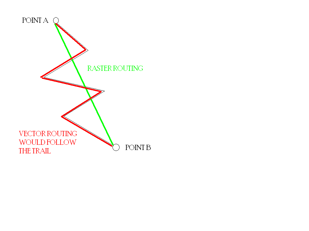
This shows the difference between vector and raster maps. If you try and route yourself from Point A to B with raster data, the GPS will route you "as the crow flies," or in a straight line. However, if you have vector data for the trail, the GPS will actually route you on the trail. This is one of key differences between vector and raster maps.
On the PN-40, all Topo 8 maps are vector data, whereas the downloaded USGS maps are raster data. |
Image ID: 7204 Hits: 2368  Object Title: Routing with GPS Object Title: Routing with GPS |
