GPS
| Page Type | Gear Category |
|---|---|
| Object Title | GPS |
| Page By | Alan Ellis |
| Created/Edited | Jan 15, 2007 / Nov 28, 2007 |
| Object ID | 21 |
| Hits | 9847 |
| Page Score | 84.11% |
| Vote |
Vote: Log in to vote |
Global Positioning System satellites transmit signals to equipment on the ground. GPS receivers passively receive satellite signals; they do not transmit. GPS receivers require an unobstructed view of the sky, so they are used only outdoors and they often do not perform well within forested areas or near tall buildings. GPS operations depend on a very accurate time reference, which is provided by atomic clocks at the U.S. Naval Observatory. Each GPS satellite has atomic clocks on board.
Each GPS satellite transmits data that indicates its location and the current time. All GPS satellites synchronize operations so that these repeating signals are transmitted at the same instant. The signals, moving at the speed of light, arrive at a GPS receiver at slightly different times because some satellites are farther away than others. The distance to the GPS satellites can be determined by estimating the amount of time it takes for their signals to reach the receiver. When the receiver estimates the distance to at least four GPS satellites, it can calculate its position in three dimensions. There are at least 24 operational GPS satellites at all times. The satellites, operated by the U.S. Air Force, orbit with a period of 12 hours. Ground stations are used to precisely track each satellite's orbit.
A GPS receiver "knows" the location of the satellites, because that information is included in satellite transmissions. By estimating how far away a satellite is, the receiver also "knows" it is located somewhere on the surface of an imaginary sphere centered at the satellite. It then determines the sizes of several spheres, one for each satellite. The receiver is located where these spheres intersect.
The accuracy of a position determined with GPS depends on the type of receiver. Most hand-held GPS units have about 10-20 meter accuracy. Other types of receivers use a method called Differential GPS (DGPS) to obtain much higher accuracy. DGPS requires an additional receiver fixed at a known location nearby. Observations made by the stationary receiver are used to correct positions recorded by the roving units, producing an accuracy greater than 1 meter.
When the system was created, timing errors were inserted into GPS transmissions to limit the accuracy of non-military GPS receivers to about 100 meters. This part of GPS operations, called Selective Availability, was eliminated in May 2000.
Here is a great GPS Guide For Beginners.
What GPS Unit Is Best For You
There are many decisions to make when determining which GPS unit is best for you.
What type of unit do I want? GPS units are available as hand-held, portable (automotive/marine), wrist-mounted, etc.
How much do you want to spend? Depending on features, you can spend anywhere from $79.00 to over $500.00 for a hand-held unit. The bottom line is that the more you spend, the more features and bells & whistles you get.
What features do I want? The features in your unit are only limited by your budget. Features to consider are: mapping capability, down-load ability, altimeter/barometer, number of waypoints, number of routes, size of memory, channels, WAAP ability, heart-rate monitor, two-way radio ability, waterproofness, etc. All these features can best be described at GPSinformation.net.
A Word About Mapping Capability
Some units have the ability to show topographic or street maps directly on the unit screen. This is a great feature that is highly recommended and helps give a visual reference point for your location. Without mapping, the screen on the unit will only show a location icon, waypoints, and a bread-crumb trail as you move.
Many mapping units have a built-in base map that comes with the unit. The base map is usually a general map of the area with major cities, highways, and water features. In addition, mapping units have the ability to download more detailed maps such as topographic maps, street maps, and detailed marine waterway charts. These maps and charts normally are available on CD as an optional accessory from the manufacturer and are down-loaded from your personal computer. Some units/manufacturers have the maps and charts on data cards which are inserted directly into the unit. This has the advantage and convenience of directly installing the maps onto the unit without having to be at home on your personal computer.
Mapping Software
Maps and charts that can be down-loaded to your GPS unit are only available from the GPS unit manufacturer. Maps downloaded from the manufacturer's software can be seen directly on the GPS unit screen. Examples of these types of software are Garmin Mapsource, and Magellan Mapsend.
There are several companies that also make mapping software that is GPS Compatible. GPS compatible means that you can use the mapping software on your PC to plot waypoints and routes and down-load them to your GPS unit. However, the maps on the software WILL NOT down-load and to be seen on the unit's screen. With GPS Compatible software, only the waypoints and routes will be seen on the unit screen. Examples of these types of software are National Geographic Topo! and Maptech.
Finally...
GPS units are a great tool and a fun gadget to use while in the outdoors. Never assume that a GPS unit will prevent you from being lost or be a substitute good navigation skills. Good map and compass skills are a must in the outdoors and should be learned prior to your backcountry adventure. However, using a GPS unit in addition to good map and compass skills will make your navigation fun, and will help ensure you never lose your way on the trail.
Images
 |  |
Children
- Gear (45)
- Garmin Edge 200
- Garmin Forerunner 305
- Foretrex 301
- GPS 60
- GPSmap 62st
- Triton 500
- Forerunner 301
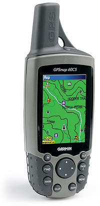
- GPSMap 60CS
- GPSMap 60CSx
- Rino 120
- Geko 301
- GPSMAP 76S
- eTrex Legend C
- Delorme Earthmate PN-40
- Foretrex 101/201
- eTrex Vista HCx
- Meridan Platnium
- Oregon 450t
- Geko 201
- eTrex Legend
- Oregon 450
- SporTrak Map
- Magellan Explorist 100
- Oregon 550
- Venture
- Magellan Explorist 600
- GPSMAP 78s
- Oregon 550t
- Rino 130
- ETrex Summit
[ 15 More  ]
]
]