

Bob Sihler - May 3, 2012 8:52 pm - Voted 10/10
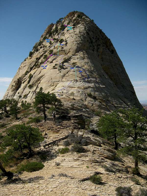
ThanksAbout three weeks ago, I climbed NGA, and this picture was useful to me beforehand in envisioning the route and then seeing it for real. Interestingly, though, somewhere between "Horiz. Tree" and "Finger Crack," I headed up more vertically until I was below the overhanging ledges you see just below the "summit" in this picture. Not immediately seeing a good way up or to the left, I worked to the right and climbed some exposed Class 4/5 stuff to gain the summit ridge. On the way back down, I did find two decent ways through those overhanging ledges, one better for going up and the other better for down. A good morning, and I'm putting together a trip report that will include pictures of those route variations.
Anyway, thanks again; this picture helped me have a mental image of the route before getting there.

MoapaPk - May 3, 2012 9:11 pm - Hasn't voted
Re: Thanks"Branch Whitney" describes a route that veers off to the right in about that section; he calls it class 3, but the pictures look pretty intimidating. That may be the route you found on the way down. The "classic" way, after the horiz tree, is to go diagonally up this ramp, identifiable by the cracks:
ramp ... it's awkward, but really not that steep. However, I did have someone ask for a belay on that spot, which was tough, because there are no good anchors for 100'.


Comments
Post a Comment