
|
|
Mountain/Rock |
|---|---|
|
|
46.50843°N / 10.54438°E |
|
|
Mountaineering |
|
|
Summer |
|
|
12812 ft / 3905 m |
|
|
Overview
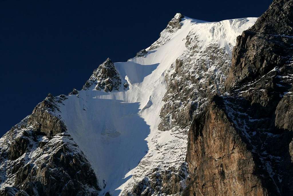
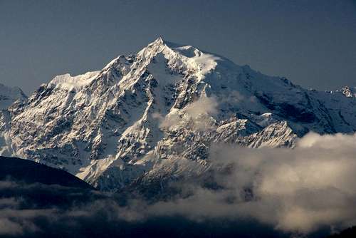
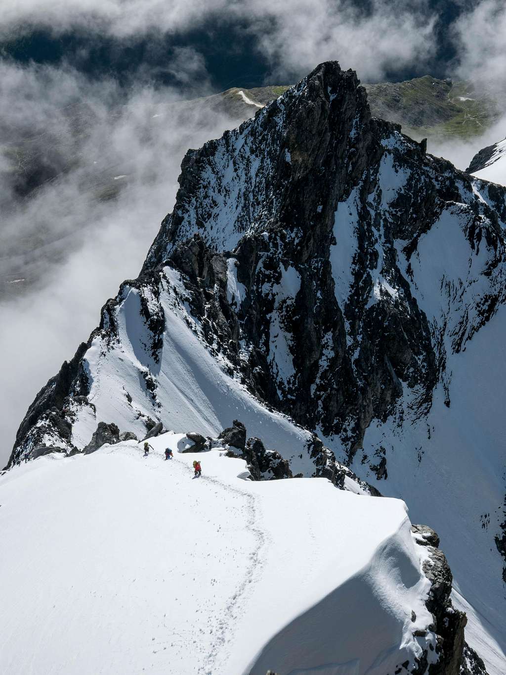
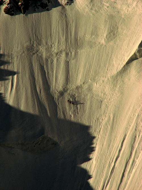
Ortler North Face by haubi
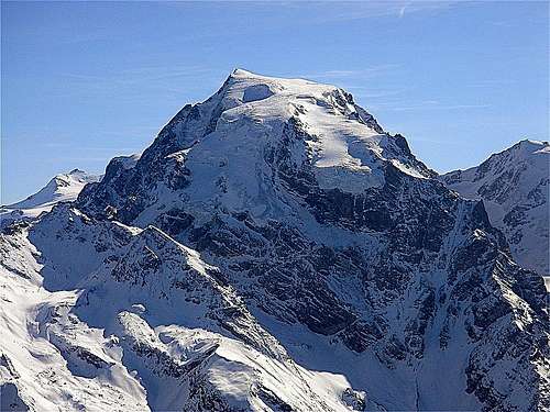
Ortler (Italian: Ortles) is, at 3905 m (12.812 ft) above sea level, the highest mountain in the Eastern Alps outside the Bernina Range. This gigantic and mighty peak composes together with its neighbours Monte Zebrù and Gran Zebrù/ Königsspitze the impressive “Dreigestirn” of Solda (Sulden). Ortler is the main peak of the Ortler Range, is the highest point of the Southern Limestone Alps, of the Italian province of South Tyrol, of Tyrol overall, and until 1919, of the Austrian-Hungarian empire. In German the mountain is commonly referred to as "König Ortler" (King Ortler), like in the unofficial hymn of South Tyrol, the Bozner Bergsteigerlied.
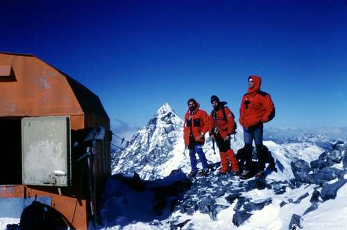
Once, the King of the eastern alps was the highest mountain of the Austrian-Hungarian Monarchy (higher than Grossglockner, today Austria's highest mountain). And so it came that by command of Erzherzog Johann the first ascent to its summit already occurred in 1804:The first ascent was made by Josef Pichler, a chamois hunter from St. Leonhard in Passeier, and his companions Johann Leitner and Johann Klausner from Zell am Ziller. They summited on September 27th, 1804. It is still one of the most notable alpine ascents of that time. The legendary and dangerous north wall was first climbed by Hans Ertl and Franz Schmid in 1931.
 W-NW-Face | 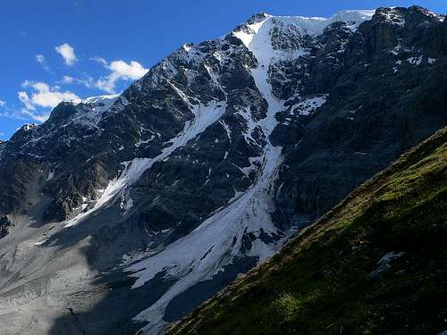 N-Face | 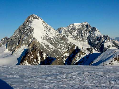 SE-Face |
The Ortler is the highest mountain within a radius of 49 kilometers. The nearest higher mountain is Bellavista (3922 m), located in the Bernina Group with Piz Bernina (4049 m) as its highest peak. The passo di Fraele (1955m) is the lowest saddlepoint inbetween. Therefore, the prominence of Ortler is 1950 meters. Ortler ranks 14th by prominence in the entire Alps.
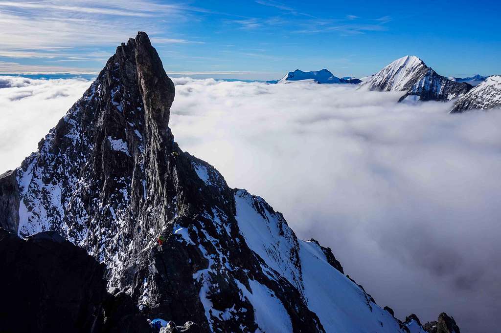
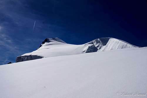
The Ortler is considered one of the most important mountains of the Eastern Alps. All routes to the summit are challenging climbs, of which the normal route from the north is the most ascended one. The normal route is also the easiest route to the summit of Ortler, but is still graded PD+/AD- (UIAA III) and therefore a challenging climb. The north face (D+, 90°) of the mountain is the largest ice wall in the Eastern Alps and also a popular objective for climbers. Other main routes are the Hintergrat (AD, UIAA IV-) along the East ridge and the Meranerweg along the Pleisshorngrat / west ridge.
 NE-Face | 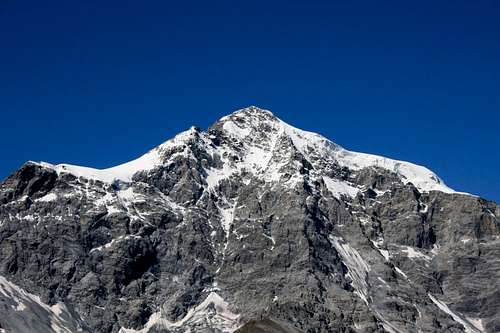 E-Face |  W-Face |
Ortler is situated in the western part of Südtirol, in the upper Vinschgau, south of the border with Austria. The massive mountain is capped by a glacier on the northwest flank and has a long north ridge that ends at the village of Gomagoi and separates the valleys of Trafoi and Sulden. The South ridge leads to the Hochjoch (3527 m) on the main ridge of the Ortler Alps that forms the border of the Province of Sondrio and South Tyrol. Going west on this main ridge are the Thurwieserspitze (3652) and Trafoier Eiswand (3565 m), while to the Southeast are the Monte Zebrù (3740 m) and the majestic Königspitze (Gran Zebru, 3859 m).
Routes
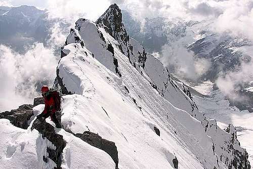
Ortler Hintergrat
I Normal route
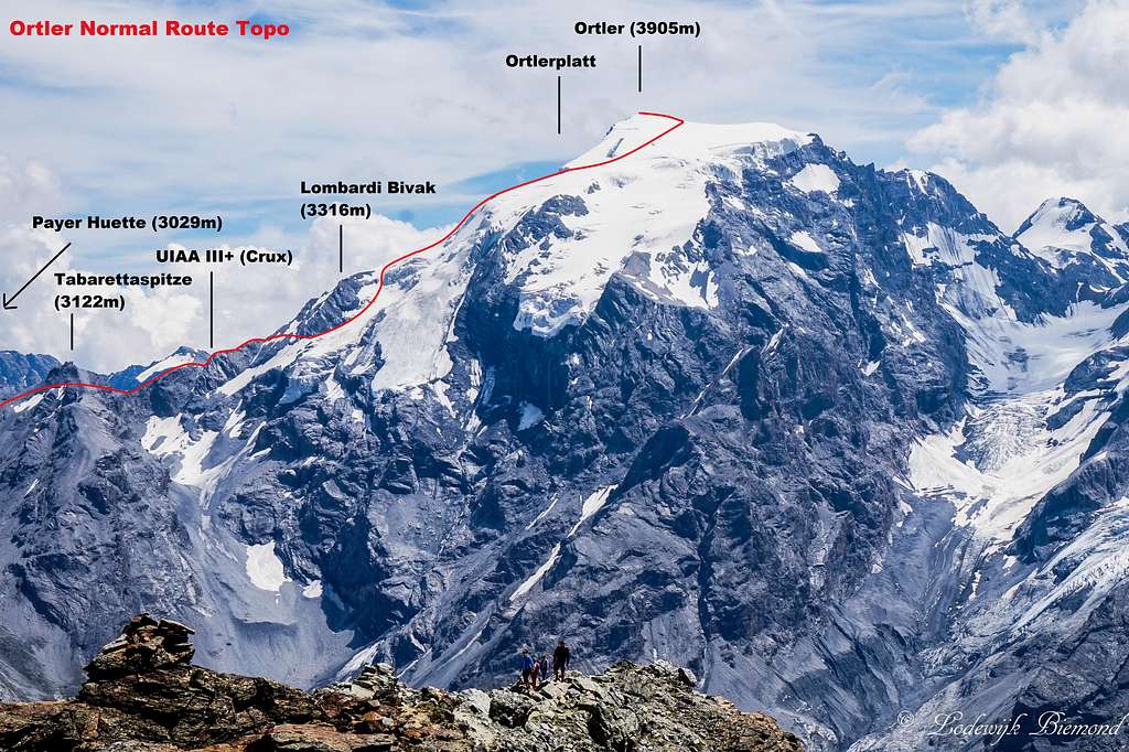
The normal route on Ortler is graded PD+ and is a mixed climb. The first part of the route, after the Payer Hut, requires rock climbing in the third grade (UIAA III) and the upper part of the route is a climb on glaciated terrain with a steepness up to 40 degrees. The combination of rock and ice makes this route very diverse and fun. Having said that, the climbing should not be underestimated. As a result of the popularity and the harder rock climbing sections up to UIAA III, traffic jams are quite common, especially in the summer months. The route can get crowded in this period, especially during the weekends. So if you have the possibility, avoid climbing during the weekends.
Climbing Ortler via the normal route requires 2 days. The first day one has to hike up to the Payer Hut from Sulden. This hike is not difficult and graded T3-. The second day is for climbing Ortler from the Payerhut and returning via the same route back to the Payerhut and further down to Sulden. The summit day is long and requires between 8 and 11 hours from hut to summit and back.II Hintergrat
III Meranerweg
Although the elevation gain of the Meranerweg is big, the route is technically not more difficult compared to the normal route. Steepness on snow/ice is up to 40 degrees and climbing is up to grade III on the UIAA-scala. Since 2004, the route is secured by steel cables on the most difficult parts. It takes about 5 to 7 hours from the Berglhuette to the summit of Ortler. Descent is along the normal route down to the Payerhuette.
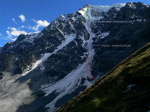
IV North Face
V Other routes
Hintergrat 2nd snowfield
Hochjochgrat (IV, 50°)
East side:
Minnigeroderinne (45°)
Schückrinne (III, 55°)
North side:
Holl-Witt-Weg im Western part of the North Wall (V-, up to 90°)
Ertlweg (55°)
Rothböckgrat (IV, 55°)
Marltgrat (III, 50°)
West side:
Pichlerführe via the "Hinteren Wandlen" (II, 45–50°) route of the first ascent, not climbed anymore
Südwestgrat (IV, 50-55°)
When To Climb
The best period to climb Ortler is during the summer months. (July to September). The best period for the North Face is mostly spring (providing that the Face is in good condition)
Red Tape
No permits or summit fees.History
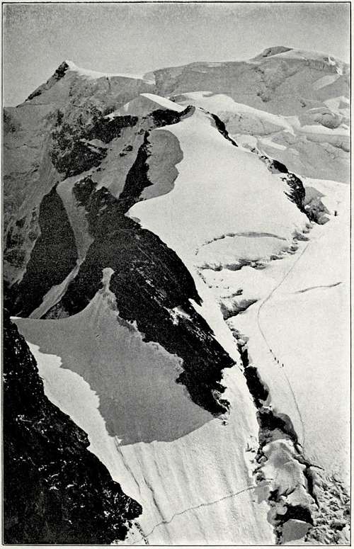
Ortler around 1900
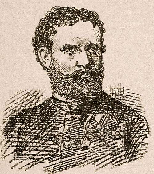
Knight Julius von Payer
Upon their return, the men were not believed on their words alone. Gebhard sent Pichler onto the mountain twice more, first in August 1805 with a flag that could be observed with a telescope from the valley, and again in September 1805 with a huge torch. Only after the torch had been seen burning at night was the accomplishment acknowledged. The route Pichler and his men (two brothers named Hell and an unnamed hunter from Langtaufers) took in 1805 was the currently still popular East ridge (Hintergrat) route. In 1834, at the age of 70, Pichler would make his fifth and final ascent, guiding professor Karl Thurwieser to the top.
The first time the Ortler was climbed via the easiest and currently normal route, the North ("Tabaretta") ridge, was more recently, in July 1865, as the approach is rather lengthy. In 1875 a hut was erected 3029m high on the North ridge, to break up the climb in two steps. It was named the Payer house, after Julius von Payer, who had mapped the Ortler Alps between 1865–1868 and had climbed 50 of its peaks with Johann Pinggera as his guide.
The 1200 m high ice route on the Ortler north face, the longest in the Eastern Alps, was first climbed in June 1931 by Hans Ertland and Franz Schmid. The North face was soloed first in 1963 by Dieter Drescher who had also added some first winter ascents to his name, including a traverse of Königspitze, Monte Zebrù, and Ortler in February 1975. On August 31, 1981, Reinhard Patscheider achieved the amazing feat of climbing the north faces of Königspitze, Monte Zebrù and Ortler all in one day.
Mountain Huts
There are several mountain huts surrounding Ortler. The Payerhütte is situated on the ridge north of Tabarettaspitze and can be reached from both the Sulden as well as the Trafoi side of the mountain. The Payerhütte is the main base for climbing the normal route on Ortler. An alternative mountain hut for climbs of the normal route is the lower in elevation Tabarettahütte. The Tabarettahütte is situated east of Ortler and can be reached easily from Sulden.
The Tabarettahütte is also the base of climbs on the North Face of Ortler.The Hintergrathütte / Rifugio del Coston is also located on the eastern side of Ortler and is situated right below the Hintergrat / East ridge. The Hut is of course the base for climbing the Hintergrat on Ortler. It is also a starting point for the Minnigeroderinne. The Berglhütte is located above Trafoi to the NW of Ortler. The main route to be climbed from this hut is the Meranerweg or Pleisshorngrat.
Clicking on the name of the Hut in the table below directs you to the official internet page. Also the SP-link is given when available.
| Hut | Elevation | Telephone | SP Link | Photo |
| Payerhütte | 3020m | +39 0473 613010 | Here | 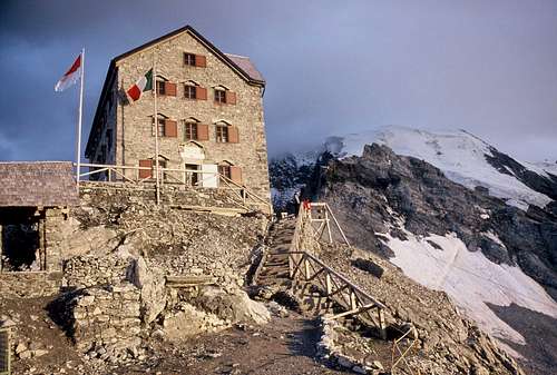 |
| Hintergrathütte / Rifugio del Coston | 2661m | +39 0473 613188 | / | 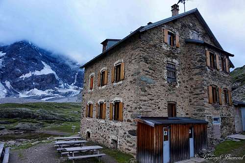 |
| Berglhütte | 2188m | +39 338 3877344 | / | 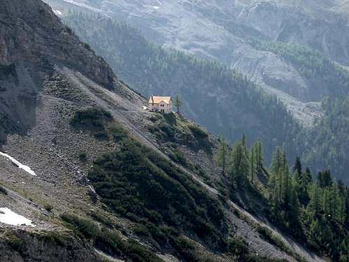 |
| Tabarettahütte | 2556m | +39 347 2614872 | / | 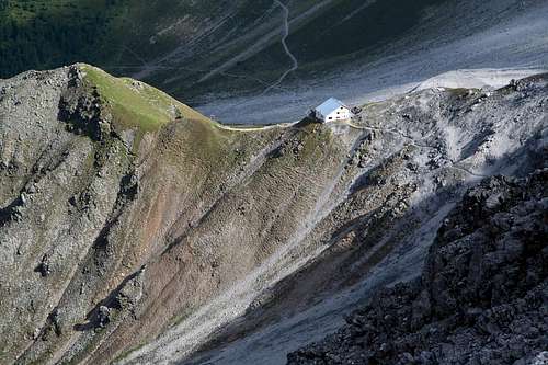 |
| K2-hütte | 2330m | / | / |
Bivouac / Shelter
Hochjochbiwak
TheLombardi Bivouac is an emergency shelterlocated on the north ridge of Ortlerabout halfway on the normal route inbetween the Payer Hut and the summit ofOrtler. Its elevation is 3312m. The German name for the shelter is Tschierfeckhuette.
Hochjochbiwak (3535m)
TheHochjochbiwak (Italian: Bivacco città di Cantù) is locatedon the south side of Ortler. It wasbuilt in 1901 and at that time the highest bivouac shelter in the Alps. The Hutis located on the Hochjoch at 3535m.The shelter is used mostly for ascents along the Hochjochgrat on Ortler or the normal route on Monte Zebru. The Bivouac can be reached from the Hintergrathuettein 4 hours and from the Alpini-Huette as well in 4 hours. The Bivouac wasrebuilt in 1972.
Getting there
Trafoi am Ortler
To get to Sulden also see the official Internet page with descriptions how to get to Sulden by car, bus, train and a local shuttle service
To get to Trafoi also see the official Internet page with descriptions how to get to Trafoi by car, bus and train.
Accomodation
Accomodation: Camping, Hotels, Appartments
I Camping
There are several campsites in the Ortler area. Camping Sagemuhle and Kiefernhain are both situated near Prato dello Stelvio to the north of Ortler. Somewhat closer to the mountain in Camping Trafoi in Trafoi. Camping Trafoi offers fine views of Ortler and Ortler is literally looming above the campsite.
Camping Sägemühle
Prato allo Stelvio
Tel.: +39 0473 61 60 78
Tel.: +39 0473 61 60 78
Trafoi am Ortler
Tel.: +39 0473 611533
Prato allo Stelvio
+39 0473 616422
II Hotels
Accomodation in Trafoi
Accomodation in Sulden
Guides & Books
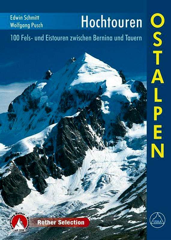
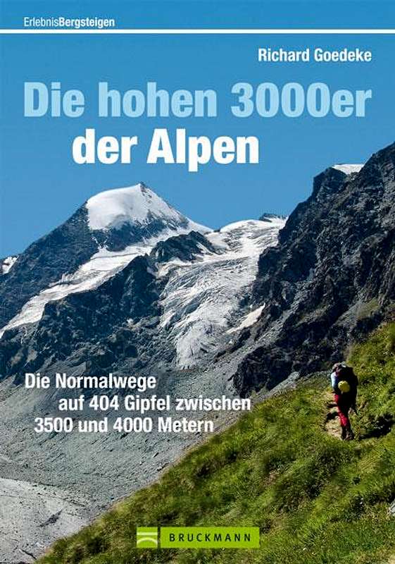
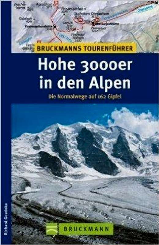
There are several good guides and books for climbing Ortler. I would personally recommend the ''Hochtouren Ostalpen'' by Rother Verlag. The former guide by Rother covering Ortler is the "Alpenvereinsfuehrer Ortleralpen" by Peter Holl. The latest print of this guide was back in 2003 and therefore outdated. Rother came up with a new series called Hochtouren with a version covering the Ostalpen (Eastern Alps) and a version covering the Western Alps (Westalpen Band I). The ''Hochtouren Ostalpen'', which includes Ortler, has very good descriptions on several routes like the Normal route , the North Face and the Hintergrat. It also includes detailed route maps and useful route photos. Other options are the ''3000er'' series by Richard Goedeke. The ''Hohe 3000er in den Alpen'' is a pocket size guide covering many 3000 meter peaks including Ortler. The descriptions are somewhat shorter compared to the ''Hochtouren Ostalpen'', but provide all basic information about climbing Ortler. ''Die hohen 3000er der Alpen'' is a newer version of the ''Hohe 3000er in den Alpen'' guide, the book is slightly bigger and has a slightly more detailed description of the routes.
Books from Rother Verlag can be purchased at their internet page . Books from Bruckmann Verlag can be purchased here.
|
| Publisher | Name | Author | ISBN / EAN |
| Rother Verlag | Hochtouren Ostalpen | Wolfgang Pusch | 9783763330102 |
| Bruckmann Verlag | Die Hohen 3000er der Alpen | Richard Goedeke | 9783765461224 |
| Bruckmann Verlag | Hohe 3000er in den Alpen | Richard Goedeke | 9783765452369 |
Maps
Kompass 72 Ortler/Ortles Cevedale
ISBN / EAN: 9783850267113
Scale: 1:50.000
ISBN / EAN: 9783850267113
Scale: 1:50.000
Tabacco Ortles - Cevedale – Ortlergebiet
ISBN / EAN: 9788883150081
Scale:1:25.000
External Links
Climbers on Ortler's Nordwand
Ortler on CamptoCamp Description of all routes on Ortler
Webcam Ortler by Bergfex
Webcam Stelvio & Ortler by Bergfex
Langenstein Chairlift - Sulden am Ortler
Ortler Official Tourist Internet Page
Ortler Weather forecast by mountain-forescast.com
desainme - Nov 18, 2003 6:57 am - Voted 10/10
Untitled CommentLatitude46.503 N Longitude10.539 E
Sebastian Hamm - Feb 7, 2006 10:49 am - Hasn't voted
Untitled CommentHi, it would be useful to add the Hintergrat-Hut.
HINTERGRAT-HUT / Rifugio Alto del Coston
(2661m)
57 beds
Owner: Società Guide Alpine Solda
TEL: 0473 613188 (HUT) o. privat: 0473 613061
Adress:
Fam. Gutgsell
Haus Peder,
39029 Sulden
From the Hut are following ascents possible:
Ortler-Hintergrat
Ortler-Hochjochgrat
Königsspitze-Suldengrat
Königsspitze-Nordwand
Schrötterhorn
Suldenspitze
Zebru-Nordwand
patascent - Mar 30, 2010 3:05 pm - Hasn't voted
Monte Pasquale(3558 m)
selinunte01 - Jun 25, 2015 6:50 am - Hasn't voted
Overhaul recommendedI would recommend a major overhaul of the page as Ortler is an important mountain. There should be at least a short section about the main routes 1. North route from Payerhütte, 2. Hintergrat from Hintergrathütte and 3. Meraner Weg from Berglhütte. Actually only Hintergrat is described in a Route page. Berglhütte and the Lombardi Bivvy is missing in the mountain huts section. The "How to reach the summit" section shortly describes the North Route from Payerhütte together with some pics of Hintergrat route, which I find a bit confusing. The rating of the Northern route should be upgraded a bit in my opinion. Due to glacier retreat the section below and above Lombardi Bivouak can be nasty enough not only in September and I learned that nowadays the Meraner Weg from Berglhütte is more and more considered as the easiest way up to the summit. Maybe I can report about that route later in the year. Michael