
|
|
Mountain/Rock |
|---|---|
|
|
37.42900°N / 118.7653°W |
|
|
12835 ft / 3912 m |
|
|
Overview
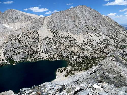
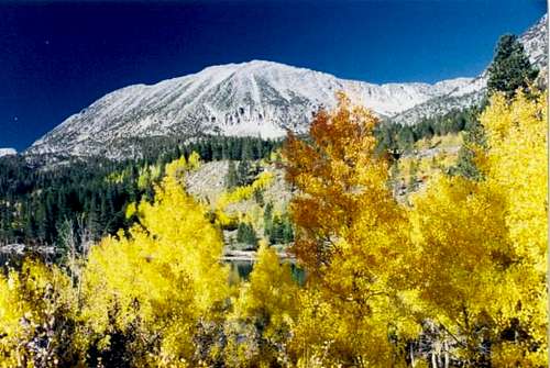
Mount Starr is located in the Little Lakes Valley area of the Sierra Nevada mountains, south of Mammoth Lakes. The Little Lakes Valley is an extremely beautiful area with a string of lakes, surrounded by several 13k peaks. Mount Starr isn't one of the premier peaks in the region, but it is a worthy day hike that has outstanding views.
Mount Starr is one of the most accessible summits in the area, but it cannot be considered easy. A trip to the summit isn't for those afraid of heights. There is some scrambling involved.
The views from the top include gorgeous lakes along with Mt. Morgan S, Mt. Dade, Mt. Abbot, Mt. Mills, Bear Creek Spire, and to the North Pioneer Basin, Mt. Huntington, Mt. Hopkins, Mt. Crocker and much more!
 |
 |
 |
 |
 |
Getting There
Mount Starr is accessed from the scenic and spectacular U.S. 395 that runs along the east side of the Sierra Nevada mountain range. To get to the trailhead for Mount Starr, turn west into Toms Place/ Rock Creek Canyon about halfway between Mammoth Lakes and Bishop. Drive all the way up past Rock Creek Lake to the end of the road at the Mosquito Flat Trailhead parking lot, 10.4 miles from U.S. 395.
From here, there is access to the primary Mono Pass Trail route or the East Face route. More details are found on the route pages. For the Mono Pass route, Mount Starr can be combined with nearby peaks. Probably the easiest one of these is Lookout Peak 11,902', which also requires scrambling, but is more fun and less technical than others in the immediate vicinity.
Red Tape
There are no restrictions for day hiking Mount Starr during the summer and early fall months. To do a backpacking trip into the region you would need to contact the White Mountain Ranger Station down in Bishop at 760-873-2500.
When To Climb
Mount Starr is most accessible during the summer months and early fall. The road is closed during the winter time and generally opens after the snowmelt. Primary hike times are June-October.
Camping
There is plenty of camping options in the area, as well as at the trailhead. For more information, see the Little Lakes Valley page.
Mountain Conditions
Call the Ranger Station in Bishop 760-873-2500
Mosquito Flat Weather
External Links
- A traverse to Ruby Peak - Aug 28, 2003
- Eastern Sierra Web Page
General info on the Eastern Sierra - Forest Service Web Site
Inyo National Forest website
clmber14 - Jul 30, 2003 5:12 pm - Hasn't voted
Untitled Commentthere is also a good dayhike to the top of mount starr from the north. Start at the hilton lakes trailhead just above Rock Creek Lake and climb up the bowl to the top of Half Moon pass. After descending over a short class 3 section of the pass on the other side, go south and climb back up to the top of the ridge via a small saddle on the very northern end of Mt. Starr (easy class 2). follow the ridge south to the summit and exit via the mono pass trail back down to Rock Creek. This route makes a great dayhike for those who want to hike a cross country loop.
Bob Burd - Oct 3, 2003 12:26 am - Hasn't voted
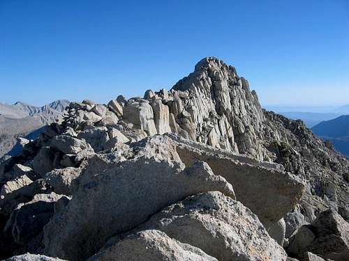
Untitled CommentThe summit is a long ridge running north-south with several summit blocks of similar height. While the northern ones seems to be the highest, the southernmost one is where the register is located.