|
|
Mountain/Rock |
|---|---|
|
|
43.36290°N / 111.0949°W |
|
|
Bonneville |
|
|
Hiking |
|
|
Summer, Fall |
|
|
10025 ft / 3056 m |
|
|
Overview
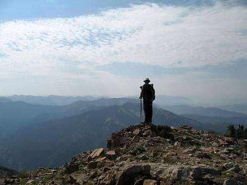
Found in the eastern portion of the state of Idaho, Mt. Baird is a really nice mountain that is sought after by those who like to visit the county highpoints. It has the distinction of being the highest mountain in Bonneville county and it also has prominence of over 1,725 feet
(see here).
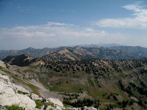
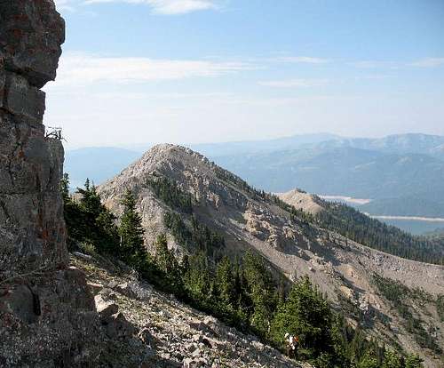
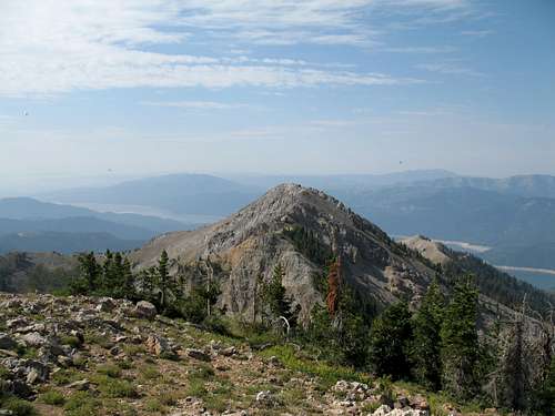
Great views are available from the summit in all directions and you can see the Teton range very nicely on a clear day. One neat advantage that this mountain offers is the road access. The trailhead is only a mile and a half off of a state highway and at the time we visited the dirt road connector was in excellent shape. The mountain area itself was extremely pleasant and you
have an opportunity of seeing wildlife as you hike up the trail. Be aware that in the summer, thunderstorms can be a problem particularly in the afternoon so plan to be off the summit as early as you can. This is one of
those peaks that I would enjoy doing again. Other prominence peaks in the area can make this a worthwhile area for prominence peak baggers.
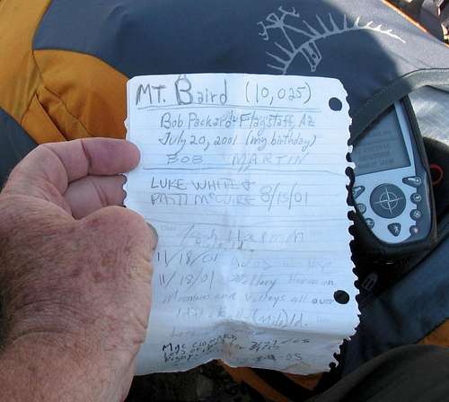
NOTE: Originally there was a page for this mountain (see this thread) but the SP member that put it up deleted it along with all his other peaks and pictures. So, if you find that your name isn't in the summit log, please add your entry again. Also, if your images aren't included, please add them again. I did my best to locate as many as I could via a search effort but I'm sure I didn't find them all.
Getting There
The easiest way to get to this area is from Idaho Falls. From I-15 in Idaho Falls get on US 26 East and follow until you reach the Palisades Reservoir Dam. An Idaho road map will give mileage and a feel for the area. After reaching the Palisade Dam, continue 2.5 miles east on 26 to a left turn on a gravel road signed for Little Elk Creek. Keep a sharp eye open for the turn off as you can easily drive past it. A helpful hint is that this turnoff is between milepost markers 390 and 391. Turn north on the signed Little Elk Creek road and follow this road (suitable for passenger sedans) to its end (~1.5 miles), where a sign indicates the Sheep Creek ATV trail to the left, and the Little Elk Creek trail to the right. A small camping area is found at the trailhead but no facilities are present. Watch out for cattle on the drive in.
Red Tape
None that I am aware of.
Caribou-Targhee National Forest:
Palisades Ranger District
3659 E. Ririe Hwy
Idaho Falls, Idaho 83401
208-523-1412
Camping
We camped right at the trailhead. No facilities available.
Campground information for the area:
Caribou-Targhee National Forest
Route
From the trailhead, it is 4.5 miles to the summit with an elevation gain of
close to 4200 feet. Early spring might be problematic due to snow conditions so you might consider saving this for summer conditions.

Here is a brief description of the trail route:
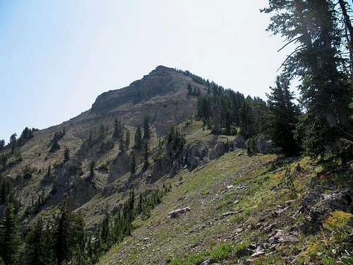
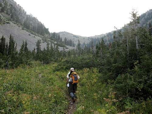
Take the trail up Little Elk Creek to a basin at about 8800'. Turn right on an unmapped trail, which passes around the east side of the 8920+' knoll. Leave the trail and pick up the northwest ridge of Mt. Baird, which you can follow to the summit. This route is class 2, though a bit steep in spots near the top with a bit of exposure possible if you get near the edge of the ridge Dennis had this to say "This ridgeline gets steeper the further you go. At about 9,600 ft we were climbing what someone called Class 3 dirt. It was steep and I was glad it was dry. The alternative would be to bushwhack through some short fir trees and brush on the south side of the ridge. We finally got to the top of the ridge, but now we had to find our way up the talus covered south slope of the summit block. It is steep here also, but there are climber’s trails through the tough section. Dean and I each chose a different route. I don’t think he wanted to follow me up another ugly rocky climb." On the way down, I chose the short fir trees as I didn't like the "dirt" part at all. See Dennis's trip report at the left side for the full discussion.

External Links
The next day found us at Mt. Meade.
Dan Robbins Trip report page
Palisades Reservoir Info page
County Highpoint Information
Idaho County Highpoints
Weather (Jackson Hole & Idaho Falls)

 Map linkClick here for a topo map
Teton views